Castle Lake Campground
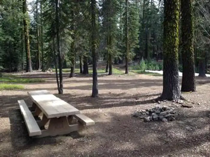
Description: This small primitive campground is nestled in a thick mixed conifer forest approximately ¼ mile below Castle Lake. There are 6 sites with tables, fire rings and vault toilets. Bring your own water. 3-night limit. No fee. No reservations. Not recommended for large vehicle or trailers. Usually opens around the end of May depending on when the snow melts, and usually is closed by snow around the first of November. Features: Visitors may walk or drive the short distance to the lake. Castle Lake is a pristine glacial cirque lake with granite cliffs and clear water, one of the most popular attractions in the Mt. Shasta area.
More like this: first-come in California · free in California

Season & status
| Status | Closed for the season. Forest Service sites close for the season; check the official page for the reopening date. |
| Forest | Shasta-Trinity National Forest |
| Fees | No fee |
Weather by month
Getting there
From Mt. Shasta city, head west on Lake Street over the freeway and to the stop sign at Old Stage Road. Turn left (south) and drive 1/4 mile to a fork in the road. Stay to the right at the fork and continue on this road (W.A. Barr Road). In 2 miles you will cross the dam at Lake Siskiyou and then you will see the turnoff for Castle Lake.
| Coordinates | 41.2357° N, 122.3790° W · Directions ↗ |
Fire nearby
- PrescribedFive-6 Rx
44 mi from the campground
- PrescribedFive-7 Rx
45 mi from the campground
- PrescribedShf Rx
49 mi from the campground
Distance is to the reported incident point, not the fire edge. Call the managing office before you drive.
Supplies & services
| Dump station | Dump station ↗ | 3.2 mi |
| Outdoor gear | Ted Fay Fly Shop ↗ | 5.8 mi |
| RV sales & service | Cousin Gary RV Center ↗ | 40 mi |
Locations © OpenStreetMap contributors. Call ahead; hours change seasonally.
Explore
Video
Castle Lake Campground & Cottages
Trails nearby
- 0.4 miCastle Shore0.6 mi trail · hiking, horse, bike
- 0.4 miCastle Lake ↗4.9 mi trail · hiking, horse
- 2.7 miNey Springs Creek0.5 mi trail · hiking, horse, bike
- 2.9 miFairy Falls0.09 mi trail · hiking, horse, bike
- 3 miGray Rock Lake1.1 mi trail · hiking, horse
- 3.5 miSisson-Callahan NRT ↗9 mi trail · hiking, horse, bike · national_recreation_or_other
Trail and trailhead records are the Forest Service's. Distances are straight-line to the nearer trail end. Trail conditions are not tracked here.
Public land it sits in
This campground sits inside Shasta-Trinity National Forest.
- inShasta-Trinity National Forest ↗National Forest · Forest Service · 2,715,499 acres
- 0.4 miCastle Crags Wilderness ↗Wilderness · Forest Service · 10,999 acres
- 11.3 miMt. Shasta Wilderness ↗Wilderness · Forest Service · 36,981 acres
Each unit is published as a centre point and an acreage rather than a boundary, so this section stands it in for a circle of the same area. Whether a campground is inside, and how far it is from one it is outside, are both approximate.
Other campgrounds nearby



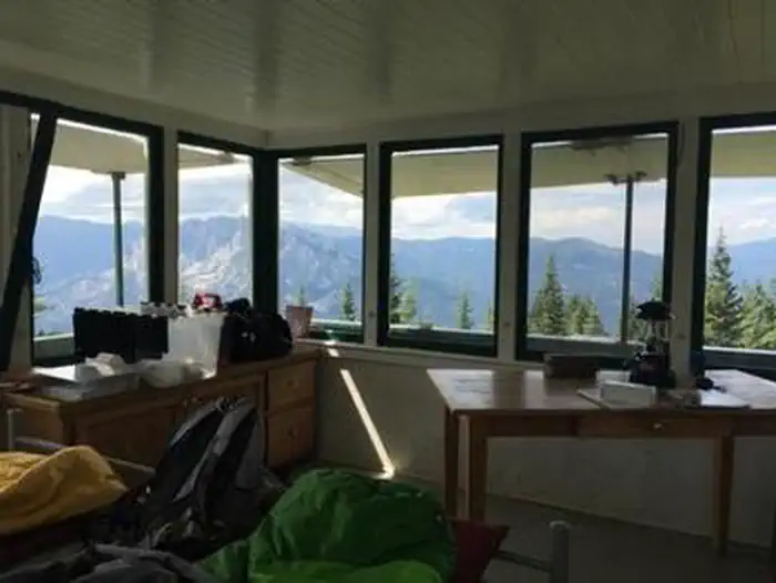
Cabin and lookout rentals nearby

On the National Register nearby
- Dunsmuir Historic Commercial DistrictHistoric district · Dunsmuir · 5.8 mi
- Shasta Inn and Weed Lumber Company Boarding HouseBuilding · Weed · 13.5 mi
Guidebooks for California
We earn a small commission if you buy through these links. It does not change what we list.

Titles come from Open Library's catalog, matched by subject heading or by title.
Reference
Questions people ask
Do I need a reservation at Castle Lake Campground?
No. Castle Lake Campground is first-come, first-served. Sites are taken on arrival and paid at the fee station.
Source: Forest Service
How much does it cost to camp at Castle Lake Campground?
Nothing. Castle Lake Campground is listed as free. No fee
Source: Forest Service
Is Castle Lake Campground open right now?
Closed for the season as of Oct 16, 2026.
Source: Forest Service status
What if Castle Lake Campground is full?
The nearest public campgrounds are Gumboot Campground (7 mi, first-come), Mcbride Springs Campground (9.5 mi, first-come), and Red Fir Flat Group Campground (9.9 mi).
Source: Campgrounds nearby