Mcbride Springs Campground
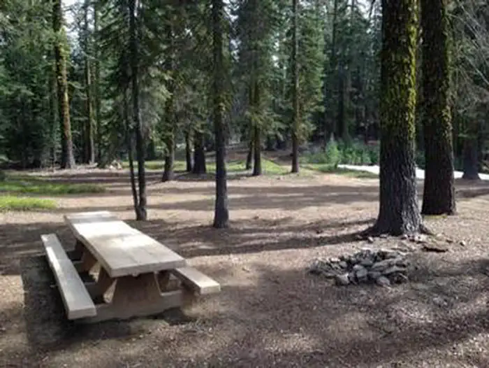
Description: Situated on the lower slopes of Mt. Shasta at an elevation of 5000 feet, this popular campground has 12 sites with tables and fire rings, suitable for tents and small RV's. Vault toilets. 7 day limit. $10 per night. No reservations. Usually opens by Memorial Day weekend and closes near the end of October. Conveniently located on Mt. Shasta and only a few minutes from I-5, services and supplies. A miniature spring-fed seasonal creek flows through the campground, and a hand operated pump provides well water. Special note: In 2009 a root disease was discovered in the campground that affected all of the white fir trees, killing some and infecting others.
Sites are first-come, first-served. Recreation.gov lists this campground for paying on site, and you may be able to pay with the Scan and Pay feature of its app.
More like this: first-come in California · tent only in California

Amenities & rules
| Equipment | Tents |
| Fees | $10.00 per night. |
Individual sites vary. Confirm on Recreation.gov or with the managing office.
Season & status
| Status | Closed for the season. Forest Service sites close for the season; check the official page for the reopening date. |
| Forest | Shasta-Trinity National Forest |
| Booking | No reservations. There is a 7days stay limit per person, per year. |
| Fees | $10.00 per night. |
Weather by month
Getting there
| Coordinates | 41.3526° N, 122.2820° W · Directions ↗ |
Supplies & services
| Outdoor gear | The Fifth Season ↗ | 3.1 mi |
| Dump station | Dump station ↗ | 5.9 mi |
| RV sales & service | Cousin Gary RV Center ↗ | 48.2 mi |
Locations © OpenStreetMap contributors. Call ahead; hours change seasonally.
Explore
Worth a stop
- 15 miJuniper Flat Ohv Area ↗OHV / range
Trails nearby
- 0.1 miSisson'S1.8 mi trail · hiking, horse, bike
- 0.5 miLemurian Delirium1.7 mi trail · hiking, horse, bike
- 0.9 miMoon Doggie1.2 mi trail · hiking, horse, bike
- 1 miStrawberry Valley2.3 mi trail · hiking, horse, bike
- 1.4 miFoundation0.2 mi trail · hiking, horse, bike
- 1.6 miMarly1 mi trail · hiking, horse, bike
Trail and trailhead records are the Forest Service's. Distances are straight-line to the nearer trail end. Trail conditions are not tracked here.
Public land it sits in
This campground sits inside Shasta-Trinity National Forest.
- inShasta-Trinity National Forest ↗National Forest · Forest Service · 2,715,499 acres
- 1.8 miMt. Shasta Wilderness ↗Wilderness · Forest Service · 36,981 acres
- 4.5 miKlamath National Forest ↗National Forest · Forest Service · 1,705,451 acres
Each unit is published as a centre point and an acreage rather than a boundary, so this section stands it in for a circle of the same area. Whether a campground is inside, and how far it is from one it is outside, are both approximate.
Other campgrounds nearby


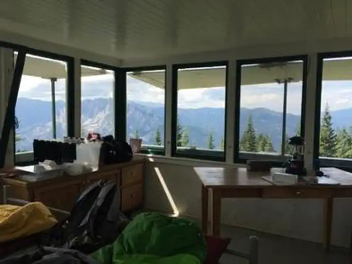
Cabin and lookout rentals nearby
On the National Register nearby
- Shasta Inn and Weed Lumber Company Boarding HouseBuilding · Weed · 7.5 mi
- Dunsmuir Historic Commercial DistrictHistoric district · Dunsmuir · 9.9 mi
- Edgewood StoreBuilding · Edgewood · 10.6 mi
Guidebooks for California
We earn a small commission if you buy through these links. It does not change what we list.

Titles come from Open Library's catalog, matched by subject heading or by title.
Reference
Questions people ask
Do I need a reservation at Mcbride Springs Campground?
No. Mcbride Springs Campground is first-come, first-served. No reservations. Sites are taken on arrival and paid at the fee station.
Source: Forest Service
How much does it cost to camp at Mcbride Springs Campground?
$10.00 per night.
Source: Forest Service
Is Mcbride Springs Campground open right now?
Closed for the season as of Oct 16, 2026.
Source: Forest Service status
How many sites does Mcbride Springs Campground have?
12 sites.
Source: Forest Service
Can I bring an RV to Mcbride Springs Campground?
Mcbride Springs Campground is listed for tents only.
Source: Forest Service
What if Mcbride Springs Campground is full?
The nearest public campgrounds are Red Fir Flat Group Campground (1.6 mi), Panther Meadows Campground (4.2 mi, first-come), and Castle Lake Campground (9.5 mi, first-come).
Source: Campgrounds nearby