Magone Lake Campground
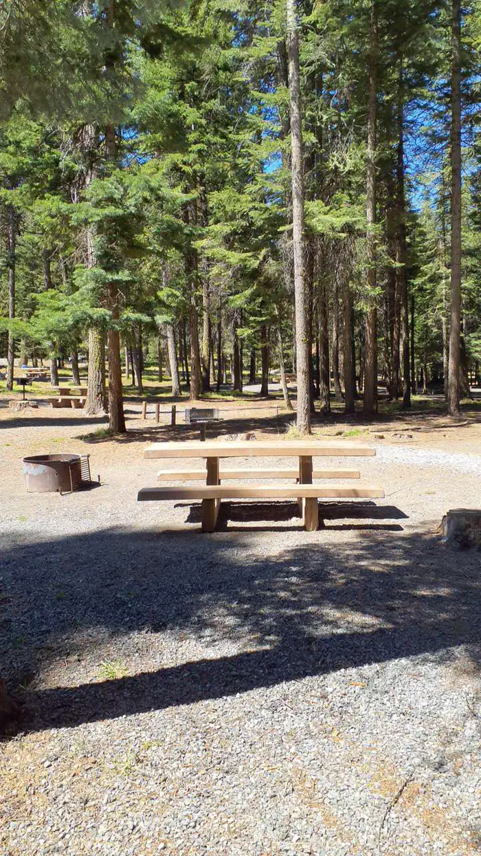
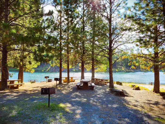
Magone Lake Campground is situated along its namesake lake. Visitors enjoy fishing, canoeing, swimming, mountain biking and hiking. The campground is set in a forest of White Fir and Ponderosa Pine. Magone Lake covers about 50 acres and features both deep holes of up to 100 feet and shoals on the north side. Geologists believe Magone Lake was created by a landslide in the early 1800s.
Some sites take reservations on Recreation.gov. Others are first-come, first-served.
More like this: first-come in Oregon · reservable in Oregon · big rigs in Oregon · pets allowed in Oregon
Check availability on Recreation.gov ↗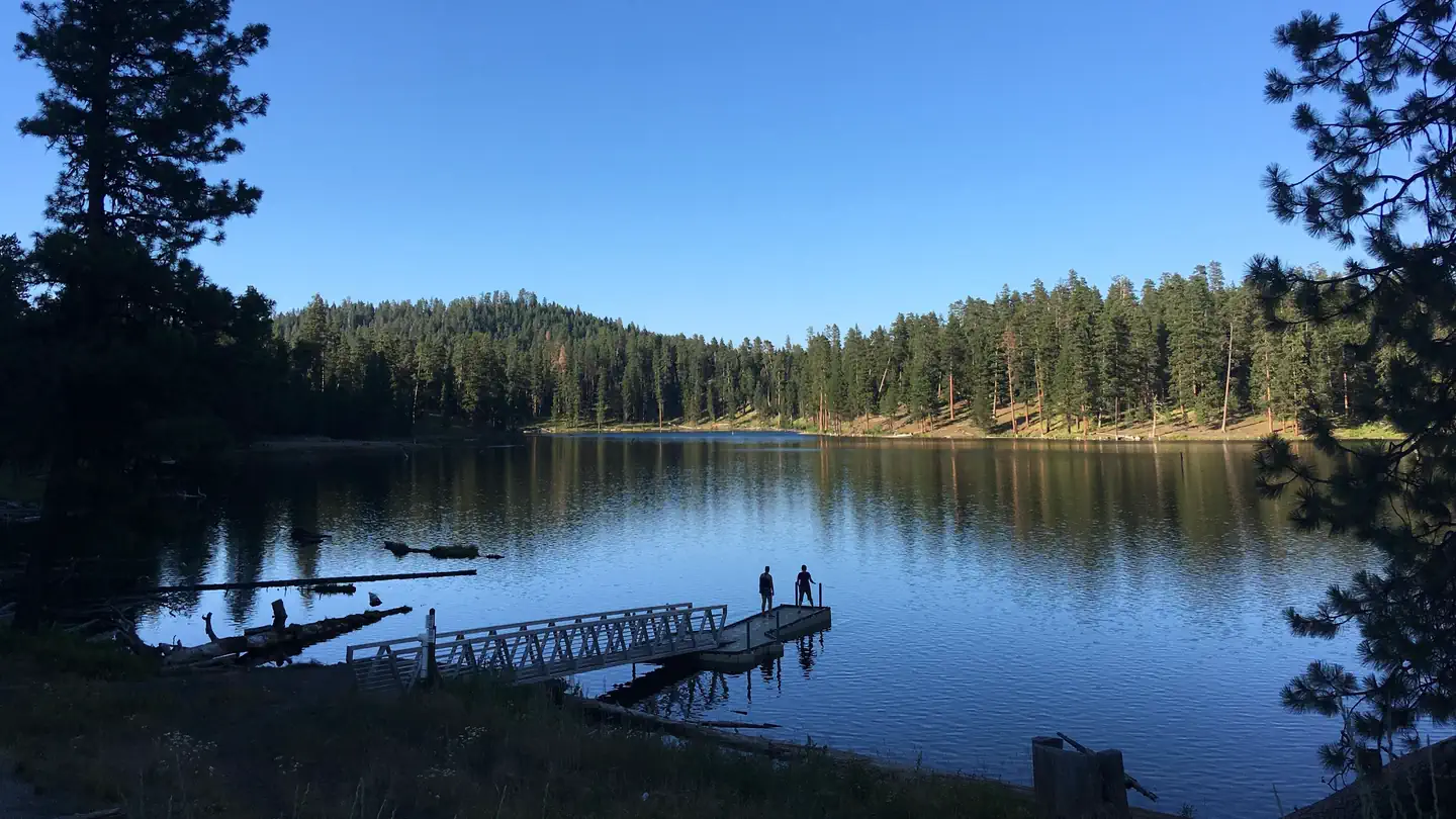
Site mix
| Standard, no hookups | 18 |
| Tent-only | 3 |
Site guide
Will my RV fit
The longest site here provides 50 feet of vehicle capacity. Most sites are shorter.
21 sites. Tap a filter to narrow the list; the map follows.
| Site | Type | Entry | Fits, ft | Surface | Shade | Water / sewer | People / vehicles | Fires |
|---|---|---|---|---|---|---|---|---|
| 01 | Standard | Back-in | 45 | Gravel | Partial | No / No | 8 / 2 | Yes |
| 02 | Standard | Back-in | 62 | Gravel | Partial | No / No | 8 / 2 | Yes |
| 03 | Standard | Back-in | 38 | Gravel | Partial | No / No | 8 / 2 | Yes |
| 04 | Standard | Back-in | 50 | Gravel | Partial | No / No | 8 / 2 | Yes |
| 05 | Tent only | Pull-through | Gravel | Partial | No / No | 8 / 1 | Yes | |
| 06 | Tent only | Pull-through | Gravel | Partial | No / No | 8 / 1 | Yes | |
| 07 | Tent only | Pull-through | Gravel | Partial | No / No | 8 / 1 | Yes | |
| 08 | Standard | Back-in | 35 | Gravel | Partial | No / No | 8 / 2 | Yes |
| 09 | Standard | Back-in | 35 | Gravel | Partial | No / No | 8 / 2 | Yes |
| 10 | Standard | Back-in | 65 | Gravel | Partial | No / No | 8 / 2 | Yes |
Per-site records as published by the managing agency on Recreation.gov. Blank cells mean the agency listed nothing for that site.
Amenities & rules
| Hookups | None |
| Max vehicle length | 50 ft |
| Equipment | RVs & trailers, Tents |
| Pets | Allowed |
- Day use swimming area with beach
- Boat launch and dock
- Fishing pier
- Walking trail around the lake
- Potable water during summer months
- Mountain bike trails
- Reservable Group Picnic Shelter
- Reservable Group Campsite
Individual sites vary. Confirm on Recreation.gov or with the managing office.
Season & status
| Status | Open |
| Forest | Malheur National Forest |
| Booking | To reserve the group site, visit www.recreation.gov or call 1-877-444-6777. Reservations can be made same day and up to 6 months in advance for the group sites. |
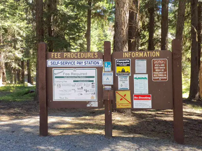
| Fees | The Group Sites range from $25-60. See details at Recreation.gov $13/Night for single unit, $6.50/Night for extra vehicle - All individual sights are first come first serve. |
Weather by month
Getting there
From John Day, Oregon, take U.S. Highway 26 east for approximately 9 miles. At the junction of County Road 18, travel north approximately 10 miles. At Forest Road 3620, turn west and drive approximately 1 mile to Forest Road 3618. The campground is about 1 mile from the turnoff. From Prairie City, Oregon, take U.S.
| Nearest town | John Day, Oregon |
| Coordinates | 44.5494° N, 118.9128° W · Directions ↗ |
Fire nearby
- PrescribedGreenwood Rx
19 mi from the campground · 38 acres
- PrescribedDamon 2A Rx
23 mi from the campground · 85 acres
- WildfireMccully
37 mi from the campground · 13,604 acres · 91% contained
- PrescribedJane 102 Rx
37 mi from the campground · 3,000 acres
Distance is to the reported incident point, not the fire edge. Call the managing office before you drive.
Supplies & services
| Dump station | Dump station ↗ | 12.6 mi |
Locations © OpenStreetMap contributors. Call ahead; hours change seasonally.
Explore
Video
Magone Lake 2017
Worth a stop
- Middle Fork John Day River
- Magone Bike Trail Network
- Magone Lake Trail
- Magone Slide Trail
- Nipple Butte Trail
- Davis Creek Trail
- Vinegar Hill Indian Rock Scenic Area
- Austin House
- Bates State Park
- Dewitt Museum and Depot Park
- Kam Wah Chung & Co. State Heritage Site
- Grant County Ranch and Rodeo Museum
- Grant County Historical Museum
- 14.4 miDavis Creek West Trailhead ↗Trailhead
Trails nearby
- 0.1 miMagone Lake1.7 mi trail
- 0.1 miMagone Slide0.5 mi trail
- 0.3 miMagone Slide Spur0.07 mi trail
- 0.3 miBack of Beyond3 mi trail
- 0.5 miDeadhead0.7 mi trail
- 0.5 miBehind Magone Bicycle2 mi trail
Trailheads within three miles
- 0.1 miMagone Slide Trailhead ↗Malheur National Forest
Trail and trailhead records are the Forest Service's. Distances are straight-line to the nearer trail end. Trail conditions are not tracked here.
Public land it sits in
This campground sits inside Malheur National Forest.
- inMalheur National Forest ↗National Forest · Forest Service · 1,787,138 acres
- 12.9 miStrawberry Mountain Wilderness ↗Wilderness · Forest Service · 69,411 acres
- 13.4 miUmatilla National Forest ↗National Forest · Forest Service · 1,498,100 acres
Each unit is published as a centre point and an acreage rather than a boundary, so this section stands it in for a circle of the same area. Whether a campground is inside, and how far it is from one it is outside, are both approximate.
Other campgrounds nearby
Cabin and lookout rentals nearby
On the National Register nearby
- Advent Christian ChurchBuilding · John Day · 9.4 mi
- John Day Compound, Supervisor's WarehouseBuilding · John Day · 9.4 mi
- Supervisor's House No. 1001Building · John Day · 9.7 mi
Natural features
The campground is set in a forest of Engelmann spruce and ponderosa pine. Magone Lake covers about 50 acres and features both deep holes of up to 100 feet and shoals on the north side. Geologists believe Magone Lake was created by a landslide in the early 1800s. It is located in the southern reaches of the Malheur National Forest.
Recreation
The Magone Lake area offers swimming, fishing, hiking and mountain biking opportunities. The lake contains eastern brook and rainbow trout. A boat ramp is available on-site. Visitors also enjoy viewing wildflowers and interesting geology throughout the region
Guidebooks for Oregon
We earn a small commission if you buy through these links. It does not change what we list.

Titles come from Open Library's catalog, matched by subject heading or by title.
Reference
Questions people ask
Do I need a reservation at Magone Lake Campground?
For some sites. Some sites take reservations on Recreation.gov. Others are first-come, first-served.
Source: Recreation.gov
How much does it cost to camp at Magone Lake Campground?
The Group Sites range from $25-60. See details at Recreation.gov $13/Night for single unit, $6.50/Night for extra vehicle - All individual sights are first come first serve.
Source: Recreation.gov
Is Magone Lake Campground open right now?
Open as of Oct 16, 2026.
Source: Forest Service status
How many sites does Magone Lake Campground have?
21 sites, including 18 standard sites without power and 3 tent-only sites.
Source: Recreation.gov
Will my RV fit at Magone Lake Campground?
The longest site here provides 50 feet of vehicle capacity. Most sites are shorter. The sidebar tool checks a trailer or motorhome length against every site.
Source: Will my RV fit
Are pets allowed at Magone Lake Campground?
Yes, pets are allowed at Magone Lake Campground. Leash rules apply.
Source: Recreation.gov
What is there to do at Magone Lake Campground?
The Magone Lake area offers swimming, fishing, hiking and mountain biking opportunities. The Recreation section on this page has the rest.
Source: Recreation
What is the nearest town to Magone Lake Campground?
John Day, Oregon. Middle Fork John Day River
Source: Getting there
What if Magone Lake Campground is full?
The nearest public campgrounds are Lower Camp Creek Campground (10.2 mi), Dixie Campground (16 mi), and Middle Fork Campground (16.1 mi).
Source: Campgrounds nearby