Southfork Campground
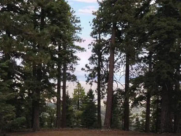
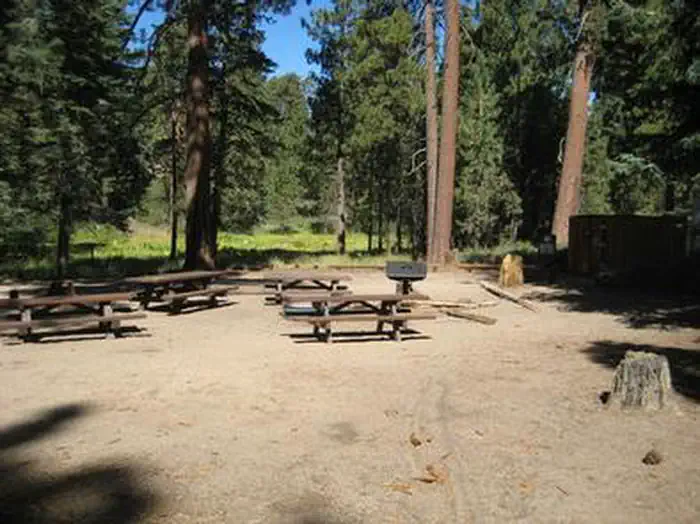
4,500-foot elevation. 21 sites. RV's up to 16'. No water. Vault toilets. South Fork Campground on the backside of the San Gabriel Mountains is a hidden gem in the Mojave Desert. Tucked in the middle of steep canyon walls descending from Mt. Islip from the South and Vazquez Rocks in the North, this campground offers 21 spacious sites of year-round tranquility. Each site comes with a fire-ring and grill to huddle around and cook those family campfire meals. Additionally, each site comes with a picnic bench should your group decide a game of cards is in order.
More like this: first-come in California

Season & status
| Status | Open |
| Forest | Angeles National Forest |
| Fees | Adventure Pass/America the Beautiful Pass required. |
| Rules | See current fire restrictions. |
Weather by month
Getting there
| Coordinates | 34.3956° N, 117.8207° W · Directions ↗ |
Supplies & services
| Outdoor gear | REI ↗ | 21.2 mi |
| RV sales & service | Major RV Sales ↗ | 26.2 mi |
| Dump station | Dump station ↗ | 27.8 mi |
Locations © OpenStreetMap contributors. Call ahead; hours change seasonally.
No site-by-site records, no amenities, no fee schedule, no directions or photos in the Recreation.gov record. What is here comes from the agency's own listing. The rest lives there.
Checked nightly. Modules appear as soon as the record fills in.
Explore
Worth a stop
- 3.2 miIslip Saddle Day Use Area ↗Day use
- 3.9 mi
- 4.7 miWindy Gap Trailhead ↗Trailhead
- 5.5 miIslip Wawona Trailhead ↗Trailhead
- 11 miWest Fork Fishing Access Fishing Site ↗Fishing site
- 11.1 mi
Show all 7Hide
- 13.1 miFisherman's Point Fishing Site ↗Fishing site
Trails nearby
- 0.1 miHigh Desert NRT (south Fork) ↗5 mi trail · hiking, horse, bike
- 0.1 miHigh Desert NRT (devils Pbowl) ↗7.9 mi trail · hiking, horse, bike
- 0.1 miHigh Desert NRT (manzanita) ↗5.5 mi trail · hiking, horse, bike
- 1.4 miDevil'S Chair0.2 mi trail · hiking, horse, bike
- 2.2 miDawson Saddle1.9 mi trail · hiking, horse, bike
- 2.4 miDevils Punchbowl Interpretive1 mi trail · hiking, horse, bike
Trail and trailhead records are the Forest Service's. Distances are straight-line to the nearer trail end. Trail conditions are not tracked here.
Public land it sits in
Angeles National Forest begins about 0.8 miles away, and it is the closest of these.
- 0.8 miAngeles National Forest ↗National Forest · Forest Service · 706,719 acres
- 1.1 miPleasant View Ridge Wilderness ↗Wilderness · Forest Service · 26,839 acres
- 3.9 miSheep Mountain Wilderness ↗Wilderness · Forest Service · 43,182 acres
Each unit is published as a centre point and an acreage rather than a boundary, so this section stands it in for a circle of the same area. Whether a campground is inside, and how far it is from one it is outside, are both approximate.
Other campgrounds nearby


Guidebooks for California
We earn a small commission if you buy through these links. It does not change what we list.

Titles come from Open Library's catalog, matched by subject heading or by title.
Reference
Questions people ask
Do I need a reservation at Southfork Campground?
No. Southfork Campground is first-come, first-served. Sites are taken on arrival and paid at the fee station.
Source: Forest Service
How much does it cost to camp at Southfork Campground?
Adventure Pass/America the Beautiful Pass required.
Source: Forest Service
Is Southfork Campground open right now?
Open as of Oct 16, 2026.
Source: Forest Service status
What if Southfork Campground is full?
The nearest public campgrounds are Sycamore Flat Campground (1.3 mi, partly first-come), Big Rock Campground (2.6 mi, first-come), and Jackson Flats (2.7 mi).
Source: Campgrounds nearby