Sycamore Flat Campground
Sycamore Flat Campground is a small, developed campground located in the Big Rock Creek Recreation Area of the Angeles National Forest. At approximately 4,200 feet in elevation, it offers a peaceful setting with mature sycamore and juniper trees and easy access to Big Rock Creek. The campground features 11 first-come, first-served campsites for tents and small RVs or trailers up to approximately 18 feet. It is open year-round, weather and road permitting.
Some sites take reservations on Recreation.gov. Others are first-come, first-served.
More like this: first-come in California · reservable in California · tent only in California · pets allowed in California
Check availability on Recreation.gov ↗
Site mix
| Standard, no hookups | 11 |
| Host/management | 1 |
Site guide
11 sites. Tap a filter to narrow the list; the map follows.
| Site | Shade | Water / sewer | People / vehicles | Fires |
|---|---|---|---|---|
| 01 | None | No / No | 8 / – | Yes |
| 02 | None | No / No | 8 / – | Yes |
| 03 | None | No / No | 8 / – | Yes |
| 04 | None | No / No | 8 / – | Yes |
| 05 | None | No / No | 8 / – | Yes |
| 06 | None | No / No | 8 / – | Yes |
| 07 | None | No / No | 8 / – | Yes |
| 08 | None | No / No | 8 / – | Yes |
| 09 | None | No / No | 8 / – | Yes |
| 10 | None | No / No | 8 / – | Yes |
Per-site records as published by the managing agency on Recreation.gov. Blank cells mean the agency listed nothing for that site. Check-in 02:00 PM, checkout 11:00 AM.
Amenities & rules
| Max vehicle length | 18 ft |
| Equipment | Tents |
| Pets | Allowed |
| Campfires | Allowed, subject to restrictions |
Sycamore Flat Campground offers basic developed amenities, including 11 first-come, first-served campsites with picnic tables, fire rings, and a communal vault toilet. There is currently no piped water available so campers should bring enough for cooking, cleaning, drinking, and extinguishing campfires. The campground accommodates tents and small RVs or trailers up to approximately 18 feet. Cell phone service is limited, and visitors should check current forest conditions and fire restrictions before arrival.
Individual sites vary. Confirm on Recreation.gov or with the managing office.
Season & status
| Status | Open |
| Forest | Angeles National Forest |
| Fees | Adventure Pass Required $5/day or $30/year. Interagency Passes are also accepted. |
| Rules | See current fire restrictions. |
Weather by month
Getting there
From Pearblossom - Highway 138. From Highway 138 in Pearblossom, turn south onto Longview Road. Continue south and turn left onto Avenue W. Follow Avenue W toward Valyermo, passing the Mojave Work Center. Continue toward Big Rock Creek Road and turn right. Follow Big Rock Creek Road approximately 3 miles up Big Rock Creek Canyon.
| Nearest town | Pearblossom, California |
| Coordinates | 34.4138° N, 117.8251° W · Directions ↗ |
Supplies & services
| Outdoor gear | Beffet ↗ | 22.1 mi |
| RV sales & service | Major RV Sales ↗ | 26.4 mi |
| Dump station | Dump station ↗ | 28.4 mi |
Locations © OpenStreetMap contributors. Call ahead; hours change seasonally.
Explore
Video
Sycamore Flat Campground in Los Angeles County, California
Worth a stop
- Big Rock Creek – Popular for picnicking, photography, and seasonal recreation.
- Devil’s Punchbowl Natural Area – Unique geologic formations with hiking trails and interpretive exhibits.
- South Fork Trail – A scenic trail following Big Rock Creek through the San Gabriel Mountains.
- Jackson Lake – Seasonal fishing, picnicking, and nearby camping opportunities.
- 2.7 mi
- 4.2 miIslip Saddle Day Use Area ↗Day use
- 6 miWindy Gap Trailhead ↗Trailhead
- 6.6 miIslip Wawona Trailhead ↗Trailhead
- 12.2 miWest Fork Fishing Access Fishing Site ↗Fishing site
- 12.3 mi
Show all 7Hide
- 12.4 miFisherman's Point Fishing Site ↗Fishing site
Trails nearby
- 1.2 miHigh Desert NRT (manzanita) ↗5.5 mi trail · hiking, horse, bike
- 1.4 miHigh Desert NRT (south Fork) ↗5 mi trail · hiking, horse, bike
- 1.4 miHigh Desert NRT (devils Pbowl) ↗7.9 mi trail · hiking, horse, bike
- 1.4 miDevil'S Chair0.2 mi trail · hiking, horse, bike
- 1.8 miDevils Punchbowl Interpretive1 mi trail · hiking, horse, bike
- 3.4 miDawson Saddle1.9 mi trail · hiking, horse, bike
Trail and trailhead records are the Forest Service's. Distances are straight-line to the nearer trail end. Trail conditions are not tracked here.
Public land it sits in
Angeles National Forest begins about 0.6 miles away, and it is the closest of these.
- 0.6 miAngeles National Forest ↗National Forest · Forest Service · 706,719 acres
- 1.3 miPleasant View Ridge Wilderness ↗Wilderness · Forest Service · 26,839 acres
- 5 miSheep Mountain Wilderness ↗Wilderness · Forest Service · 43,182 acres
Each unit is published as a centre point and an acreage rather than a boundary, so this section stands it in for a circle of the same area. Whether a campground is inside, and how far it is from one it is outside, are both approximate.
Other campgrounds nearby



Natural features
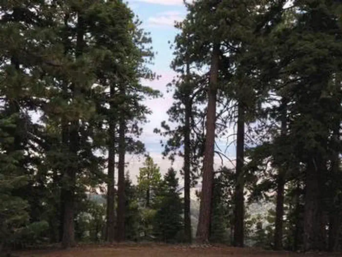
Located where the Mojave Desert meets the San Gabriel Mountains, Sycamore Flat offers a unique blend of mountain and desert landscapes. Mature California sycamores, juniper trees, and native shrubs provide shade in portions of the campground, Nearby Big Rock Creek creates seasonal riparian habitat for birds and other wildlife. Rocky canyon walls, rolling hills, and open mountain views define the surrounding scenery.
Recreation
Visitors can enjoy hiking, wildlife viewing, photography, picnicking, and exploring Big Rock Creek. Nearby trails include the South Fork Trail, Manzanita Trail, and Punchbowl Trail. The surrounding roads also offer scenic drives through the northeastern section of the San Gabriel Mountains.
Guidebooks for California
We earn a small commission if you buy through these links. It does not change what we list.

Titles come from Open Library's catalog, matched by subject heading or by title.
Reference
Questions people ask
Do I need a reservation at Sycamore Flat Campground?
For some sites. Some sites take reservations on Recreation.gov. Others are first-come, first-served.
Source: Recreation.gov
How much does it cost to camp at Sycamore Flat Campground?
Adventure Pass Required $5/day or $30/year. Interagency Passes are also accepted.
Source: Recreation.gov
What time is check-in at Sycamore Flat Campground?
Check-in 02:00 PM, checkout 11:00 AM.
Source: Recreation.gov
Is Sycamore Flat Campground open right now?
Open as of Oct 16, 2026.
Source: Forest Service status
How many sites does Sycamore Flat Campground have?
12 sites, including 11 standard sites without power.
Source: Recreation.gov
Will my RV fit at Sycamore Flat Campground?
The longest site here provides 18 feet of vehicle capacity. Most sites are shorter. The sidebar tool checks a trailer or motorhome length against every site.
Source: Will my RV fit
Are pets allowed at Sycamore Flat Campground?
Yes, pets are allowed at Sycamore Flat Campground. Leash rules apply.
Source: Recreation.gov
Can I have a campfire at Sycamore Flat Campground?
Fires are allowed in the provided rings under normal conditions. See current fire restrictions.
Source: Recreation.gov
What is there to do at Sycamore Flat Campground?
Visitors can enjoy hiking, wildlife viewing, photography, picnicking, and exploring Big Rock Creek. The Recreation section on this page has the rest.
Source: Recreation
What is the nearest town to Sycamore Flat Campground?
Pearblossom, California. Big Rock Creek – Popular for picnicking, photography, and seasonal recreation.
Source: Getting there
What if Sycamore Flat Campground is full?
The nearest public campgrounds are Southfork Campground (1.3 mi, first-come), Big Rock Campground (3.3 mi, first-come), and Jackson Flats (3.9 mi).
Source: Campgrounds nearby