Surveyors Lookout
Located near the Mallard-Larkins Pioneer Area Attractions, Surveyors Lookout is perched atop a 30 foot tower, providing phenomenal views of Snow Peak and the surrounding mountains. The cabin is listed on the National Historic Register for Lookouts and offers visitors a unique camping experience in the Idaho Panhandle National Forest. The original pole structure lookout was built in 1931 as part of a network of lookouts used to spot fires in the Upper St. Joe Country. The original lookout was replaced with the current treated timber structure in 1964. Road may be slick when wet.
Check availability on Recreation.gov ↗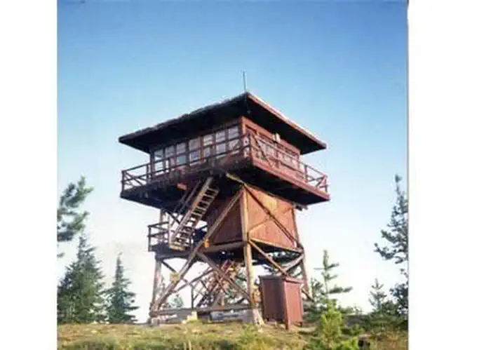
Site mix
| Cabins | 1 |
Site guide
1 site. Tap a filter to narrow the list; the map follows.
| Site | People / vehicles |
|---|---|
| 001 | 4 / 2 |
Per-site records as published by the managing agency on Recreation.gov. Blank cells mean the agency listed nothing for that site. Check-in 2:00 PM, checkout 11:00 AM.
Amenities & rules
Surveyors Lookout can accommodate up to four guests. Furnishings include a propane cook stove, heater and lights. A twin bed and two extra mattresses are provided, along with a chest with some drawers. A refrigerator is also available, but it is very small and unreliable. It is recommended that guests bring a cooler with ice as backup. Cooking pots and utensils are included. No drinking water is available; guests should bring plenty of their own. An alternate option is to collect water from a spring located 1.4 miles down the access road. This water is non-potable and must be boiled or treated before consuming. Items to pack include food, bedding, a first aid kit, dish soap, towels, toiletries and binoculars. If planning to collect water from a stream, water containers are needed. Guests are advised to bring warm clothes and blankets for cold evenings.
Individual sites vary. Confirm on Recreation.gov or with the managing office.
Weather by month
Getting there
From the St. Joe River Road (FH50) to Beaver Creek, drive 29 miles east of Avery to the junction of the Red Ives Road 218. Turn south (right) and drive 8 miles to the junction of Beaver Creek Road 303 (just past Beaver Creek Campground). Drive about 7.5 miles to Road 201. Turn south (left) toward Sawtooth Saddle.
| Nearest town | Avery, Idaho |
| Coordinates | 46.9942° N, 115.5333° W · Directions ↗ |
Good to know
- Access to the lookout is via a rugged single-lane road with pullouts, and is not recommended for low clearance vehicles.
- Although a heater is provided, the lookout is not insulated so it remains cold.
Fire nearby
- PrescribedD4 Rx Simmons Peak
14 mi from the campground
- WildfireNugget Hill
15 mi from the campground · 35 acres
- PrescribedRx Barnyard Units Nfrd
17 mi from the campground · 41 acres
- PrescribedD4 Rx Hwy 50 Roadside Salvage
17 mi from the campground
Distance is to the reported incident point, not the fire edge. Call the managing office before you drive.
Supplies & services
| Dump station | Dump station ↗ | 21.3 mi |
Locations © OpenStreetMap contributors. Call ahead; hours change seasonally.
Explore
Worth a stop
Avery is the nearest town for conveniences.
- 7.7 miIsabella Point Trailhead ↗Trailhead
- 11 miIsabella Landing Trailhead ↗Trailhead
Trails nearby
- 0.2 miScribner Falls ↗8 mi trail · hiking, horse, bike
- 0.5 miNorthbound Creek ↗6.8 mi trail · hiking, horse, bike
- 0.5 miSurveyor'S Ridge ↗9.3 mi trail · hiking, horse, bike
- 0.6 miHorseshoe Loop ↗5.5 mi trail · hiking, horse, bike
- 1.2 miBuck Creek ↗9.3 mi trail · hiking, horse, bike
- 1.2 miSawtooth Creek ↗4.8 mi trail · hiking, horse, bike
Trail and trailhead records are the Forest Service's. Distances are straight-line to the nearer trail end. Trail conditions are not tracked here.
Public land it sits in
Nez Perce-Clearwater National Forest begins about 10.4 miles away, and it is the closest of these.
- 10.4 miNez Perce-Clearwater National Forest ↗National Forest · Forest Service · 4,072,795 acres
Each unit is published as a centre point and an acreage rather than a boundary, so this section stands it in for a circle of the same area. Whether a campground is inside, and how far it is from one it is outside, are both approximate.
Other campgrounds nearby


Cabin and lookout rentals nearby

On the National Register nearby
- Mallard Peak LookoutBuilding · Avery · 3.9 mi
- Halm Creek, Bean Creek FireSite · Red Ives · 8.5 mi
Natural features
Surveyors Lookout is located atop Surveyors Ridge at an elevation of 6,000 feet. The 30 foot tower overlooks the spectacular Mallard-Larkins Pioneer Area, which straddles the divide between the Little North Fork Clearwater River basins and the North Fork Clearwater River. Snow Peak, Middle Sister and Mallard Peak Lookouts are still standing and can be seen from Surveyors.
Recreation
The Mallard-Larkins Pioneer Area straddles the divide between the Little North Fork Clearwater River basins and the North Fork Clearwater River. This beautiful area attracts hikers and some technical rock climbers. Hunting and trout fishing are offered in designated areas. From the lookout, there is access to Scribner Falls Trail #106 and nearby access to Surveyor's Ridge Trail #40, Horseshoe Loop Trail #141, and Northbound Creek Trail #111. A scenic drive through the upper St. Joe country is an excellent way to take in the sights leading up to the lookout.
Guidebooks for Idaho
We earn a small commission if you buy through these links. It does not change what we list.

Titles come from Open Library's catalog, matched by subject heading or by title.
Reference
Questions people ask
Do I need a reservation at Surveyors Lookout?
Sites at Surveyors Lookout are reservable on Recreation.gov. Any walk-up sites are listed on the booking page.
Source: Recreation.gov
What time is check-in at Surveyors Lookout?
Check-in 2:00 PM, checkout 11:00 AM.
Source: Recreation.gov
How many sites does Surveyors Lookout have?
1 site, including 1 cabin.
Source: Recreation.gov
What is there to do at Surveyors Lookout?
The Mallard-Larkins Pioneer Area straddles the divide between the Little North Fork Clearwater River basins and the North Fork Clearwater River. The Recreation section on this page has the rest.
Source: Recreation
What is the nearest town to Surveyors Lookout?
Avery, Idaho. Avery is the nearest town for conveniences.
Source: Getting there
What if Surveyors Lookout is full?
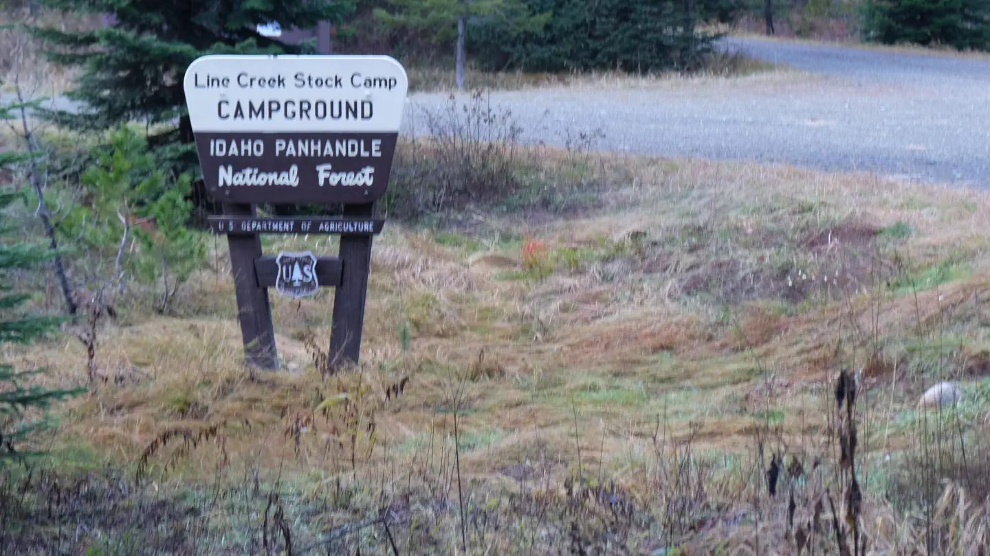
The nearest public campgrounds are Mammoth Springs Campground (8.9 mi, first-come), Spruce Tree Campground (9.2 mi, first-come), and Line Creek Stock Campground (9.3 mi).
Source: Campgrounds nearby