Murderers Creek Guard Station
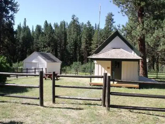
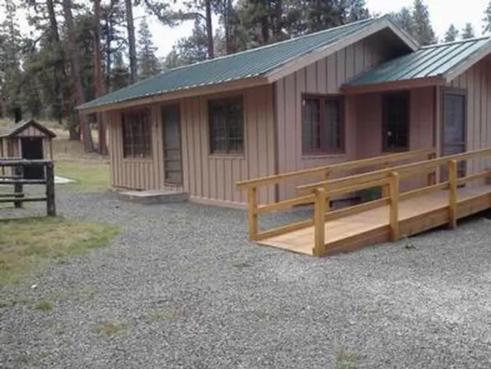
Murderer's Creek Guard Station is in the heart of the Malheur National Forest, in central Oregon. It makes an excellent base camp for back country recreating, and is a cozy retreat for a couple and a fun opportunity to imagine the life of the early day forest rangers. The historic guard station is one of the oldest standing buildings in the forest. The cabin contains some modern amenities and can be accessed by vehicle. Guests are responsible for their own travel arrangements and safety, and must bring several of their own amenities.
Check availability on Recreation.gov ↗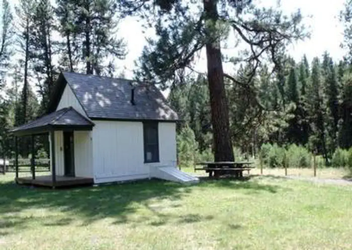

Site mix
| Cabins | 1 |
Site guide
1 site. Tap a filter to narrow the list; the map follows.
| Site | Surface | Shade | People / vehicles |
|---|---|---|---|
| 01 | Gravel | Partial | 2 / 2 |
Per-site records as published by the managing agency on Recreation.gov. Blank cells mean the agency listed nothing for that site. Check-in 4:00 PM, checkout 12:00 PM.
Amenities & rules
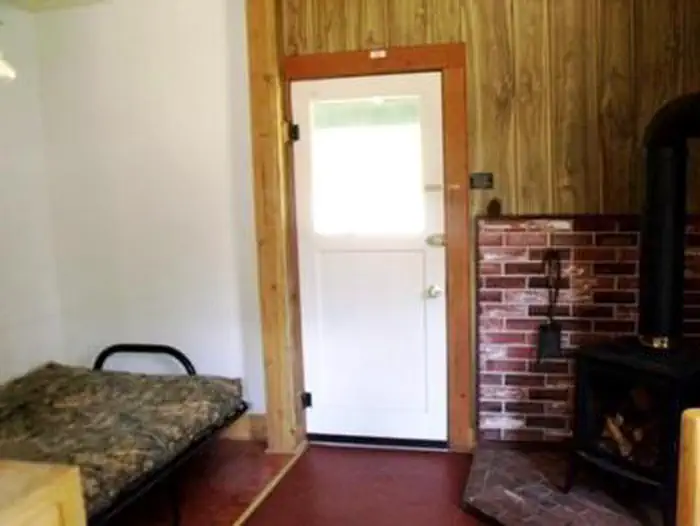
The one-room "studio" cabin is equipped with a futon that folds down into a full (double) bed. It has a table and chairs, a propane cook stove, propane refrigerator and propane heater inside the cabin. Basic cooking pots, utensils and tableware are also provided. There is a garage building and room to park an RV in the adjacent driveway. A newer style vault toilet is located outside. Guests will need to bring water for drinking, cooking and cleaning purposes, as well as bedding, flashlights or a lantern for emergencies, a first aid kit, towels, garbage bags and dish soap, among other necessities. Guests will need to clean the cabin and carry out all trash before leaving. No pets allowed in the Guard Station.
Individual sites vary. Confirm on Recreation.gov or with the managing office.
Weather by month
Getting there
From Burns, travel North on Highway 395 approximately 55 miles to County Road 63. Turn left on County Road 63 to the junction of Forest Service Road 21. Take a right onto Forest Service Road 21 and travel approximately 16 miles to the guard station.
| Nearest town | John Day, Oregon |
| Coordinates | 44.2613° N, 119.2757° W · Directions ↗ |
Fire nearby
- PrescribedDamon 2A Rx
13 mi from the campground · 85 acres
- PrescribedJane 102 Rx
30 mi from the campground · 3,000 acres
- PrescribedGreenwood Rx
37 mi from the campground · 38 acres
- WildfireSecond Flat
46 mi from the campground · 105,854 acres · 99% contained
Distance is to the reported incident point, not the fire edge. Call the managing office before you drive.
Supplies & services
| Dump station | Dump station ↗ | 14.1 mi |
Locations © OpenStreetMap contributors. Call ahead; hours change seasonally.
Explore
Worth a stop
- 6.1 miMcclellan Trailhead ↗Trailhead
Trails nearby
- 0.4 miSnomo #5117 ↗11.6 mi trail
- 0.4 miHorse Mountain Loop Snowmobile ↗17.2 mi trail
- 3.2 miBurma Road Snowmobile4.1 mi trail
- 3.4 miFlagtail Ski Trail E2.1 mi trail
- 4.2 miFields Peak2.2 mi trail
- 4.3 miSnomo #51123.5 mi trail
Trail and trailhead records are the Forest Service's. Distances are straight-line to the nearer trail end. Trail conditions are not tracked here.
Public land it sits in
Malheur National Forest begins about 5.7 miles away, and it is the closest of these.
- 5.7 miMalheur National Forest ↗National Forest · Forest Service · 1,787,138 acres
Each unit is published as a centre point and an acreage rather than a boundary, so this section stands it in for a circle of the same area. Whether a campground is inside, and how far it is from one it is outside, are both approximate.
Other campgrounds nearby


Cabin and lookout rentals nearby
Natural features
The guard station is located approximately 32 miles from the town of John Day. It sits at an elevation of about 5,000 feet. The facility was built in 1913 and was originally used as a fire guard station. It was in use by Forest Service officials until the late 1990s. Murderer's Creek, a small creek that runs east and west along the southern base of Aldrich Mountain, is nearby the cabin. The guard station is surrounded by open meadows and timbered areas of ponderosa pine and mixed conifer. Abundant wildflowers dot the Cedar Grove Botanical Area, a 26-acre cedar grove on the northeast slope of Aldrich Mountain. The area is known for its wild horses, which coexist with mule deer, elk, antelope, bighorn sheep, bear, cougar, and myriad smaller forest animals.
Recreation
Viewing wildlife and birds is popular in the area, as is hunting not far from the facility. Guests can hike area trails, explore the Cedar Grove Botanical Area and fish Murderer's Creek and South Fork John Day, though area creeks run dry toward summer's end.
Guidebooks for Oregon
We earn a small commission if you buy through these links. It does not change what we list.

Titles come from Open Library's catalog, matched by subject heading or by title.
Reference
Questions people ask
Do I need a reservation at Murderers Creek Guard Station?
Sites at Murderers Creek Guard Station are reservable on Recreation.gov. Any walk-up sites are listed on the booking page.
Source: Recreation.gov
What time is check-in at Murderers Creek Guard Station?
Check-in 4:00 PM, checkout 12:00 PM.
Source: Recreation.gov
How many sites does Murderers Creek Guard Station have?
1 site, including 1 cabin.
Source: Recreation.gov
What is there to do at Murderers Creek Guard Station?
Viewing wildlife and birds is popular in the area, as is hunting not far from the facility. The Recreation section on this page has the rest.
Source: Recreation
What is the nearest town to Murderers Creek Guard Station?
John Day, Oregon.
Source: Getting there
What if Murderers Creek Guard Station is full?
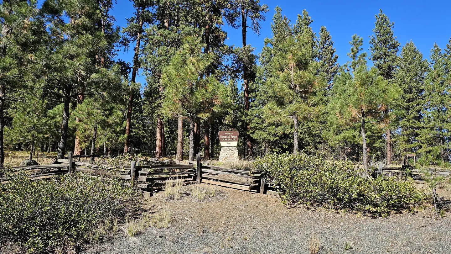
The nearest public campgrounds are Oregon Mine Campground (1.4 mi, first-come), Billy Fields Campground (6.2 mi, first-come), and Starr Campground (12.9 mi).
Source: Campgrounds nearby