Juniper Campground
Juniper Family Campground is the ideal place to camp on the Pajarito Plateau. Located just inside the main park entrance, the campground is a short drive from the Bandelier Visitor Center, the Frijoles Canyon Shuttle bus system (mid-May to mid-October), and the adjacent towns of Los Alamos and White Rock. Juniper Family Campground is the perfect "home base" to explore the Pajarito Plateau, Jemez M The campground is divided into 3 loops: Abert's Squirrel Loop (Loop A) campsites are available year-round as first-come, first serve only.
Some sites take reservations on Recreation.gov. Others are first-come, first-served.
More like this: first-come in New Mexico · reservable in New Mexico · big rigs in New Mexico · pets allowed in New Mexico · group sites in New Mexico
Check availability on Recreation.gov ↗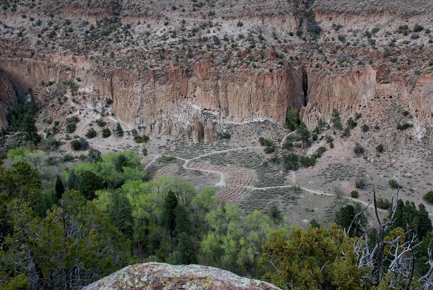
Site mix
| Standard, no hookups | 48 |
| Group sites | 2 |
| Host/management | 6 |
Site guide
Will my RV fit
The longest site here provides 40 feet of vehicle capacity. Most sites are shorter.
50 sites in 4 loops. Tap a filter to narrow the list; the map follows.
| Site | Loop | Type | Entry | Fits, ft | Surface | Shade | Water / sewer | People / vehicles | Fires | Accessible | Rating |
|---|---|---|---|---|---|---|---|---|---|---|---|
| 2 | Abert's Squirrel | Standard | Back-in | 20 | Paved | None | No / – | 10 / 2 | Yes | Basic | |
| 3 | Abert's Squirrel | Standard | Back-in | 35 | Paved | None | No / – | 10 / 2 | Yes | Basic | |
| 4 | Abert's Squirrel | Standard | Back-in | 20 | Paved | None | No / – | 10 / 2 | Yes | Basic | |
| 6 | Abert's Squirrel | Standard | Back-in | 33 | Paved | Partial | No / – | 10 / 2 | Yes | Basic | |
| 7 | Abert's Squirrel | Standard | Back-in | 25 | Paved | None | No / – | 10 / 2 | Yes | Basic | |
| 8 | Abert's Squirrel | Standard | Back-in | 33 | Paved | Partial | No / – | 10 / 2 | Yes | Basic | |
| 9 | Abert's Squirrel | Standard | Pull-through | 40 | Paved | None | No / – | 10 / 2 | Yes | Basic | |
| 10 | Abert's Squirrel | Standard | Back-in | 35 | Paved | Partial | No / – | 10 / 2 | Yes | Basic | |
| 11 | Abert's Squirrel | Standard | Back-in | 35 | Paved | Partial | No / – | 10 / 2 | Yes | Basic | |
| 12 | Abert's Squirrel | Standard | Back-in | 30 | Paved | Partial | No / – | 10 / 2 | Yes | Basic |
Per-site records as published by the managing agency on Recreation.gov. Blank cells mean the agency listed nothing for that site. Check-in 1:00 PM, checkout 11:30 AM.
Amenities & rules
| Hookups | None |
| Max vehicle length | 50 ft |
| Equipment | RVs & trailers, Tents |
| Pets | Allowed |
| Campfires | Allowed, subject to restrictions |
| Fees | Camping Fees. Payment for reservations is due upon booking. You may pay for first-come, first-serve campsites (Abert's Squirrel Loop) at the self-pay kiosk in the campground or in-person at the Bandelier Visitor Center during business hours. Entrance fees. |
| Accessibility | Sites 38, 45 are listed accessible |
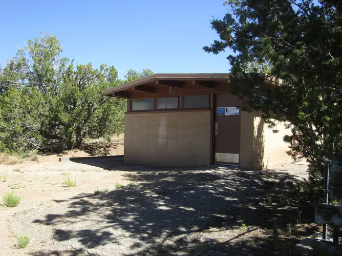
Juniper Family Campground has 3 camping loops. There is an RV dump station on the road into the campground, however water at the dump station is completely turned off from mid-October to mid-April (campers will not be able to fill water tanks or dump). During the summer months, interpretive programs may be offered during the day at the Visitor Center and in the evening at the campground amphitheater (check with the Visitor Center for program schedule). Each loop offers its own comfort station with restrooms and running water and centrally located water spigots with potable water. No hookups are available at any campsites. Shade is limited in most campsites. During the summer months a camp host is present in the campground. Individual Campsites Each individual campsite has a paved parking pull in or pull through parking spot. Driveways/pull through size vary by site, many can accommodate larger RVs/trailers. Picnic tables, fire rings with grills, and food lockers are provided at each campsite.
Individual sites vary. Confirm on Recreation.gov or with the managing office.
Weather by month
Getting there
From Santa Fe (approximately 1 hour travel time). Take Highway 84/285 (Saint Francis Drive) north toward Los Alamos. Merge right onto NM 502 to Los Alamos. Exit onto NM 4 toward White Rock. Continue for 12 miles (19 km), passing through White Rock. Bandelier's entrance is on the left. Entrance station is staffed most days during business hours.
| Nearest town | Los Alamos, New Mexico |
| Coordinates | 35.7961° N, 106.2792° W · Directions ↗ |
Good to know
- HOWEVER, cell service/data is not always reliable in the park and no public WiFi is available.
Fire nearby
- WildfireFrijoles
25 mi from the campground · 15,956 acres · 90% contained
- PrescribedStone Angel Fall Rx
40 mi from the campground
- PrescribedMesa Juan Domingo Fall Rx
44 mi from the campground
Distance is to the reported incident point, not the fire edge. Call the managing office before you drive.
Supplies & services
| Dump station | Juniper Campground Dump Station ↗ | 0.1 mi |
| RV sales & service | Land of Enchantment RV ↗ | 19.3 mi |
| Outdoor gear | Sierra ↗ | 19.8 mi |
Locations © OpenStreetMap contributors. Call ahead; hours change seasonally.
Explore
Video
Juniper Campground - Theodore Roosevelt National Park - Campground Review
Worth a stop
The town of Los Alamos has shopping, museums, amenities, a movie theater, ice rink, ski hill, and is home to Manhattan Project National Historic Site. Nearby Department of Energy and US Forest Service lands provide trails which accommodate pets. Valles Caldera National Preserve is 16 miles (26 km) west of Bandelier. Jemez Historic Site is 37 miles (60 km) west. Pecos National Historical Park is 70 miles (113 km) southeast. Santa Fe, 40 miles (64 km) south of the park, is home to the New Mexico state capitol, museums, historic districts, art galleries, food, accomodations, and more.
- 13.8 miLas Conchas Day Use Site ↗Day use
- 14.2 miVolcano Discovery Center ↗Visitor center
- 14.3 miLas Conchas Trailhead ↗Trailhead
Trails nearby
- 4.4 miCuesta Colorada1.2 mi trail · hiking, horse, bike
- 4.4 miAlamo Spring ↗5.3 mi trail · hiking, horse, bike
- 4.9 miBoundary Peak0.7 mi trail · hiking, horse, bike
Trail and trailhead records are the Forest Service's. Distances are straight-line to the nearer trail end. Trail conditions are not tracked here.
Public land it sits in
This campground sits inside Santa Fe National Forest.
- inSanta Fe National Forest ↗National Forest · Forest Service · 1,681,851 acres
- 0.1 miBandelier Wilderness ↗Wilderness · National Park Service · 23,267 acres
- 5.1 miDome Wilderness ↗Wilderness · Forest Service · 5,185 acres
Each unit is published as a centre point and an acreage rather than a boundary, so this section stands it in for a circle of the same area. Whether a campground is inside, and how far it is from one it is outside, are both approximate.
Other campgrounds nearby
Historic landmarks nearby


Natural features
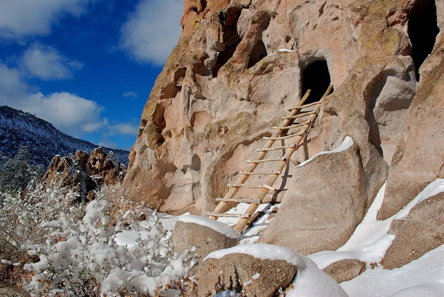
Bandelier National Monument protects over 33,000 acres (13355 ha) of rugged, beautiful canyon and mesa country which features evidence of human presence going back over 11,000 years. Petroglyphs, dwellings carved into the soft rock cliffs, and standing masonry walls pay tribute to the early days of a culture that still survives in the surrounding communities. Bandelier National Monument sits at the southern end of the Pajarito (Spanish for little bird) Plateau. The plateau was formed by two eruptions 1.6 and 1.4 million years ago. Home to the Bandelier Wilderness, Bandelier ranges from 5340 ft (1628 m) at the Rio Grande River to the south and 10,199 ft (3109 m) at the summit of Cerro Grande to the north, almost a mile of elevation change in just under 12 miles (19 km). This elevation gradient creates a unique diversity of habitats specific to Northern New Mexico. The diversity of habitats and quick access to water supported a relatively large population of Ancestral Pueblo people. Currently, Piñon-Juniper woodlands dominate in the southern parts of the park transitioning through ponderosa pine savannahs and forests, finally reaching mixed conifer forests at the highest elevation.
Recreation
Bandelier is home to over 70 miles (113 km) of hiking trails most of which are located within federally designated wilderness. Two trails are accessible directly from Juniper Family Campground. The Frey Trail follows the historic route into Frijoles Canyon and descends down the canyon wall to the Visitor Center and the Main Loop Trail. The Tyuonyi Overlook Trail leaves the amphitheater parking area for a 3/4-mile (1.2 km) hike across the open mesa top to an overlook providing breathtaking views of Frijoles Canyon and of Tyounyi, an ancestral Pueblo village. The Bandelier Visitor Center houses museum exhibits, park film, information and ranger programs, Western National Parks Association sales outlet, and more. Entrance to Frijoles Canyon and the Visitor Center is by shuttle bus only (or by hiking) from mid-May to mid-October. These areas are accesibile by private vehicle outside the shuttle bus period.
Guidebooks for New Mexico
We earn a small commission if you buy through these links. It does not change what we list.
Titles come from Open Library's catalog, matched by subject heading or by title.
Reference
Questions people ask
Do I need a reservation at Juniper Campground?
For some sites. Some sites take reservations on Recreation.gov. Others are first-come, first-served.
Source: Recreation.gov
How much does it cost to camp at Juniper Campground?
Camping Fees. Payment for reservations is due upon booking. You may pay for first-come, first-serve campsites (Abert's Squirrel Loop) at the self-pay kiosk in the campground or in-person at the Bandelier Visitor Center during business hours.
Source: Recreation.gov
What time is check-in at Juniper Campground?
Check-in 1:00 PM, checkout 11:30 AM.
Source: Recreation.gov
How many sites does Juniper Campground have?
56 sites, including 48 standard sites without power and 2 group sites.
Source: Recreation.gov
Will my RV fit at Juniper Campground?
The longest site here provides 50 feet of vehicle capacity. Most sites are shorter. The sidebar tool checks a trailer or motorhome length against every site.
Source: Will my RV fit
Are there showers or a dump station at Juniper Campground?
There is an RV dump station on the road into the campground, however water at the dump station is completely turned off from mid-October to mid-April (campers will not be able to fill water tanks or dump).
Source: Recreation.gov
Are pets allowed at Juniper Campground?
Yes, pets are allowed at Juniper Campground. Leash rules apply.
Source: Recreation.gov
Can I have a campfire at Juniper Campground?
Fires are allowed in the provided rings under normal conditions. As of 2026-10-16, there are 3 active fires within 50 miles, so check current restrictions before you light one.
Source: Fire nearby
Are there accessible sites at Juniper Campground?
Sites 38 and 45 are listed accessible on Recreation.gov. What that covers (a paved pad, an accessible table, a nearby accessible restroom) is on each site's booking page.
Source: Recreation.gov
Is there cell service at Juniper Campground?
FCC coverage maps show AT&T 4G LTE and T-Mobile 4G LTE at the campground point. Terrain changes that from one site to the next.
Source: FCC Broadband Map
What is there to do at Juniper Campground?
Bandelier is home to over 70 miles (113 km) of hiking trails most of which are located within federally designated wilderness. The Recreation section on this page has the rest.
Source: Recreation
What is the nearest town to Juniper Campground?
Los Alamos, New Mexico. The town of Los Alamos has shopping, museums, amenities, a movie theater, ice rink, ski hill, and is home to Manhattan Project National Historic Site.
Source: Getting there