Acker Rock Lookout
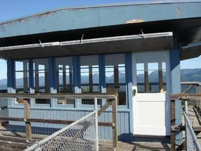
Perched atop the edge of a rocky cliff in the Umpqua National Forest, Acker Rock Lookout offers visitors a unique lodging experience with spectacular panoramic views of the South Umpqua watershed in southwest Oregon. Still used in active fire detection today, the lookout was placed on the rocky cliff via helicopter in the 1960's. Before the advent of airplane surveillance for fire detection, there were more than a dozen lookouts on the Tiller Ranger District. Today Acker Rock and Pickett Butte are the only remaining lookouts on the District. The lookout tower is generally available for reservation from August 1st thru November 15th (depending on snow).
Check availability on Recreation.gov ↗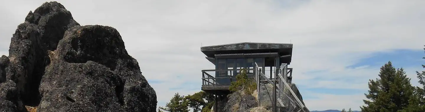
Site mix
| Fire lookouts | 1 |
Site guide
1 site. Tap a filter to narrow the list; the map follows.
| Site | Surface | Shade | People / vehicles | Rating |
|---|---|---|---|---|
| ACKER ROCK LOOKOUT | Gravel | Partial | 4 / 2 | Preferred |
Per-site records as published by the managing agency on Recreation.gov. Blank cells mean the agency listed nothing for that site. Check-in 2:00 PM, checkout 11:00 AM.
Amenities & rules
| Pets | Allowed |
| Fees | $40 |
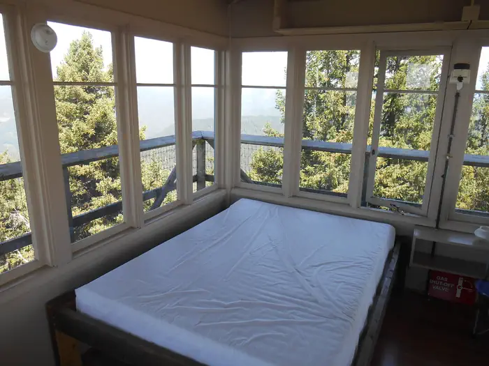
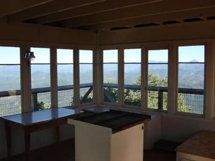
The 12-foot by 12-foot, one-room lookout is furnished with a single bed, a small table and chair, and is equipped with a propane fueled wall heater, lanterns, cooking stove with oven and a refrigerator (propane is provided). A composting toilet is located at the lookout site. There is no water at the site, so visitors must bring plenty for drinking, cooking and washing. Potable water is available at a spigot in front of the Tiller Ranger Station office (45 minute drive). Guests must supply their own food, cooking utensils, sleeping bags, sleeping pads, towels, dish soap, matches, cooking gear, toilet paper and garbage bags. Although propane lighting is available, bringing an additional light source is recommended.
Individual sites vary. Confirm on Recreation.gov or with the managing office.
Weather by month
Getting there
Important note regarding GPS use: please be advised that GPS units can, and have sent guests down the wrong roads to access the Lookout. Please consider following the directions below rather than your GPS unit. Directions: From Canyonville take West 1st Street and turn onto SE 3rd St/OR-227.
| Nearest town | Tiller, Oregon |
| Coordinates | 43.0524° N, 122.6457° W · Directions ↗ |
Good to know
- The lookout is not rented during the winter months due to wind and snow weight restrictions on the building.
Fire nearby
- PrescribedRx Long Prairie
23 mi from the campground · 112 acres
- PrescribedRx Cold Springs
25 mi from the campground · 158 acres
Distance is to the reported incident point, not the fire edge. Call the managing office before you drive.
Supplies & services
| Dump station | Mazama Campground Dump Station ↗ | 27.5 mi |
| Outdoor gear | Sportsman's Warehouse ↗ | 38.8 mi |
| RV sales & service | Blue Dog RV of Oregon ↗ | 48 mi |
Locations © OpenStreetMap contributors. Call ahead; hours change seasonally.
Explore
Worth a stop
Opportunities for fishing are within 10 miles of the lookout.
- 5 miFish Lake Trailhead ↗Trailhead
- 7.2 miCougar Butte Trailhead ↗Trailhead
- 14.6 miJim Creek Picnic Site ↗Day use
Trails nearby
- under 0.1 miAcker Rock0.4 mi trail · hiking, horse, bike
- 0.9 miNfst-29008010.1 mi trail · hiking, horse, bike, motorcycle and 2 more
- 1.1 miNfst-29389040.4 mi trail · hiking, horse, bike, motorcycle and 2 more
- 1.9 miNfst-28388250.5 mi trail · hiking, horse, bike, motorcycle and 2 more
- 2.1 miNfst-27009010.6 mi trail · hiking, horse, bike, motorcycle and 2 more
- 2.4 miNfst-27009030.4 mi trail · hiking, horse, bike, motorcycle and 2 more
Trail and trailhead records are the Forest Service's. Distances are straight-line to the nearer trail end. Trail conditions are not tracked here.
Public land it sits in
This campground sits inside Umpqua National Forest.
- inUmpqua National Forest ↗National Forest · Forest Service · 1,035,837 acres
- 5 miRogue-Umpqua Divide Wilderness ↗Wilderness · Forest Service · 35,749 acres
Each unit is published as a centre point and an acreage rather than a boundary, so this section stands it in for a circle of the same area. Whether a campground is inside, and how far it is from one it is outside, are both approximate.
Other campgrounds nearby

Cabin and lookout rentals nearby
On the National Register nearby
- Hershberger Mountain LookoutBuilding · Prospect · 9.7 mi
- Whaleback Snow–Survey CabinBuilding · Prospect · 10.3 mi
- Mt. Stella LookoutBuilding · Prospect · 13.3 mi
Natural features
Unique volcanic and sedimentary rock outcroppings and dense conifer forests define the landscape, giving way to sub-alpine meadows and summer wildflowers in the higher elevations. The rock formation on which the lookout building sits is itself a magnificent feature. Sheer cliffs drop off for several hundred feet on the west and south sides. The translation of the word "Umpqua," meaning "thundering waters," defines the area. High mountain lakes, heart-stopping rapids, peaceful ponds and thundering waterfalls await visitor.
Recreation
The panorama includes landmarks on the Rogue-Umpqua Divide; on a clear day you can see mountains on the Willamette, Rogue, and Deschutes River watersheds and Crater Lake Rim. Overlooking the Umpqua River and several of its tributaries, the lookout is a delightful setting for hiking, birding and wildlife viewing. Seasonal changes envelope the area as snowmelt gives rise to spring flowers and vivid autumn colors bring with it numerous recreation opportunities. For a day trip, guests may enjoy a scenic drive along a portion of the 172-mile Rogue-Umpqua National Scenic Byway or a mountain hike into the Rogue Umpqua Divide wilderness on over 100 miles of trail.
Guidebooks for Oregon
We earn a small commission if you buy through these links. It does not change what we list.

Titles come from Open Library's catalog, matched by subject heading or by title.
Reference
Questions people ask
Do I need a reservation at Acker Rock Lookout?
Sites at Acker Rock Lookout are reservable on Recreation.gov. Any walk-up sites are listed on the booking page.
Source: Recreation.gov
How much does it cost to camp at Acker Rock Lookout?
$40
Source: Recreation.gov
What time is check-in at Acker Rock Lookout?
Check-in 2:00 PM, checkout 11:00 AM.
Source: Recreation.gov
How many sites does Acker Rock Lookout have?
1 site, including 1 lookout.
Source: Recreation.gov
Are pets allowed at Acker Rock Lookout?
Yes, pets are allowed at Acker Rock Lookout. Leash rules apply.
Source: Recreation.gov
What is there to do at Acker Rock Lookout?
The panorama includes landmarks on the Rogue-Umpqua Divide; on a clear day you can see mountains on the Willamette, Rogue, and Deschutes River watersheds and Crater Lake Rim. The Recreation section on this page has the rest.
Source: Recreation
What is the nearest town to Acker Rock Lookout?
Tiller, Oregon. Opportunities for fishing are within 10 miles of the lookout.
Source: Getting there
What if Acker Rock Lookout is full?
The nearest public campgrounds are South Umpqua Falls Campground (2.2 mi, first-come), Ash Flat Campground (4.4 mi, first-come), and Camp Comfort Campground (4.4 mi, first-come).
Source: Campgrounds nearby