Camp 4 Group Campground
This group site is nestled in the Shasta-Trinity National Forest on the Upper McCloud River, popular for its three stunning waterfalls. Camp 4 is typically open from mid-spring through mid-fall, offering primitive accommodations near a variety of recreational activities and magnificent scenery. Learn more about the Camp 4 daily lottery in Yosemite National Park.
More like this: reservable in California · pets allowed in California · group sites in California
Check availability on Recreation.gov ↗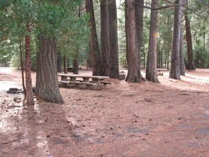
Site mix
| group standard area nonelectric | 1 |
Site guide
Will my RV fit
The longest site here provides 30 feet of vehicle capacity. Most sites are shorter.
1 site. Tap a filter to narrow the list; the map follows.
| Site | Fits, ft | Surface | Shade | Water / sewer | Waterfront | People / vehicles | Fires | Rating |
|---|---|---|---|---|---|---|---|---|
| Camp 4 Group | 30 | Gravel | Partial | No / – | Riverfront | 10 / 10 | Yes | Prime |
Per-site records as published by the managing agency on Recreation.gov. Blank cells mean the agency listed nothing for that site. Check-in 12:00 PM, checkout 11:00 AM.
The site record lists 10 people. The campground description says up to 30 people.
Amenities & rules
| Hookups | None |
| Max vehicle length | 30 ft |
| Equipment | RVs & trailers, Tents |
| Pets | Allowed |
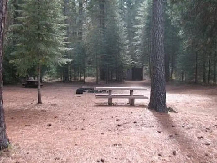
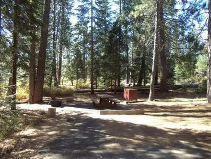
Vehicle access to Camp 4 is mostly on paved roads, but the last 1/4 mile is gravel. The facility can accommodate 10 vehicles and up to 30 guests, with a maximum of 10 tents plus 5 RV or motor homes. The campground has no water or electricity, but there are picnic tables, vault toilets and campfire rings provided, as well as trash collection-visitors are expected to bring their own trash bags. Water is available at the McCloud Ranger Station.
Individual sites vary. Confirm on Recreation.gov or with the managing office.
Weather by month
Getting there
From Redding or Mt. Shasta, take I-5 towards Hwy 89 McCloud. Get off I-5 at the McCloud/Hwy 89 Exit, from here the campground is approximately 20 miles over paved road. Head south on Hwy 89 past the town of McCloud towards Reno, Lassen Park. Turn right off hwy 89 onto the River Loop Rd. (Fowlers/Lower Falls exit).
| Nearest town | Mccloud, California |
| Coordinates | 41.2339° N, 121.9839° W · Directions ↗ |
Good to know
- This is not Camp 4 in Yosemite National Park.
Charges and cancellations
A $10.00 service fee will apply if you change or cancel your reservation. Late cancellations are subject to additional fees.
Supplies & services
| Dump station | Dump station ↗ | 7.8 mi |
| Outdoor gear | Ted Fay Fly Shop ↗ | 15 mi |
| RV sales & service | Cousin Gary RV Center ↗ | 44.4 mi |
Locations © OpenStreetMap contributors. Call ahead; hours change seasonally.
Explore
Video
Video of Camp 4 Group Campsite and Day Use Area, CA from Lauren Y.
Trails nearby
- 1.1 miBigelow Neotropical0.4 mi trail · hiking, horse, bike
- 1.4 miUpper Falls Main0.1 mi trail · hiking, horse, bike
- 1.4 miUpper Falls Main Bunder 0.1 mi trail · hiking, horse, bike
- 1.4 miUpper Falls Park 1under 0.1 mi trail · hiking, horse, bike
- 1.4 miUpper Falls Park 2under 0.1 mi trail · hiking, horse, bike
- 1.4 miUpper Falls Main Aunder 0.1 mi trail · hiking, horse, bike
Trail and trailhead records are the Forest Service's. Distances are straight-line to the nearer trail end. Trail conditions are not tracked here.
Public land it sits in
Klamath National Forest begins about 0.8 miles away, and it is the closest of these.
- 0.8 miKlamath National Forest ↗National Forest · Forest Service · 1,705,451 acres
- 4.1 miShasta-Trinity National Forest ↗National Forest · Forest Service · 2,715,499 acres
- 13 miMt. Shasta Wilderness ↗Wilderness · Forest Service · 36,981 acres
Each unit is published as a centre point and an acreage rather than a boundary, so this section stands it in for a circle of the same area. Whether a campground is inside, and how far it is from one it is outside, are both approximate.
Other campgrounds nearby



Cabin and lookout rentals nearby
Natural features
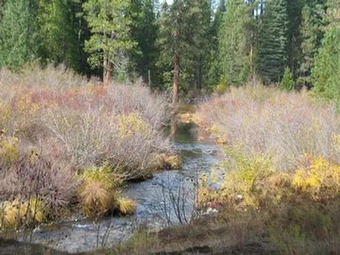
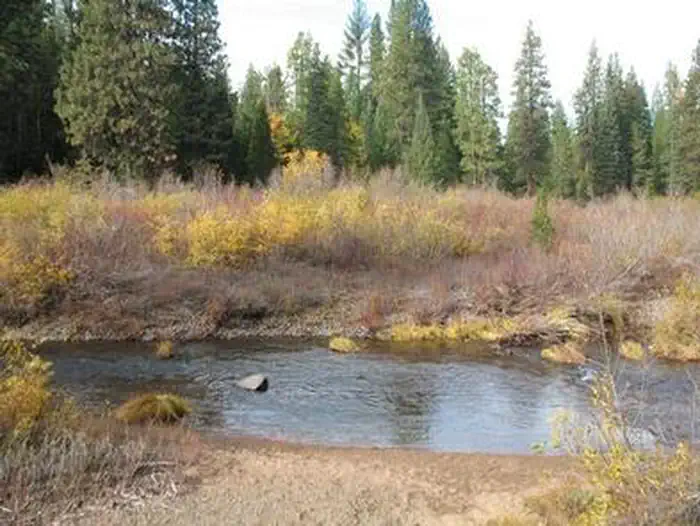
The Shasta-Trinity encompasses 2.1 million acres with over 6,278 miles of streams and rivers. It ranges from 1,000 ft. in elevation at Shasta Lake, to the spectacular Mt. Shasta with an elevation of 14,179 feet. The Shasta-Trinity includes portions of 5 designated Wilderness Areas: Castle Crags, Chanchelulla, Mount Shasta, Trinity Alps and Yolla Bolly-Middle Eel. It also sits among 7 major geographic and botanic regions: the Coast Range, Klamath Mountains, Willamette Valley, te Cascade Mountains, the High Desert, the Sierra Nevada Mountains and the Central Valley. The Upper McCloud River features the Upper, Middle and Lower Falls, which cascade over basalt lava flows, impressing visitors and kayakers alike.
Recreation
During the late spring, summer and early fall, the McCloud River is the most popular attraction in this area, offering fishing, swimming, camping, kayaking and plenty of photography opportunities. The Upper McCloud River, located from the point the river dumps into the McCloud Reservoir to its source, is a popular spot for trout fishing. Anglers can find rainbow, brook and McCloud River red band trout. The Lower McCloud River, which begins below the dam at the McCloud Reservoir, offers many additional angling opportunities as well. The nearby McCloud River Falls Trail offers hikers the opportunity to view all 3 of the waterfalls, as well as take in breathtaking views of Mt. Shasta. For hikers looking to cool off in the summer heat, the Middle Falls and Lower Falls both offer popular swimming holes, for those brave enough to take on the cool waters.
Nearby
The nearest services and amenities are 9 miles from Camp 4 in McCloud, a historic mill town that offers opportunities for golfing, eating out, shopping and sightseeing. Throughout Shasta-Trinity National Forest, there are access points for the Pacific Crest Trail, a 2,663-mile trail stretching from Mexico to Canada.
Guidebooks for California
We earn a small commission if you buy through these links. It does not change what we list.

Titles come from Open Library's catalog, matched by subject heading or by title.
Reference
Questions people ask
Do I need a reservation at Camp 4 Group Campground?
Sites at Camp 4 Group Campground are reservable on Recreation.gov. Any walk-up sites are listed on the booking page.
Source: Recreation.gov
What time is check-in at Camp 4 Group Campground?
Check-in 12:00 PM, checkout 11:00 AM.
Source: Recreation.gov
What does it cost to cancel a reservation at Camp 4 Group Campground?
A $10.00 service fee will apply if you change or cancel your reservation.
Source: Charges and cancellations
How many sites does Camp 4 Group Campground have?
1 site, including 1 group standard area nonelectric.
Source: Recreation.gov
Will my RV fit at Camp 4 Group Campground?
The longest site here provides 30 feet of vehicle capacity. Most sites are shorter. The sidebar tool checks a trailer or motorhome length against every site.
Source: Will my RV fit
Are pets allowed at Camp 4 Group Campground?
Yes, pets are allowed at Camp 4 Group Campground. Leash rules apply.
Source: Recreation.gov
Is there cell service at Camp 4 Group Campground?
FCC coverage maps show Verizon 4G LTE and AT&T 4G LTE at the campground point. Terrain changes that from one site to the next.
Source: FCC Broadband Map
What is there to do at Camp 4 Group Campground?
During the late spring, summer and early fall, the McCloud River is the most popular attraction in this area, offering fishing, swimming, camping, kayaking and plenty of photography opportunities. The Recreation section on this page has the rest.
Source: Recreation
What is the nearest town to Camp 4 Group Campground?
Mccloud, California. The nearest services and amenities are 9 miles from Camp 4 in McCloud, a historic mill town that offers opportunities for golfing, eating out, shopping and sightseeing.
Source: Getting there
What if Camp 4 Group Campground is full?
The nearest public campgrounds are Fowlers Campground (2.2 mi), Cattle Camp (2.9 mi, first-come), and Algoma Campground (5.5 mi, first-come).
Source: Campgrounds nearby