Zapata Falls Campground
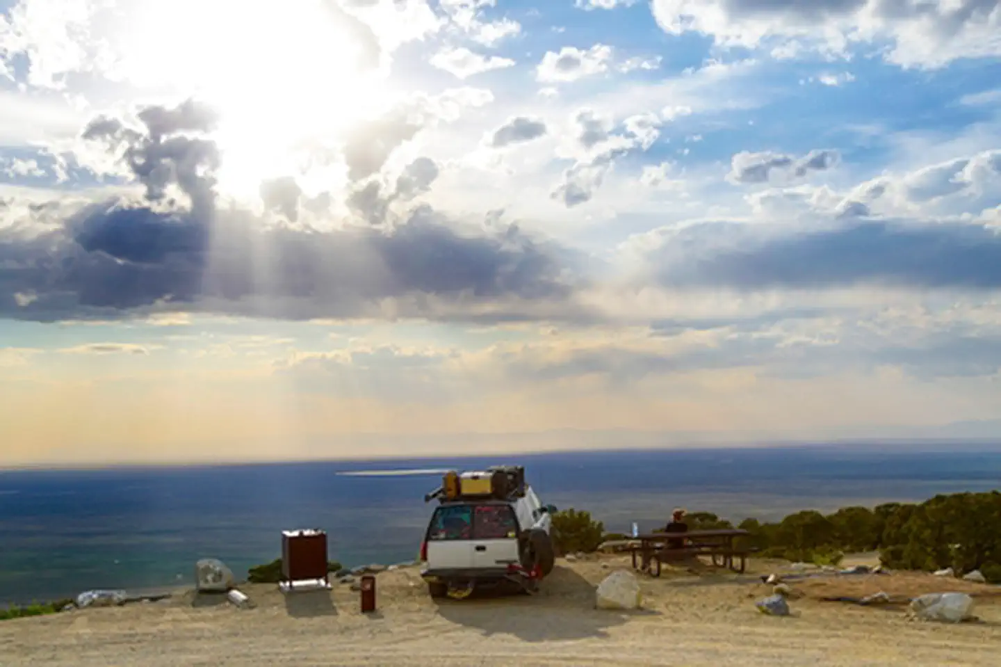
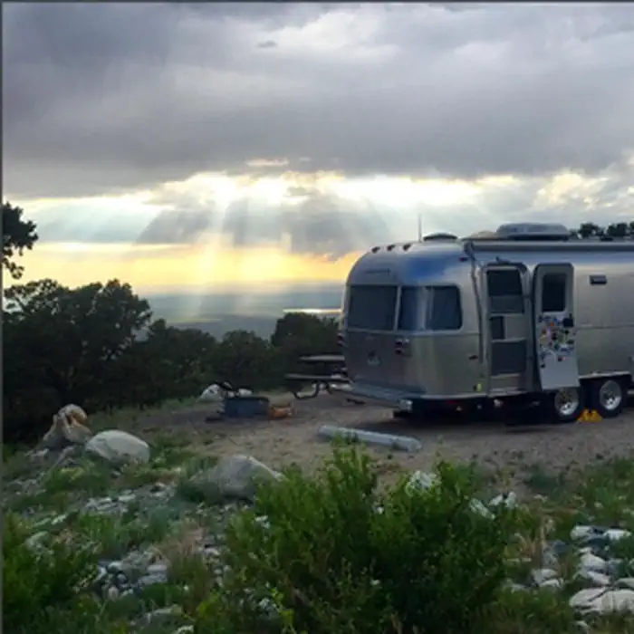
A short drive up the gravel road that leads to the Bureau of Land Management’s Zapata Falls Campground (CG) will let visitors to the area see the San Luis Valley and Great Sand Dunes National Park & Preserve from a whole new perspective. The campground offers bird’s-eye views of the valley floor below, the San Juan Mountains to the west, the adjacent Great Sand Dunes National Park and Preserve, and several 14er’s and many other towering peaks of the Sangre de Cristo Mountain range that Zapata Falls CG sits on — not to mention spectacular sunrises, sunsets and night skies!
More like this: reservable in Colorado · pets allowed in Colorado · group sites in Colorado
Check availability on Recreation.gov ↗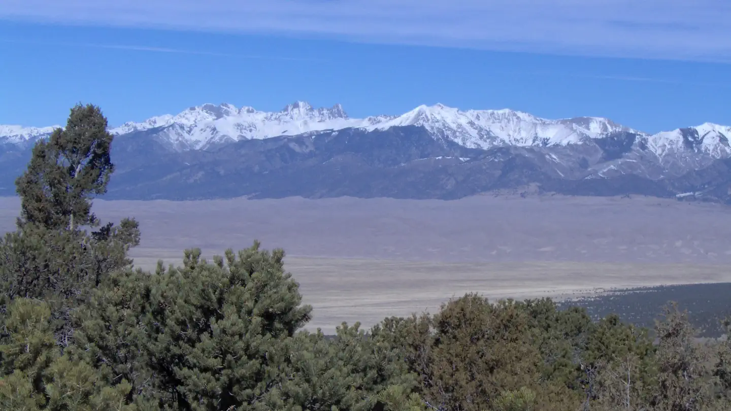
Site mix
| RV, no hookups | 25 |
| Standard, no hookups | 11 |
| picnic | 3 |
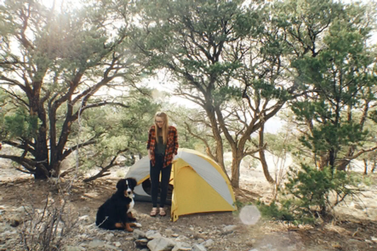
| Group tent areas | 1 |
| Host/management | 5 |
Site guide
24 sites. Tap a filter to narrow the list; the map follows.
| Site | Entry | Fits, ft | Surface | People / vehicles | Fires | Accessible |
|---|---|---|---|---|---|---|
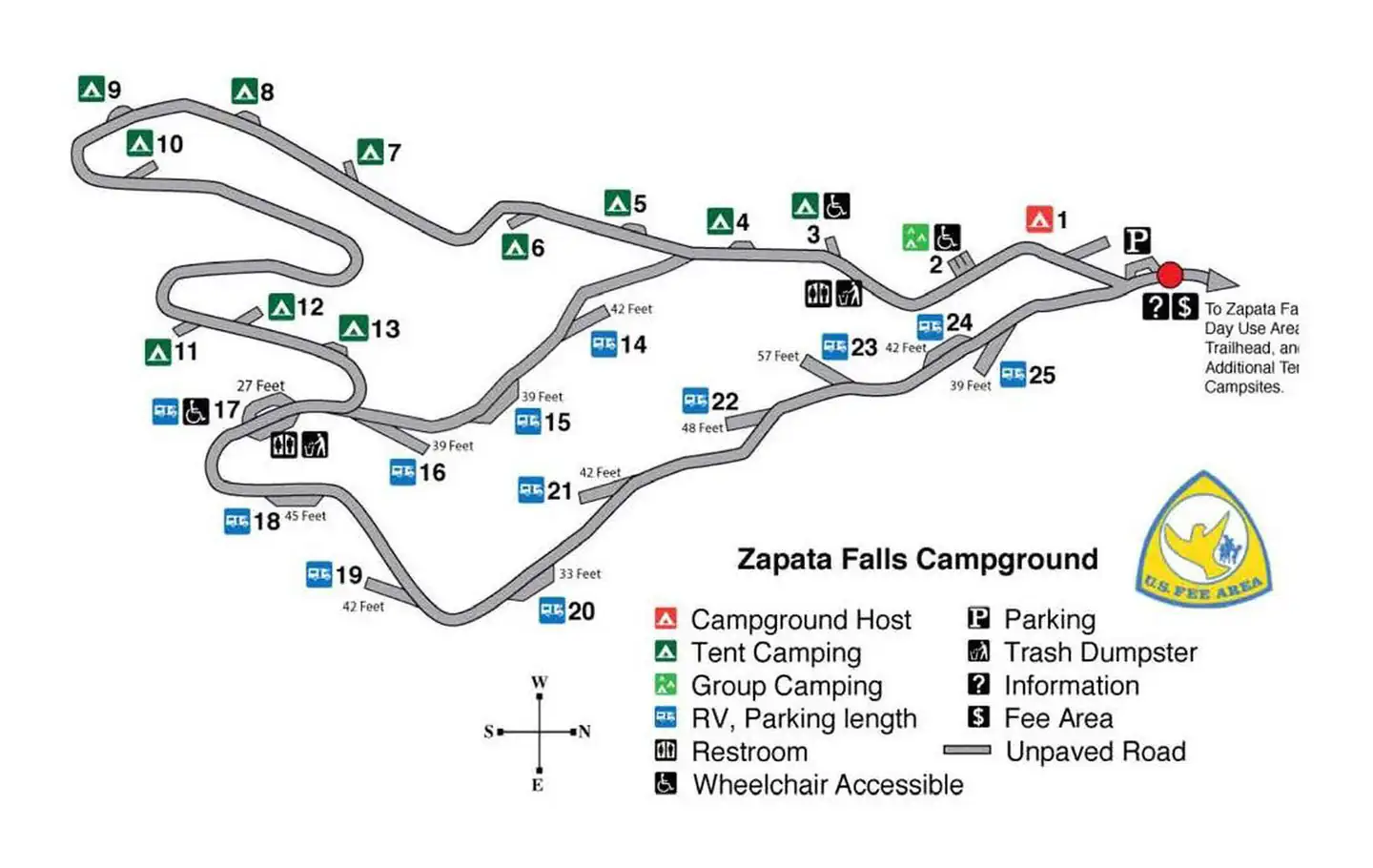
| 15 | Pull-through | 39 | Gravel | 6 / 2 | Yes | |
| 16 | Back-in | 39 | Gravel | 6 / 2 | Yes | |
| 17 | Pull-through | 27 | Gravel | 6 / 2 | Yes | Yes |
| 18 | Pull-through | 45 | Gravel | 6 / 2 | Yes | |
| 19 | Back-in | 42 | Gravel | 6 / 2 | Yes | |
| 20 | Pull-through | 33 | Gravel | 6 / 2 | Yes | |
| 21 | Back-in | 42 | Gravel | 6 / 2 | Yes | |
| 22 | Back-in | 48 | Gravel | 6 / 2 | Yes | |
| 23 | Back-in | 57 | Gravel | 6 / 2 | Yes | |
| 24 | Pull-through | 42 | Gravel | 6 / 2 | Yes |
Per-site records as published by the managing agency on Recreation.gov. Blank cells mean the agency listed nothing for that site. Check-in 1:00 PM, checkout 12:00 PM.
Amenities & rules
| Pets | Allowed |
| Campfires | Allowed, subject to restrictions |
| Fees | Individual Sites = $11/night. Group Tent Site = $20/night. 14 day Max Stay |
| Accessibility | Sites 17, 26, 2, 3 are listed accessible |
• Road signs from highway to Recreation Area. • Improved gravel roads in Recreation Area (no pavement). • No public drinking water system. • 6 vault (or pit-type) toilets. • Trash bins throughout campground and day-use areas. • 23 Individual sites (11 Tent, 12 RV, 1 Group Tent, 1 CG Host Site, 7 Picnic sites. • Standard campground amenities-table, tent pads, fire ring, food storage locker, parking. • Interpretive, informational, and directional signs. • Trailhead and overflow parking areas. • Foot and horse trails. • All facilities open year-round. • Cell phone service is good.
Individual sites vary. Confirm on Recreation.gov or with the managing office.
Weather by month
Getting there
Zapata Falls is accessed by Colorado State Highway 150 between mile markers 10 and 11, located approximately 5 miles south of Great Sand Dunes National Park and Preserve and 10.5 miles north of U.S. Highway 160. The turn-off is to the east, and the campground is located 3.5 miles (5.8km) up an unpaved road. Elevation 9,088ft.
| Nearest town | Monte Vista, Colorado |
| Coordinates | 37.6286° N, 105.5951° W · Directions ↗ |
Fire nearby
- WildfireAspen Acres
39 mi from the campground · 102,007 acres · 90% contained
Distance is to the reported incident point, not the fire edge. Call the managing office before you drive.
Supplies & services
| Dump station | Dump station ↗ | 8.3 mi |
| Outdoor gear | Kristi's Mountain Sports ↗ | 19.7 mi |
| RV sales & service | RV sales & service ↗ | 53.1 mi |
Locations © OpenStreetMap contributors. Call ahead; hours change seasonally.
Explore
Video
Zapata Falls Campground Review | Best Place to Camp Near Great Sand Dunes National Park Co
Worth a stop
Zapata Falls Trail To reach Zapata Falls, you will need to take a short but arduous hike to Zapata Creek. The falls are upstream from where the trail meets the creek. The only way to view the falls is to get your feet wet by wading carefully upstream to the base of the falls. Length: 1/2 mile each way Elevation: 9,000 to 9,400 feet Connections: South Zapata Lake Trail (U.S. Forest Service Trail #852) Other Nearby Attractions: • NPS-Great Sand Dunes National Park and Preserve. • USFS-Rio Grande National Forest and Sangre de Cristo Wilderness. • BLM-Blanca Wetlands Recreation Area. • USFWS-Baca and Alamosa National Wildlife Refuges. • Great Sand Dunes Oasis-Restaurant, gift shop, and lodge (near GRSA Park entrance). • Ft. Garland Museum and Cultural Center. • Colorado Gators Reptile Park. • UFO Watchtower. • Sand Dunes Hot Springs Pool. Other Nearby Campgrounds: Pinyon Flats CG, Great Sand Dunes NPP
- 2.4 miZapata Falls Day Use Area ↗Day use
- 7.9 miEntrance Station ↗Visitor center
- 8.5 miGreat Sand Dunes Visitor Center ↗Visitor center
Trails nearby
- 2 miS. Zapata ↗4.8 mi trail · hiking, horse, bike
- 3.6 miN. Fork Zapata1 mi trail · hiking, horse
Trailheads within three miles
- 2 miSouth Zapata Trailhead - Trail # 852 ↗Rio Grande National Forest
Trail and trailhead records are the Forest Service's. Distances are straight-line to the nearer trail end. Trail conditions are not tracked here.
Public land it sits in
Great Sand Dunes Wilderness begins about 5.7 miles away, and it is the closest of these.
- 5.7 miGreat Sand Dunes Wilderness ↗Wilderness · National Park Service · 32,643 acres
- 13.6 miBaca National Wildlife Refuge ↗National Wildlife Refuge · Fish and Wildlife Service · 85,815 acres
- 15 miAlamosa National Wildlife Refuge ↗National Wildlife Refuge · Fish and Wildlife Service · 12,065 acres
Each unit is published as a centre point and an acreage rather than a boundary, so this section stands it in for a circle of the same area. Whether a campground is inside, and how far it is from one it is outside, are both approximate.
Other campgrounds nearby

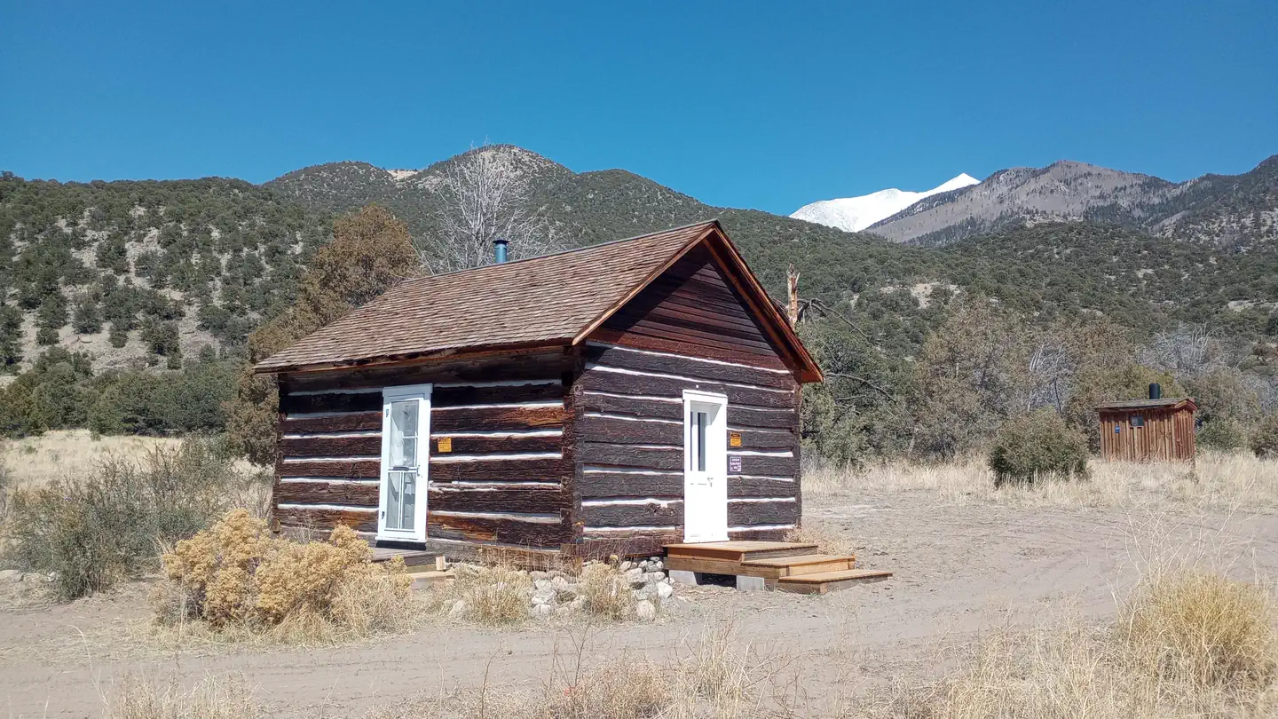
Cabin and lookout rentals nearby
On the National Register nearby
- Zapata Ranch HeadquartersBuilding · Mosca · 1.7 mi
- Superintendent's Residence, Great Sand Dunes National MonumentBuilding · Mosca · 7.9 mi
Natural features
Zapata Falls Special Recreation Management Area The Zapata Falls Special Recreation Management Area (SRMA) is rich in history and geology and offers opportunities to hike, camp, mountain bike and view spectacular scenery. Zapata Falls and the 628 acres surrounding them are State Trust Lands owned by the Colorado State Land Board and are also a designated Colorado Natural Area. They are cooperatively managed with the Bureau of Land Management. History The name “Zapata” is the Spanish word for shoe and is tied to the history of settlement in the San Luis Valley. In 1864, Mexican families established the community of Zapata at the western base of the Sangre de Cristo Mountains and raised sheep and other livestock. In the 1870s, cattleman consolidated land holdings and established one of the San Luis Valley’s first and largest cattle ranches know as Zapata Ranch, which remains an active ranch today. Geology Zapata Falls SRMA perches on the edge of an active rift valley.
Recreation
Zapata Falls Recreation Area is a destination known for its waterfall viewing and sweeping vistas of the San Luis Valley, its soaring mountain ranges, and the adjacent Great Sand Dunes National Park. From the waterfall, the trail continues onto the Rio Grande National Forest, for those seeking a backcountry experience in the high country above and the Sangre de Cristo Wilderness. Recreation Sites • Standard Nonelectric • Rv Nonelectric • Group Tent Only Area Nonelectric • Overnight
Guidebooks for Colorado
We earn a small commission if you buy through these links. It does not change what we list.



Titles come from Open Library's catalog, matched by subject heading or by title.
Reference
Questions people ask
Do I need a reservation at Zapata Falls Campground?
Sites at Zapata Falls Campground are reservable on Recreation.gov. Any walk-up sites are listed on the booking page.
Source: Recreation.gov
How much does it cost to camp at Zapata Falls Campground?
Individual Sites = $11/night. Group Tent Site = $20/night. 14 day Max Stay
Source: Recreation.gov
What time is check-in at Zapata Falls Campground?
Check-in 1:00 PM, checkout 12:00 PM.
Source: Recreation.gov
How many sites does Zapata Falls Campground have?
45 sites, including 25 RV sites without hookups, 11 standard sites without power, 3 picnic, and 1 group tent area.
Source: Recreation.gov
Are pets allowed at Zapata Falls Campground?
Yes, pets are allowed at Zapata Falls Campground. Leash rules apply.
Source: Recreation.gov
Can I have a campfire at Zapata Falls Campground?
Fires are allowed in the provided rings under normal conditions. As of 2026-10-16, there is 1 active fire within 50 miles, so check current restrictions before you light one.
Source: Fire nearby
Are there accessible sites at Zapata Falls Campground?
Sites 17, 26, 2, and 3 are listed accessible on Recreation.gov. What that covers (a paved pad, an accessible table, a nearby accessible restroom) is on each site's booking page.
Source: Recreation.gov
What is there to do at Zapata Falls Campground?
Zapata Falls Recreation Area is a destination known for its waterfall viewing and sweeping vistas of the San Luis Valley, its soaring mountain ranges, and the adjacent Great Sand Dunes National Park. The Recreation section on this page has the rest.
Source: Recreation
What is the nearest town to Zapata Falls Campground?
Monte Vista, Colorado. Zapata Falls Trail To reach Zapata Falls, you will need to take a short but arduous hike to Zapata Creek.
Source: Getting there
What if Zapata Falls Campground is full?
The nearest public campgrounds are Pinon Flats Campground (9.4 mi), Medano Pass Primitive Road Campsites (13.3 mi, first-come), and North Crestone Creek Campground (27.8 mi, first-come).
Source: Campgrounds nearby