Pine Springs Campground
Be aware, this is a paved parking lot. The area shares a popular and busy trailhead accessing four major trails. The area is frequently congested with day use hikers searching for available parking and with foot traffic from overflow parking areas. Before booking a reservation: It is your responsibility to review all (Site Details, Allowable Equipment, Allowable Vehicle/Driveway and Need to Know) for the individual campsite. Failing to do so may result in being prohibited from occupying the site upon your arrival. Refunds are not provided by the park. Pine Springs Campground is located near the Pine Springs Visitor Center, just off U.S. 62/180 and at an elevation of 5,730 feet.
More like this: reservable in Texas · big rigs in Texas · pets allowed in Texas · group sites in Texas
Check availability on Recreation.gov ↗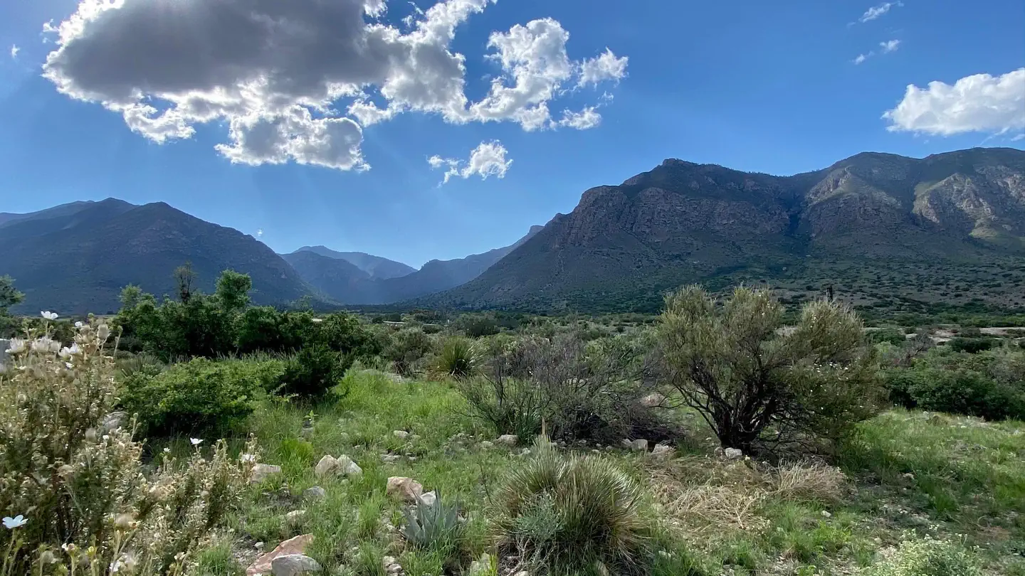
Site mix
| Tent-only | 20 |
| RV, no hookups | 13 |
| Group tent areas | 2 |
Site guide
Will my RV fit
The longest site here provides 50 feet of vehicle capacity. Most sites are shorter.
35 sites in 2 loops. Tap a filter to narrow the list; the map follows.
| Site | Loop | Type | Entry | Fits, ft | Surface | Shade | Water / sewer | People / vehicles | Fires | Accessible | Rating |
|---|---|---|---|---|---|---|---|---|---|---|---|
| 21 | RV Loop | RV | Back-in | 22 | Paved | None | No / – | 6 / 2 | No | Yes | Basic |
| 22 | RV Loop | RV | Back-in | 22 | Paved | None | No / – | 6 / 2 | No | ||
| 23 | RV Loop | RV | Back-in | 22 | Paved | Partial | No / – | 6 / 2 | No | ||
| 24 | RV Loop | RV | Back-in | 22 | Paved | Partial | No / – | 6 / 2 | No | Basic | |
| 25 | RV Loop | RV | Back-in | 20 | Paved | Partial | No / – | 6 / 2 | No | Basic | |
| 26 | RV Loop | RV | Pull-through | 50 | Paved | None | No / – | 6 / 2 | No | ||
| 27 | RV Loop | RV | Pull-through | 50 | Paved | None | No / – | 6 / 2 | No | Basic | |
| 28 | RV Loop | RV | Pull-through | 50 | Paved | None | No / – | 6 / 2 | No | Basic | |
| 29 | RV Loop | RV | Pull-through | 50 | Paved | None | No / – | 6 / 2 | No | Basic | |
| 30 | RV Loop | RV | Pull-through | 50 | Paved | None | No / – | 6 / 2 | No | Basic |
Per-site records as published by the managing agency on Recreation.gov. Blank cells mean the agency listed nothing for that site. Check-in 12:01 PM, checkout 12:00 PM.
Amenities & rules
| Hookups | None |
| Max vehicle length | 50 ft |
| Equipment | RVs & trailers, Tents |
| Pets | Allowed |
| Fees | Guadalupe Mountains National Park group campsite fees are $60.00 per night. Group site occupancy requires a minimum of 10 persons and is limited to a maximum of 20 persons per site. Groups larger than 20 persons are required to obtain a Special Use Permit 3 weeks prior to your visit. |
| Accessibility | Sites 21, 17, Group Site # 1 are listed accessible |
- The campground features 35 sites total with 20 tent, 13 RV and 2 group sites available by reservation.
- Campsite occupancy is limited to 6 persons or 2 tents, per site. Group sites allow 10-20 persons per site.
- No open fires (this includes portable propane fire rings and charcoal) are permitted anywhere in the park. Only cooking stoves or lanterns using containerized fuel are permitted.
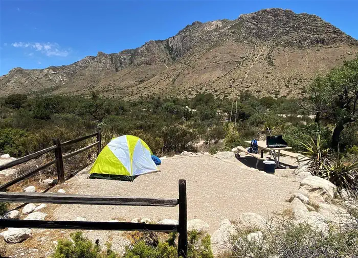
- Tent sites are hike-in only (38’ – 277’ from parking) and cannot accommodate RV parking due to the narrow access road. Each site offers a tent pad and picnic table.
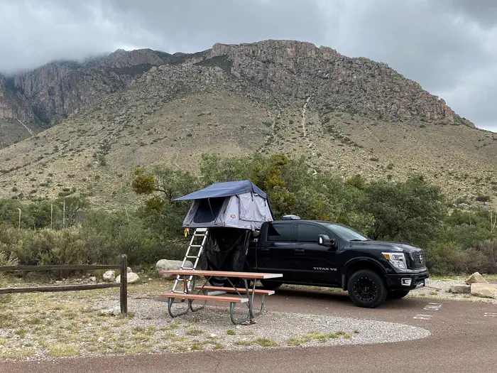
- RV sites are paved but very basic, offering picnic tables at most sites.
- No shower facilities, hookups or dump stations.
- The park is remote. Fuel your vehicle and purchase supplies before heading to the park. The visitor center bookstore carries limited camping and hiking supplies.
- The use of weight-bearing hammocks, slacklines, tarps or similar devices tied to natural and/or manmade features is prohibited. This regulation is intended to protect the landscape and environment in the park, as these devices may cause damage to trees and other features and encourage camping out of bounds and off designated camping pads. Incidental and temporary lines for clothes drying or Wilder
Individual sites vary. Confirm on Recreation.gov or with the managing office.
Weather by month
Getting there
The Pine Springs area of Guadalupe Mountains National Park is located on the north side of US Hwy 62/180 near Mile Post 130. From Interstate 10, take the Van Horn, Texas exit. Follow TX Hwy 54 (56 miles/17 km) north to the intersection of US Hwy 62/180. Turn east on 62/180 and travel (9 miles/14.5 km) to the park.
| Coordinates | 31.8955° N, 104.8260° W · Directions ↗ |
Good to know
- The Pine Springs RV campground is not a traditional campground.
Charges and cancellations
- Individual Site: A $10.00 service fee will apply if you modify your reservation or change your stay dates. Cancelling your reservation prior to 11:59 p.m. Eastern Time two nights before your stay will incur a $10.00 cancellation fee. Camping reservations cancelled the day before and day of arrival incur a $10 cancellation fee and forfeit the first night's use fee.
- If you need to cancel or modify your reservation, you must do so through Recreation.gov.
- Group Site: Customers who cancel a group overnight reservation less than 14 days before the arrival date will pay a $10.00 service fee & forfeit the first night's use fee.
Supplies & services
| RV sales & service | Carlsbad RV Center ↗ | 47.5 mi |
Locations © OpenStreetMap contributors. Call ahead; hours change seasonally.
Explore
Video
Pine Springs Campground Review
Worth a stop
Carlsbad Caverns National Park: In addition to a variety of cave tours, the national park also offers hiking trails and a scenic drive. Rattlesnake Springs and Slaughter Canyon, part of Carlsbad Caverns are nearer attractions for day use activities. Birding is excellent at Rattlesnake Springs. Lincoln National Forest: The Guadalupe District of the Lincoln National Forest is located just over the state line, north of the national park. Road access is through New Mexico, north of White’s City, via Dark Canyon Road to nm sr 137 through Queen (also the way to the national park’s Dog Canyon). The forest provides for various camping, hiking, caving, hunting, and picnicking opportunities. Sitting Bull Falls is a nice waterfall and picnic area in the Lincoln National Forest. Five Point Vista is a glorious ridge road ride of the area, closer to Dog Canyon. Fort Davis National Historic Site and State Park: Fort Davis is one of the best surviving examples of an Indian Wars' frontier military post in the Southwest.
- 7.1 miMckittrick Canyon Contact Station ↗Visitor center
Public land it sits in
This campground sits inside Guadalupe Mountains Wilderness.
- inGuadalupe Mountains Wilderness ↗Wilderness · National Park Service · 46,850 acres
Each unit is published as a centre point and an acreage rather than a boundary, so this section stands it in for a circle of the same area. Whether a campground is inside, and how far it is from one it is outside, are both approximate.
Other campgrounds nearby

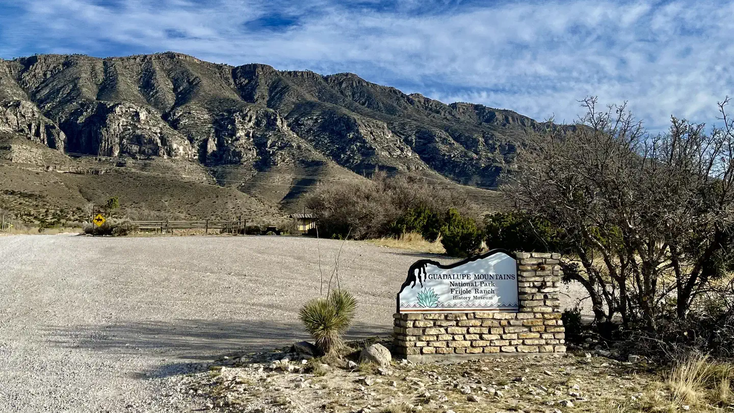
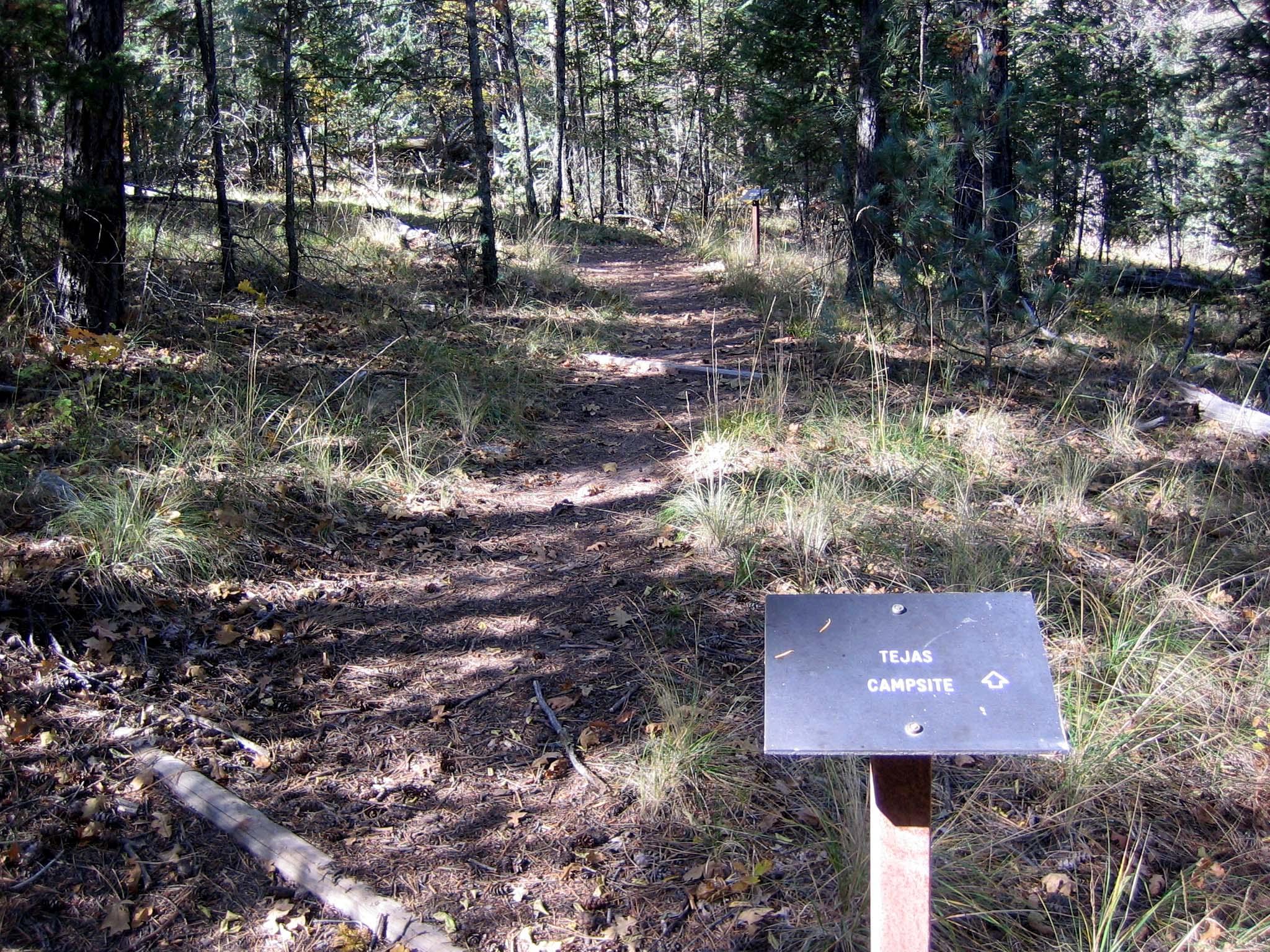

On the National Register nearby
- Pinery StationSite · Gaudalupe Mountain National Park · 0.5 mi
- Guadalupe RanchBuilding · Salt Flat · 1.7 mi
- Wallace Pratt LodgeBuilding · Gaudalupe Mountain National Park · 6.6 mi
Natural features
- The Pine Springs Campground is in an area with small, scattered trees, shrubs, and grasses. Trees include gray oaks and alligator junipers, which cast partial shade at some sites. Texas madrones, bigtooth maples, chinquapin oaks, and ponderosa pines become more common along the canyon floor. Higher elevations include Douglas fir and hop-hornbeam. Shrubs include whitethorn acacia, Mexican orange, A
- Hunter Peak and cross-sectional views of the Capitan reef are visible from the campground. Roadside pullouts (one mile and four miles away) provide excellent views of El Capitan. Hiking into Pine Springs canyon or along the foothills reveals Guadalupe Peak. The Guadalupe Peak trail ascends to the highest point in Texas and offers excellent views of the surrounding desert.
- Birds commonly seen and/or heard around the campground can include Canyon towhees, turkey vultures, white-winged doves, common ravens, chipping sparrows, Say’s phoebes, common poorwills, and phainopeplas depending on the season.
- Night sky visibility is excellent and nearly pristine directly overhead, to the south, and the southwest. Nearby high ridges and peaks are situated to the west and north.
Recreation
- The Pine Springs Trailhead includes access to many different types of hikes. Hikes to Guadalupe Peak or the Bowl are strenuous, 8-9 miles, and have 2500-3000 feet of elevation gain. Another strenuous hike is the Devil’s Hall Trail (4.2 miles round-trip, 500 feet elevation gain, ½ of the trail in a rocky, uneven wash which includes route-finding and boldering skills). For a more moderate hike consi
- The ruins of a Butterfield stage station, called the Pinery are next to the highway, and a short, paved nature trail connects the visitor center and the historic site.
- The Frijole Ranch & History Museum is 1.5 miles away. The grounds are always open, but the museum is staffed intermittently.
- Seven miles to the east on Hwy 62/180 is McKittrick Canyon. This area offers three trails, the McKittrick Canyon Nature Trail (0.9 miles loop), McKittrick Canyon Trail (4.8 miles round-trip to Pratt Cabin or 6.8 miles round-trip to the Grotto) and the Permian Reef Trail (8.4 miles round-trip, for serious geology buffs).
Guidebooks for Guadalupe Mountains National Park and Texas
We earn a small commission if you buy through these links. It does not change what we list.
- Hiking Carlsbad Caverns and Guadalupe Mountains National ParksBill Schneider, 2023Find at Bookshop.org
- Best Easy Day Hikes Carlsbad Caverns and Guadalupe Mountains National ParksStewart M. Green, 2018Find at Bookshop.org
Titles come from Open Library's catalog, matched by subject heading or by title.
Reference
Questions people ask
Do I need a reservation at Pine Springs Campground?
Sites at Pine Springs Campground are reservable on Recreation.gov. Any walk-up sites are listed on the booking page.
Source: Recreation.gov
How much does it cost to camp at Pine Springs Campground?
Guadalupe Mountains National Park group campsite fees are $60.00 per night. Group site occupancy requires a minimum of 10 persons and is limited to a maximum of 20 persons per site. Groups larger than 20 persons are required to obtain a Special Use Permit 3 weeks prior to your visit.
Source: Recreation.gov
What time is check-in at Pine Springs Campground?
Check-in 12:01 PM, checkout 12:00 PM.
Source: Recreation.gov
What does it cost to cancel a reservation at Pine Springs Campground?
Individual Site: A $10.00 service fee will apply if you modify your reservation or change your stay dates. Cancelling your reservation prior to 11:59 p.m.
Source: Charges and cancellations
How many sites does Pine Springs Campground have?
35 sites, including 20 tent-only sites, 13 RV sites without hookups, and 2 group tent areas.
Source: Recreation.gov
Will my RV fit at Pine Springs Campground?
The longest site here provides 50 feet of vehicle capacity. Most sites are shorter. The sidebar tool checks a trailer or motorhome length against every site.
Source: Will my RV fit
Are there showers or a dump station at Pine Springs Campground?
No shower facilities, hookups or dump stations.
Source: Recreation.gov
Are pets allowed at Pine Springs Campground?
Yes, pets are allowed at Pine Springs Campground. Leash rules apply.
Source: Recreation.gov
Are there accessible sites at Pine Springs Campground?
Sites 21, 17, and Group Site # 1 are listed accessible on Recreation.gov. What that covers (a paved pad, an accessible table, a nearby accessible restroom) is on each site's booking page.
Source: Recreation.gov
What is there to do at Pine Springs Campground?
The Pine Springs Trailhead includes access to many different types of hikes. Hikes to Guadalupe Peak or the Bowl are strenuous, 8-9 miles, and have 2500-3000 feet of elevation gain. Another strenuous hike is the Devil’s Hall Trail (4.2 miles round-trip, 500 feet elevation gain, ½ of the trail in a r
Source: Recreation
What if Pine Springs Campground is full?
The nearest public campgrounds are Guadalupe Peak (1.5 mi, first-come), Frijole Horse Corral Campground (1.6 mi), and Tejas Wilderness Campground (3.2 mi, first-come).
Source: Campgrounds nearby
Which national park is Pine Springs Campground in?
Pine Springs Campground is a Guadalupe Mountains National Park campground. Entrance fees, alerts, and hours are on Park Atlas.