Backbone Rock Campground
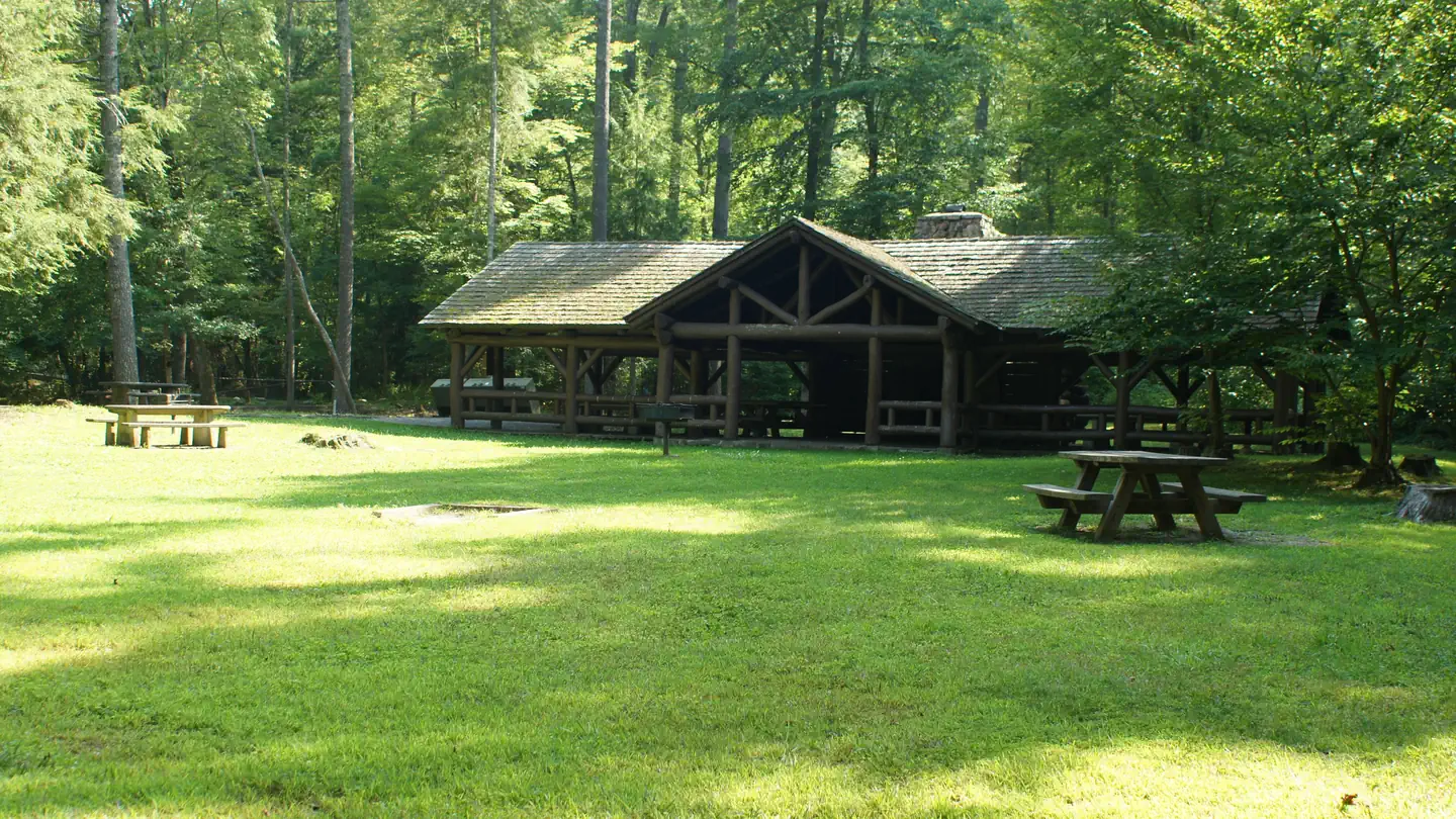
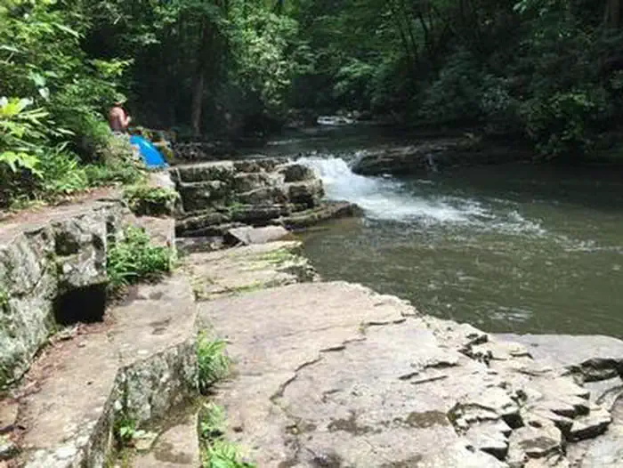
Backbone Rock Campground is closed for the season. Backbone Rock Pavilion is open to reservations until the first Monday in November, and the vault toilet in the day-use area is open until the third Monday in November. Backbone Rock is a small campground situated along the beautiful Beaverdam Creek at an elevation of 2,100 feet in northern Johnson County. This developed campground is popular with those visiting the nearby Backbone Rock, a tunnel originally blasted through the rock ridge for the railway. The creek side location with popular swim area and lush forest surroundings make Backbone Rock Campground particularly desirable during hot summer months.
More like this: reservable in Tennessee · pets allowed in Tennessee
Check availability on Recreation.gov ↗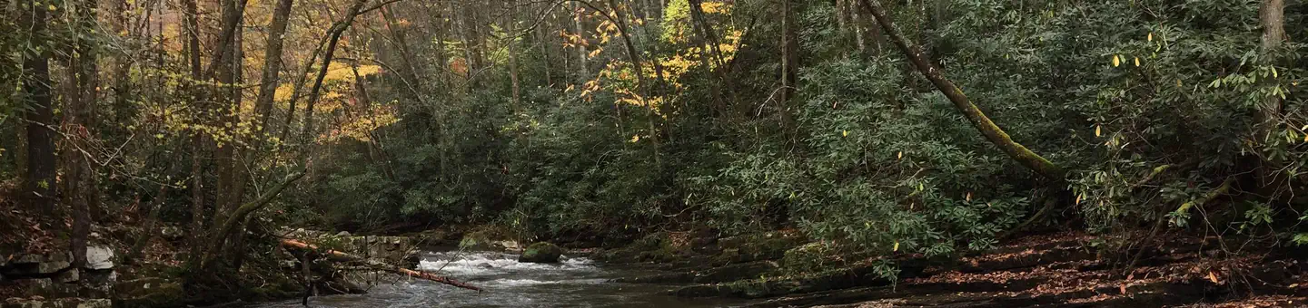

Site mix
| Standard, no hookups | 11 |
Site guide
11 sites. Tap a filter to narrow the list; the map follows.
| Site | Entry | Fits, ft | Surface | Waterfront | People / vehicles | Fires | Accessible | Rating |
|---|---|---|---|---|---|---|---|---|
| 01 | Back-in | 68 | Gravel | 5 / 2 | Yes | Yes | Standard | |
| 02 | Back-in | 50 | Gravel | 5 / 2 | Yes | Yes | Standard | |
| 03 | Back-in | 90 | Gravel | Riverfront | 10 / 4 | Yes | Yes | Standard |
| 04 | Back-in | 84 | Gravel | Riverfront | 5 / 2 | Yes | Yes | Standard |
| 05 | Back-in | 52 | Gravel | Riverfront | 5 / 2 | Yes | Yes | Standard |
| 06 | Back-in | 50 | Gravel | Riverfront | 5 / 2 | Yes | Yes | Standard |
| 07 | Back-in | 85 | Gravel | Riverfront | 5 / 2 | Yes | Yes | Standard |
| 08 | Back-in | 50 | Gravel | Riverfront | 10 / 4 | Yes | Yes | Standard |
| 09 | Back-in | 50 | Gravel | Riverfront | 5 / 2 | Yes | Yes | Standard |
| 10 | Back-in | 60 | Gravel | Riverfront | 5 / 2 | Yes | Yes | Standard |
Per-site records as published by the managing agency on Recreation.gov. Blank cells mean the agency listed nothing for that site. Check-in 2:00 PM, checkout 11:00 AM.
Amenities & rules
| Hookups | None |
| Equipment | RVs & trailers, Tents |
| Pets | Allowed |
| Campfires | Allowed, subject to restrictions |
| Tent pads | Yes |
| Accessibility | Sites 01, 02, 03, 04 and 7 more are listed accessible |
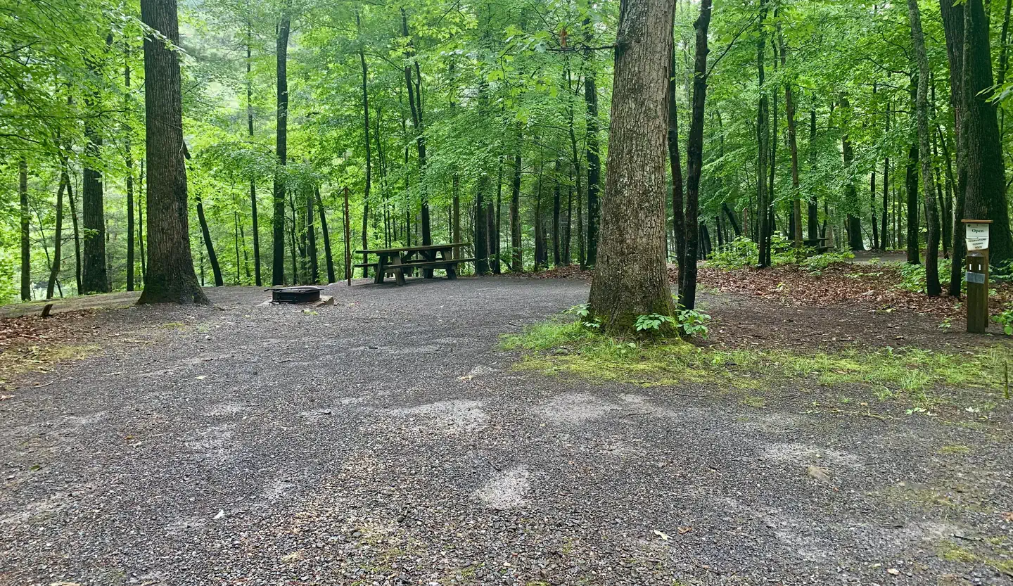
There are 10 single campsites, including two double sites within Backbone Rock Campground. The campground has flush toilets. Each site contains a table, fire ring and lantern holder.
Individual sites vary. Confirm on Recreation.gov or with the managing office.
Season & status
| Status | Closed for the season. Forest Service sites close for the season; check the official page for the reopening date. |
| Forest | Cherokee National Forest |
| Fees | Camping is $10 for single site (8 sites) and $20 for double site (2 sites). One pavilion is reservable at $50 per day. (Pavilion is currently closed for renovations). |
| Rules | Starting Nov 1, 2023 the Large reservable pavilion and the smaller non-reservable pavilion will be CLOSED due to Historic Preservation Repair. Campsites are limited to a single family or not more than 5 people and 2 vehicles. Double campsites allow for up to 10 individuals and 4 vehicles. No alcoholic beverages are allowed in the area. |
Weather by month
Getting there
Highway TN 133 north from Highway 91. The campsite is on Highway 133, just north of Backbone Rock.
| Nearest town | Shady Valley, Tennessee |
| Coordinates | 36.5939° N, 81.8150° W · Directions ↗ |
Fire nearby
- PrescribedRx - Stone Mountain
35 mi from the campground
Distance is to the reported incident point, not the fire edge. Call the managing office before you drive.
Supplies & services
| Outdoor gear | Damascus Outfitters ↗ | 3.2 mi |
| RV sales & service | RV sales & service ↗ | 13.4 mi |
| Dump station | Dump station ↗ | 24.8 mi |
Locations © OpenStreetMap contributors. Call ahead; hours change seasonally.
Explore
Video
Backbone Rock - Shady Valley TN - Near US 421 "The Snake"
Worth a stop
The trailhead for the Backbone Rock Trail (#53) is approximately a quarter mile South of the campground on TN Highway 133. This trail is 4 miles and at the end of the trail is where it joins into the Appalachian National Scenic Trail (#1) Damascus, VA is approximately 5 minutes North of the campground. The Backbone Falls Trail (#198) is approximately a third of a mile South of the campground. This 0.4 mile loop trail takes you to the top of Backbone Falls.
- 3.2 miAppalachian Trail Conservancy ↗Visitor center
- 12.5 miKeller Interpretive Center, Abingdon Muster Ground ↗Visitor center
Trails nearby
- under 0.1 miBackbone Falls Trail0.3 mi trail
- under 0.1 miBackbone Rock2.4 mi trail
- 1.5 miAppalachian Trail ↗384.9 mi trail · hiking · national_scenic_or_historic
- 2.1 miTennessee0.9 mi trail · hiking, horse, bike
- 2.8 miIron Mountain ↗19.3 mi trail
- 4 miVirginia Creeper ↗17.1 mi trail · hiking, horse, bike · national_recreation_or_other
Trail and trailhead records are the Forest Service's. Distances are straight-line to the nearer trail end. Trail conditions are not tracked here.
Public land it sits in
Lewis Fork Wilderness begins about 13.9 miles away, and it is the closest of these.
- 13.9 miLewis Fork Wilderness ↗Wilderness · Forest Service · 6,071 acres
Each unit is published as a centre point and an acreage rather than a boundary, so this section stands it in for a circle of the same area. Whether a campground is inside, and how far it is from one it is outside, are both approximate.
Other campgrounds nearby
On the National Register nearby
- Morrison Farm and StoreBuilding · Laurel Bloomery · 3.6 mi
- Long MeadowBuilding · Surgoinsville · 6.8 mi
- Butler HouseBuilding · Mountain City · 8.4 mi
Natural features
Backbone Rock Campground is located along the beautiful Beaverdam Creek nestled in the mountains of the Southern Appalachians.
Recreation
Along with camping, Beaverdam Creek is stocked with trout. The Appalachian National Scenic Trail is accessed via the Backbone Rock Trail (#53).
Guidebooks for Cherokee National Forest and Tennessee
We earn a small commission if you buy through these links. It does not change what we list.
- Cherokee National Forest hiking guideWilliam H. Skelton and Lamar Alexander, 2024Find at Bookshop.org
- Campgrounds in and Around the Great Smoky Mountains National ParkGrueen Huffman, 2010Find at Bookshop.org
Titles come from Open Library's catalog, matched by subject heading or by title.
Reference
Questions people ask
Do I need a reservation at Backbone Rock Campground?
Sites at Backbone Rock Campground are reservable on Recreation.gov. Any walk-up sites are listed on the booking page.
Source: Recreation.gov
How much does it cost to camp at Backbone Rock Campground?
Camping is $10 for single site (8 sites) and $20 for double site (2 sites). One pavilion is reservable at $50 per day. (Pavilion is currently closed for renovations).
Source: Recreation.gov
What time is check-in at Backbone Rock Campground?
Check-in 2:00 PM, checkout 11:00 AM.
Source: Recreation.gov
Is Backbone Rock Campground open right now?
Closed for the season as of Oct 16, 2026.
Source: Forest Service status
How many sites does Backbone Rock Campground have?
11 sites, including 11 standard sites without power.
Source: Recreation.gov
Can I bring an RV to Backbone Rock Campground?
Backbone Rock Campground is listed for tents only.
Source: Recreation.gov
Are there showers or a dump station at Backbone Rock Campground?
The campground has flush toilets.
Source: Recreation.gov
Are pets allowed at Backbone Rock Campground?
Yes, pets are allowed at Backbone Rock Campground. Leash rules apply.
Source: Recreation.gov
Can I have a campfire at Backbone Rock Campground?
Fires are allowed in the provided rings under normal conditions. As of 2026-10-16, there is 1 active fire within 50 miles, so check current restrictions before you light one. Starting Nov 1, 2023 the Large reservable pavilion and the smaller non-reservable pavilion will be CLOSED due to Historic Preservation Repair.
Source: Fire nearby
Are there accessible sites at Backbone Rock Campground?
Sites 01, 02, 03, and 04 are listed accessible on Recreation.gov, 11 sites in all. What that covers (a paved pad, an accessible table, a nearby accessible restroom) is on each site's booking page.
Source: Recreation.gov
What is there to do at Backbone Rock Campground?
Along with camping, Beaverdam Creek is stocked with trout. The Recreation section on this page has the rest.
Source: Recreation
What is the nearest town to Backbone Rock Campground?
Shady Valley, Tennessee. The trailhead for the Backbone Rock Trail (#53) is approximately a quarter mile South of the campground on TN Highway 133.
Source: Getting there