Herring Creek Campground
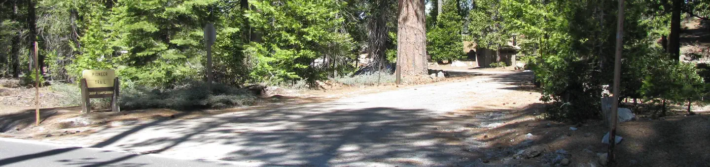
Herring Creek Campground situated in a mixed conifer forest near Herring Creek. It is located on Forest Road 4N12; turn right onto Herring Creek Road (4N12) off of Highway 108, about 3 miles from the Summit Ranger Station. The campground is approximately 9 miles from the Summit Ranger Station. There are 7 sites; each site has a table and a fire ring. The main road and parking pads are dirt-surfaced. Toilets are vault.
More like this: first-come in California

Season & status
| Status | Closed for the season. Forest Service sites close for the season; check the official page for the reopening date. |
| Season | May to December |
| Forest | Stanislaus National Forest |
| Booking | No reservations can be made for Herring Creek Campground. |
| Fees | The Forest Service operates the Herring Creek Campground and charges the following fees: New campsite fee prices, 2024 & 2025 $15 per night and fee raises to $20 per night in 2026. The America the Beautiful, Interagency Senior and Access Passes are honored and receive 50% off the nightly rate. |
| Rules | Camp in designated sites only. The number of people allowed in a single campsite is six. The maximum length of stay in any campground is 14 days. Please leave the area in as good (or better) condition than you found it. |
Weather by month
Getting there
7 miles from Highway 108 on Herring Creek Road.
| Coordinates | 38.2448° N, 119.9329° W · Directions ↗ |
Good to know
- Potable water is not available.
Fire nearby
- PrescribedTmu Rx Support
47 mi from the campground
- WildfireDome
50 mi from the campground · 6,788 acres · 95% contained
Distance is to the reported incident point, not the fire edge. Call the managing office before you drive.
Supplies & services
| Outdoor gear | Bear Valley Adventure Company ↗ | 16.1 mi |
| Dump station | Dump station ↗ | 32.3 mi |
Locations © OpenStreetMap contributors. Call ahead; hours change seasonally.
Explore
Worth a stop
- 1.2 miWaterhouse Th ↗Trailhead
- 2.9 miCoyote Meadows Th ↗Trailhead
- 4.9 miPinecrest Day Use ↗Day use
- 7.1 miBeardsley Day Use ↗Day use
Trails nearby
- 0.5 mi04n12-Snow Trail ↗19.4 mi trail · snowmobile, snowshoe, ski, snowcoach
- 0.5 miTrail of the Gargoyles0.2 mi trail · hiking, horse, bike, motorcycle and 3 more
- 0.6 miTrail of the Gargoyles Interpe0.6 mi trail · hiking, horse, bike
- 0.7 miHerring Creek ↗6.1 mi trail · hiking, horse, bike
- 1.2 mi05n31 Snow Trail0.7 mi trail · snowmobile, snowshoe, ski, snowcoach
- 1.2 miWaterhouse Lake1.4 mi trail · hiking, horse
Trailheads within three miles
- 1.2 miWaterhouse TH ↗Stanislaus National Forest · Season May to December
- 2.9 miCoyote Meadows TH ↗Stanislaus National Forest · Season May to December
Trail and trailhead records are the Forest Service's. Distances are straight-line to the nearer trail end. Trail conditions are not tracked here.
Public land it sits in
This campground sits inside Stanislaus National Forest.
- inStanislaus National Forest ↗National Forest · Forest Service · 1,090,354 acres
- 2.7 miEmigrant Wilderness ↗Wilderness · Forest Service · 112,723 acres
- 9.1 miCarson-Iceberg Wilderness ↗Wilderness · Forest Service · 158,147 acres
Each unit is published as a centre point and an acreage rather than a boundary, so this section stands it in for a circle of the same area. Whether a campground is inside, and how far it is from one it is outside, are both approximate.
Other campgrounds nearby


On the National Register nearby
- Stanislaus Branch, California Forest and Range Experiment StationHistoric district · Strawberry · 6.3 mi
- Baker Highway Maintenance StationHistoric district · Strawberry · 11.2 mi
- Leighton EncampmentSite · Pinecrest · 11.7 mi
Guidebooks for California
We earn a small commission if you buy through these links. It does not change what we list.

Titles come from Open Library's catalog, matched by subject heading or by title.
Reference
Questions people ask
Do I need a reservation at Herring Creek Campground?
No. Herring Creek Campground is first-come, first-served. No reservations can be made for Herring Creek Campground. Sites are taken on arrival and paid at the fee station.
Source: Forest Service
How much does it cost to camp at Herring Creek Campground?
The Forest Service operates the Herring Creek Campground and charges the following fees: New campsite fee prices, 2024 & 2025 $15 per night and fee raises to $20 per night in 2026. The America the Beautiful, Interagency Senior and Access Passes are honored and receive 50% off the nightly rate.
Source: Forest Service
Is Herring Creek Campground open right now?
Closed for the season as of Oct 16, 2026. Season May to December.
Source: Forest Service status
What if Herring Creek Campground is full?
The nearest public campgrounds are Herring Reservoir Campground (0.3 mi, first-come), Cascade Creek Campground (3.2 mi, first-come), and Mill Creek Campground (4 mi, first-come).
Source: Campgrounds nearby