North Fork Poudre Campground
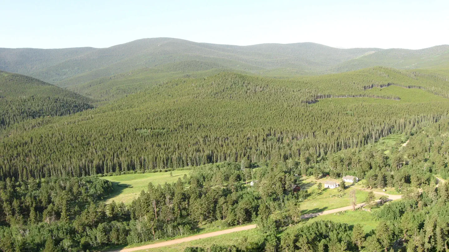
The North Fork Poudre Campground is located along the Deadman Road west of Red Feather Lakes, near the banks of the North Fork Cache la Poudre River in a dense lodgepole pine forest. This is an older facility with short parking spurs that will not accommodate larger RVs. Each of the nine sites have a picnic table, tent pad and fire grate. Recreational activities in the area include hiking, stream fishing and four-wheel driving.
More like this: first-come in Colorado

Season & status
| Status | Closed for the season. Forest Service sites close for the season; check the official page for the reopening date. |
| Forest | Arapaho & Roosevelt National Forests Pawnee NG |
| Fees | Check our campground table for fee information. Interagency Senior, Interagency Access, Golden Age and Golden Access passes provide cardholders half price for basic campground fees. |
| Rules | A single site may hold up to eight people. Tents must fit on the pads provided. RVs, trailers or other vehicles must fit on the parking spur because driving or parking off road is not permitted. The parking length ranges from 30 to 35 feet. |
Arapaho & Roosevelt National Forests Pawnee NG recreation page ↗
Weather by month
Getting there
Drive 21 miles north of Fort Collins on U.S. Highway 287.Turn left (west) onto the Red Feather Lakes Road (County Road 74E). Continue west as the road designation changes to County Road 86 (Deadman Road, formerly County Road 162), through Red Feather Lakes.
| Coordinates | 40.8133° N, 105.7106° W · Directions ↗ |
Fire nearby
- PrescribedMagic Feather Broadcast Rx
10 mi from the campground
Distance is to the reported incident point, not the fire edge. Call the managing office before you drive.
Supplies & services
| Dump station | Dump station ↗ | 30.2 mi |
| Outdoor gear | Kirks Mountain Adventures ↗ | 31.8 mi |
| RV sales & service | Manhattan RV & Trailer ↗ | 43.8 mi |
Locations © OpenStreetMap contributors. Call ahead; hours change seasonally.
No site-by-site records, no amenities, no fee schedule or photos in the Recreation.gov record. What is here comes from the agency's own listing. The rest lives there.
Checked nightly. Modules appear as soon as the record fills in.
Explore
Worth a stop
- 5.7 miBellaire Lake Picnic Site ↗Day use
- 6.2 mi
- 6.5 miCreedmore Lake Fishing Site ↗Fishing site
- 11.9 miIndian Meadows Fishing Site ↗Fishing site
Trails nearby
- 0.1 miKillpecker4.2 mi trail · hiking, horse, bike, motorcycle and 1 more
- 2.1 miPearl Creek ↗4.9 mi trail · hiking, horse, bike, snowshoe and 1 more
- 2.1 miNorth Lone Pine ↗4.8 mi trail · hiking, horse, bike
- 3.9 miSwamp Creek3.4 mi trail · hiking, horse, bike, motorcycle and 1 more
- 4.6 miRoaring Creek ↗5.9 mi trail · hiking, horse, bike
Trail and trailhead records are the Forest Service's. Distances are straight-line to the nearer trail end. Trail conditions are not tracked here.
Public land it sits in
Rawah Wilderness begins about 7.8 miles away, and it is the closest of these.
- 7.8 miRawah Wilderness ↗Wilderness · Forest Service · 74,408 acres
- 10.1 miComanche Peak Wilderness ↗Wilderness · Forest Service · 68,025 acres
Each unit is published as a centre point and an acreage rather than a boundary, so this section stands it in for a circle of the same area. Whether a campground is inside, and how far it is from one it is outside, are both approximate.
Other campgrounds nearby
Cabin and lookout rentals nearby

On the National Register nearby
- Arrowhead LodgeHistoric district · Bellvue · 8.5 mi
Guidebooks for Colorado
We earn a small commission if you buy through these links. It does not change what we list.



Titles come from Open Library's catalog, matched by subject heading or by title.
Reference
Questions people ask
Do I need a reservation at North Fork Poudre Campground?
No. North Fork Poudre Campground is first-come, first-served. Sites are taken on arrival and paid at the fee station.
Source: Forest Service
How much does it cost to camp at North Fork Poudre Campground?
Check our campground table for fee information. Interagency Senior, Interagency Access, Golden Age and Golden Access passes provide cardholders half price for basic campground fees.
Source: Forest Service
Is North Fork Poudre Campground open right now?
Closed for the season as of Oct 16, 2026.
Source: Forest Service status
Is there cell service at North Fork Poudre Campground?
FCC coverage maps show AT&T 4G LTE and T-Mobile 4G LTE at the campground point. Terrain changes that from one site to the next.
Source: FCC Broadband Map
What if North Fork Poudre Campground is full?
The nearest public campgrounds are Bellaire Lake Campground (6.1 mi), Big Bend Campground (7.2 mi, first-come), and West Lake (7.6 mi).
Source: Campgrounds nearby