Upper Hole Campground
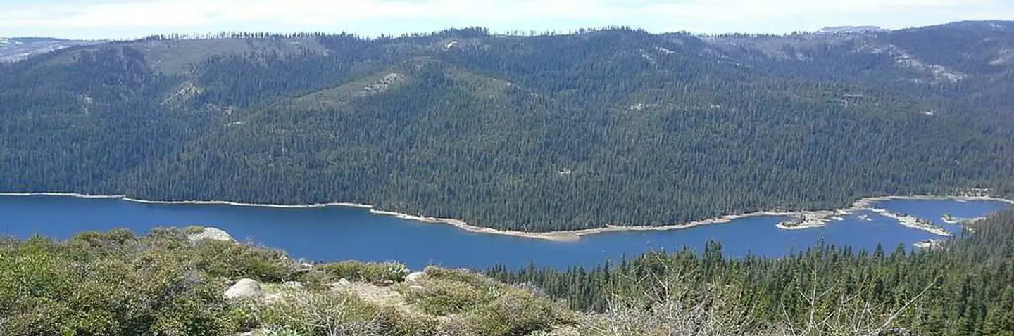
This facility is only accessible by boat or trail. Location: 22 miles east of Georgetown on Wentworth Springs Road, and 29 miles northeast on Forest Highway 2 (Eleven Pines road) to Hell Hole Reservoir, then 3 miles southeast by boat or hiking trail. Upper Hell Hole Campground Recreation Opportunity Guide (ROG) - This guide contains information, maps, and directions to assist you in enjoying your trip to the Eldorado National Forest.
More like this: first-come in California

Season & status
| Status | Closed for the season. Forest Service sites close for the season; check the official page for the reopening date. |
| Season | June to October |
| Forest | Eldorado National Forest |
| Booking | No Reservations. |
| Fees | No fee |
| Rules | There is no piped water available at the campground. Lake water is available close by but should be boiled before using. Water quality testing is not performed on open water sources. Do not feed the animals. Please keep family pets on a leash at all times. Use only dead and down wood for your campfires. Make sure your fire is dead out before leaving. Check ahead. |
Weather by month
Getting there
| Coordinates | 39.0819° N, 120.3579° W · Directions ↗ |
Fire nearby
- PrescribedTmu Rx Support
23 mi from the campground
Distance is to the reported incident point, not the fire edge. Call the managing office before you drive.
Supplies & services
| Dump station | Dump station ↗ | 11.4 mi |
| Outdoor gear | Alpenglow Sports ↗ | 13 mi |
| RV sales & service | Custom Truck Accessories ↗ | 31.8 mi |
Locations © OpenStreetMap contributors. Call ahead; hours change seasonally.
No site-by-site records, no amenities, no fee schedule, no directions or photos in the Recreation.gov record. What is here comes from the agency's own listing. The rest lives there.
Checked nightly. Modules appear as soon as the record fills in.
Explore
Worth a stop
- 4.1 miFrench Meadows Picnic Site ↗Day use
- 4.3 miFrench Meadows Boat Ramp ↗Boat launch
- 4.5 miMcguire Picnic Site ↗Day use
- 4.6 miMcguire Boat Ramp ↗Boat launch
- 10.3 miMckinney/Rubicon Trailhead ↗Trailhead
- 10.3 miMckinney/Rubicon Trailhead ↗Trailhead
Trails nearby
- 0.4 miSteamboat0.7 mi trail · hiking, horse, bike
- 0.7 miMcKinstry3.8 mi trail · hiking, horse, bike
- 0.7 miHellhole4.2 mi trail · hiking, horse, bike
- 0.7 miHellhole 4WD Trail3.8 mi trail · hiking, horse, bike, ATV and 1 more
- 0.7 miHellhole ↗7.5 mi trail · hiking, horse, bike
- 1.4 miBuckskin4 mi trail · hiking, horse, bike
Trail and trailhead records are the Forest Service's. Distances are straight-line to the nearer trail end. Trail conditions are not tracked here.
Public land it sits in
This campground sits inside Tahoe National Forest.
- inTahoe National Forest ↗National Forest · Forest Service · 1,181,139 acres
- 0.6 miEldorado National Forest ↗National Forest · Forest Service · 793,653 acres
- 1.4 miGranite Chief Wilderness ↗Wilderness · Forest Service · 28,374 acres
Each unit is published as a centre point and an acreage rather than a boundary, so this section stands it in for a circle of the same area. Whether a campground is inside, and how far it is from one it is outside, are both approximate.
Other campgrounds nearby
Cabin and lookout rentals nearby
On the National Register nearby
- Laura Russ Westphal HouseBuilding · Homewood · 11 mi
- Chapel of the TransfigurationBuilding · Tahoe City · 12.4 mi
- Lake Tahoe DamStructure · Tahoe City · 12.8 mi
Guidebooks for California
We earn a small commission if you buy through these links. It does not change what we list.

Titles come from Open Library's catalog, matched by subject heading or by title.
Reference
Questions people ask
Do I need a reservation at Upper Hole Campground?
No. Upper Hole Campground is first-come, first-served. No Reservations. Sites are taken on arrival and paid at the fee station.
Source: Forest Service
How much does it cost to camp at Upper Hole Campground?
No fee
Source: Forest Service
Is Upper Hole Campground open right now?
Closed for the season as of Oct 16, 2026. Season June to October.
Source: Forest Service status
What if Upper Hole Campground is full?
The nearest public campgrounds are Hell Hole Campground (3.2 mi, first-come), Big Meadows Campground (3.8 mi, first-come), and French Meadows (4.2 mi, partly first-come).
Source: Campgrounds nearby