Gold Butte Lookout
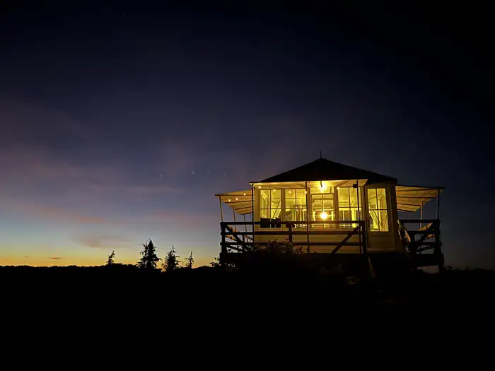
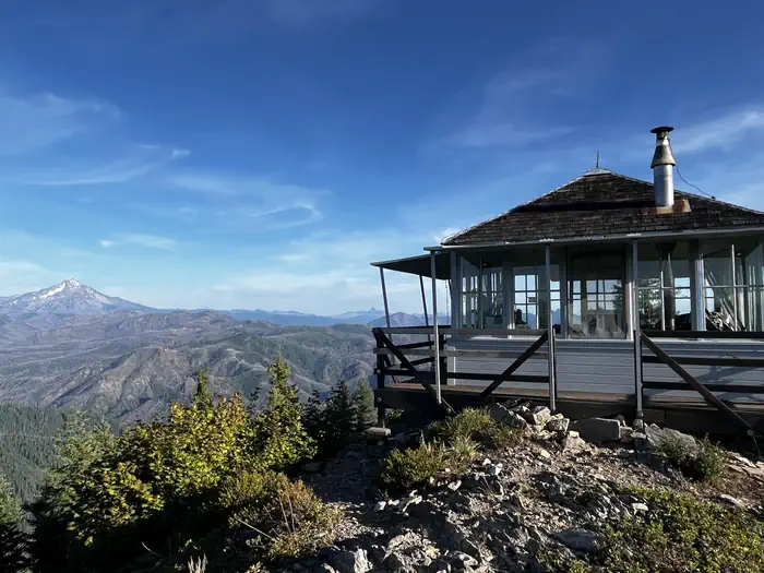
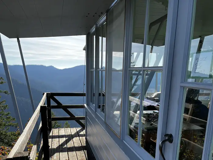
The Gold Butte Lookout sits on the summit of Gold Butte at an elevation of 4,618 feet in the Willamette National Forest. It was built in 1934 by the Civilian Conservation Corps. During World War II, the lookout served as part of Aircraft Warning System station in defense of the nation against air attack. It was staffed around the clock, usually by a husband and wife team, who reported all passing aircraft within sight or sound to a central filter center. The lookout stands on 3-foot stilts and is surrounded by glass windows and an exterior catwalk, offering a panoramic view of the Cascades. It is furnished with refurbished or replica furniture.
Check availability on Recreation.gov ↗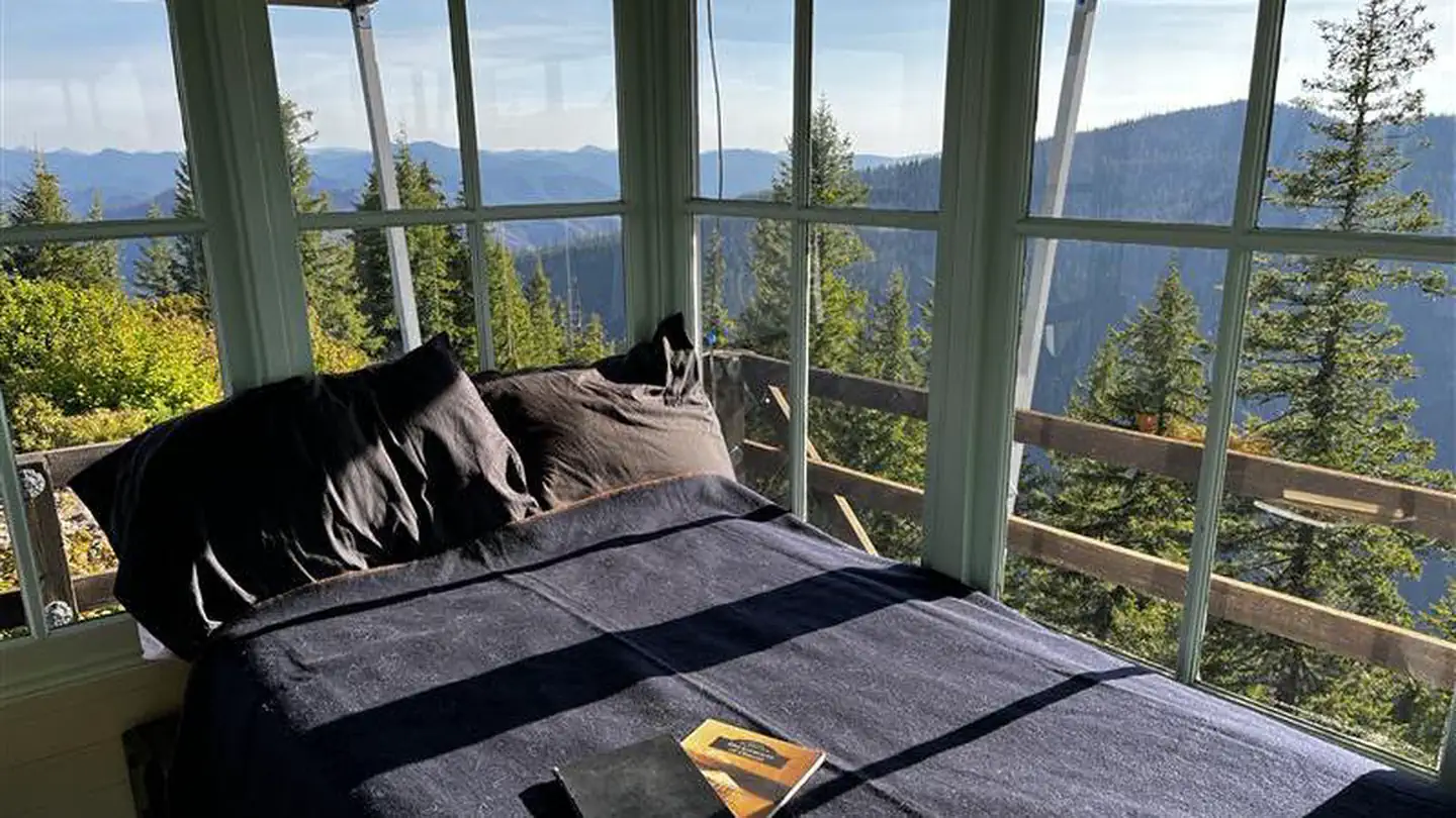
Site mix
| Cabins | 1 |
Site guide
1 site. Tap a filter to narrow the list; the map follows.
| Site | Surface | People / vehicles |
|---|---|---|
| 001 | Gravel | 4 / 2 |
Per-site records as published by the managing agency on Recreation.gov. Blank cells mean the agency listed nothing for that site. Check-in 2:00 PM, checkout 11:00 AM.
Amenities & rules
| Max vehicle length | 20 ft |
The 14x14-ft. wood cabin accommodates 4 people and comes equipped with 1 twin bed with mattress and 3 folding cots. Other amenities include a table, bench, chair, cabinet, wood bins, fire extinguisher, broom, dustpan, cleaning supplies, dishes and utensils. A wood stove is provided for heat. An outhouse and a woodshed stocked with firewood are located nearby. An axe may be available for chopping wood. Water, a cook stove and electricity are not provided. Guests must bring enough water for drinking, cooking and washing. Items such as bedding, lanterns or flashlights, cookware, fire starters, extra toilet paper, first aid supplies, trash bags, dish soap, towels and an ice chest are not available. This facility is opened and closed by the Sand Mountain Society. Guests are expected to pack out their trash and clean the cabin before leaving.
Individual sites vary. Confirm on Recreation.gov or with the managing office.
Weather by month
Getting there
From Detroit Ranger Station, drive east on State Highway 22 toward the town of Detroit. Directly after crossing the bridge, take a left onto Forest Service Road (FSR) 46 (Breitenbush). Drive FSR 46 for about 4 miles to FSR 4696. Turn left (northeast) onto FSR 4696 and drive about three-quarters of a mile to FSR 4697.
| Nearest town | Mill City, Oregon |
| Coordinates | 44.8053° N, 122.0837° W · Directions ↗ |
Fire nearby
- PrescribedSisi Lookout Admin Piles Rx - West
13 mi from the campground
- PrescribedAustin Repair Pile Rx - West
16 mi from the campground
- PrescribedSpike Timber Sale Rx - West
16 mi from the campground
- WildfireAustin
17 mi from the campground · 12,888 acres · 98% contained
Distance is to the reported incident point, not the fire edge. Call the managing office before you drive.
Supplies & services
| Outdoor gear | Timber Town Resale ↗ | 16.7 mi |
| Dump station | Dump station ↗ | 36.3 mi |
| RV sales & service | RV sales & service ↗ | 42.9 mi |
Locations © OpenStreetMap contributors. Call ahead; hours change seasonally.
Explore
Worth a stop
- 2.4 miBattle Ax Creek Trailhead ↗Trailhead
- 4.9 miUpper Arm Day Use Area ↗Day use
- 9.6 miOpal Creek Trailhead (Gate) ↗Trailhead
- 11.6 miThree Pools Day Use Area ↗Day use
Trails nearby
- under 0.1 miGold Butte Lookout1.2 mi trail · hiking, horse, bike
- 2.1 miElk Lake Creek ↗8.7 mi trail
- 2.4 miHumbug Flats1 mi trail · hiking, horse, bike
- 3.1 miBattle Ax Mountain1.3 mi trail · hiking, horse
- 3.1 miBattle Ax Mountain0.5 mi trail · hiking, horse
- 3.1 miMother Lode ↗5.7 mi trail
Trailheads within three miles
- 2.4 miBattle Ax Creek Trailhead ↗Willamette National Forest
Trail and trailhead records are the Forest Service's. Distances are straight-line to the nearer trail end. Trail conditions are not tracked here.
Public land it sits in
Bull of the Woods Wilderness begins about 1.2 miles away, and it is the closest of these.
- 1.2 miBull of the Woods Wilderness ↗Wilderness · Forest Service · 36,879 acres
- 1.6 miOpal Creek Wilderness ↗Wilderness · Forest Service · 20,777 acres
- 9.2 miMt. Hood National Forest ↗National Forest · Forest Service · 1,060,160 acres
Each unit is published as a centre point and an acreage rather than a boundary, so this section stands it in for a circle of the same area. Whether a campground is inside, and how far it is from one it is outside, are both approximate.
Other campgrounds nearby

Cabin and lookout rentals nearby
On the National Register nearby
- Bagby Guard StationBuilding · Estacada · 10 mi
- Olallie Lake Guard StationBuilding · Estacada · 14.4 mi
- Marion Forks Guard StationBuilding · Marion Forks · 14.7 mi
Natural features
Guests at the lookout can enjoy panoramic views of the Cascade Range, including nearby Mt. Jefferson, Three Fingered Jack, Mt. Hood, the Three Sisters and Bull of the Woods Wilderness Area. Seasonal wildflowers and wild huckleberries grow nearby. Willamette National Forest offers prime habitat for such species as Roosevelt elk, black bear, bald eagles, blacktail deer and bobcats, among other wildlife.
Recreation
In addition to relaxing and taking in the incredible views from Gold Butte, guests can venture out and experience other recreation opportunities nearby. Canoeing and fishing is possible in peaceful Elk Lake. Day hiking is a popular pastime in the adjacent Bull of the Woods and Opal Creek Wilderness Areas or nearby Mt. Jefferson Wilderness.
Guidebooks for Oregon
We earn a small commission if you buy through these links. It does not change what we list.

Titles come from Open Library's catalog, matched by subject heading or by title.
Reference
Questions people ask
Do I need a reservation at Gold Butte Lookout?
Sites at Gold Butte Lookout are reservable on Recreation.gov. Any walk-up sites are listed on the booking page.
Source: Recreation.gov
What time is check-in at Gold Butte Lookout?
Check-in 2:00 PM, checkout 11:00 AM.
Source: Recreation.gov
How many sites does Gold Butte Lookout have?
1 site, including 1 cabin.
Source: Recreation.gov
Will my RV fit at Gold Butte Lookout?
The longest site here provides 20 feet of vehicle capacity. Most sites are shorter. The sidebar tool checks a trailer or motorhome length against every site.
Source: Will my RV fit
What is there to do at Gold Butte Lookout?
In addition to relaxing and taking in the incredible views from Gold Butte, guests can venture out and experience other recreation opportunities nearby. The Recreation section on this page has the rest.
Source: Recreation
What is the nearest town to Gold Butte Lookout?
Mill City, Oregon.
Source: Getting there
What if Gold Butte Lookout is full?
The nearest public campgrounds are Fox Creek Group Camp (2.3 mi), Humbug Campground (2.4 mi, partly first-come), and Elk Lake (2.4 mi, first-come).
Source: Campgrounds nearby