Oak Flat Lookout
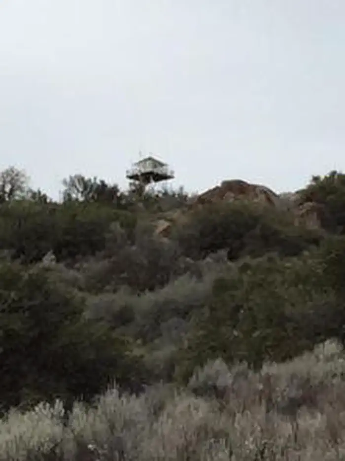
The Oak Flat Lookout sits the Greenhorn Mountains in the Sequoia National Forest and Sequoia National Monument, about an hour from Bakersfield, California. Perched at an elevation of 4,900 feet, the tower overlooks the scenic Kern River and Kern River Valley and has panoramic views of the mountains, river and valley. Oak Flat Lookout was constructed in 1934 to provide fire detection views along the Kern River Canyon. In the early years of the Forest Service, lookouts provided a crucial link in wild land management, often being the only source of communication and fire detection for many miles. The lookout was operational until the 1980s. There is no electricity or water in the lookout.
Check availability on Recreation.gov ↗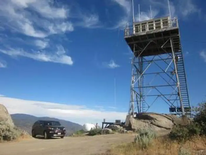

Site mix
| Cabins | 1 |
Site guide
1 site. Tap a filter to narrow the list; the map follows.
| Site | People / vehicles |
|---|---|
| 01 | 4 / 3 |
Per-site records as published by the managing agency on Recreation.gov. Blank cells mean the agency listed nothing for that site. Check-in 3:00 PM, checkout 12:00 PM.
Amenities & rules
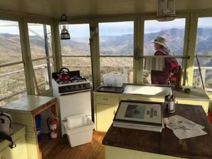
The lookout has no electricity or water. A thermostat-controlled propane heater provides heat. The one-room cabin contains two twin beds. The tower can hold up to four adults. The kitchen area includes a propane range, a counter and a sink with a drain. A propane light, fire extinguisher, a bucket and cleaning gear are all provided. There is a single vault toilet 100 yards northwest of the lookout, and an outdoor barbecue fire ring and picnic table near the tower.
Individual sites vary. Confirm on Recreation.gov or with the managing office.
Weather by month
Getting there
From Bakersfield, California, take Highway 99 to Highway 178 and travel east towards the Kern River Canyon. After passing through the last traffic light (Miramonte Drive) east of town, you will travel downhill. Rancheria Road will be the next left turn off the highway. Proceed 15 miles north along this road.
| Nearest town | Kernville, California |
| Coordinates | 35.5353° N, 118.7069° W · Directions ↗ |
Fire nearby
- WildfireCyrus
20 mi from the campground · 543 acres · 95% contained
Distance is to the reported incident point, not the fire edge. Call the managing office before you drive.
Supplies & services
| Dump station | Dump station ↗ | 16 mi |
| RV sales & service | Camping World ↗ | 24.6 mi |
| Outdoor gear | Triple Crown Outfitters ↗ | 46.2 mi |
Locations © OpenStreetMap contributors. Call ahead; hours change seasonally.
Explore
Worth a stop
- 4.1 miLive Oak Picnic Site ↗Day use
- 4.2 miUpper Richbar Picnic Site ↗Day use
Trails nearby
- under 0.1 miOak Flat Lookout3 mi trail · hiking, horse, bike, motorcycle and 1 more
- 1.3 miBadger Gap ↗12.2 mi trail · hiking, horse, bike, motorcycle and 1 more
- 2.1 miDemocrat1.5 mi trail · hiking, horse, bike
- 2.5 miKern River Trail1 mi trail · hiking, horse, bike, motorcycle and 1 more
- 2.5 miGolf Meadow 4WD1.1 mi trail · hiking, horse, bike, motorcycle and 3 more
- 2.6 miPowerhouse ↗10 mi trail · hiking, horse, bike
Trail and trailhead records are the Forest Service's. Distances are straight-line to the nearer trail end. Trail conditions are not tracked here.
Public land it sits in
Sequoia National Forest begins about 11.9 miles away, and it is the closest of these.
- 11.9 miSequoia National Forest ↗National Forest · Forest Service · 1,160,053 acres
Each unit is published as a centre point and an acreage rather than a boundary, so this section stands it in for a circle of the same area. Whether a campground is inside, and how far it is from one it is outside, are both approximate.
Other campgrounds nearby

Cabin and lookout rentals nearby
Natural features
The lookout tower has panoramic views of the mountains, the canyon and the river.
Recreation
Birdwatching and stargazing from the tower or the mountaintop are popular pastimes. For guests who wish to visit an operating lookout, Breckenridge Lookout located southeast of Oak Flat is open during the summer months.
Guidebooks for Sequoia National Forest and California
We earn a small commission if you buy through these links. It does not change what we list.

Titles come from Open Library's catalog, matched by subject heading or by title.
Reference
Questions people ask
Do I need a reservation at Oak Flat Lookout?
Sites at Oak Flat Lookout are reservable on Recreation.gov. Any walk-up sites are listed on the booking page.
Source: Recreation.gov
What time is check-in at Oak Flat Lookout?
Check-in 3:00 PM, checkout 12:00 PM.
Source: Recreation.gov
How many sites does Oak Flat Lookout have?
1 site, including 1 cabin.
Source: Recreation.gov
Is there cell service at Oak Flat Lookout?
FCC coverage maps show Verizon 4G LTE and T-Mobile 4G LTE at the campground point. Terrain changes that from one site to the next.
Source: FCC Broadband Map
What is there to do at Oak Flat Lookout?
Birdwatching and stargazing from the tower or the mountaintop are popular pastimes. The Recreation section on this page has the rest.
Source: Recreation
What is the nearest town to Oak Flat Lookout?
Kernville, California.
Source: Getting there
What if Oak Flat Lookout is full?
The nearest public campgrounds are Breckenridge Campground (8.5 mi, first-come), Evans Flat Campground (9.9 mi, first-come), and Sandy Flat (10.3 mi).
Source: Campgrounds nearby