Summit Guard Station Bunkhouse
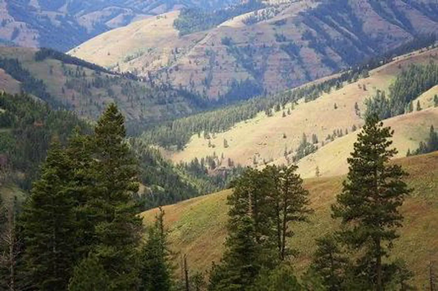
Summit Guard Station Bunkhouse sets the stage for a truly relaxing getaway. Located on the breaks of Meacham Canyon in Umatilla National Forest, spectacular views of the Blue Mountains are guaranteed. The rustic bunkhouse, built by the Civilian Conservation Corps, dates back to 1938. The site of the cabin was the Summit Ranger Station in 1908, when the land was part of the Wenaha National Forest. Wenaha was one of the first national forests in the country, established in 1907. It was renamed Umatilla National Forest in 1920.
Check availability on Recreation.gov ↗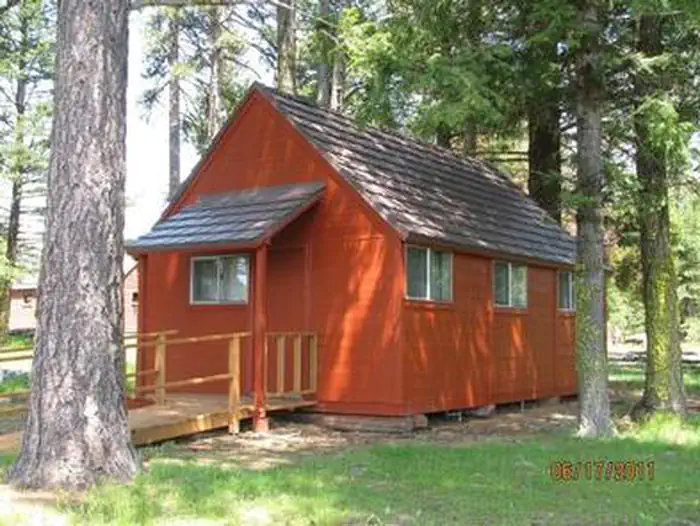
Site mix
| Cabins | 1 |
Site guide
1 site. Tap a filter to narrow the list; the map follows.
| Site | Surface | Shade | People / vehicles |
|---|---|---|---|
| 001 | Gravel | Partial | 4 / 3 |
Per-site records as published by the managing agency on Recreation.gov. Blank cells mean the agency listed nothing for that site. Check-in 2:00 PM, checkout 12:00 PM.
Amenities & rules
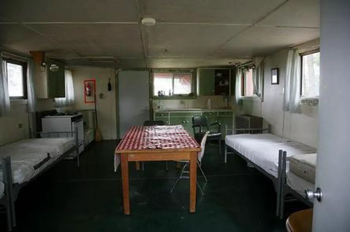
The single-room cabin accommodates up to four guests. The red, wood framed cabin has two full beds and two twin beds with mattresses, a table and four chairs, and is equipped with a propane cook stove, propane lights and a propane heater. The cabin is stocked with a limited supply of pots, pans, eating utensils and cleaning supplies. A vault toilet is located a short distance from the cabin and additional guests may use the yard to pitch a tent. No water is available on-site, so guests must bring plenty of water for drinking, cooking and washing. Other items to bring include food, bedding, towels, garbage bags, dish soap and a first aid kit. It's a great idea to bring binoculars as well.
Individual sites vary. Confirm on Recreation.gov or with the managing office.
Weather by month
Getting there
From Weston, Oregon: Travel 28 miles east of Weston on Highway 204. Turn right (south) onto Forest Service Road 31. Go 9.4 miles to Ruckel Junction. Stay on Forest Service Road 31 and go 17 miles until you reach the junction with Forest Service Road 3113.
| Nearest town | Walla Walla, Oregon |
| Coordinates | 45.4764° N, 118.2089° W · Directions ↗ |
Fire nearby
- PrescribedBird Track 610/607A Rx
9 mi from the campground · 141 acres
- PrescribedBirdtrack 621 Broadcast Rx
12 mi from the campground · 377 acres
- WildfireHagen
16 mi from the campground · 61,380 acres · 99% contained
- WildfireNorth Cayuse
19 mi from the campground · 4,887 acres · 97% contained
Distance is to the reported incident point, not the fire edge. Call the managing office before you drive.
Supplies & services
| Dump station | Dump station ↗ | 16.8 mi |
| Outdoor gear | The Sports Corral ↗ | 48.2 mi |
Locations © OpenStreetMap contributors. Call ahead; hours change seasonally.
Explore
Public land it sits in
Wallowa-Whitman National Forest begins about 4.1 miles away, and it is the closest of these.
- 4.1 miWallowa-Whitman National Forest ↗National Forest · Forest Service · 2,525,292 acres
- 14.1 miNorth Fork Umatilla Wilderness ↗Wilderness · Forest Service · 20,213 acres
Each unit is published as a centre point and an acreage rather than a boundary, so this section stands it in for a circle of the same area. Whether a campground is inside, and how far it is from one it is outside, are both approximate.
Other campgrounds nearby

On the National Register nearby
- Dry Creek SchoolBuilding · Summerville · 9.4 mi
- Meacham HotelBuilding · Meacham · 10.5 mi
- August J. Stange HouseBuilding · La Grande · 11.5 mi
Natural features
Summit Guard Station is located on a high ridge nestled in an open stand of large Ponderosa pine and Douglas fir. The view to the south and west from this ridge-top setting is exceptional. Prominent points in the area include Wilbur Mountain, Spring Mountain, Sugarloaf Mountain and Green Mountain. Bird species in the region include kinglets, sparrows, chickadees and hummingbirds, while wildflowers include larkspur, lupine and orchids.
Recreation
Bird and wildlife watching is exceptional at Summit.
Nearby
The Whitman Route Overlook is a short drive away, boasting views of Meacham Canyon and the Hell Hole Roadless Area, as well as a look back into the history of the area.
Guidebooks for Oregon
We earn a small commission if you buy through these links. It does not change what we list.

Titles come from Open Library's catalog, matched by subject heading or by title.
Reference
Questions people ask
Do I need a reservation at Summit Guard Station Bunkhouse?
Sites at Summit Guard Station Bunkhouse are reservable on Recreation.gov. Any walk-up sites are listed on the booking page.
Source: Recreation.gov
What time is check-in at Summit Guard Station Bunkhouse?
Check-in 2:00 PM, checkout 12:00 PM.
Source: Recreation.gov
How many sites does Summit Guard Station Bunkhouse have?
1 site, including 1 cabin.
Source: Recreation.gov
Is there cell service at Summit Guard Station Bunkhouse?
FCC coverage maps show AT&T 4G LTE and T-Mobile 4G LTE at the campground point. Terrain changes that from one site to the next.
Source: FCC Broadband Map
What is the nearest town to Summit Guard Station Bunkhouse?
Walla Walla, Oregon. The Whitman Route Overlook is a short drive away, boasting views of Meacham Canyon and the Hell Hole Roadless Area, as well as a look back into the history of the area.
Source: Getting there
What if Summit Guard Station Bunkhouse is full?
The nearest public campgrounds are Spring Creek Campground (9.7 mi), Bird Track Springs Campground (13.1 mi), and Umatilla Forks Campground (17.1 mi, first-come).
Source: Campgrounds nearby