Mt. Baldy-Buckhorn Ridge
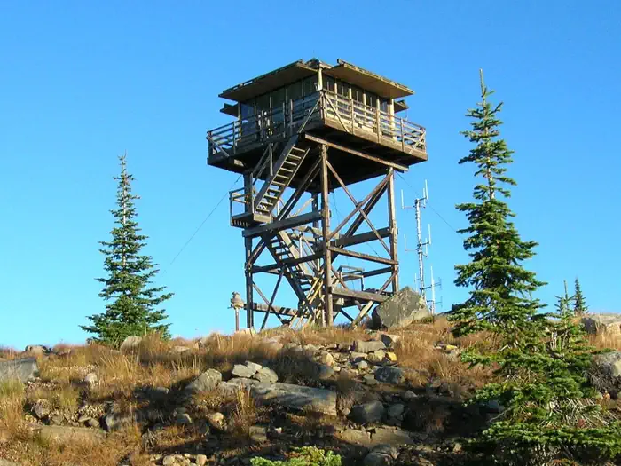
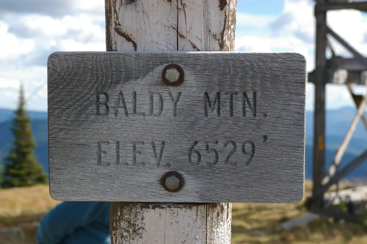
The Mount Baldy - Buckhorn Ridge Lookout sits at an elevation of 6,529 feet in the Kootenai National Forest. This location has been used as an observation point for detecting forest fires since 1910. The current lookout tower was built in 1957. The lookout is typically available from late June through late September, and is accessible by car, though high clearance vehicles are recommended for the primitive roads. Some creature comforts are provided, but guests should be prepared to pack in many of their own amenities.
Check availability on Recreation.gov ↗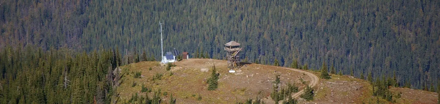
Site mix
| Cabins | 1 |
Site guide
1 site. Tap a filter to narrow the list; the map follows.
| Site | Entry | Surface | Water / sewer | People / vehicles | Fires | Rating |
|---|---|---|---|---|---|---|
| 001 | Pull-through | Gravel | No / No | 4 / 2 | Yes | Standard |
Per-site records as published by the managing agency on Recreation.gov. Blank cells mean the agency listed nothing for that site. Check-in 2:00 PM, checkout 11:00 AM.
Amenities & rules
| Pets | Allowed |
| Campfires | Allowed, subject to restrictions |
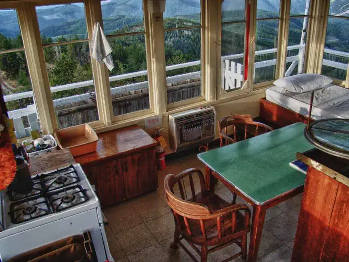
This 144 square foot lookout cabin sits atop a 26-foot tower and is encircled by a catwalk. It can accommodate 4 people and comes equipped with 2 twin beds and 4 mattresses, a table, 2 chairs, broom and dustpan. Propane appliances are provided that include a cook stove, heater and lights. An outhouse with vault toilet islocated nearby. The lookout does not have electricity or water. Guests must provide their own water for drinking, cooking and washing. Items such as cooking gear, bedding, lanterns or flashlights, matches, extra toilet paper, first aid supplies, trash bags, dish soap, and towels are not available. Guests are expected to pack out their trash and clean the cabin before leaving.
Individual sites vary. Confirm on Recreation.gov or with the managing office.
Weather by month
Getting there
From Troy Montana, follow Highway 2 West for 9.5 miles to Yaak Highway 508. Follow Yaak Highway 508 for 18 miles north to Meadow Creek Road 524. Follow Road 524 1 mile to junction with Road 745. Take road 745 approximately 4 miles to Baldy Mountain Lookout Road 591. Follow 591 for approximately 2 miles to Road 5954. Take Road 5954 to the lookout.
| Nearest town | Troy, Montana |
| Coordinates | 48.8361° N, 115.9292° W · Directions ↗ |
Fire nearby
- WildfireUpper Smith
31 mi from the campground · 4,848 acres · 41% contained
- WildfireParker Lake
32 mi from the campground · 1,531 acres · 1% contained
- WildfireSilver
36 mi from the campground · 2,593 acres · 30% contained
Distance is to the reported incident point, not the fire edge. Call the managing office before you drive.
Supplies & services
| Dump station | Dump station ↗ | 18.5 mi |
| RV sales & service | Kootenay RV ↗ | 33.4 mi |
| Outdoor gear | North 40 ↗ | 45.9 mi |
Locations © OpenStreetMap contributors. Call ahead; hours change seasonally.
Explore
Trails nearby
- 0.2 miBaldy Mountain4 mi trail · hiking, horse, bike, snowmobile
- 0.2 miBaldy Spring0.8 mi trail · hiking, horse, bike, snowmobile
- 0.7 miBaldy/Buckhorn3.9 mi trail · hiking, horse, bike, snowmobile
- 2 miHellroaring Creek3.7 mi trail · hiking, horse, bike, snowmobile
- 2.4 miRock Candy ↗11.4 mi trail · hiking, horse, bike · national_scenic_or_historic
- 2.8 miNorth Fork Meadow Creek1.4 mi trail · hiking, horse, bike, snowmobile
Trail and trailhead records are the Forest Service's. Distances are straight-line to the nearer trail end. Trail conditions are not tracked here.
Public land it sits in
This campground sits inside Kootenai National Forest.
- inKootenai National Forest ↗National Forest · Forest Service · 2,622,202 acres
Each unit is published as a centre point and an acreage rather than a boundary, so this section stands it in for a circle of the same area. Whether a campground is inside, and how far it is from one it is outside, are both approximate.
Other campgrounds nearby


Cabin and lookout rentals nearby
On the National Register nearby
- Snyder Guard Station Historical DistrictHistoric district · Eastport · 11.4 mi
- Spokane & International Railroad Construction CampSite · Eastport · 14.2 mi
Natural features
The lookout offers views of the Kaniksu National Forest in Idaho, the Cabinet Mountain Range and Rock Candy Mountain. The panorama features endless mountain peaks and evergreen forest. Guests have an ideal location for watching sunrises and sunsets, or for gazing out over the starry night skies. Kootenai National Forest supports populations of deer, elk, moose, grizzly and black bears, wolves and mountain lions ( bear safety ). A variety of smaller mammals and birds can also be found.
Recreation
Aside from exploring Mount Baldy, hikers can find a network of trails in the surrounding Yaak Area. The Northwest Peaks Scenic Area, located in the northwest corner of the Yaak Area, offers a variety of hiking trails in beautiful settings. Hunting is also possible nearby. Wild berries grow in the area, inviting berry pickers.
Nearby
Yaak Falls is a popular destination just a short drive from the lookout off Yaak Highway 508. Spring and early summer are the best times to visit, when the snowmelt finds its way over the falls.
Guidebooks for Montana
We earn a small commission if you buy through these links. It does not change what we list.

Titles come from Open Library's catalog, matched by subject heading or by title.
Reference
Questions people ask
Do I need a reservation at Mt. Baldy-Buckhorn Ridge?
Sites at Mt. Baldy-Buckhorn Ridge are reservable on Recreation.gov. Any walk-up sites are listed on the booking page.
Source: Recreation.gov
What time is check-in at Mt. Baldy-Buckhorn Ridge?
Check-in 2:00 PM, checkout 11:00 AM.
Source: Recreation.gov
How many sites does Mt. Baldy-Buckhorn Ridge have?
1 site, including 1 cabin.
Source: Recreation.gov
Are pets allowed at Mt. Baldy-Buckhorn Ridge?
Yes, pets are allowed at Mt. Baldy-Buckhorn Ridge. Leash rules apply.
Source: Recreation.gov
Can I have a campfire at Mt. Baldy-Buckhorn Ridge?
Fires are allowed in the provided rings under normal conditions. As of 2026-10-16, there are 3 active fires within 50 miles, so check current restrictions before you light one.
Source: Fire nearby
What is there to do at Mt. Baldy-Buckhorn Ridge?
Aside from exploring Mount Baldy, hikers can find a network of trails in the surrounding Yaak Area. The Recreation section on this page has the rest.
Source: Recreation
What is the nearest town to Mt. Baldy-Buckhorn Ridge?
Troy, Montana. Yaak Falls is a popular destination just a short drive from the lookout off Yaak Highway 508.
Source: Getting there
What if Mt. Baldy-Buckhorn Ridge is full?
The nearest public campgrounds are Whitetail Campground (5.2 mi, partly first-come), Red Top Campground (5.2 mi, first-come), and Whitetail Yurt (5.2 mi).
Source: Campgrounds nearby