West Fork Butte Lookout
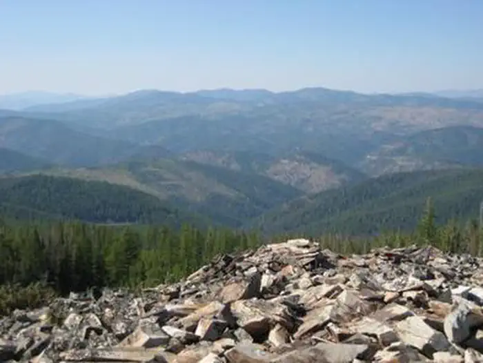
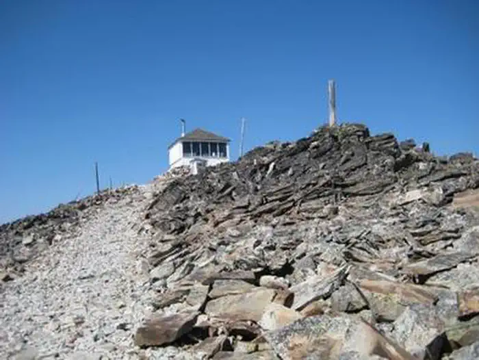
West Fork Butte Lookout is an ideal place for guests to experience the mountains south of Missoula from a unique vantage point. The facility provides near-360-degree views of the surrounding area. It is equipped with basic supplies and provides guests a base camp location from which to explore the area. Access by vehicle is available for a relatively short time during the summer months and is variable during the spring and fall. From December 1 - May 1 Forest Road 37 is closed, requiring hiking, skiing or snowmobiling roughly 7.5 miles to the facility.
Check availability on Recreation.gov ↗
Site mix
| Cabins | 1 |
Site guide
1 site. Tap a filter to narrow the list; the map follows.
| Site | Surface | People / vehicles |
|---|---|---|
| 001 | Gravel | 4 / 2 |
Per-site records as published by the managing agency on Recreation.gov. Blank cells mean the agency listed nothing for that site. Check-in 3:00 PM, checkout 12:00 PM.
Amenities & rules
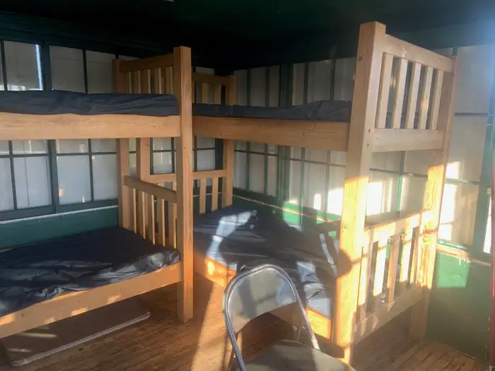
The lookout can sleep up to four people and is equipped with bunk beds and mattress pads. The lookout also has a table and chairs, a propane cook stove and lantern, as well as a wood stove for heat. A vault toilet is provided. Guests should bring their own water for drinking, cooking and cleaning purposes. Bedding and towels, propane fuel canisters, flashlights, matches, lighters, garbage bags, toilet paper and cleaning supplies are not supplied at the facility. Guests are responsible for cleaning the lookout prior to departure.
Individual sites vary. Confirm on Recreation.gov or with the managing office.
Weather by month
Getting there
From Missoula, travel south on Highway 93 to Lolo. Turn onto Highway 12 and continue west for 17 miles, following Lolo Creek to Forest Road 37. Turn left onto Road 37, and cross the concrete bridge over Lolo Creek. There are two gates along the route to the lookout.
| Nearest town | Missoula, Montana |
| Coordinates | 46.7336° N, 114.4003° W · Directions ↗ |
Fire nearby
- WildfireMoose Mountain
39 mi from the campground · 5,832 acres · 90% contained
- PrescribedRx D7 Lost Creek 155/559
42 mi from the campground · 17 acres
- PrescribedD4 Rx Simmons Peak
47 mi from the campground
Distance is to the reported incident point, not the fire edge. Call the managing office before you drive.
Supplies & services
| RV sales & service | Sport Land Trailer Sales, Service & Rentals ↗ | 15 mi |
| Outdoor gear | Cabela's ↗ | 18.6 mi |
| Dump station | Dump station ↗ | 29.5 mi |
Locations © OpenStreetMap contributors. Call ahead; hours change seasonally.
Explore
Trails nearby
- 0.8 miWest Fork Butte ↗6.8 mi trail · hiking, horse, bike
- 2.5 miE Fk-W Fk Butte Snowmo Tr# 7 ↗8.3 mi trail · snowmobile, snowshoe, ski
- 3.3 miHoward Creek Snowmobile Tr# 6 ↗7.9 mi trail · snowmobile, snowshoe, ski
- 3.3 miW Fk Butte-Elk Mdws Snow Tr# 8 ↗14.4 mi trail · snowmobile, snowshoe, ski
- 3.3 miLolo (howard Creek Loop)0.2 mi trail · hiking, horse
- 3.6 miLolo ↗18.5 mi trail · hiking, horse · national_scenic_or_historic
Trail and trailhead records are the Forest Service's. Distances are straight-line to the nearer trail end. Trail conditions are not tracked here.
Public land it sits in
Nez Perce-Clearwater National Forest begins about 14 miles away, and it is the closest of these.
- 14 miNez Perce-Clearwater National Forest ↗National Forest · Forest Service · 4,072,795 acres
Each unit is published as a centre point and an acreage rather than a boundary, so this section stands it in for a circle of the same area. Whether a campground is inside, and how far it is from one it is outside, are both approximate.
Other campgrounds nearby


On the National Register nearby
- West Fork Butte LookoutBuilding · Missoula · 0.8 mi
Natural features
The 14-by-14' lookout is situated on a rocky knob with spectacular views of the surrounding area, including Lolo Peak, the Bitterroot Mountains and the Lolo Creek drainage. The lookout is close to the Montana-Idaho border and Lolo Pass. The surrounding forest is comprised primarily of lodgepole pine and larch. The area is home to elk, moose, deer and black bears.
Recreation
Hiking trails are available in the area. Visitors often bring cross-country skis or snowshoes for wintertime fun. Snowmobiles are often used to reach the lookout in the winter, and there is a system of groomed trails to explore nearby. Fishing is available in Lolo Creek.
Guidebooks for Montana
We earn a small commission if you buy through these links. It does not change what we list.

Titles come from Open Library's catalog, matched by subject heading or by title.
Reference
Questions people ask
Do I need a reservation at West Fork Butte Lookout?
Sites at West Fork Butte Lookout are reservable on Recreation.gov. Any walk-up sites are listed on the booking page.
Source: Recreation.gov
What time is check-in at West Fork Butte Lookout?
Check-in 3:00 PM, checkout 12:00 PM.
Source: Recreation.gov
How many sites does West Fork Butte Lookout have?
1 site, including 1 cabin.
Source: Recreation.gov
What is there to do at West Fork Butte Lookout?
Hiking trails are available in the area. The Recreation section on this page has the rest.
Source: Recreation
What is the nearest town to West Fork Butte Lookout?
Missoula, Montana.
Source: Getting there
What if West Fork Butte Lookout is full?
The nearest public campgrounds are Lee Creek Campground (6.7 mi, first-come), Charles Waters Campground (16.5 mi, first-come), and Larry Creek Group Camp (16.5 mi).
Source: Campgrounds nearby