Mccart Lookout
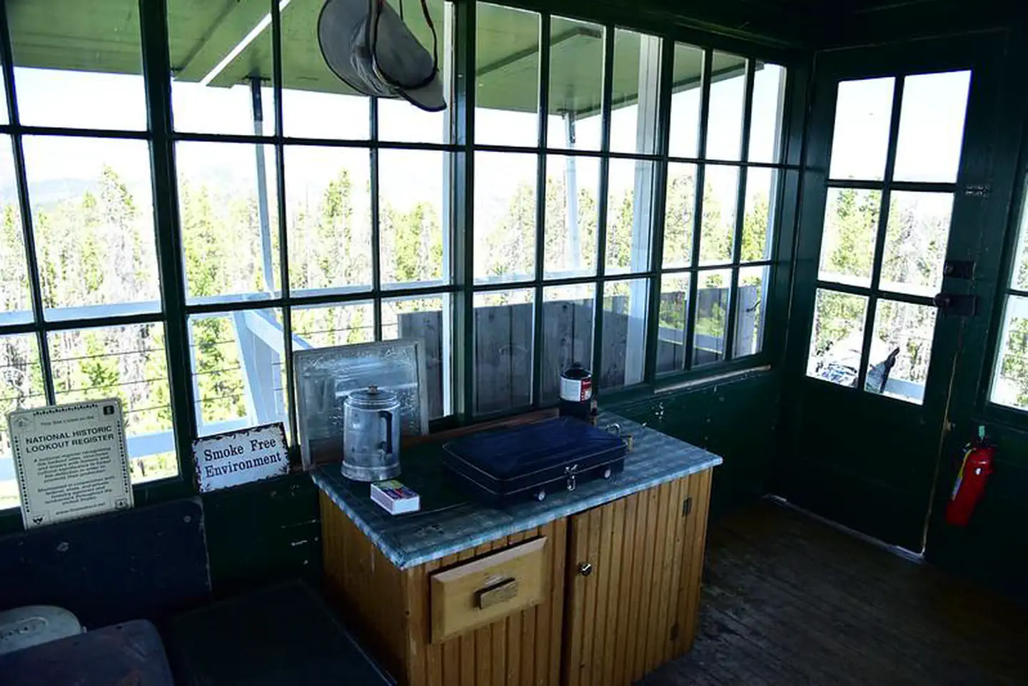
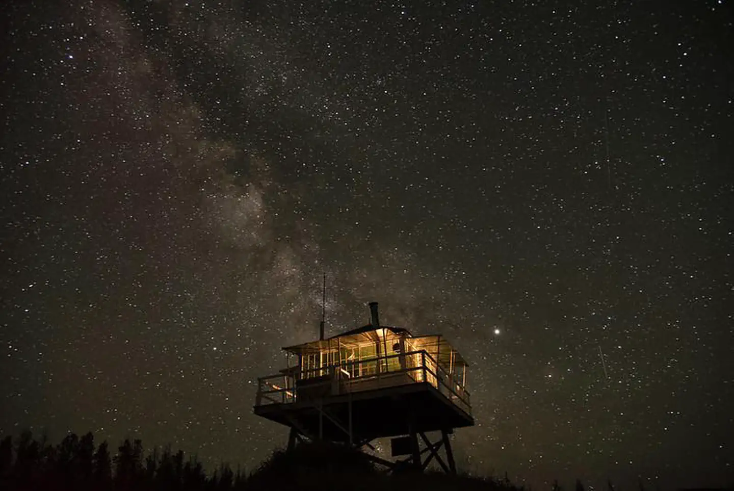
McCart Lookout is a historic tower located on McCart Peak, east of Sula. It has been restored to reflect a lookout of the 1940s, including the stove, furniture, dishes and other small touches. It offers a unique chance for visitors to camp on a mountain peak, on the border of the Anaconda-Pintler Wilderness, in a rustic, old-time setting. The tower provides spectacular views of the surrounding western Montana wilderness.
Check availability on Recreation.gov ↗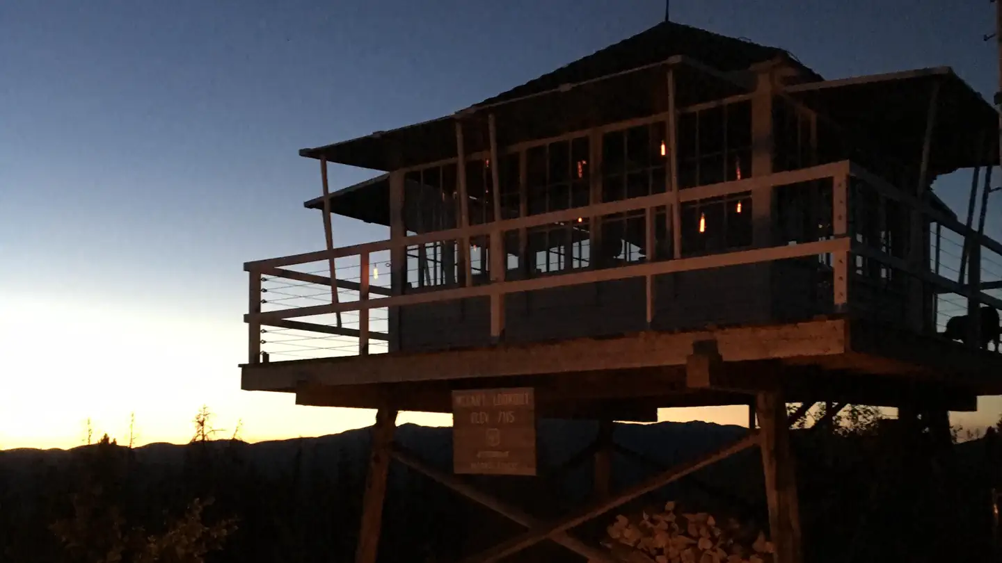
Site mix
| Cabins | 1 |
Site guide
1 site. Tap a filter to narrow the list; the map follows.
| Site | People / vehicles | Pets |
|---|---|---|
| 01 | 4 / 2 | No |
Per-site records as published by the managing agency on Recreation.gov. Blank cells mean the agency listed nothing for that site. Check-in 2:00 PM, checkout 12:00 PM.
Amenities & rules
| Fees | The lookout can be reserved up to 180 days in advance. |
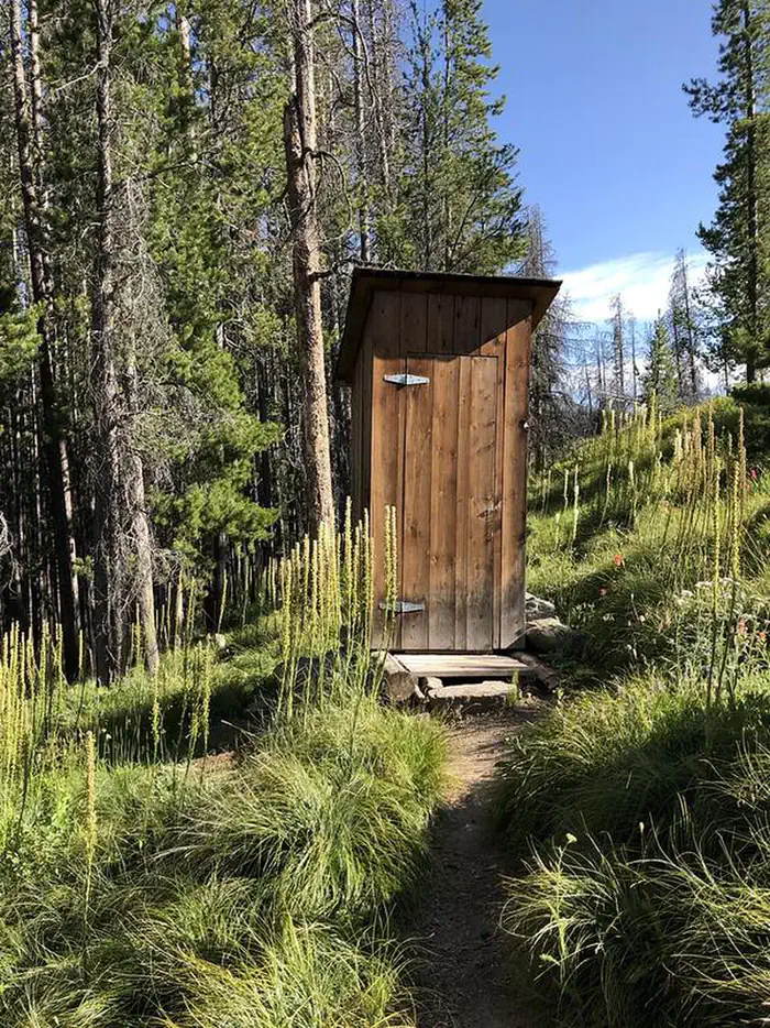
McCart Lookout is a historic "L4" lookout located on Mccart Peak east of the Bitterroot Valley. The lookout is a one room cabin with a bed platform suitable for two people. The lookout can accommodate up to four. Others are welcome to tent camp in the area. The lookout measures 14ft.X14ft. with a 30 inch catwalk around the outside. There is a wood stove for heat. You may have to saw your own wood from dead and down material found nearby. A bow saw and ax are provided. A two burner propane camp stove and lanterns are provided. Utensils for cooking and eating are provided. There is no water available near the lookout so please bring your own water. An outdoor toilet serves the lookout. You will need to provide your own toilet paper. The lookout is built on a 10 foot tall tower, with narrow steps and catwalk. This may pose a hazard for children and pets. Guests are responsible for their own safety. Remember, guests will need to bring their own water for drinking, cooking and cleaning purposes, as well as propane fuel canisters for cooking and lighting.
Individual sites vary. Confirm on Recreation.gov or with the managing office.
Weather by month
Getting there
From Missoula, Montana, travel south on Highway 93 for approximately 90 miles to Sula. Go east on Highway 472 for about 15 miles and then south on Forest Road 5765/McCart Road for about 6 miles to the Johnson Peak Trailhead. Hike about 1.5 miles to the lookout tower.
| Nearest town | Sula, Montana |
| Coordinates | 45.8847° N, 113.7175° W · Directions ↗ |
Good to know
- Propane is not provided, you will need to bring your own propane canisters.
Fire nearby
- PrescribedRx D3 Cameron Gaps
9 mi from the campground · 1,100 acres
- PrescribedScf Nz Pile Burn Rx
21 mi from the campground · 34 acres
- PrescribedRx D4 Piquett Creek
23 mi from the campground · 2,210 acres
- WildfireSand Creek
30 mi from the campground · 35,520 acres · 83% contained
Distance is to the reported incident point, not the fire edge. Call the managing office before you drive.
Supplies & services
| RV sales & service | Hamilton RV Sales Of Montana ↗ | 34.1 mi |
Locations © OpenStreetMap contributors. Call ahead; hours change seasonally.
Explore
Worth a stop
A variety of natural hot springs exist in the area, including the Lost Trail Hot Springs, which is located about 13 miles northwest of the tower. It provides swimming and additional amenities, including a general store and lodging.
- 0.4 miMccart Trailhead ↗Trailhead
- 2.4 miSwift Creek Trailhead ↗Trailhead
Trails nearby
- under 0.1 miMcCart Lookout0.1 mi trail
- 0.4 miMcCart-Johnson Peak ↗6.8 mi trail
- 1.6 miSwift Creek ↗5.4 mi trail
- 1.7 miEast Fork Near Vapor ↗0.5 mi trail
- 1.7 miEast Fork ↗11.5 mi trail
- 1.8 miEcho Gulch ↗1.6 mi trail
Trailheads within three miles
- 0.4 miMccart Trailhead ↗Bitterroot National Forest · Season June
- 1.7 miEast Fork Trailhead ↗Bitterroot National Forest
- 2.4 miSwift Creek Trailhead ↗Bitterroot National Forest
Trail and trailhead records are the Forest Service's. Distances are straight-line to the nearer trail end. Trail conditions are not tracked here.
Public land it sits in
This campground sits inside Bitterroot National Forest, which overlaps Beaverhead-Deerlodge National Forest.
- inBitterroot National Forest ↗National Forest · Forest Service · 1,664,512 acres
- inBeaverhead-Deerlodge National Forest ↗National Forest · Forest Service · 3,614,456 acres
- 3.8 miAnaconda Pintler Wilderness ↗Wilderness · Forest Service · 158,712 acres
Each unit is published as a centre point and an acreage rather than a boundary, so this section stands it in for a circle of the same area. Whether a campground is inside, and how far it is from one it is outside, are both approximate.
Other campgrounds nearby

Cabin and lookout rentals nearby
On the National Register nearby
- McCart Fire LookoutStructure · Sula · 0 mi
- Moose Lake Camp Historic DistrictHistoric district · Philipsburg · 14.7 mi
Natural features
The tower is situated east of the Bitterroot Valley, at an elevation of 7,115 feet. It was named for William McCart, who settled the area but failed to complete his homestead entry to patent. It is poised on the edge of the Anaconda-Pintler Wilderness and offers beautiful views of the Pintler Mountains to the east and the Bitterroot Mountains to the west. The Bitterroot forest is home to many species of wildlife, from mule deer, whitetail deer, elk, bighorn sheep, mountain goats, black bear, mountain lions, and moose, to many varieties of smaller animals and birds.
Recreation
The trail to reach the tower continues south and joins the Continental Divide National Scenic Trail, which extends 3,100 miles across the United States, from the borders of Mexico to Canada. While it might take about six months to complete, a variety of day hikes and points of exploration are available within the area of the lookout tower. Trails can be enjoyed on foot or on horseback. Backpackers also enjoy the terrain. Aside from hiking and horseback riding, the area is replete with wildlife and offers scenic views. A lookout journal is kept inside, providing instructions of what to do in case of emergency or a storm. Danger from lightning is largely abated due to a lightning rod implanted at the structure.
Guidebooks for Montana
We earn a small commission if you buy through these links. It does not change what we list.

Titles come from Open Library's catalog, matched by subject heading or by title.
Reference
Questions people ask
Do I need a reservation at Mccart Lookout?
Sites at Mccart Lookout are reservable on Recreation.gov. Any walk-up sites are listed on the booking page.
Source: Recreation.gov
How much does it cost to camp at Mccart Lookout?
The lookout can be reserved up to 180 days in advance.
Source: Recreation.gov
What time is check-in at Mccart Lookout?
Check-in 2:00 PM, checkout 12:00 PM.
Source: Recreation.gov
How many sites does Mccart Lookout have?
1 site, including 1 cabin.
Source: Recreation.gov
What is there to do at Mccart Lookout?
The trail to reach the tower continues south and joins the Continental Divide National Scenic Trail, which extends 3,100 miles across the United States, from the borders of Mexico to Canada. The Recreation section on this page has the rest.
Source: Recreation
What is the nearest town to Mccart Lookout?
Sula, Montana. A variety of natural hot springs exist in the area, including the Lost Trail Hot Springs, which is located about 13 miles northwest of the tower.
Source: Getting there
What if Mccart Lookout is full?
The nearest public campgrounds are Martin Creek Campground (3.3 mi, first-come), Jennings Camp (5 mi, first-come), and Mussigbrod Campground (8.4 mi, first-come).
Source: Campgrounds nearby