East Fork Cabin
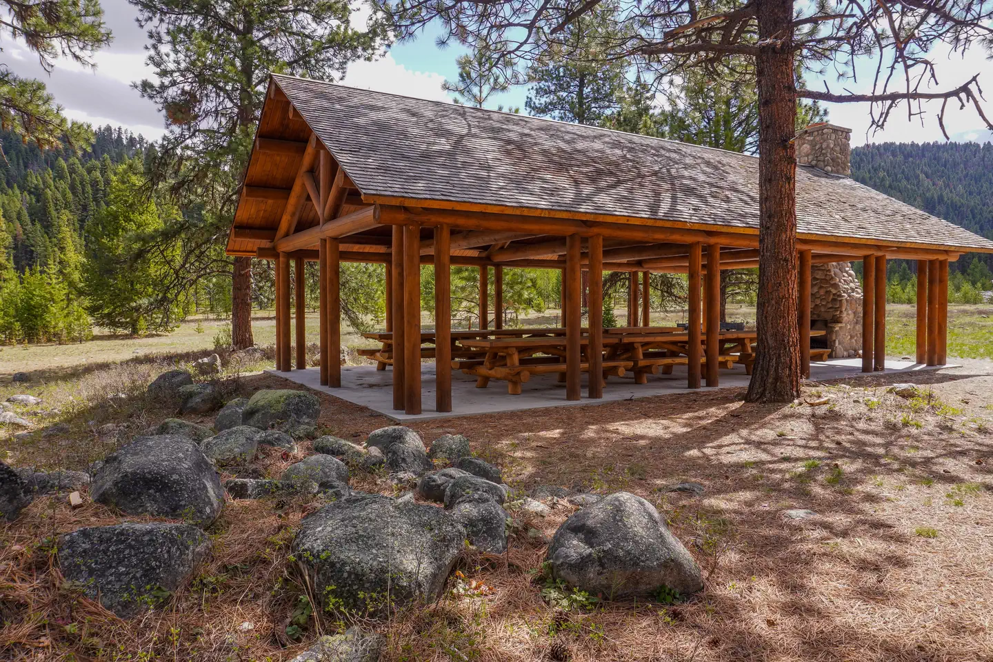
East Fork Cabin offers visitors a unique chance to camp in the Bitterroot National Forest of southwestern Montana. The cabin takes visitors back to a rustic, old-time setting and provides access to a variety of recreational opportunities on public lands. The site is available year-round and offers additional camping areas to accommodate large groups. An adjacent picnic area and pavillion provides a convenient location for everyone to gather. The cabin can be accessed by vehicle, however during winter months (October through April), alternative resources may be required to reach the cabin. The road is plowed up to three-quarters of a mile from the cabin.
Check availability on Recreation.gov ↗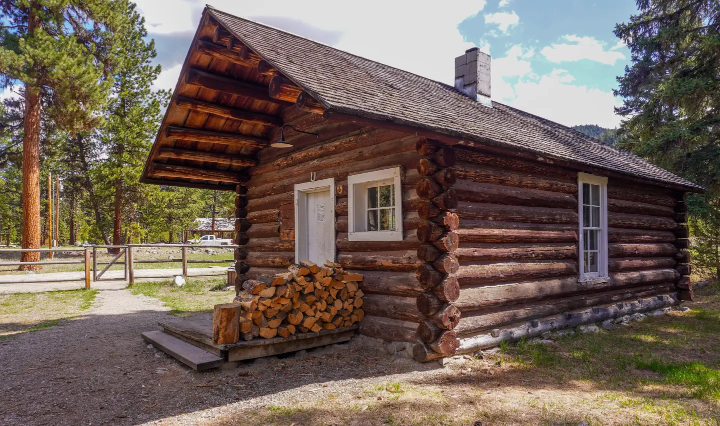
Site mix
| Cabins with electric | 1 |
Site guide
1 site. Tap a filter to narrow the list; the map follows.
| Site | Entry | Fits, ft | Surface | Shade | Waterfront | People / vehicles | Fires |
|---|---|---|---|---|---|---|---|
| 001 | Back-in | 600 | Gravel | Partial | Riverfront | 8 / 6 | Yes |
Per-site records as published by the managing agency on Recreation.gov. Blank cells mean the agency listed nothing for that site. Check-in 2:00 PM, checkout 12:00 PM.
Amenities & rules
| Max vehicle length | 45 ft |
| Fees | The cabin can be reserved up to 180 days in advance. Changes in scheduled reservation dates may be assessed an additional fee by the National Recreation Reservation Service. |
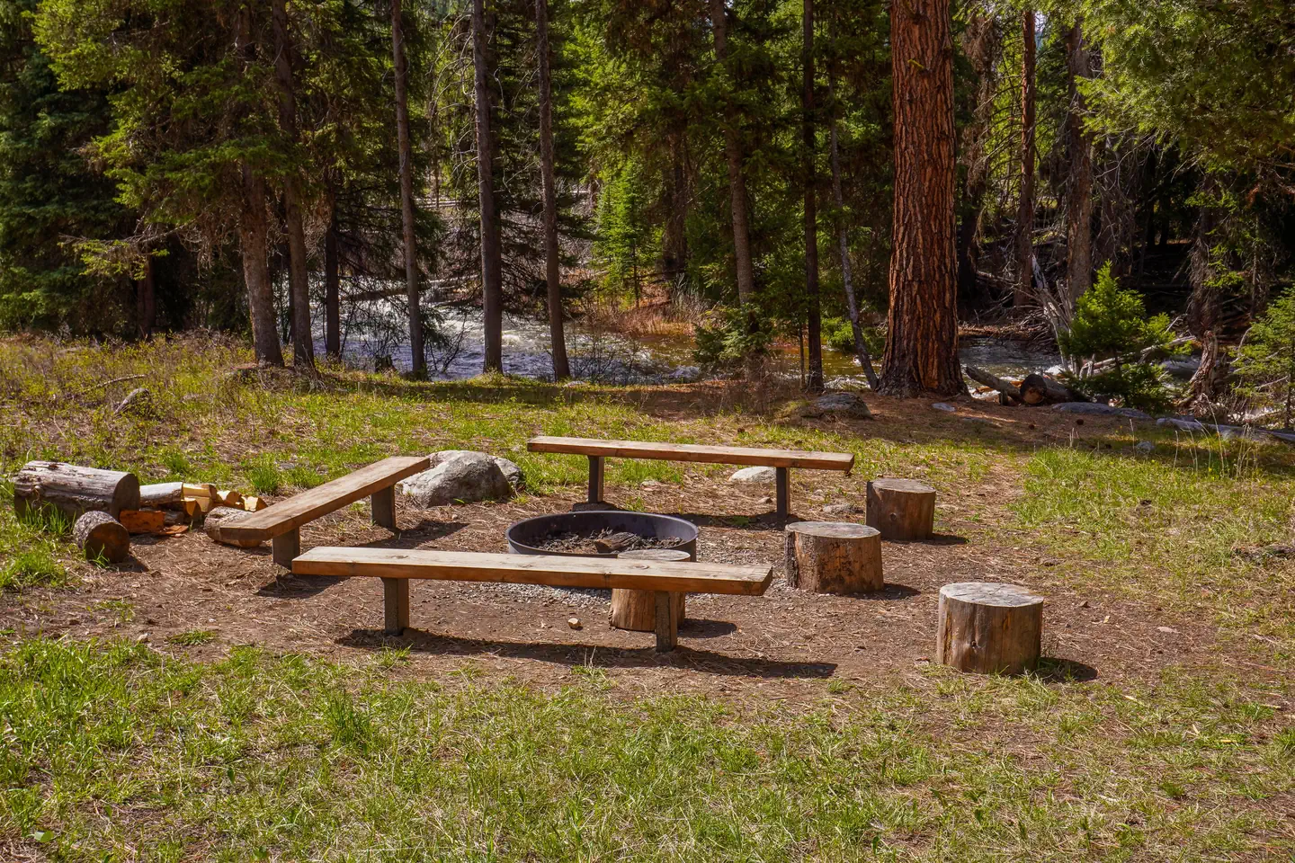
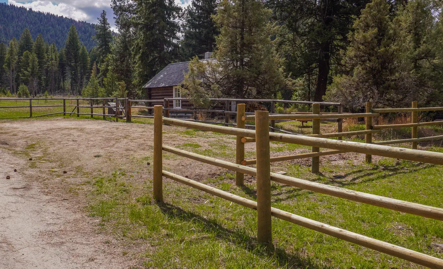
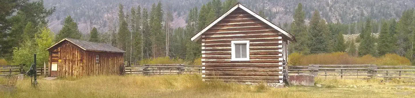
East fork guard station cabin is a rustic, historic cabin located on the East Fork of the Bitterroot River. It is a small one room cabin and can accommodate up to eight people. It is equipped with two bunk beds and mattress pads, a table and chairs/benches, a counter with cupboards, and a propane range with oven. Propane is provided. There are electric lights and one outlet inside the cabin. There is a wood stove for heat, firewood is provided but you may need to split your own logs. Please fill wood box inside before you leave. Pots, pans, plates, and utensils are provided. You will need to provide your own bedding and towels. Drinking water is available at the pump house. A vault toilet is located adjacent to the cabin and toilet paper is provided. A picnic table is available near the cabin for outdoor eating and activites. A group use fire pit with benches is located between the cabin and the East Fork River. Please supply your own firewood for outside fire pit use. Wood provided in the woodshed is for heating the cabin indoors. There is a corral/pasture area for stock use, but you should check the fence line prior to turn them loose. Hay must be certified weed free.
Individual sites vary. Confirm on Recreation.gov or with the managing office.
Weather by month
Getting there
From Sula, travel northwest on Highway 93 for less than a mile. Turn northeast (right) onto East Fork Road/County Road 472 and continue about 16 miles to the cabin. Maps may be purchased by calling the Darby-Sula Ranger District at 406-821-3913.
| Nearest town | Sula, Montana |
| Coordinates | 45.9228° N, 113.7261° W · Directions ↗ |
Fire nearby
- PrescribedRx D3 Cameron Gaps
8 mi from the campground · 1,100 acres
- PrescribedScf Nz Pile Burn Rx
23 mi from the campground · 34 acres
- PrescribedRx D4 Piquett Creek
23 mi from the campground · 2,210 acres
- WildfireSand Creek
32 mi from the campground · 35,520 acres · 83% contained
Distance is to the reported incident point, not the fire edge. Call the managing office before you drive.
Supplies & services
| RV sales & service | Hamilton RV Sales Of Montana ↗ | 31.8 mi |
Locations © OpenStreetMap contributors. Call ahead; hours change seasonally.
Explore
Worth a stop
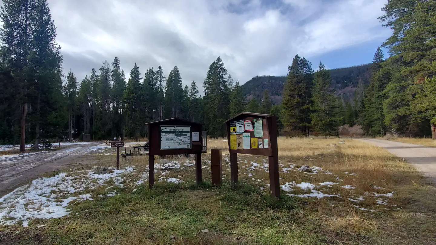
- East Fork Trailhead
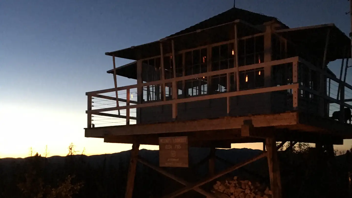
- McCart Lookout
- Lost Trail Ski Area
- Cheif Joeseph cross-country ski area
- Anaconda-Pintler Wilderness
- 2.3 miMccart Trailhead ↗Trailhead
- 3 miSwift Creek Trailhead ↗Trailhead
Trails nearby
- 0.4 miSouth of Tepee Point ↗0.7 mi trail
- 0.7 miHole in the Wall ↗8.1 mi trail
- 0.8 miEast Fork Near Vapor ↗0.5 mi trail
- 1 miLick Creek ↗1 mi trail
- 1.5 miEast Fork ↗11.5 mi trail
- 1.9 miEcho Gulch ↗1.6 mi trail
Trailheads within three miles
- 1.5 miEast Fork Trailhead ↗Bitterroot National Forest
- 2.3 miMccart Trailhead ↗Bitterroot National Forest · Season June
Trail and trailhead records are the Forest Service's. Distances are straight-line to the nearer trail end. Trail conditions are not tracked here.
Public land it sits in
This campground sits inside Bitterroot National Forest, which overlaps Beaverhead-Deerlodge National Forest.
- inBitterroot National Forest ↗National Forest · Forest Service · 1,664,512 acres
- inBeaverhead-Deerlodge National Forest ↗National Forest · Forest Service · 3,614,456 acres
- 3.6 miAnaconda Pintler Wilderness ↗Wilderness · Forest Service · 158,712 acres
Each unit is published as a centre point and an acreage rather than a boundary, so this section stands it in for a circle of the same area. Whether a campground is inside, and how far it is from one it is outside, are both approximate.
Other campgrounds nearby

Cabin and lookout rentals nearby
On the National Register nearby
- McCart Fire LookoutStructure · Sula · 2.7 mi
- Moose Lake Camp Historic DistrictHistoric district · Philipsburg · 13 mi
Natural features
The rustic cabin was built before 1914 and was restored in 1987. It was originally a guard station, used by fire watchers in the forest. It is situated on the East Fork of Bitterroot River, at an elevation of about 5,200 feet. The river flows west from within the Anaconda-Pintler Wilderness, to just south of Conner, Montana, where it joins the West Fork of the Bitterroot River to form the Bitterroot River. During the spring the river becomes a dangerous combination of fast water and snags. The Anacondas are home to abundant wildlife, including mountain lions, elk, deer, moose and bears ( learn about outdoor safety ).
Recreation
Fishing is popular in the nearby river. A variety of trout, including brown, rainbow, cutthroat and brook, can be found in the area between Sula and Conner. Winter fishing for whitefish is popular and productive, as the river is closed to trout fishing during the colder months. The catch along the East Fork is fairly evenly divided between bait, spin and fly fishermen. The surrounding hills and valleys are popular for hiking, backpacking and horseback riding in the summer and fall. Cross country skiing, snowshoeing and snowmobiling can be enjoyed in the area during the winter ( learn more about avalanche safety ). Winter sports enthusiasts can enjoy more than 50 miles of groomed trails, along with a number of unmarked trails that are open for recreation.
Guidebooks for Montana
We earn a small commission if you buy through these links. It does not change what we list.

Titles come from Open Library's catalog, matched by subject heading or by title.
Reference
Questions people ask
Do I need a reservation at East Fork Cabin?
Sites at East Fork Cabin are reservable on Recreation.gov. Any walk-up sites are listed on the booking page.
Source: Recreation.gov
How much does it cost to camp at East Fork Cabin?
The cabin can be reserved up to 180 days in advance. Changes in scheduled reservation dates may be assessed an additional fee by the National Recreation Reservation Service.
Source: Recreation.gov
What time is check-in at East Fork Cabin?
Check-in 2:00 PM, checkout 12:00 PM.
Source: Recreation.gov
How many sites does East Fork Cabin have?
1 site, including 1 cabin with power.
Source: Recreation.gov
Will my RV fit at East Fork Cabin?
The longest site here provides 45 feet of vehicle capacity. Most sites are shorter. The sidebar tool checks a trailer or motorhome length against every site.
Source: Will my RV fit
What is there to do at East Fork Cabin?
Fishing is popular in the nearby river. The Recreation section on this page has the rest.
Source: Recreation
What is the nearest town to East Fork Cabin?
Sula, Montana. East Fork Trailhead
Source: Getting there
What if East Fork Cabin is full?
The nearest public campgrounds are Martin Creek Campground (0.7 mi, first-come), Jennings Camp (4.9 mi, first-come), and Mussigbrod Campground (10.8 mi, first-come).
Source: Campgrounds nearby