Bear Basin Lookout And Cabin
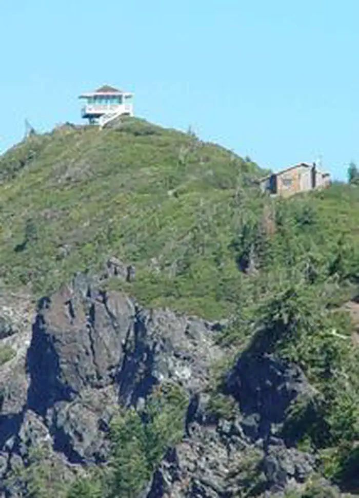
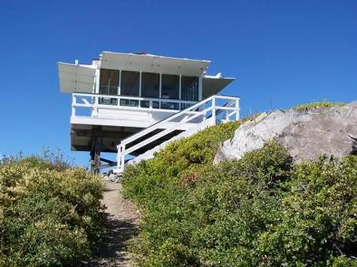
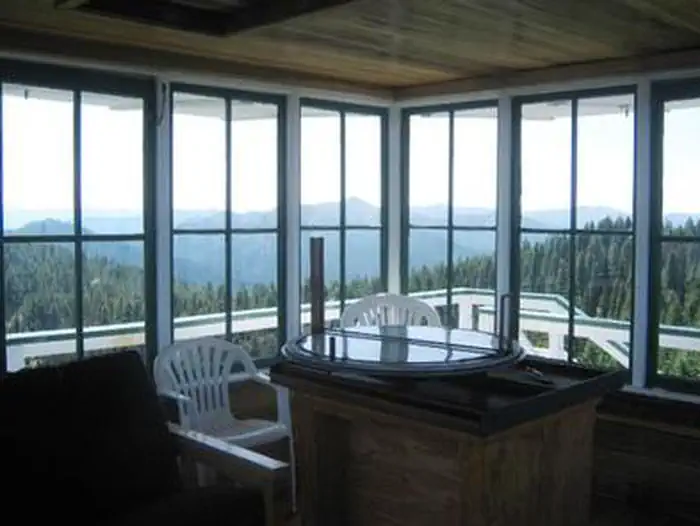
On a high, narrow mountain ridge at 5,280 feet, Bear Basin Lookout and Pierson Cabin offer visitors an awe-inspiring experience and a quiet haven away from crowds. Excellent views of the Siskiyou Wilderness to the east and the Pacific Ocean to the west are why visitors love staying in the heart of the Six Rivers National Forest of northern California. The current lookout building was previously situated at Camp Six, where it was used to spot forest fires. That structure was moved from Camp Six to Bear Basin Butte in 1996. The original Bear Basin Butte lookout existed in the 1930s.
Check availability on Recreation.gov ↗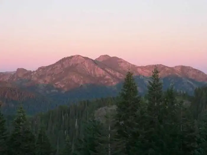
Site mix
| Cabins | 1 |
Site guide
1 site. Tap a filter to narrow the list; the map follows.
| Site | People / vehicles | Accessible |
|---|---|---|
| 5116 | 12 / 4 | Yes |
Per-site records as published by the managing agency on Recreation.gov. Blank cells mean the agency listed nothing for that site. Check-in 2:00 PM, checkout 11:00 AM.
Amenities & rules
| Pets | Allowed |
| Fees | Reservations must be made at least 3 Day(s) ahead of arrival and can be made up to 6 Month(s) in advance. The lookout and cabin, rented as a pair, may be reserved for one to four nights between July 1 and September 30. |
| Accessibility | Site 5116 is listed accessible |
The lookout and cabin can accommodate up to eight guests, but up to 12 guests are permitted for an extra fee. The cabin has an entry room with a countertop suitable for organizing supplies and preparing food. Three double beds are provided (one of which is a bunk above the other) in the cabin and a futon in the lookout. The cabin also has a four-seat dining table, three chairs, a bench, a book case, and a wood-burning stove (firewood is provided). Board games and various books may be available for use. A vault toilet, picnic tables and a campfire ring are outside. No water or electricity is available.
Individual sites vary. Confirm on Recreation.gov or with the managing office.
Weather by month
Getting there
Driving to Bear Basin Butte Lookout. Take Highway 199 to milepost 24.85, ten miles east to Gasquet. Turn onto Little Jones Creek Road. Stay on the paved road (FS16/17N05 Jawbone Road) for 9.7 miles. Turn left on 16N02 and go.5 miles. Locked gate to lookout access road is on left.
| Nearest town | Gasquet, California |
| Coordinates | 41.8092° N, 123.7400° W · Directions ↗ |
Good to know
- Access to the cabin is variable and the road is not maintained for winter use.
Fire nearby
- PrescribedPatterson Rx
26 mi from the campground
- PrescribedRoots & Shoots Rx: Or
32 mi from the campground
- PrescribedSrf 2026 Rx Implementation
37 mi from the campground · 500 acres
- PrescribedLeary Rx
41 mi from the campground
Distance is to the reported incident point, not the fire edge. Call the managing office before you drive.
Supplies & services
| Dump station | Dump station ↗ | 17.8 mi |
| RV sales & service | Blue Compass RV ↗ | 57.1 mi |
Locations © OpenStreetMap contributors. Call ahead; hours change seasonally.
Explore
Worth a stop
The Smith River National Recreation Area Visitor Center is about 21 miles, or roughly one hour by vehicle, from the lookout. Doe Flat and Island Lake Trailheads, which access the Siskiyou Wilderness, are within three miles of the lookout.
- 1.7 miDoe Flat Trailhead ↗Trailhead
- 10.8 miBlack Butte Trailhead ↗Trailhead
Trails nearby
- 1.3 miIsland Lake ↗6.3 mi trail · hiking, horse
- 1.7 miDoe Flat1 mi trail · hiking, horse, bike
- 1.9 miBuck Lake1 mi trail
- 2.7 miBuck Lake (to Clear Cr.)3 mi trail
- 3.5 miDevil'S Punchbowl3 mi trail
Trailheads within three miles
- 1.7 miDoe Flat Trailhead ↗Six Rivers National Forest
Trail and trailhead records are the Forest Service's. Distances are straight-line to the nearer trail end. Trail conditions are not tracked here.
Public land it sits in
This campground sits inside Siskiyou Wilderness.
- inSiskiyou Wilderness ↗Wilderness · Forest Service · 179,847 acres
- 9.1 miRogue River-Siskiyou National Forests ↗National Forest · Forest Service · 1,852,705 acres
Each unit is published as a centre point and an acreage rather than a boundary, so this section stands it in for a circle of the same area. Whether a campground is inside, and how far it is from one it is outside, are both approximate.
Other campgrounds nearby


Cabin and lookout rentals nearby
On the National Register nearby
- Gasquet Ranger Station Historic DistrictHistoric district · Gasquet · 11.9 mi
- Osgood DitchStructure · Cave Junction · 12.2 mi
Recreation
Bird watching is available, as well as great hiking opportunities in the nearby Siskiyou Wilderness. Please don't forget to pick up a Siskiyou Wilderness Map at your nearest Forest Service Visitor Center or local outdoor store before venturing into the wilderness. Horseback riding trails may be accessed nearby, and wildlife viewers may catch a glimpse of deer or bears, which make their home in the area.
Guidebooks for California
We earn a small commission if you buy through these links. It does not change what we list.

Titles come from Open Library's catalog, matched by subject heading or by title.
Reference
Questions people ask
Do I need a reservation at Bear Basin Lookout And Cabin?
Sites at Bear Basin Lookout And Cabin are reservable on Recreation.gov. Any walk-up sites are listed on the booking page.
Source: Recreation.gov
How much does it cost to camp at Bear Basin Lookout And Cabin?
Reservations must be made at least 3 Day(s) ahead of arrival and can be made up to 6 Month(s) in advance. The lookout and cabin, rented as a pair, may be reserved for one to four nights between July 1 and September 30.
Source: Recreation.gov
What time is check-in at Bear Basin Lookout And Cabin?
Check-in 2:00 PM, checkout 11:00 AM.
Source: Recreation.gov
How many sites does Bear Basin Lookout And Cabin have?
1 site, including 1 cabin.
Source: Recreation.gov
Are pets allowed at Bear Basin Lookout And Cabin?
Yes, pets are allowed at Bear Basin Lookout And Cabin. Leash rules apply.
Source: Recreation.gov
Are there accessible sites at Bear Basin Lookout And Cabin?
Site 5116 is listed accessible on Recreation.gov. What that covers (a paved pad, an accessible table, a nearby accessible restroom) is on each site's booking page.
Source: Recreation.gov
What is there to do at Bear Basin Lookout And Cabin?
Bird watching is available, as well as great hiking opportunities in the nearby Siskiyou Wilderness. The Recreation section on this page has the rest.
Source: Recreation
What is the nearest town to Bear Basin Lookout And Cabin?
Gasquet, California. The Smith River National Recreation Area Visitor Center is about 21 miles, or roughly one hour by vehicle, from the lookout.
Source: Getting there
What if Bear Basin Lookout And Cabin is full?
The nearest public campgrounds are Patrick Creek Campground (7 mi), Grassy Flat Campground (8.3 mi, partly first-come), and Panther Flat Campground (10.1 mi, partly first-come).
Source: Campgrounds nearby