Thompson Flat
Thompson Flat Campground is located high in the Albion Mountain Range of southern Idaho, near the towns of Declo and Albion. Visitors enjoy the area for its abundant trails, alpine lakes and scenic beauty.
The group sites take reservations. Single sites are first-come, first-served.
More like this: first-come in Idaho · reservable in Idaho · big rigs in Idaho · pets allowed in Idaho · group sites in Idaho
Check availability on Recreation.gov ↗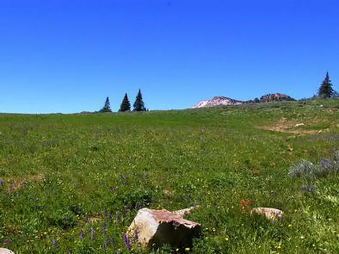


Site mix
| Standard, no hookups | 8 |
| Group sites | 3 |
| Host/management | 2 |
Site guide
Will my RV fit
The longest site here provides 60 feet of vehicle capacity. Most sites are shorter.
11 sites in 3 loops. Tap a filter to narrow the list; the map follows.
| Site | Loop | Type | Entry | Fits, ft | Surface | Shade | People / vehicles | Fires | Accessible | Rating |
|---|---|---|---|---|---|---|---|---|---|---|
| A1 -A5 | LOOP A | Group | Back-in | 60 | Gravel | Partial | 40 / 10 | Yes | Yes | Standard |
| B1 -B8 | LOOP B | Group | Back-in | 60 | Gravel | Partial | 64 / 16 | Yes | Yes | Standard |
| C1-C4 | LOOP C | Group | Back-in | 60 | Gravel | Partial | 56 / 14 | Yes | Yes | Standard |
| 02 | Standard | Back-in | 50 | Gravel | Partial | 16 / 4 | Yes | Yes | Standard | |
| 06 | Standard | Back-in | 48 | Gravel | Partial | 8 / 2 | Yes | Yes | Standard | |
| 10 | Standard | Back-in | 60 | Gravel | Partial | 16 / 4 | Yes | Yes | Standard | |
| 11 | Standard | Back-in | 56 | Gravel | Partial | 8 / 2 | Yes | Yes | Standard | |
| 12 | Standard | Back-in | 60 | Gravel | Partial | 16 / 4 | Yes | Yes | Standard | |
| 17 | Standard | Back-in | 60 | Gravel | Partial | 8 / 2 | Yes | Yes | Standard | |
| 19 | Standard | Back-in | 52 | Gravel | Partial | 16 / 4 | Yes | Yes | Standard |
Per-site records as published by the managing agency on Recreation.gov. Blank cells mean the agency listed nothing for that site. Check-in 2:00 PM, checkout 12:00 PM.
Amenities & rules
| Hookups | None |
| Max vehicle length | 60 ft |
| Equipment | RVs & trailers, Tents |
| Pets | Allowed |
| Campfires | Allowed, subject to restrictions |
| Accessibility | Sites A1 -A5, B1 -B8, C1-C4, Double S&P and 9 more are listed accessible |
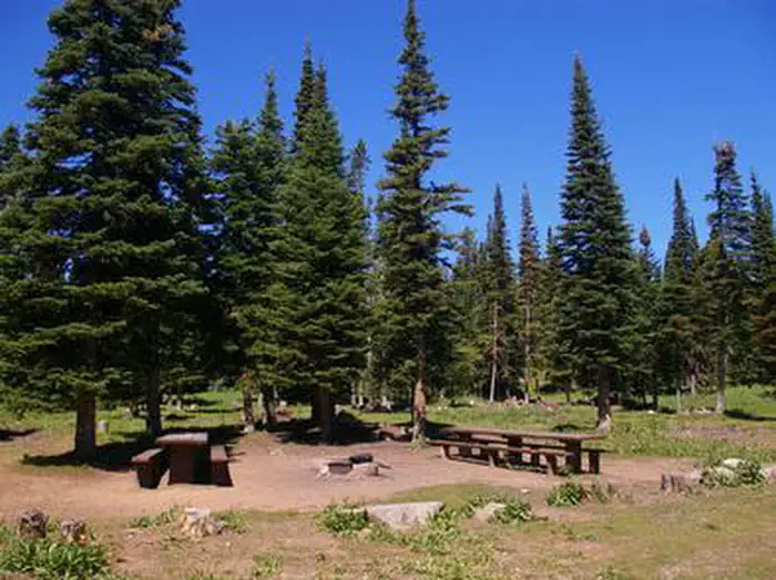
The campground contains three group sites, which can accommodate from 40 to 64 people, respectively. All sites are equipped with large picnic tables and campfire rings with grills. There are four reservable single units and four double unit campsites as well as 17 additional single-family campsites that are available on a first-come, first-served basis, but the group sites must be reserved. Accessible vault toilets are provided. A campground host is located on-site. Roads and parking spurs within the campground are gravel.
Individual sites vary. Confirm on Recreation.gov or with the managing office.
Season & status
| Status | Open |
| Season | July |
| Forest | Sawtooth National Forest |
| Fees | Single Unit/$8 night; Group Unit/$50 night Camping fees at Thompson Flat remain the same at $8.00 per site; this includes the sites within the new group areas as well. |
| Rules | Occupancy: The following act is prohibited within the Minidoka Ranger District: Pursuant to 36 CFR 262.58 (a), camping in any area including a developed recreation site or an undeveloped/dispersed recreation site for more than 14 (fourteen) days in a 28 (twenty-eight) day period. |
Weather by month
Getting there
From Interstate 84, take exit 216 and follow State Highway 77 south for approximately 18 miles, through the towns of Declo and Albion, to Howell Canyon Road. Turn west at the Pomerelle Ski Area sign and drive seven miles up the canyon on Howell Canyon Road. The road is steep and winding, watch for the campground entrance sign on the right.
| Nearest town | Burley, Idaho |
| Coordinates | 42.3247° N, 113.6236° W · Directions ↗ |
Fire nearby
- PrescribedStinson Creek Rx 2026
8 mi from the campground · 450 acres
Distance is to the reported incident point, not the fire edge. Call the managing office before you drive.
Supplies & services
| Dump station | Dump station ↗ | 17 mi |
| Outdoor gear | Xtreme RV ↗ | 38.3 mi |
Locations © OpenStreetMap contributors. Call ahead; hours change seasonally.
Explore
Video
Thompson Flat campground review
Trails nearby
- 0.3 miTwin Lakes3.4 mi trail · snowmobile, snowshoe, ski
- 0.6 miSkyline Trail ↗26 mi trail · hiking, horse, bike, motorcycle and 1 more
- 0.7 miThompson Flat1.9 mi trail · snowmobile, snowshoe, ski
- 0.7 miLake Cleveland1.1 mi trail · snowmobile, snowshoe, ski
- 0.9 miMt. Harrison Lookout4.3 mi trail · snowmobile, snowshoe, ski
- 1.2 miHowell Creek1 mi trail · hiking, horse, bike, motorcycle and 2 more
Trail and trailhead records are the Forest Service's. Distances are straight-line to the nearer trail end. Trail conditions are not tracked here.
Other campgrounds nearby


On the National Register nearby
- Swanger HallBuilding · Albion · 6.4 mi
- Albion Methodist ChurchBuilding · Albion · 6.5 mi
Natural features
The campground is situated in a beautiful wildflower-filled meadow lined with tall pine and fir trees, on the eastern slope of Mount Harrison. It sits at an elevation of 8,400 feet.
Recreation
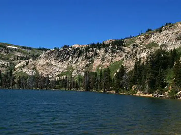
The Twin Lakes Campground area is located just outside the campground and across the road. It offers picnic areas, horse corrals and access to a variety of trails. Lake Cleveland is a two-mile drive from the campground, offering fishing, canoeing and trail opportunities. Several additional hiking, mountain biking, horse and off-road vehicle trails are on the mountain.
Nearby
A visit up the road to the Mount Harrison Lookout offers interesting area information and breathtaking panoramic views of the valleys below. Pomerelle Ski Area, just below Thompson Flat, offers lift-served hiking and mountain biking, scenic chairlift rides and a few dining options, generally on weekends.
Guidebooks for Idaho
We earn a small commission if you buy through these links. It does not change what we list.

Titles come from Open Library's catalog, matched by subject heading or by title.
Reference
Questions people ask
Do I need a reservation at Thompson Flat?
For some sites. The group sites take reservations. Single sites are first-come, first-served.
Source: Recreation.gov
How much does it cost to camp at Thompson Flat?
Single Unit/$8 night; Group Unit/$50 night Camping fees at Thompson Flat remain the same at $8.00 per site; this includes the sites within the new group areas as well.
Source: Recreation.gov
What time is check-in at Thompson Flat?
Check-in 2:00 PM, checkout 12:00 PM.
Source: Recreation.gov
Is Thompson Flat open right now?
Open as of Oct 16, 2026. Season July.
Source: Forest Service status
How many sites does Thompson Flat have?
13 sites, including 8 standard sites without power and 3 group sites.
Source: Recreation.gov
Will my RV fit at Thompson Flat?
The longest site here provides 60 feet of vehicle capacity. Most sites are shorter. The sidebar tool checks a trailer or motorhome length against every site.
Source: Will my RV fit
Are pets allowed at Thompson Flat?
Yes, pets are allowed at Thompson Flat. Leash rules apply.
Source: Recreation.gov
Can I have a campfire at Thompson Flat?
Fires are allowed in the provided rings under normal conditions. As of 2026-10-16, there is 1 active fire within 50 miles, so check current restrictions before you light one. Occupancy: The following act is prohibited within the Minidoka Ranger District: Pursuant to 36 CFR 262.58 (a), camping in any area including a developed recreation site or an undeveloped/dispersed recreation site for more than 14 (fourteen) days in a 28 (twenty-eight) day period.
Source: Fire nearby
Are there accessible sites at Thompson Flat?
Sites A1 -A5, B1 -B8, C1-C4, and Double S&P are listed accessible on Recreation.gov, 13 sites in all. What that covers (a paved pad, an accessible table, a nearby accessible restroom) is on each site's booking page.
Source: Recreation.gov
Is there cell service at Thompson Flat?
FCC coverage maps show AT&T 5G and T-Mobile 5G at the campground point. Terrain changes that from one site to the next.
Source: FCC Broadband Map
What is there to do at Thompson Flat?
The Twin Lakes Campground area is located just outside the campground and across the road. The Recreation section on this page has the rest.
Source: Recreation
What is the nearest town to Thompson Flat?
Burley, Idaho. A visit up the road to the Mount Harrison Lookout offers interesting area information and breathtaking panoramic views of the valleys below.
Source: Getting there