Lake Cleveland Campground - West Side
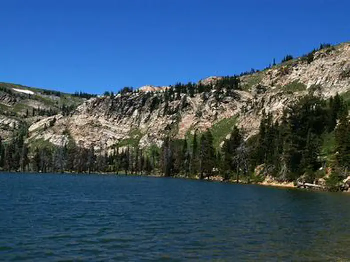
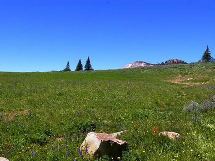
Lake Cleveland Campground is a very popular summer recreational facility. Located next to its namesake, the campground is divided into the East Side and West Side loops. Very popular with residents of local communities, the campground is often full every weekend from early July to Labor Day. Natural Features: At an elevation of 8,300 feet, the campground facility is located in an alpine lake basin below Mt. Harrison which has an elevation of 9,240 feet. Late season snowdrifts often block access to the campground until early to mid-July. The campground is near the timberline and alpine wildflower meadows.
Sites are first-come, first-served. Recreation.gov lists this campground for paying on site, and you may be able to pay with the Scan and Pay feature of its app.
More like this: first-come in Idaho

Season & status
| Status | Open |
| Season | July |
| Forest | Sawtooth National Forest |
| Booking | Campsites are on a first-come, first-served basis. There are no reservable sites on the west side of the lake. Campsite must be occupied the first night. |
| Fees | Fees are $10.00 per night. |
| Rules | No motorized boats on Lake Cleveland. The following act is prohibited within the Minidoka Ranger District: Pursuant to 36 CFR 262.58 (a), camping in any area including a developed recreation site or an undeveloped/dispersed recreation site for more than 14 (fourteen) days in a 28 (twenty-eight) day period. |
Weather by month
Getting there
From Interstate 84, take exit 216 and follow State Highway 77 south approximately 18 miles, through the towns of Declo and Albion, to Howell Canyon Road. Turn west at the Pomerelle Ski Area sign and drive up the canyon on Howell Canyon Road another 7 miles. The road is steep and winding. Look for an entrance sign on your right.
| Coordinates | 42.3249° N, 113.6483° W · Directions ↗ |
Fire nearby
- PrescribedStinson Creek Rx 2026
7 mi from the campground · 450 acres
Distance is to the reported incident point, not the fire edge. Call the managing office before you drive.
Supplies & services
| Dump station | Dump station ↗ | 17 mi |
| Outdoor gear | Xtreme RV ↗ | 37.2 mi |
Locations © OpenStreetMap contributors. Call ahead; hours change seasonally.
Explore
Trails nearby
- 0.4 miLake Cleveland1.1 mi trail · snowmobile, snowshoe, ski
- 0.6 miThompson Flat1.9 mi trail · snowmobile, snowshoe, ski
- 0.8 miMarsh Creek ↗5.1 mi trail · hiking, horse, bike, motorcycle and 2 more
- 1 miNew Canyon ↗9.3 mi trail · snowmobile, snowshoe, ski
- 1.2 miMt. Harrison Lookout4.3 mi trail · snowmobile, snowshoe, ski
- 1.3 miSkyline Trail ↗26 mi trail · hiking, horse, bike, motorcycle and 1 more
Trail and trailhead records are the Forest Service's. Distances are straight-line to the nearer trail end. Trail conditions are not tracked here.
Other campgrounds nearby

On the National Register nearby
- Swanger HallBuilding · Albion · 6.9 mi
- Albion Methodist ChurchBuilding · Albion · 7.1 mi
Guidebooks for Idaho
We earn a small commission if you buy through these links. It does not change what we list.

Titles come from Open Library's catalog, matched by subject heading or by title.
Reference
Questions people ask
Do I need a reservation at Lake Cleveland Campground - West Side?
No. Lake Cleveland Campground - West Side is first-come, first-served. Campsites are on a first-come, first-served basis. Sites are taken on arrival and paid at the fee station.
Source: Forest Service
How much does it cost to camp at Lake Cleveland Campground - West Side?
Fees are $10.00 per night.
Source: Forest Service
Is Lake Cleveland Campground - West Side open right now?
Open as of Oct 16, 2026. Season July.
Source: Forest Service status
What if Lake Cleveland Campground - West Side is full?
The nearest public campgrounds are Lake Cleveland - East Side (0.1 mi, partly first-come), Thompson Flat (1.3 mi, partly first-come), and Twin Lakes Campground (Sawtooth) (1.3 mi, first-come).
Source: Campgrounds nearby