Bald Butte Lookout
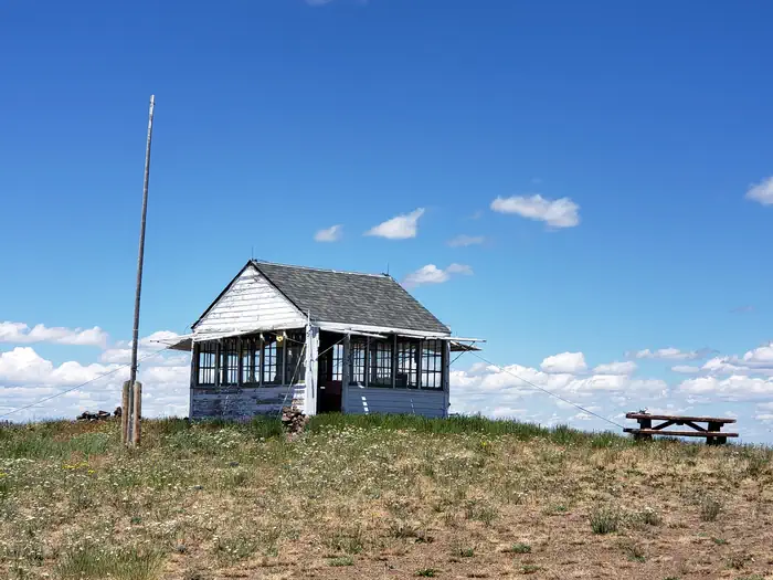
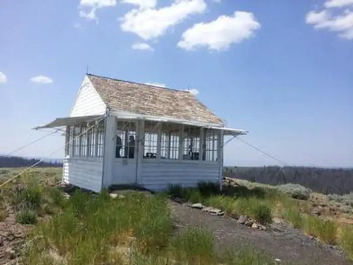
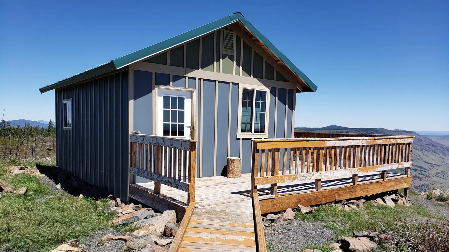
Bald Butte Lookout is perched atop the windy summit of Bald Butte in the Fremont-Winema National Forest in south-central Oregon. It is surrounded by forested hillsides and expansive views. The lookout was built in 1931 and served as a Forest Service fire detection site for over 50 years. It was constructed from an Aladdin L4 ground-mounted lookout kit in which all of the pieces were pre-cut in six-foot lengths or less so the entire kit could be packed by horses into the remote site. The total cost of the structure at the time was $668.49 and only took a few days to assemble. At one time, hundreds of these types of lookouts were in service throughout the Pacific Northwest.
Check availability on Recreation.gov ↗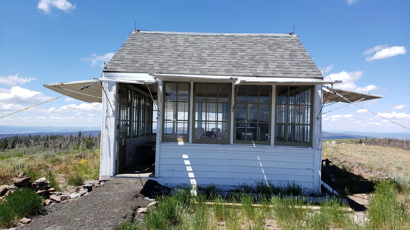
Site mix
| Cabins | 1 |
Site guide
1 site. Tap a filter to narrow the list; the map follows.
| Site | People / vehicles |
|---|---|
| 001 | 2 / 2 |
Per-site records as published by the managing agency on Recreation.gov. Blank cells mean the agency listed nothing for that site. Check-in 2:00 PM, checkout 12:00 PM.
Amenities & rules
| Pets | Allowed |
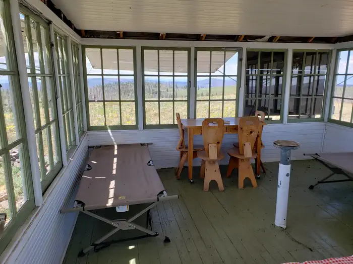
The 14' x 14' lookout is furnished with two cots, a table, bench and storage cabinets. It is also equipped with a propane heater, cook stove, and lights. An outdoor picnic table and an accessible vault toilet are also on-site. There is no water on-site, so guests must bring sufficient supplies for drinking, cooking and washing. Guests must also provide their own sleeping bags, linens, towels, dish soap, matches, cooking gear, first aid kit, toilet paper, ice cooler and garbage bags. Although lighting is available, it is recommended that guests bring an additional light source in case of emergencies.
Individual sites vary. Confirm on Recreation.gov or with the managing office.
Weather by month
Getting there
From the Paisley District Office, travel 0.5 miles north on Highway 31 and turn left on Mill Street. Stay on Mill Street to the Y junction (turns into gravel at this point), then turn right on Forest Road 3315. Continue on Forest Road 3315 for 21 miles. Turn left on Forest Road 28, and travel 0.5 miles to the junction with Forest Road 3411.
| Nearest town | Paisley, Oregon |
| Coordinates | 42.6144° N, 120.7898° W · Directions ↗ |
Fire nearby
- PrescribedCoyote Rx
25 mi from the campground
Distance is to the reported incident point, not the fire edge. Call the managing office before you drive.
Explore
Trails nearby
- 1 miHadley C4 mi trail · snowmobile, snowshoe, ski
- 1.7 miHadley I ↗8.7 mi trail · snowmobile, snowshoe, ski
- 1.9 miHadley B ↗5.9 mi trail · snowmobile, snowshoe, ski
- 2.3 miDead Horse Rim ↗14 mi trail · hiking, horse, bike
- 2.8 miDead Cow Trail1.9 mi trail · hiking, horse, bike
- 3.4 miHanan Trail ↗7.5 mi trail · hiking, horse, bike
Trailheads within three miles
- 2.4 miLee Thomas Trailhead ↗Fremont-Winema National Forest · Season 06/15 to 09/15
Trail and trailhead records are the Forest Service's. Distances are straight-line to the nearer trail end. Trail conditions are not tracked here.
Public land it sits in
This campground sits inside Fremont-Winema National Forest.
- inFremont-Winema National Forest ↗National Forest · Forest Service · 2,815,968 acres
- 4.4 miGearhart Mountain Wilderness ↗Wilderness · Forest Service · 22,614 acres
Each unit is published as a centre point and an acreage rather than a boundary, so this section stands it in for a circle of the same area. Whether a campground is inside, and how far it is from one it is outside, are both approximate.
Other campgrounds nearby


Cabin and lookout rentals nearby
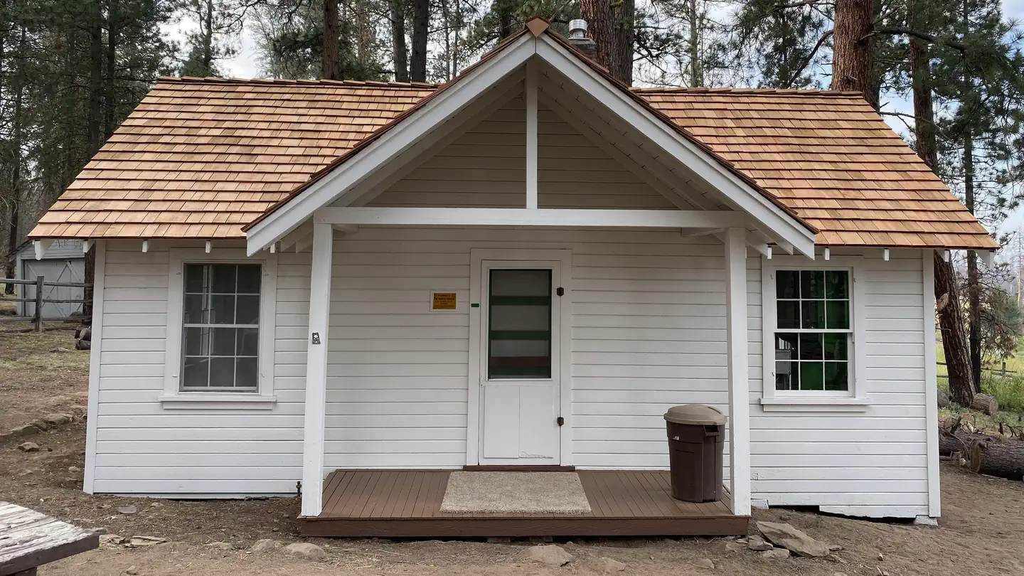
Natural features
Fremont National Forest is known for its towering snow-capped peaks, volcanic landscapes, wide-open sage basins, scenic vistas and wild places where visitors can still find solitude. Nearby Gearhart Wilderness offers 22,823 acres of scenic views and primitive recreational opportunities. Throughout the remote area, streams rush through narrow meadows and Blue Lake lies nestled beneath a canopy of mixed-conifer forests. Rock formations cap most of the high elevation ridge tops.
Recreation
Hiking, birding, stargazing and wildlife viewing are popular activities. Bald Butte Trail is a quiet all-season trail that offers a variety of terrain and wildlife viewing opportunities. Hikers traverse large open meadows filled with summer wildflowers, heavily wooded forests and ridgetop scrambles along Oak Ridge Trail and Surveyor's Ridge Trail, overlooking the Hood River Valley. Trails in the Gearhart Mountain Wilderness are also nearby. At night the lookout provides an ideal setting for stargazing, as constellations and planets put on a dazzling display.
Guidebooks for Oregon
We earn a small commission if you buy through these links. It does not change what we list.

Titles come from Open Library's catalog, matched by subject heading or by title.
Reference
Questions people ask
Do I need a reservation at Bald Butte Lookout?
Sites at Bald Butte Lookout are reservable on Recreation.gov. Any walk-up sites are listed on the booking page.
Source: Recreation.gov
What time is check-in at Bald Butte Lookout?
Check-in 2:00 PM, checkout 12:00 PM.
Source: Recreation.gov
How many sites does Bald Butte Lookout have?
1 site, including 1 cabin.
Source: Recreation.gov
Are pets allowed at Bald Butte Lookout?
Yes, pets are allowed at Bald Butte Lookout. Leash rules apply.
Source: Recreation.gov
What is there to do at Bald Butte Lookout?
Hiking, birding, stargazing and wildlife viewing are popular activities. The Recreation section on this page has the rest.
Source: Recreation
What is the nearest town to Bald Butte Lookout?
Paisley, Oregon.
Source: Getting there
What if Bald Butte Lookout is full?
The nearest public campgrounds are Lee Thomas Campground (3 mi, first-come), Deadhorse Lake Campground (3.8 mi, first-come), and Campbell Lake Campground (3.9 mi, first-come).
Source: Campgrounds nearby