Currier Guard Station
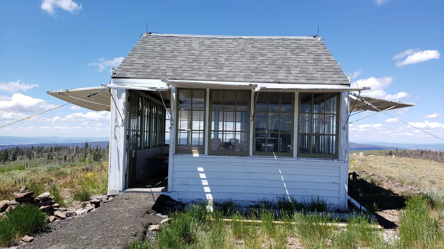
Historic Currier Guard Station is nestled in a scattering of fir, pine and aspen, providing an ideal setting for guests seeking relaxation and recreation in the Fremont-Winema National Forest. The guard station was named after a local ranch owner, and was constructed in 1933 as an out station for the Paisley Ranger District to house forest fire prevention and suppression crews in the field. Fire crews occupied the station seasonally until the early 1990s. Today, the cabin offers guests a secluded getaway in a landscape abundant with wildlife and nature.
Check availability on Recreation.gov ↗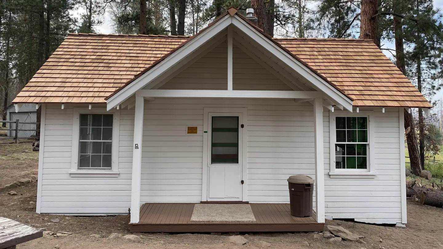
Site mix
| Cabins | 1 |
Site guide
1 site. Tap a filter to narrow the list; the map follows.
| Site | Shade | People / vehicles | Fires |
|---|---|---|---|
| 001 | Full | 4 / 3 | Yes |
Per-site records as published by the managing agency on Recreation.gov. Blank cells mean the agency listed nothing for that site. Check-in 2:00 PM, checkout 12:00 PM.
Amenities & rules
| Pets | Allowed |
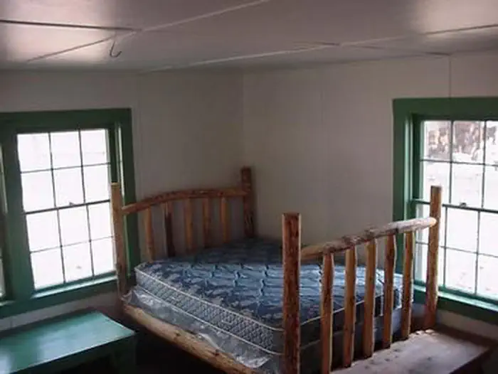
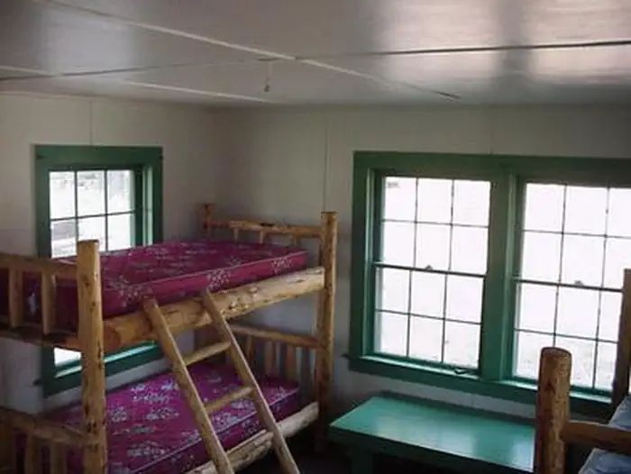
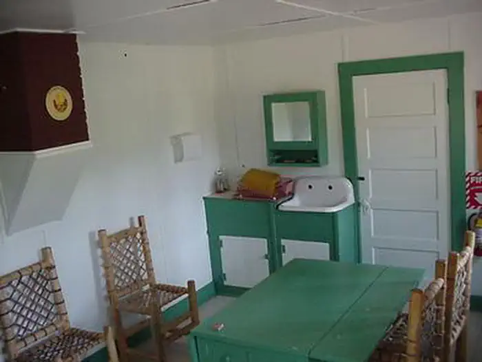
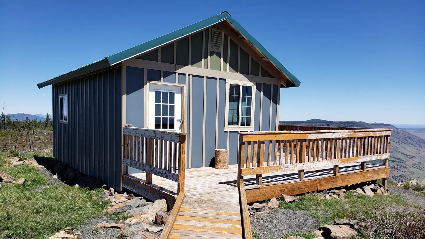
The 450 square-foot cabin has two rooms and can accommodate up to four people. The combination bedroom/living room is furnished with a set of bunk beds, a double bed, propane heating stove and a propane fridge. The kitchen is equipped with a table and chairs and a propane cook stove. A picnic table and campfire ring are provided for outdoor cooking, dining and campfires. A vault toilet is located near the cabin. There is no water on site, so guests must bring sufficient supplies for drinking, cooking and washing. Guests must also provide their own sleeping bags, sleeping pads, towels, dish soap, matches, cooking gear, first aid kit, toilet paper and garbage bags. Although propane lighting is available, guests are advised to bring an additional light source in case of emergencies. Campers can collect up to half a cord of firewood for use on site without a permit.
Individual sites vary. Confirm on Recreation.gov or with the managing office.
Weather by month
Getting there
From Paisley Ranger District, drive 12 miles north on Highway 31 and turn left on Forest Road 29, also referred to as Government Harvey Pass. Drive 10 miles on Forest Road 29. Drive carefully on this road as it has narrow curves and washboard conditions. At the junction with Forest Road 2901, turn left and stay on Forest Road 29 for 2 more miles.
| Nearest town | Paisley, Oregon |
| Coordinates | 42.7116° N, 120.9069° W · Directions ↗ |
Fire nearby
- PrescribedCoyote Rx
16 mi from the campground
Distance is to the reported incident point, not the fire edge. Call the managing office before you drive.
Explore
Trails nearby
- 3.8 miMtr33721121.7 mi trail · hiking, horse, bike, ATV and 1 more
- 4.3 miMtr33720130.9 mi trail · hiking, horse, bike, ATV and 1 more
- 4.3 miMtr33721141.3 mi trail · hiking, horse, bike, ATV and 1 more
- 4.6 miMtr32392512.2 mi trail · hiking, horse, bike, ATV and 1 more
Trail and trailhead records are the Forest Service's. Distances are straight-line to the nearer trail end. Trail conditions are not tracked here.
Public land it sits in
This campground sits inside Fremont-Winema National Forest.
- inFremont-Winema National Forest ↗National Forest · Forest Service · 2,815,968 acres
- 10.8 miGearhart Mountain Wilderness ↗Wilderness · Forest Service · 22,614 acres
Each unit is published as a centre point and an acreage rather than a boundary, so this section stands it in for a circle of the same area. Whether a campground is inside, and how far it is from one it is outside, are both approximate.
Other campgrounds nearby



Cabin and lookout rentals nearby
Natural features
Fremont National Forest is known for its towering snow-capped peaks, volcanic landscapes, wide-open sage basins, scenic vistas and wild places where visitors can still find solitude. Behind the cabin, an expanse of meadow stretches to meet the forest's edge, providing a perfect habitat for a variety of wildlife. Red tail hawks perch in treetops looking for field mice. Meadowlarks, Steller's jays and hummingbirds also frequent the area. Larger mammals, such as deer and Rocky Mountain elk find homes in the forests. In the early summer months there are a lot of musqitos, be prepared with bug spray and nets.
Recreation
Currier Guard Station is a wonderful location for hiking, fishing, horseback riding and biking in summer and early fall. The cabin is located one mile north of the Sycan Wild and Scenic River, a scenic spot for fly fishing. The river corridor winds from a steep canyon to broad meadows, containing a diversity of landforms, rocks and vegetation. Coniferous forests intermingle with riparian vegetation, and expanses of sage and bitterbrush grow in the drier areas. The river supports rainbow, brook, brown and bull trout. Hikers and equestrians will enjoy numerous trails threading through the forest.
Guidebooks for Oregon
We earn a small commission if you buy through these links. It does not change what we list.

Titles come from Open Library's catalog, matched by subject heading or by title.
Reference
Questions people ask
Do I need a reservation at Currier Guard Station?
Sites at Currier Guard Station are reservable on Recreation.gov. Any walk-up sites are listed on the booking page.
Source: Recreation.gov
What time is check-in at Currier Guard Station?
Check-in 2:00 PM, checkout 12:00 PM.
Source: Recreation.gov
How many sites does Currier Guard Station have?
1 site, including 1 cabin.
Source: Recreation.gov
Are pets allowed at Currier Guard Station?
Yes, pets are allowed at Currier Guard Station. Leash rules apply.
Source: Recreation.gov
What is there to do at Currier Guard Station?
Currier Guard Station is a wonderful location for hiking, fishing, horseback riding and biking in summer and early fall. The Recreation section on this page has the rest.
Source: Recreation
What is the nearest town to Currier Guard Station?
Paisley, Oregon.
Source: Getting there
What if Currier Guard Station is full?
The nearest public campgrounds are Currier Spring Horse Camp (4.6 mi, first-come), Sandhill Crossing Campground (8.2 mi, first-come), and Lee Thomas Campground (9 mi, first-come).
Source: Campgrounds nearby