Evergreen Mountain Lookout
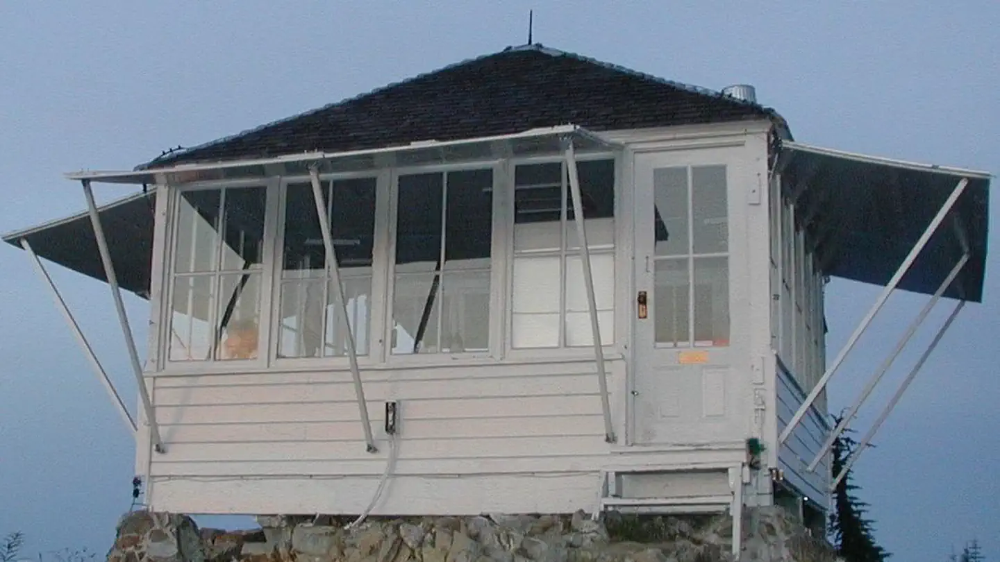
Perched atop its namesake mountain at an elevation of 5,587 feet, Evergreen Mountain Lookout was built in 1935 for detecting wildfires. During fire season, lookouts stayed in the cabin, watching for lightning strikes and forest fires in the Skykomish drainage. Once the lookout located a fire or smoke, he or she would radio to the Skykomish Ranger Station and give local landmarks to help firefighters locate the fire quickly. During World War II, Evergreen Mountain Lookout was used as an Aircraft Warning Station, and then remained an active fire tower until the early 1980s. During volunteer restoration efforts in the 1990s, the lookout was placed on the National Register of Historic Places.
Check availability on Recreation.gov ↗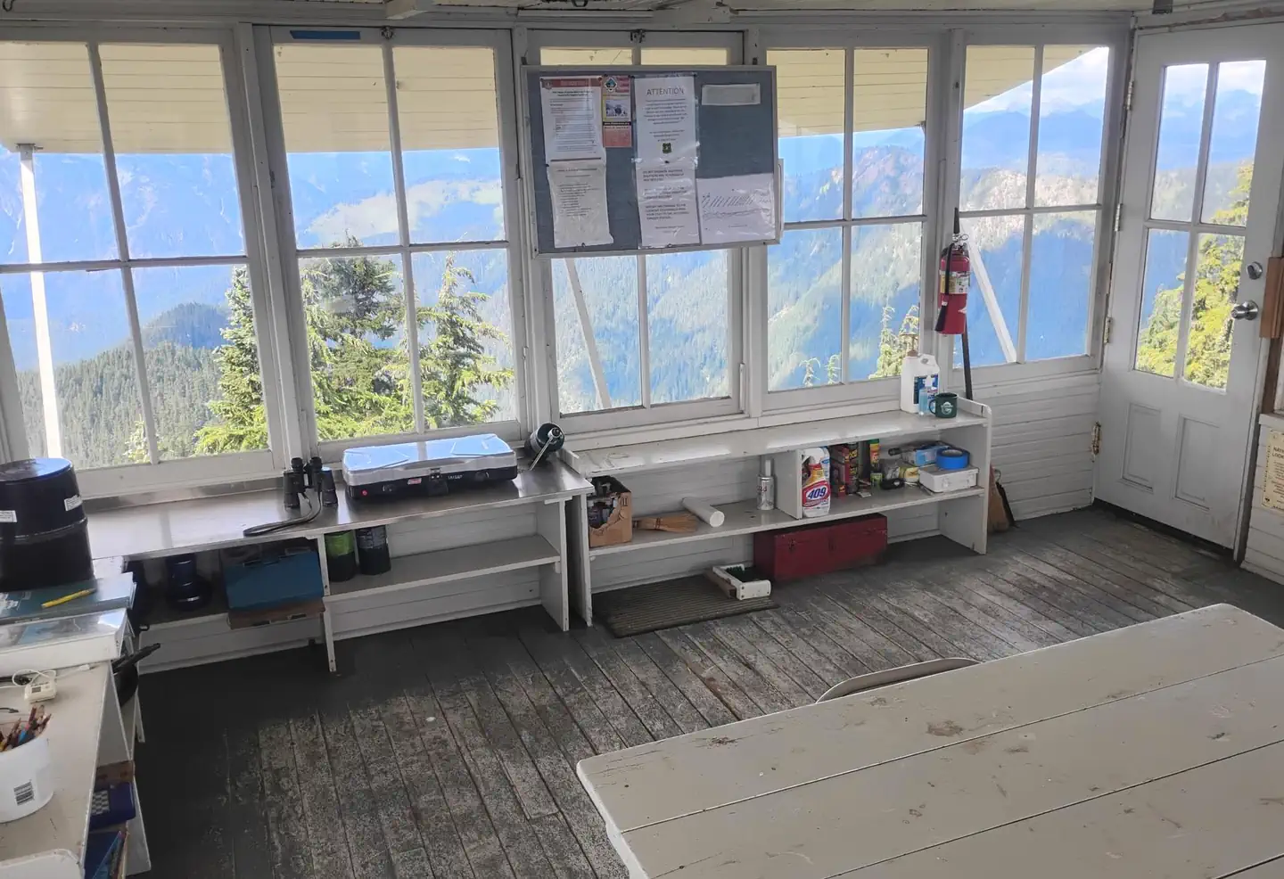

Site mix
| Fire lookouts | 1 |
Site guide
1 site. Tap a filter to narrow the list; the map follows.
| Site | People / vehicles |
|---|---|
| 01 | 4 / – |
Per-site records as published by the managing agency on Recreation.gov. Blank cells mean the agency listed nothing for that site. Check-in 2:00 PM, checkout 1:00 PM.
Amenities & rules
| Fees | Evergreen Mt Lookout is closed for the season due to an on going wildfire. Contact Rec.gov for a refund |
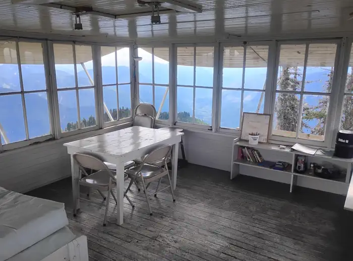
The 14x14-ft. lookout cabin sleeps four and is furnished with one twin-sized bed and mattress, three extra mattresses, a table and chairs, propane stove, two battery powered lanterns, a cooking pot, dishes and a coffee pot. A primitive vault toilet is located several hundred feet down the ridge from the lookout. There is no water or heat at the site. Guests must bring water for drinking, cooking and washing. Guests must also bring flashlights, sleeping bags, towels, dish soap, matches, a first aid kit, toilet paper and garbage bags. All trash and food must be packed out, and guests are expected to clean the cabin before leaving.
Individual sites vary. Confirm on Recreation.gov or with the managing office.
Weather by month
Getting there
From State Route 2, turn north onto Beckler River Road (Forest Road #65), which is 0.5 miles east of the town of Skykomish. Continue on Forest Road #65 for 13 miles to Jack Pass. At Jack Pass, turn right onto FSR #6550 and drive about 1 mile to FSR #6554. Drive FSR #6554 6.5 miles to the trailhead. It is another 1.5 mile hike to the lookout.
| Nearest town | Skykomish, Washington |
| Coordinates | 47.8364° N, 121.2640° W · Directions ↗ |
Fire nearby
- WildfireLittle Giant
23 mi from the campground · 172,912 acres · 95% contained
- WildfireKing
25 mi from the campground · 3,427 acres · 36% contained
- WildfireThree Queens
29 mi from the campground · 9,575 acres · 33% contained
- WildfireSisi
41 mi from the campground · 4,615 acres · 34% contained
Distance is to the reported incident point, not the fire edge. Call the managing office before you drive.
Supplies & services
| Outdoor gear | Stevens Pass Nordic Center ↗ | 12.4 mi |
| Dump station | Dump station ↗ | 22.3 mi |
| RV sales & service | Open Road RV ↗ | 33.5 mi |
Locations © OpenStreetMap contributors. Call ahead; hours change seasonally.
Explore
Worth a stop
- 6.3 miNorth Fork Skykomish Trailhead ↗Trailhead
- 7.8 miIron Goat/Martin Creek Trailhead ↗Trailhead
Trails nearby
- 0.5 miEvergreen Mountain2.5 mi trail · hiking, horse
- 2.7 miMeadow Creek ↗8.1 mi trail · hiking, horse
- 2.7 miBeckler River Road ↗22.5 mi trail · snowmobile, snowshoe, ski
- 2.8 miJohnson Ridge ↗4.6 mi trail · hiking
- 3.6 miFrog Mountain ↗7.1 mi trail · hiking, horse, bike, motorcycle and 1 more
- 4.5 miKelley Creek ↗6 mi trail · hiking
Trailheads within three miles
- 2.7 miMeadow Creek Trailhead ↗Mt. Baker-Snoqualmie National Forest
- 2.8 miJohnson Ridge Trailhead ↗Mt. Baker-Snoqualmie National Forest
Trail and trailhead records are the Forest Service's. Distances are straight-line to the nearer trail end. Trail conditions are not tracked here.
Public land it sits in
This campground sits inside Henry M. Jackson Wilderness, which overlaps Wild Sky Wilderness.
- inHenry M. Jackson Wilderness ↗Wilderness · Forest Service · 102,919 acres
- inWild Sky Wilderness ↗Wilderness · Forest Service · 105,543 acres
- inMt. Baker-Snoqualmie National Forest ↗National Forest · Forest Service · 2,025,595 acres
Each unit is published as a centre point and an acreage rather than a boundary, so this section stands it in for a circle of the same area. Whether a campground is inside, and how far it is from one it is outside, are both approximate.
Other campgrounds nearby

Cabin and lookout rentals nearby

On the National Register nearby
- Evergreen Mountain LookoutStructure · Skykomish · 0 mi
- Great Northern DepotBuilding · Skykomish · 9.9 mi
- Maloney's General StoreBuilding · Skykomish · 9.9 mi
Natural features
On a clear day, guests at Evergreen Mountain Lookout see views of Glacier Peak, Mt. Daniels, Keyes Peak, Columbia Glacier, Mt. Rainier and parts of the Henry M. Jackson Wilderness. Remains of the last big fire spotted on Evergreen Mountain in 1967 are still evident on the rocky south face of the ridge to within several hundred feet of the lookout. Evergreen Mountain Lookout is situated within the Wild Sky Wilderness area. Wildlife is abundant, and guests may catch a glimpse of black bears, bobcat, elk or bald eagle. Wolves are making a comeback to the area, but they are usually heard and not seen.
Recreation
Hiking, birding and wildlife viewing are popular activities around the lookout. Guests access the lookout via the Evergreen Lookout Trail that climbs steeply through the old Evergreen Mountain Burn of 1967. Hikers enter dense forest, where the grade eases a bit upon reaching a small saddle below the lookout. At this point, the trail ascends again to reach the building. The trail is noted for wildflowers, scenery and wildlife.
Guidebooks for Washington
We earn a small commission if you buy through these links. It does not change what we list.
Titles come from Open Library's catalog, matched by subject heading or by title.
Reference
Questions people ask
Do I need a reservation at Evergreen Mountain Lookout?
Sites at Evergreen Mountain Lookout are reservable on Recreation.gov. Any walk-up sites are listed on the booking page.
Source: Recreation.gov
How much does it cost to camp at Evergreen Mountain Lookout?
Evergreen Mt Lookout is closed for the season due to an on going wildfire. Contact Rec.gov for a refund
Source: Recreation.gov
What time is check-in at Evergreen Mountain Lookout?
Check-in 2:00 PM, checkout 1:00 PM.
Source: Recreation.gov
How many sites does Evergreen Mountain Lookout have?
1 site, including 1 lookout.
Source: Recreation.gov
Is there cell service at Evergreen Mountain Lookout?
FCC coverage maps show T-Mobile 5G at the campground point. Terrain changes that from one site to the next.
Source: FCC Broadband Map
What is there to do at Evergreen Mountain Lookout?
Hiking, birding and wildlife viewing are popular activities around the lookout. The Recreation section on this page has the rest.
Source: Recreation
What is the nearest town to Evergreen Mountain Lookout?
Skykomish, Washington.
Source: Getting there
What if Evergreen Mountain Lookout is full?
The nearest public campgrounds are Troublesome Creek Campground (7.7 mi, partly first-come), Beckler River Campground (7.9 mi), and Money Creek Campground (10 mi).
Source: Campgrounds nearby