Ausable River Camping
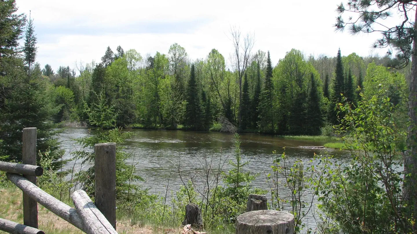
AuSable River Dispersed Camping is a unique series of 102 individually designated single-family campsites on a 55-mile stretch of the lovely AuSable River. All campsites are within Alcona and Iosco Counties in Michigan. These rustic sites are divided into sections near Alcona Pond, the AuSable Semi-Primitive Non-Motorized Area, Loud Pond, Five Channels Pond, Cooke Pond, Foote Pond and Lower Ausable. Each are ideal for family camping, with opportunities for fly fishing, swimming, canoeing and bird watching.
More like this: reservable in Michigan · big rigs in Michigan · pets allowed in Michigan
Check availability on Recreation.gov ↗


Site mix
| Standard, no hookups | 46 |
| Boat-in | 40 |
| Walk-in | 15 |
| Host/management | 1 |
Site guide
Will my RV fit
The longest site here provides 40 feet of vehicle capacity. Most sites are shorter.
101 sites in 9 loops. Tap a filter to narrow the list; the map follows.
| Site | Loop | Type | Entry | Fits, ft | Shade | People / vehicles | Fires |
|---|---|---|---|---|---|---|---|
| 001D | Alcona Pond | Standard | Back-in | 26 | Partial | 10 / 2 | Yes |
| 002D | Alcona Pond | Standard | Back-in | 26 | Partial | 10 / 2 | Yes |
| 003D | Alcona Pond | Standard | Back-in | 26 | Partial | 10 / 2 | Yes |
| 004D | Alcona Pond | Standard | Back-in | 18 | 10 / 2 | Yes | |
| 005C | Alcona Pond | Boat-in | Partial | 10 / – | Yes | ||
| 006D | Alcona Pond | Standard | Back-in | 26 | Partial | 10 / 2 | Yes |
| 007D | Alcona Pond | Standard | Back-in | 18 | Partial | 10 / 2 | Yes |
| 008W | Ausable Semi-Primitive North | Walk-in | Partial | 10 / – | Yes | ||
| 009C | Ausable Semi-Primitive North | Boat-in | Full | 10 / – | Yes | ||
| 010W | Ausable Semi-Primitive North | Walk-in | Partial | 10 / – | Yes |
Per-site records as published by the managing agency on Recreation.gov. Blank cells mean the agency listed nothing for that site. Check-in 12:00 PM, checkout 12:00 PM.
Amenities & rules
| Hookups | None |
| Max vehicle length | 40 ft |
| Equipment | RVs & trailers, Tents |
| Pets | Allowed |
| Campfires | Allowed, subject to restrictions |
All sites are primitive with no drinking water, toilets or trash removal. Campers are expected to bring plenty of water, portable toilets and garbage bags. Parking aprons are dirt or gravel.
Individual sites vary. Confirm on Recreation.gov or with the managing office.
Weather by month
Getting there
Designated campsites are spread along 55 miles of river shoreline between the AuSable River Access at 4001 Bridge (7 miles northwest of Glennie, MI) to near the Whirlpool AuSable River Access (4 miles west of Oscoda, MI).
| Nearest town | Oscoda, Michigan |
| Coordinates | 44.6511° N, 84.0994° W · Directions ↗ |
Supplies & services
| Dump station | Dump station ↗ | 2.3 mi |
| RV sales & service | Rose City RV Center ↗ | 17.4 mi |
| Outdoor gear | A-1 Woods & Waters ↗ | 30.2 mi |
Locations © OpenStreetMap contributors. Call ahead; hours change seasonally.
Explore
Video
Michigan’s AuSable river rustic campsites 60 and 61
Worth a stop
- 9.6 miLoon Lake Day Use Area ↗Day use
Trails nearby
- 0.4 miOscoda Smt N-To-E Mio Dnr967 ↗14.1 mi trail · snowmobile, snowshoe, ski
- 0.4 miMack - Mio Trail3.9 mi trail · hiking, horse, bike, motorcycle and 2 more
- 0.4 miWolf Creek Hike - TH Spur0.07 mi trail · hiking, horse, bike
- 0.5 miWolf Creek - Fireweed Hike0.8 mi trail · hiking, horse, bike
- 0.5 miWolf Creek - Fireweed Xski0.8 mi trail · snowshoe, ski
- 1 miWolf Creek - Foxglove Xski0.3 mi trail · snowshoe, ski
Trail and trailhead records are the Forest Service's. Distances are straight-line to the nearer trail end. Trail conditions are not tracked here.
Public land it sits in
This campground sits inside Huron-Manistee National Forest.
- inHuron-Manistee National Forest ↗National Forest · Forest Service · 2,028,484 acres
- 13.7 miKirtlands Warbler Wildlife Management Area ↗National Wildlife Refuge · Fish and Wildlife Service · 6,621 acres
Each unit is published as a centre point and an acreage rather than a boundary, so this section stands it in for a circle of the same area. Whether a campground is inside, and how far it is from one it is outside, are both approximate.
Other campgrounds nearby


On the National Register nearby
- Oscoda County CourthouseBuilding · Mio · 2.9 mi
Natural features
Campsites sit on bluffs that range from five to 300 feet above the waterline of the lower AuSable River. Depending on the site, access to the river may be difficult due to steep or eroding slopes. The AuSable River meanders across 138 miles of Michigan and flows into the great lake, Lake Huron.
Recreation
Both river and lake fishing are available for perch, bass and pike walleye. One recommended spot is the Whirlpool Angler access point. All sites are also near the River Road National Scenic Byway, which offers wonderful views of the river valley. The campground has boat-in camping, and canoe rentals are available in Glennie, Hale, Mio and Oscoda.
Guidebooks for Michigan
We earn a small commission if you buy through these links. It does not change what we list.
Titles come from Open Library's catalog, matched by subject heading or by title.
Reference
Questions people ask
Do I need a reservation at Ausable River Camping?
Sites at Ausable River Camping are reservable on Recreation.gov. Any walk-up sites are listed on the booking page.
Source: Recreation.gov
What time is check-in at Ausable River Camping?
Check-in 12:00 PM, checkout 12:00 PM.
Source: Recreation.gov
How many sites does Ausable River Camping have?
102 sites, including 46 standard sites without power, 40 boat-in sites, and 15 walk-in sites.
Source: Recreation.gov
Will my RV fit at Ausable River Camping?
The longest site here provides 40 feet of vehicle capacity. Most sites are shorter. The sidebar tool checks a trailer or motorhome length against every site.
Source: Will my RV fit
Are pets allowed at Ausable River Camping?
Yes, pets are allowed at Ausable River Camping. Leash rules apply.
Source: Recreation.gov
Can I have a campfire at Ausable River Camping?
Fires are allowed in the provided rings under normal conditions.
Source: Recreation.gov
Is there cell service at Ausable River Camping?
FCC coverage maps show Verizon 4G LTE and AT&T 5G at the campground point. Terrain changes that from one site to the next.
Source: FCC Broadband Map
What is there to do at Ausable River Camping?
Both river and lake fishing are available for perch, bass and pike walleye. The Recreation section on this page has the rest.
Source: Recreation
What is the nearest town to Ausable River Camping?
Oscoda, Michigan.
Source: Getting there
What if Ausable River Camping is full?
The nearest public campgrounds are Au Sable Loop Campground (under 0.1 mi), River Dune Campground (0.1 mi, first-come), and Meadow Springs Campground (1.3 mi, first-come).
Source: Campgrounds nearby