Au Sable Loop Campground
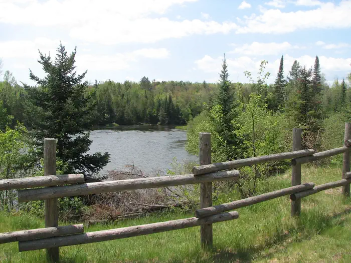
As visitors exit McKinley Road to enter the Au Sable Loop Scenic Overlook, they will first see a panoramic vista of the National Scenic portion of the Au Sable River. From the Au Sable Loop Scenic Overlook follow the unpaved road to reach the campground. The small five site campground is set amidst a mixed hardwood forest. The campground and day use areas are ideal for scenery viewing, wildlife viewing, and picnicking.
More like this: reservable in Michigan · big rigs in Michigan · pets allowed in Michigan
Check availability on Recreation.gov ↗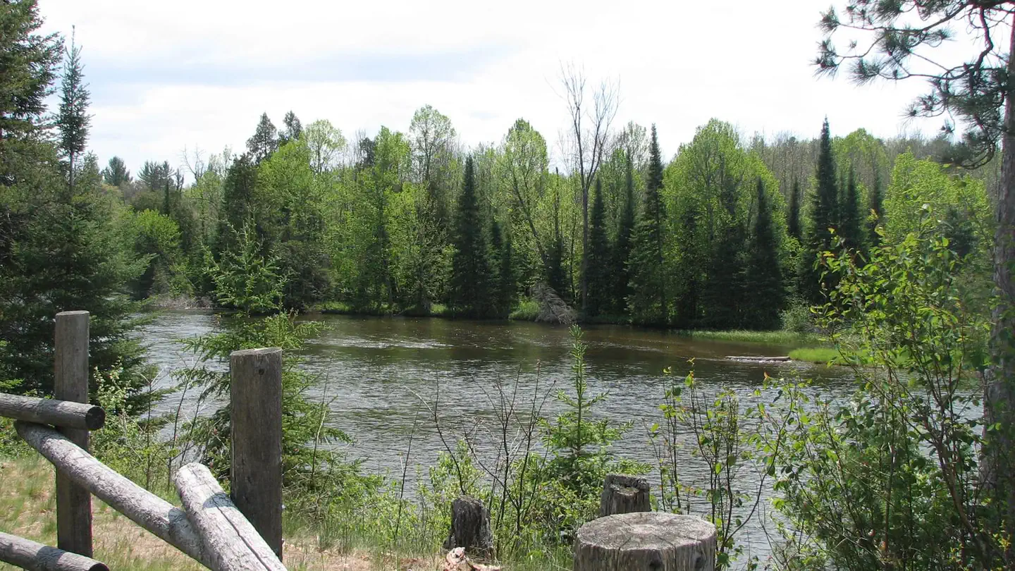

Site mix
| Standard, no hookups | 5 |
Site guide
5 sites. Tap a filter to narrow the list; the map follows.
| Site | Entry | Fits, ft | Surface | Water / sewer | People / vehicles | Fires |
|---|---|---|---|---|---|---|
| 1 | Back-in | 90 | Gravel | No / – | 8 / 2 | Yes |
| 2 | Pull-through | 75 | Gravel | No / – | 8 / 2 | Yes |
| 3 | Back-in | 45 | Gravel | No / – | 8 / 2 | Yes |
| 4 | Back-in | 38 | Gravel | No / – | 8 / 2 | Yes |
| 5 | Pull-through | Gravel | No / – | 8 / 2 | Yes |
Per-site records as published by the managing agency on Recreation.gov. Blank cells mean the agency listed nothing for that site. Check-in 2:00 PM, checkout 12:00 PM.
Amenities & rules
| Hookups | None |
| Max vehicle length | 99 ft |
| Equipment | RVs & trailers, Tents |
| Pets | Allowed |
| Campfires | Allowed, subject to restrictions |
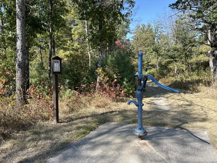
The Au Sable Loop Campground provides a hand pump well for drinking water, a vault toilet, and trash collection services. Campsites provide users with picnic tables, campfire rings, and lantern posts.
Individual sites vary. Confirm on Recreation.gov or with the managing office.
Season & status
| Status | Closed for the season. Forest Service sites close for the season; check the official page for the reopening date. |
| Season | May 1 to November 30 |
| Forest | Huron-Manistee National Forests |
| Fees | Recreation Enhancement Act Fee - Day Use - Day: $5.00. Week: $15.00. Camping - Per Night: $10.00 |
| Rules | As a visitor to the National Forest, you are asked to follow certain rules designed to protect the Forest, natural resources and to provide for public safety of visitors. These rules are available to you on-line or at any office of the Huron-Manistee National Forests. Please take time to read and understand them. General Topic orders apply across the Forests. |
Weather by month
Getting there
From Grayling. Travel east on M-72 for 30 miles. Turn left and go north on M-72/M-33 for.5 miles. Turn right and go east on McKinley Rd. for 3 miles. Turn right and follow the signs to the site.
| Nearest town | Mio, Michigan |
| Coordinates | 44.6511° N, 84.0994° W · Directions ↗ |
Supplies & services
| Dump station | Dump station ↗ | 2.3 mi |
| RV sales & service | Rose City RV Center ↗ | 17.4 mi |
| Outdoor gear | A-1 Woods & Waters ↗ | 30.2 mi |
Locations © OpenStreetMap contributors. Call ahead; hours change seasonally.
Explore
Video
Ausable Loop Campground - solo camp / kayak
Worth a stop
- 9.6 miLoon Lake Day Use Area ↗Day use
Trails nearby
- 0.4 miOscoda Smt N-To-E Mio Dnr967 ↗14.1 mi trail · snowmobile, snowshoe, ski
- 0.4 miMack - Mio Trail3.9 mi trail · hiking, horse, bike, motorcycle and 2 more
- 0.4 miWolf Creek Hike - TH Spur0.07 mi trail · hiking, horse, bike
- 0.5 miWolf Creek - Fireweed Hike0.8 mi trail · hiking, horse, bike
- 0.5 miWolf Creek - Fireweed Xski0.8 mi trail · snowshoe, ski
- 1 miWolf Creek - Foxglove Xski0.3 mi trail · snowshoe, ski
Trail and trailhead records are the Forest Service's. Distances are straight-line to the nearer trail end. Trail conditions are not tracked here.
Public land it sits in
This campground sits inside Huron-Manistee National Forest.
- inHuron-Manistee National Forest ↗National Forest · Forest Service · 2,028,484 acres
- 13.7 miKirtlands Warbler Wildlife Management Area ↗National Wildlife Refuge · Fish and Wildlife Service · 6,621 acres
Each unit is published as a centre point and an acreage rather than a boundary, so this section stands it in for a circle of the same area. Whether a campground is inside, and how far it is from one it is outside, are both approximate.
Other campgrounds nearby


On the National Register nearby
- Oscoda County CourthouseBuilding · Mio · 2.9 mi
Natural features
Located near the banks of the National Scenic Au Sable River, this campground is a haven for water based recreation. An exemplary setting for wildlife viewing, visitors and campers will see a melding of habitats as the river turns to forest and then to field. The area is inhabited by bald eagles, deer, bear, bobcat, porcupine, various songbirds, and waterfowl. Please respect wildlife and observe from a distance.
Recreation
- Water Activities: The Au Sable Loop Campground provides forest visitors with a variety of water activities. Access to the Au Sable River is afforded by a short path from the campground. Anglers can boat, wade, and fish from shore. Fish species found in the Au Sable River include bass, pike, brown trout, walleye, perch, sunfish, steelhead, and salmon. The water flows at a speed of 2 mph. The Au Sab
- Hiking: Along the north side of the river is the 0.5 mile Mio Nature Trail with a trailhead located in the Mio Ranger Station parking lot. Along the south side of the river is the 4.5 mile Wolf Creek Trail. The trailhead for Wolf Creek is on the lefthand side 1 mile west of Mio down South River road. Both trails provide views of the Au Sable River and are appropriate for a variety of skill levels.
Guidebooks for Michigan
We earn a small commission if you buy through these links. It does not change what we list.
Titles come from Open Library's catalog, matched by subject heading or by title.
Reference
Questions people ask
Do I need a reservation at Au Sable Loop Campground?
Sites at Au Sable Loop Campground are reservable on Recreation.gov. Any walk-up sites are listed on the booking page.
Source: Recreation.gov
How much does it cost to camp at Au Sable Loop Campground?
Recreation Enhancement Act Fee - Day Use - Day: $5.00. Week: $15.00. Camping - Per Night: $10.00
Source: Recreation.gov
What time is check-in at Au Sable Loop Campground?
Check-in 2:00 PM, checkout 12:00 PM.
Source: Recreation.gov
Is Au Sable Loop Campground open right now?
Closed for the season as of Oct 16, 2026. Season May 1 to November 30.
Source: Forest Service status
How many sites does Au Sable Loop Campground have?
5 sites, including 5 standard sites without power.
Source: Recreation.gov
Will my RV fit at Au Sable Loop Campground?
Recreation.gov lists no practical vehicle capacity limit for the largest site here, which usually means pull-through or open parking. The sidebar tool checks a trailer or motorhome length against every site.
Source: Will my RV fit
Are pets allowed at Au Sable Loop Campground?
Yes, pets are allowed at Au Sable Loop Campground. Leash rules apply.
Source: Recreation.gov
Can I have a campfire at Au Sable Loop Campground?
Fires are allowed in the provided rings under normal conditions. As a visitor to the National Forest, you are asked to follow certain rules designed to protect the Forest, natural resources and to provide for public safety of visitors.
Source: Recreation.gov
Is there cell service at Au Sable Loop Campground?
FCC coverage maps show Verizon 4G LTE and AT&T 5G at the campground point. Terrain changes that from one site to the next.
Source: FCC Broadband Map
What is there to do at Au Sable Loop Campground?
Water Activities: The Au Sable Loop Campground provides forest visitors with a variety of water activities. Access to the Au Sable River is afforded by a short path from the campground. Anglers can boat, wade, and fish from shore. Fish species found in the Au Sable River include bass, pike, brown tr
Source: Recreation
What is the nearest town to Au Sable Loop Campground?
Mio, Michigan.
Source: Getting there
What if Au Sable Loop Campground is full?
The nearest public campgrounds are Ausable River Camping (under 0.1 mi), River Dune Campground (0.1 mi, first-come), and Meadow Springs Campground (1.3 mi, first-come).
Source: Campgrounds nearby