Big Spring
In the rolling, forested landscape of Big Spring, two of America's most beautiful spring-fed rivers combine to make up the Ozark National Scenic Riverways. As the first national park area to protect a wild river system, visitors have plenty of scenic water activities to enjoy as well as hiking, horseback riding and wildlife viewing.
More like this: electric hookups in Missouri · reservable in Missouri · big rigs in Missouri · pets allowed in Missouri · group sites in Missouri
Check availability on Recreation.gov ↗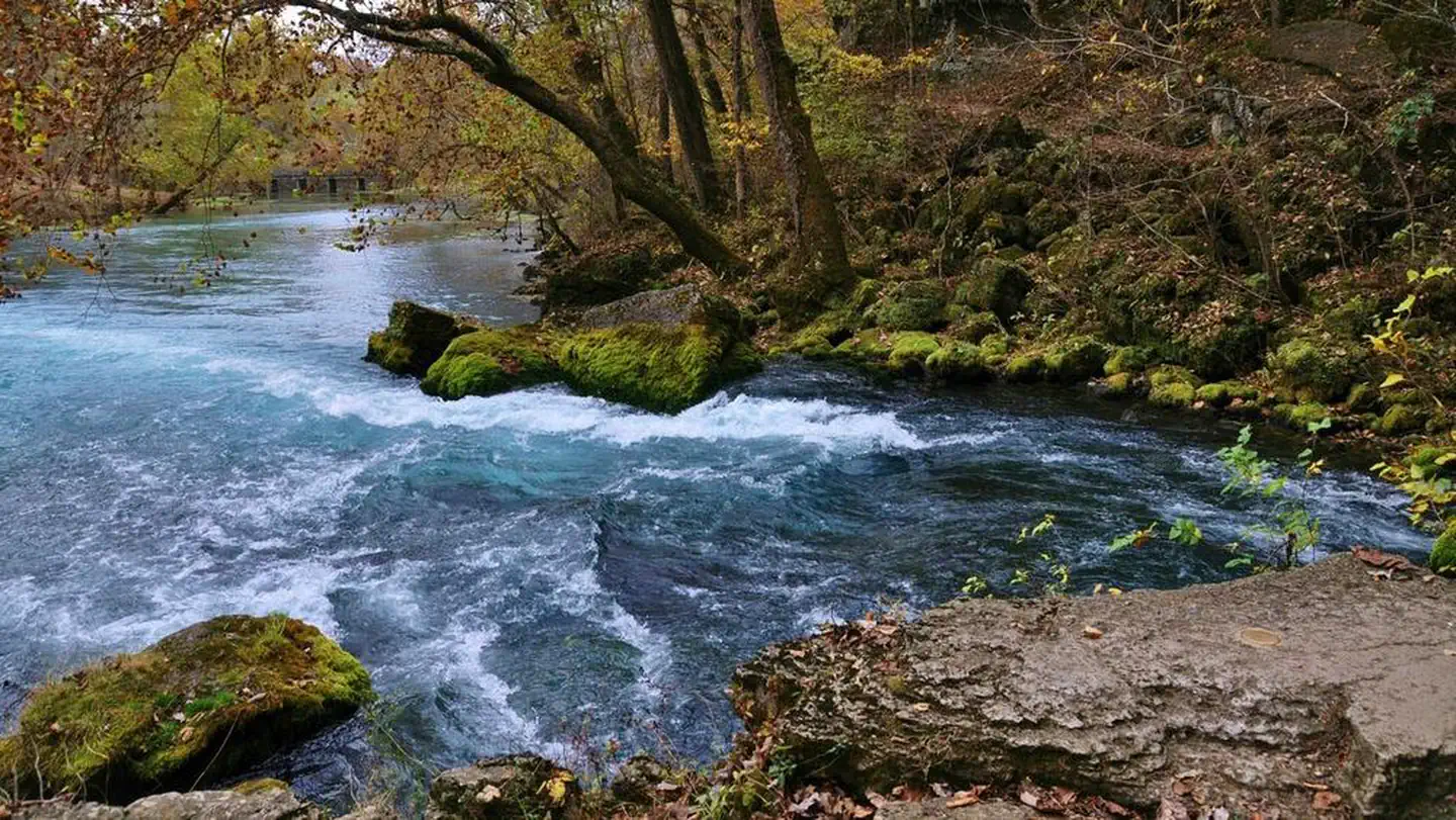


Site mix
| Standard, no hookups | 102 |
| Standard with electric | 28 |
| Group tent areas | 3 |
| group picnic area | 2 |
| Host/management | 2 |
Site guide
Will my RV fit
The longest site here provides 76 feet of vehicle capacity. Most sites are shorter.
135 sites in 10 loops. Tap a filter to narrow the list; the map follows.
| Site | Loop | Type | Entry | Fits, ft | Surface | Shade | Power | Waterfront | People / vehicles | Fires | Accessible | Rating |
|---|---|---|---|---|---|---|---|---|---|---|---|---|
| G01 | Big Spring Group Sites | Group tent | Back-in | Paved | Partial | No | Riverfront | 45 / 22 | Yes | Prime | ||
| G02 | Big Spring Group Sites | Group tent | Back-in | Paved | Partial | No | Riverfront | 45 / 15 | Yes | Prime | ||
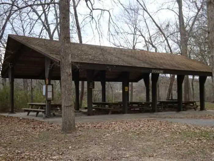
| Big Spring Picnic Pavilion | Big Spring Picnic Pavilion | Group Picnic Area | Paved | Full | 15 amp | Riverfront | 60 / 20 | Prime | ||||
| G03 | Chub Hollow/Groupsite #3 | Group tent | Gravel | Partial | No | Riverfront | 45 / 20 | Yes | Prime | |||
| 101 | Loop 100 | Standard | Back-in | 34 | Paved | Full | No | Riverfront | 6 / 2 | Yes | Prime | |
| 102 | Loop 100 | Standard | Back-in | 32 | Paved | Full | No | Riverfront | 6 / 2 | Yes | Prime | |
| 103 | Loop 100 | Standard | Back-in | 50 | Paved | Full | No | Riverfront | 6 / 2 | Yes | Prime | |
| 104 | Loop 100 | Standard | Back-in | 45 | Paved | Full | No | Riverfront | 6 / 2 | Yes | Prime | |
| 105 | Loop 100 | Standard | Back-in | 50 | Paved | Full | No | Riverfront | 6 / 2 | Yes | Prime | |
| 106 | Loop 100 | Standard | Back-in | 46 | Paved | Full | No | Riverfront | 6 / 2 | Yes | Prime |
Per-site records as published by the managing agency on Recreation.gov. Blank cells mean the agency listed nothing for that site. Check-in 1:00 PM, checkout 12:00 PM.
Amenities & rules
| Hookups | Electric, water |
| Max vehicle length | 76 ft |
| Equipment | RVs & trailers, Tents |
| Pets | Allowed |
| Campfires | Allowed, subject to restrictions |
| Accessibility | Sites 117, 203, 205 are listed accessible |
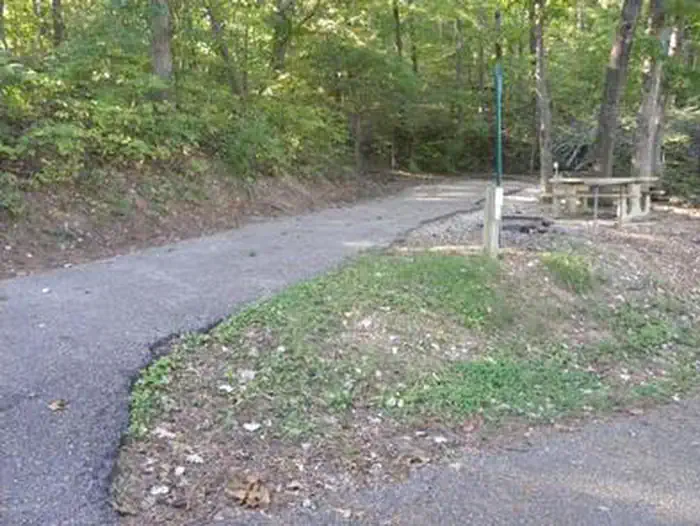
This year-round campground has flush toilets and shower facilities available. Picnic tables, fire rings, and grills are provided. Roads and parking spurs are paved. Ranger-led campfire programs are offered in the campground amphitheater during summer months. Reservations are accepted for three different group picnic areas. Be sure to specify which picnic area you desire. Big Spring Group Picnic Site is at the spring; Peavine and Chubb Hollow are along the river.
Individual sites vary. Confirm on Recreation.gov or with the managing office.
Weather by month
Getting there
Big Spring Campground is located four miles (6.4 km) south of Van Buren, Missouri. Turn south on Missouri Highway 103 and continue south for four miles (6.4 km) to the Big Spring Unit of the park.
| Nearest town | Van Buren, Missouri |
| Coordinates | 36.9625° N, 90.9831° W · Directions ↗ |
Supplies & services
| Outdoor gear | Alley Spring Store ↗ | 28.2 mi |
| Dump station | Dump station ↗ | 28.5 mi |
Locations © OpenStreetMap contributors. Call ahead; hours change seasonally.
Explore
Video
campground review video of Big Spring Campground in van buren Missouri
Worth a stop
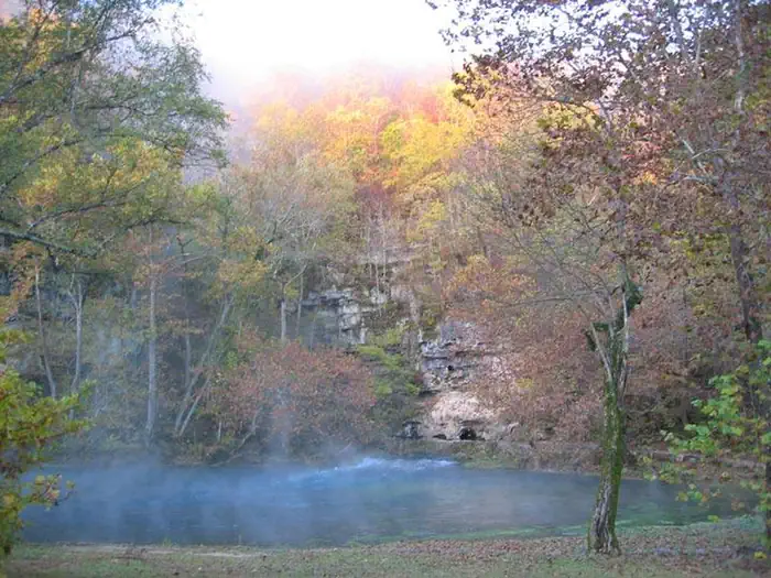
Scenic Big Spring is the largest freshwater spring in North America and produces an outflow of 280 million gallons a day. Round Spring Cave is nearby, with ranger-guided tours offered daily during summer months. Historic and picturesque Alley Mill and Alley Spring are also nearby. The mill is open daily in the summer and ranger-guided tours are available upon request.
- 1.4 miBig Spring Entrance Station ↗Visitor center
Trails nearby
- 2.4 miSkyline Trail1.4 mi trail · hiking
- 2.6 miOzark Trail - Big Springs Spur2.2 mi trail · hiking, horse
- 2.6 miBig Spring - Spring Loop0.2 mi trail · hiking, horse
- 2.8 miBig Spring - Chilton Connector0.8 mi trail · hiking, horse
- 3.2 miSongbird Trail0.5 mi trail · hiking, bike
- 3.3 miNPS Spurunder 0.1 mi trail · hiking
Trailheads within three miles
- 2.4 miSkyline Trailhead ↗Mark Twain National Forest
Trail and trailhead records are the Forest Service's. Distances are straight-line to the nearer trail end. Trail conditions are not tracked here.
Public land it sits in
This campground sits inside Mark Twain National Forest.
- inMark Twain National Forest ↗National Forest · Forest Service · 3,069,958 acres
Each unit is published as a centre point and an acreage rather than a boundary, so this section stands it in for a circle of the same area. Whether a campground is inside, and how far it is from one it is outside, are both approximate.
Other campgrounds nearby
Cabin and lookout rentals nearby
On the National Register nearby
- Carter County CourthouseBuilding · Van Buren · 2.8 mi
- Nola Kitterman HouseBuilding · Grandin · 12.3 mi
- J. W. Gibson HouseBuilding · Grandin · 12.4 mi
Natural features
The Ozark National Scenic Riverways is known for its caves, springs, sinkholes and losing streams, and features over 300 identified caves within its boundaries. The caves range in size from a rock overhang to almost seven miles of identified passages. Eight caves, including an open sinkhole, have been designated as outstanding natural features. The Ozark forest is mostly White oak and Shortleaf pine, Missouri's only native pine species. Along the rivers, Sycamore, Cottonwood, River birch and maples are common. Redbud and dogwoods are also abundant, putting on a spectacular show during most spring months.
Recreation
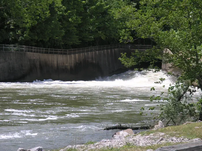
The Current River flows past the campground, offering excellent canoeing, tubing, swimming and fishing. Over 130 miles (209 km) of waterways exist within the park. Canoe and kayak rentals and outfitters can be found nearby. Several miles of hiking and horseback riding trails crisscross the region, include the Alley Overlook Trail, Chubb Hollow Trail, Ozark Trail, Cave Spring Trail and Big Springs Trail.
Guidebooks for Missouri
We earn a small commission if you buy through these links. It does not change what we list.
Titles come from Open Library's catalog, matched by subject heading or by title.
Reference
Questions people ask
Do I need a reservation at Big Spring?
Sites at Big Spring are reservable on Recreation.gov. Any walk-up sites are listed on the booking page.
Source: Recreation.gov
What time is check-in at Big Spring?
Check-in 1:00 PM, checkout 12:00 PM.
Source: Recreation.gov
How many sites does Big Spring have?
137 sites, including 102 standard sites without power, 28 standard sites with power, 3 group tent areas, and 2 group picnic area.
Source: Recreation.gov
Will my RV fit at Big Spring?
Recreation.gov lists no practical vehicle capacity limit for the largest site here, which usually means pull-through or open parking. The sidebar tool checks a trailer or motorhome length against every site.
Source: Will my RV fit
Does Big Spring have hookups?
Yes, electric and water hookups at some sites.
Source: Recreation.gov
Are there showers or a dump station at Big Spring?
This year-round campground has flush toilets and shower facilities available.
Source: Recreation.gov
Are pets allowed at Big Spring?
Yes, pets are allowed at Big Spring. Leash rules apply.
Source: Recreation.gov
Can I have a campfire at Big Spring?
Fires are allowed in the provided rings under normal conditions.
Source: Recreation.gov
Are there accessible sites at Big Spring?
Sites 117, 203, and 205 are listed accessible on Recreation.gov. What that covers (a paved pad, an accessible table, a nearby accessible restroom) is on each site's booking page.
Source: Recreation.gov
Is there cell service at Big Spring?
FCC coverage maps show Verizon 4G LTE, AT&T 5G, and T-Mobile 5G at the campground point. Terrain changes that from one site to the next.
Source: FCC Broadband Map
What is there to do at Big Spring?
The Current River flows past the campground, offering excellent canoeing, tubing, swimming and fishing. The Recreation section on this page has the rest.
Source: Recreation
What is the nearest town to Big Spring?
Van Buren, Missouri. Scenic Big Spring is the largest freshwater spring in North America and produces an outflow of 280 million gallons a day.
Source: Getting there