Watercress
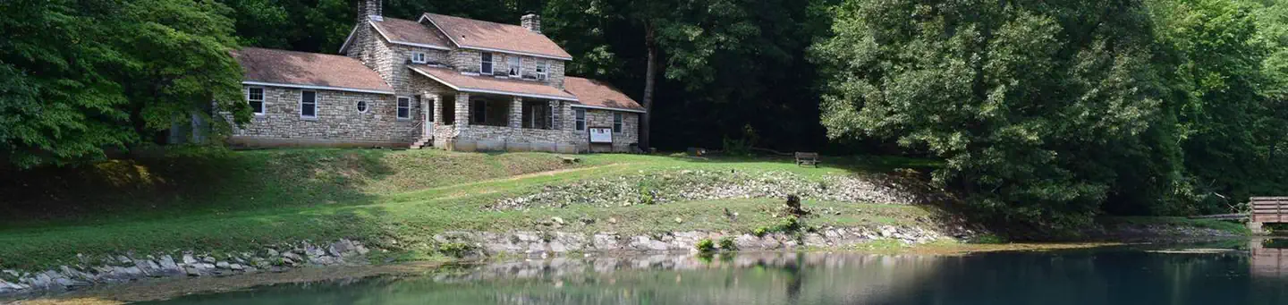
Watercress Campground lies on the banks one of the forest’s greatest treasures; the Current River. Floats on the river provide views of southeastern Missouri that otherwise can't be seen. The area is home to a variety of birds and wildlife and recreation opportunities are plentiful in the surrounding area.
Some sites take reservations on Recreation.gov. Others are first-come, first-served.
More like this: electric hookups in Missouri · first-come in Missouri · reservable in Missouri · big rigs in Missouri · pets allowed in Missouri · group sites in Missouri
Check availability on Recreation.gov ↗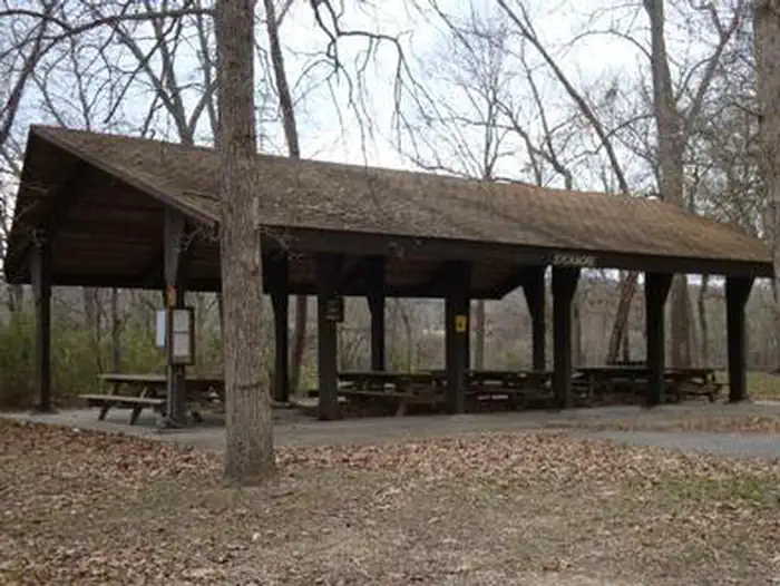
Site mix
| Standard, no hookups | 17 |
| group picnic area | 2 |
Site guide
Will my RV fit
The longest site here provides 40 feet of vehicle capacity. Most sites are shorter.
19 sites. Tap a filter to narrow the list; the map follows.
| Site | Type | Entry | Fits, ft | Surface | Shade | Power | Water / sewer | Waterfront | People / vehicles | Fires |
|---|---|---|---|---|---|---|---|---|---|---|
| 01 | Standard | Back-in | 40 | Gravel | Full | No | No / No | Riverfront | 8 / 2 | Yes |
| 02 | Standard | Back-in | 40 | Gravel | Full | No | No / No | Riverfront | 8 / 2 | Yes |
| 03 | Standard | Back-in | 40 | Gravel | Full | No | No / No | Riverfront | 8 / 2 | Yes |
| 04 | Standard | Back-in | 40 | Gravel | Full | No | No / No | Riverfront | 8 / 2 | Yes |
| 05 | Standard | Back-in | 40 | Gravel | Full | No | No / No | Riverfront | 8 / 2 | Yes |
| 06 | Standard | Back-in | 40 | Gravel | Full | No | No / No | Riverfront | 8 / 2 | Yes |
| 07 | Standard | Back-in | 40 | Gravel | Full | No | No / No | Riverfront | 16 / 2 | Yes |
| 08 | Standard | Back-in | 40 | Gravel | Full | No | No / No | Riverfront | 8 / 2 | Yes |
| 09 | Standard | Back-in | 40 | Gravel | Full | No | No / No | Riverfront | 8 / 2 | Yes |
| 10 | Standard | Back-in | 40 | Gravel | Full | No | No / No | Riverfront | 8 / 2 | Yes |
Per-site records as published by the managing agency on Recreation.gov. Blank cells mean the agency listed nothing for that site. Check-in 2:00 PM, checkout 12:00 PM.
Amenities & rules
| Hookups | Electric |
| Max vehicle length | 40 ft |
| Equipment | RVs & trailers, Tents |
| Pets | Allowed |
| Campfires | Allowed, subject to restrictions |
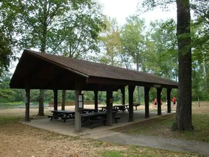
The campground offers 17 campsites for tent or RV camping and the sites are available on a first-come, first-served basis. Each site is equipped with a table and campfire ring. Vault toilets and drinking water are provided. Two group picnic shelters which can accommodate up to 75 people each are located alongside the river. Each is equipped with tables and grills. A seasonal trash collection dumpster is also available between April 1 and October 1 at the campground entrance.
Individual sites vary. Confirm on Recreation.gov or with the managing office.
Season & status
| Status | Open |
| Season | May 1 to October 1 |
| Forest | Mark Twain National Forest |
| Fees | Campsites: Single Sites: $10/night. Double Sites: $20/night. There is a 50% discount for camping for anyone with an Interagency Access or Senior Pass. |
| Rules | No OHVs/ATVs/UTVs allowed to operate at this recreation area. No more than 8 people are permitted at any one site (16 for double sites). When fishing at Watercress Recreation Area, all limits apply and necessary permits are required. Maximum Stay Permitted (days): 14. No fireworks |
Weather by month
Getting there
From Highway 60, drive north on Main Street to the National Park Service sign on Watercress Road. Turn north and drive just past the Park Service building complex, then make a left to Watercress Recreation Area. The picnic shelters are on the left toward the north end of the day use area.
| Nearest town | Poplar Bluff, Missouri |
| Coordinates | 37.0019° N, 91.0186° W · Directions ↗ |
Supplies & services
| Outdoor gear | Alley Spring Store ↗ | 25.3 mi |
| Dump station | Dump station ↗ | 25.6 mi |
Locations © OpenStreetMap contributors. Call ahead; hours change seasonally.
Explore
Video
Watercress Lodges and Camp Site
Worth a stop
The campground is adjacent to the Ozark National Scenic Riverways, which is a series of protected rivers in the area managed by the National Park Service.
- 3.9 miBig Spring Entrance Station ↗Visitor center
Trails nearby
- 0.1 miNPS Spurunder 0.1 mi trail · hiking
- 0.1 miSongbird Trail0.5 mi trail · hiking, bike
- 2.5 miSkyline Trail1.4 mi trail · hiking
- 3.4 miOzark Trail - Current River ↗9.5 mi trail · hiking, horse, bike · national_recreation_or_other
- 4 miOzark Trail Between the Rivers ↗28 mi trail · hiking, horse · national_recreation_or_other
- 4.5 miOzark Trail - Big Springs Spur2.2 mi trail · hiking, horse
Trail and trailhead records are the Forest Service's. Distances are straight-line to the nearer trail end. Trail conditions are not tracked here.
Public land it sits in
This campground sits inside Mark Twain National Forest.
- inMark Twain National Forest ↗National Forest · Forest Service · 3,069,958 acres
Each unit is published as a centre point and an acreage rather than a boundary, so this section stands it in for a circle of the same area. Whether a campground is inside, and how far it is from one it is outside, are both approximate.
Other campgrounds nearby
Cabin and lookout rentals nearby
On the National Register nearby
- Carter County CourthouseBuilding · Van Buren · 0.5 mi
Natural features
Located within the town of Van Buren, the campground and day use area are adjacent to the Current River, which flows past scenic bluffs, springs, caves as it meanders through the Mark Twain National Forest toward Doniphan, MO.
Recreation
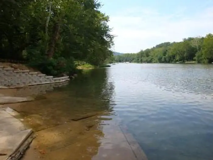
Boating and canoeing on the Current River, as well as on other nearby rivers, are popular activities. A boat ramp for both motorized and non-motorized boats is available on the east bank of the Current River. Anglers enjoy fishing for bass, walleye, sunfish and the occasional catfish. Big Spring, Missouri's largest spring, is just five miles from the campground. Hikers at Watercress area enjoy the Songbird Trail, a 1.2-mile loop that leads to Watercress Spring, passing remnants of Civil War-era earthwork that overlook the Current River.
Guidebooks for Missouri
We earn a small commission if you buy through these links. It does not change what we list.
Titles come from Open Library's catalog, matched by subject heading or by title.
Reference
Questions people ask
Do I need a reservation at Watercress?
For some sites. Some sites take reservations on Recreation.gov. Others are first-come, first-served.
Source: Recreation.gov
How much does it cost to camp at Watercress?
Campsites: Single Sites: $10/night. Double Sites: $20/night. There is a 50% discount for camping for anyone with an Interagency Access or Senior Pass.
Source: Recreation.gov
What time is check-in at Watercress?
Check-in 2:00 PM, checkout 12:00 PM.
Source: Recreation.gov
Is Watercress open right now?
Open as of Oct 16, 2026. Season May 1 to October 1.
Source: Forest Service status
How many sites does Watercress have?
19 sites, including 17 standard sites without power and 2 group picnic area.
Source: Recreation.gov
Will my RV fit at Watercress?
The longest site here provides 40 feet of vehicle capacity. Most sites are shorter. The sidebar tool checks a trailer or motorhome length against every site.
Source: Will my RV fit
Does Watercress have hookups?
Yes, electric hookups at some sites.
Source: Recreation.gov
Are pets allowed at Watercress?
Yes, pets are allowed at Watercress. Leash rules apply.
Source: Recreation.gov
Can I have a campfire at Watercress?
Fires are allowed in the provided rings under normal conditions. No OHVs/ATVs/UTVs allowed to operate at this recreation area.
Source: Recreation.gov
Is there cell service at Watercress?
FCC coverage maps show Verizon 4G LTE, AT&T 5G, and T-Mobile 5G at the campground point. Terrain changes that from one site to the next.
Source: FCC Broadband Map
What is there to do at Watercress?
Boating and canoeing on the Current River, as well as on other nearby rivers, are popular activities. The Recreation section on this page has the rest.
Source: Recreation
What is the nearest town to Watercress?
Poplar Bluff, Missouri. The campground is adjacent to the Ozark National Scenic Riverways, which is a series of protected rivers in the area managed by the National Park Service.
Source: Getting there