Greenville Recreation Area
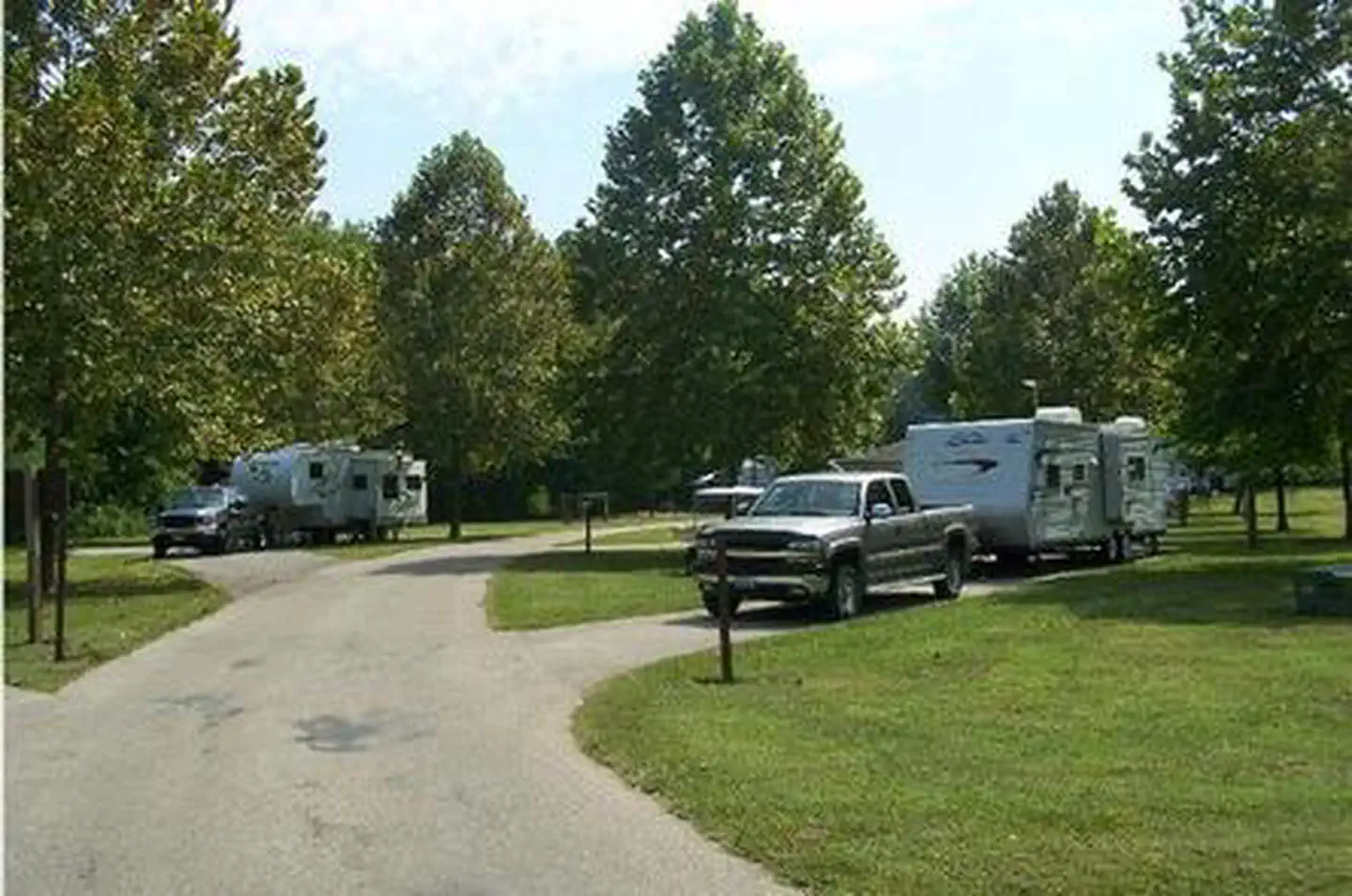
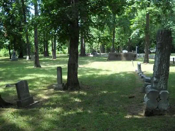
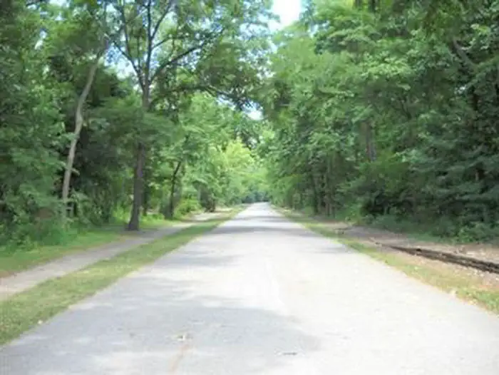
Greenville Recreation Area is located on the northen end of Wappapello Lake Project, nestled on the banks of the St. Francis River. The spacious campground is built on the original site of the historical Old Greenville City, visitors have seemingly endless opportunities for fun. The Memory Lane trail winds along the historical foundations and streets offering a glimpse back in time. The Greenville Trail, a three mile hike or bike trail, connects the modern city of Greenville to the campground. The expansive grounds, multiple playgrounds, play courts and large event area provide opportunities for all ages and abilities.
More like this: electric hookups in Missouri · full hookups in Missouri · reservable in Missouri · pets allowed in Missouri · group sites in Missouri
Check availability on Recreation.gov ↗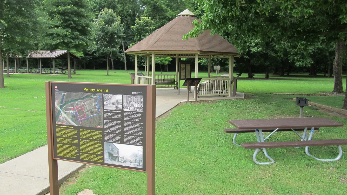
Site mix
| Standard with electric | 93 |
| group shelter electric | 1 |
| RV with electric | 1 |
| Host/management | 9 |
Site guide
Will my RV fit
The longest site here provides 118 feet of vehicle capacity. Most sites are shorter.
95 sites in 5 loops. Tap a filter to narrow the list; the map follows.
| Site | Loop | Type | Entry | Fits, ft | Surface | Shade | Power | Water / sewer | People / vehicles | Fires | Accessible |
|---|---|---|---|---|---|---|---|---|---|---|---|
| 080 | BACK | Electric | Back-in | 44 | Paved | Partial | 50 amp | Yes / Yes | 8 / 2 | Yes | |
| 081 | BACK | Electric | Back-in | 69 | Paved | Partial | 50 amp | Yes / Yes | 8 / 2 | Yes | |
| 082 | BACK | Electric | Back-in | 82 | Paved | 50 amp | Yes / Yes | 8 / 2 | Yes | ||
| 085 | BACK | Electric | Back-in | 93 | Paved | Partial | 50 amp | Yes / Yes | 8 / 2 | Yes | |
| 086 | BACK | Electric | Back-in | 76 | Paved | Partial | 50 amp | Yes / Yes | 8 / 2 | Yes | |
| 087 | BACK | Electric | Back-in | 98 | Paved | Partial | 50 amp | Yes / Yes | 8 / 2 | Yes | |
| 088 | BACK | Electric | Back-in | 73 | Paved | Partial | 50 amp | Yes / Yes | 8 / 2 | Yes | |
| 089 | BACK | Electric | Back-in | 82 | Paved | Partial | 50 amp | Yes / Yes | 8 / 2 | Yes | |
| 090 | BACK | Electric | Back-in | 72 | Paved | 50 amp | Yes / Yes | 8 / 2 | Yes | ||
| 091 | BACK | Electric | Back-in | 83 | Paved | Partial | 50 amp | Yes / Yes | 8 / 2 | Yes |
Per-site records as published by the managing agency on Recreation.gov. Blank cells mean the agency listed nothing for that site. Check-in 5:00 PM, checkout 4:00 PM.
Amenities & rules
| Hookups | Electric, water, sewer |
| Equipment | RVs & trailers, Tents |
| Pets | Allowed |
| Campfires | Allowed, subject to restrictions |
| Fees | Site Type. Full Service (50 Amp, Water, Sewer) $28.00 |
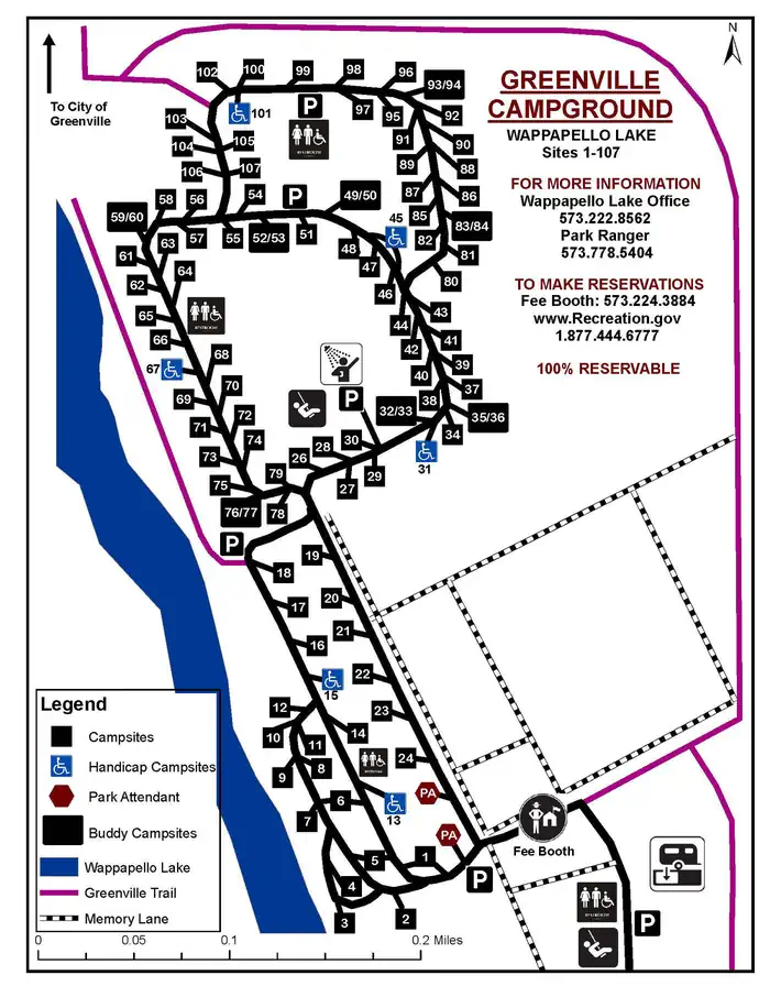
| Accessibility | Sites 101, 013, 015, S10 and 4 more are listed accessible |
The day use portion of the recreation area includes 14 picnic sites, a playground, basketball court, volleyball court, horseshoe pits, day use shelter, and boat ramp with courtesy dock. Facilities within the campground include showers, a playground, and 106 campsites with full hookups, consisting of electric, water, and sewer.
Individual sites vary. Confirm on Recreation.gov or with the managing office.
Weather by month
Getting there
The physical address of the park is located a mile south of Greenville, MO. From St. Louis, take I-55 south to Highway 67 south to Greenville. From here, continue south about 1 mile and look for signs. From Poplar Bluff take Highway 67 north about 29 miles and look for signs. If utilizing Apple or Google Maps, key in "Greenville Recreation Area".
| Nearest town | Greenville, Missouri |
| Coordinates | 37.1004° N, 90.4558° W · Directions ↗ |
Supplies & services
| Dump station | Dump station ↗ | 11.1 mi |
Locations © OpenStreetMap contributors. Call ahead; hours change seasonally.
Explore
Video
campground review video of 1 FREE and 1 cheap campground both located in Greenville, Misso
Worth a stop
Explore one of the 9 trail systems along the Wappapello Lake. The nearby Ozark Trail is the only Horse friendly trail at the Lake. The Pine Ridge Nature trail, Shell Lake Archery Trail and Wappapllo Wildflower Trail and Greenhouse areas or lower St. Francis River are approximately 22 miles away. The Mingo Wildlife Refuge is approximately 31 miles from Old Greenville Recreation Area. The Lake Wappapello State Park is approximately 21 miles away, and the Sam A. Baker State park is 14 miles away from Old Greenville Recreation Area. The nearby 34 Bridge Recreation Area is an ideal place to swim or picnic along its large gravel bars.
- 0.5 mi
- 4.9 miHolliday Landing Marina ↗Boat launch
- 9.5 miLost Creek Lodge Marina ↗Boat launch
- 10.4 miChaonia Day Use ↗Day use
Trails nearby
- 1.1 miOzark Trail Wappapello Section ↗13.3 mi trail · hiking, horse, bike · national_recreation_or_other
- 1.1 miOzark Trail Wappapello F Hwy ↗3.5 mi trail · hiking, horse, bike · national_recreation_or_other
Trail and trailhead records are the Forest Service's. Distances are straight-line to the nearer trail end. Trail conditions are not tracked here.
Public land it sits in
Mark Twain National Forest begins about 5.5 miles away, and it is the closest of these.
- 5.5 miMark Twain National Forest ↗National Forest · Forest Service · 3,069,958 acres
- 14 miMingo National Wildlife Refuge ↗National Wildlife Refuge · Fish and Wildlife Service · 21,690 acres
- 14.5 miMingo Wilderness ↗Wilderness · Fish and Wildlife Service · 7,730 acres
Each unit is published as a centre point and an acreage rather than a boundary, so this section stands it in for a circle of the same area. Whether a campground is inside, and how far it is from one it is outside, are both approximate.
Other campgrounds nearby
Cabin and lookout rentals nearby
On the National Register nearby
- Fort BentonStructure · Patterson · 7.9 mi
Natural features
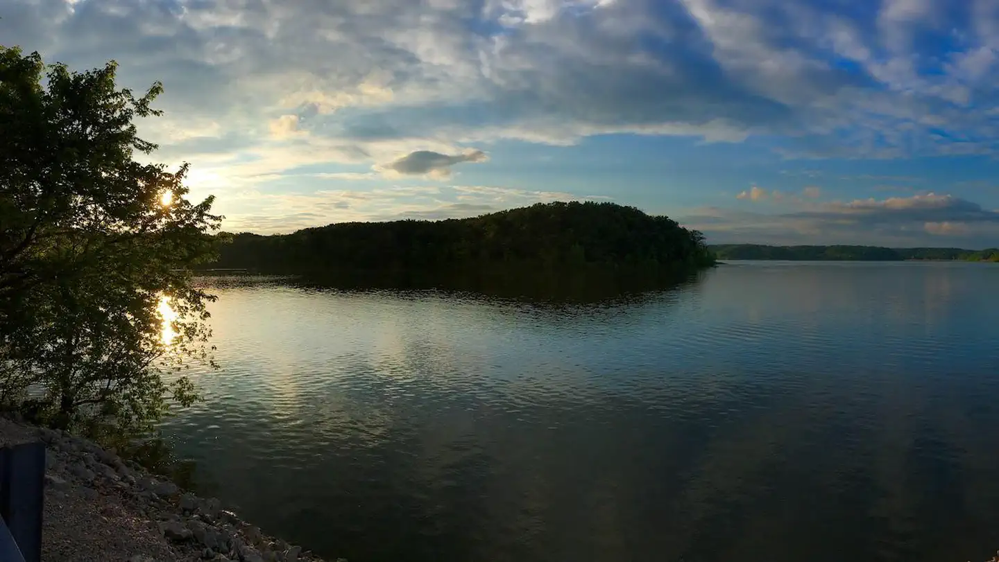
Wappapello Lake, fed by the St. Francis River, has a seemingly endless string of secluded coves hugged by a winding, wooded shoreline. The public recreation area spans 45,000 acres in the southeastern Ozark foothills. The St. Francis River provides multiple caves, gravel bars, and open stretchs of water surrounded by open woodlands and rocky bluffs.
Recreation
Greenville boasts a one-mile historical trail to explore. A three-mile hike/bike trail is open year-round and a great choice for families. The lake is home to some of Missouri's most sought after game fish, including largemouth bass, crappie, bluegill, white bass and channel catfish. Hunting and trapping are popular activities around the lake, boasting 44,000 acres for public use. Special events are put on throughout the year but the annual Black Powder Rendezvous, Old Greenville Days and Halloween Boo Bash events are notable experiences in Greenville.
Guidebooks for Missouri
We earn a small commission if you buy through these links. It does not change what we list.
Titles come from Open Library's catalog, matched by subject heading or by title.
Reference
Questions people ask
Do I need a reservation at Greenville Recreation Area?
Sites at Greenville Recreation Area are reservable on Recreation.gov. Any walk-up sites are listed on the booking page.
Source: Recreation.gov
How much does it cost to camp at Greenville Recreation Area?
Site Type. Full Service (50 Amp, Water, Sewer) $28.00
Source: Recreation.gov
What time is check-in at Greenville Recreation Area?
Check-in 5:00 PM, checkout 4:00 PM.
Source: Recreation.gov
How many sites does Greenville Recreation Area have?
104 sites, including 93 standard sites with power, 1 group shelter electric, and 1 RV site with electric.
Source: Recreation.gov
Can I bring an RV to Greenville Recreation Area?
Greenville Recreation Area is listed for tents only.
Source: Recreation.gov
Does Greenville Recreation Area have hookups?
Yes, electric, water, and sewer hookups at some sites.
Source: Recreation.gov
Are there showers or a dump station at Greenville Recreation Area?
Facilities within the campground include showers, a playground, and 106 campsites with full hookups, consisting of electric, water, and sewer.
Source: Recreation.gov
Are pets allowed at Greenville Recreation Area?
Yes, pets are allowed at Greenville Recreation Area. Leash rules apply.
Source: Recreation.gov
Can I have a campfire at Greenville Recreation Area?
Fires are allowed in the provided rings under normal conditions.
Source: Recreation.gov
Are there accessible sites at Greenville Recreation Area?
Sites 101, 013, 015, and S10 are listed accessible on Recreation.gov, 8 sites in all. What that covers (a paved pad, an accessible table, a nearby accessible restroom) is on each site's booking page.
Source: Recreation.gov
Is there cell service at Greenville Recreation Area?
FCC coverage maps show AT&T 5G and T-Mobile 5G at the campground point. Terrain changes that from one site to the next.
Source: FCC Broadband Map
What is there to do at Greenville Recreation Area?
Greenville boasts a one-mile historical trail to explore. The Recreation section on this page has the rest.
Source: Recreation