Buckhorn
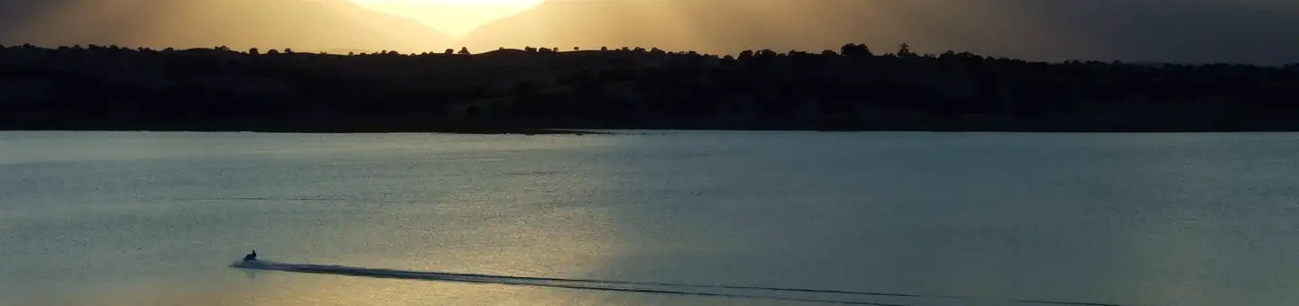
Buckhorn Recreation Area is at Black Butte Lake, situated at the northern end of the Sacramento valley, 100 miles north of Sacramento, CA and 30 minutes south of Red Bluff, CA. The lake is a popular meeting place for water sports and outdoor enthusiasts, so bring family and friends for an incredibly scenic getaway.
More like this: reservable in California · big rigs in California · pets allowed in California · group sites in California
Check availability on Recreation.gov ↗


Site mix
| Standard, no hookups | 87 |
| Walk-in | 5 |
| Group sites | 1 |
Site guide
Will my RV fit
The longest site here provides 100 feet of vehicle capacity. Most sites are shorter.
93 sites in 4 loops. Tap a filter to narrow the list; the map follows.
| Site | Loop | Type | Entry | Fits, ft | Surface | Shade | Water / sewer | People / vehicles | Fires |
|---|---|---|---|---|---|---|---|---|---|
| BH01 | 1-22 | Standard | Back-in | 28 | Paved | Partial | No / – | 8 / 4 | Yes |
| BH02 | 1-22 | Standard | Back-in | 24 | Paved | Partial | No / – | 8 / 4 | Yes |
| BH03 | 1-22 | Standard | Back-in | 31 | Paved | Partial | No / – | 8 / 4 | Yes |
| BH04 | 1-22 | Standard | Pull-through | 91 | Paved | Partial | No / – | 8 / 4 | Yes |
| BH05 | 1-22 | Standard | Back-in | 31 | Paved | Partial | No / – | 8 / 4 | Yes |
| BH06 | 1-22 | Standard | Back-in | 30 | Paved | Partial | No / – | 8 / 4 | Yes |
| BH07 | 1-22 | Standard | Pull-through | 77 | Paved | Partial | No / – | 8 / 4 | Yes |
| BH08 | 1-22 | Standard | Pull-through | 89 | Paved | Partial | No / – | 8 / 4 | Yes |
| BH09 | 1-22 | Standard | Pull-through | 66 | Paved | Partial | No / – | 8 / 4 | Yes |
| BH10 | 1-22 | Standard | Pull-through | 65 | Paved | Partial | No / – | 8 / 4 | Yes |
Per-site records as published by the managing agency on Recreation.gov. Blank cells mean the agency listed nothing for that site. Check-in 2:00 PM, checkout 1:00 PM.

Amenities & rules
| Hookups | None |
| Max vehicle length | 150 ft |
| Equipment | RVs & trailers, Tents |
| Pets | Allowed |
| Campfires | Allowed, subject to restrictions |
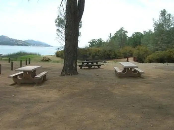
Buckhorn has 93 campsites, including a group campground and five walk-in sites. Conveniences include showers, a modern boat ramp complex, two playgrounds, an exercise area, and shoreline access. No sites have electric or water hookups. The area is open year-round.
Individual sites vary. Confirm on Recreation.gov or with the managing office.
Weather by month
Getting there
From Interstate 5, take the Black Butte Lake exit at Orland, CA. Travel west on County Road 200/Newville Road for 12 miles. Turn left on Buckhorn Road and enter the Buckhorn Recreation area.
| Nearest town | Orland, California |
| Coordinates | 39.8121° N, 122.3668° W · Directions ↗ |
Fire nearby
- PrescribedShf Rx
50 mi from the campground
Distance is to the reported incident point, not the fire edge. Call the managing office before you drive.
Supplies & services
| RV sales & service | Mike Friend RVs ↗ | 26.7 mi |
| Outdoor gear | Sportsman's Warehouse ↗ | 27.8 mi |
Locations © OpenStreetMap contributors. Call ahead; hours change seasonally.
Explore
Video
Buckhorn Campground in the Angeles National Forest, CA.
Worth a stop
A 18 hole disc golf course can be accessed across from the Orland Buttes Campground. Horeseback riders can make use of the horse trails at Grizzly Flat and Burris Creek. Drive east to visit the Mendocino National Forest.
- 14.9 miThomes Gorge Trailhead ↗Trailhead
Public land it sits in
Mendocino National Forest begins about 5.5 miles away, and it is the closest of these.
- 5.5 miMendocino National Forest ↗National Forest · Forest Service · 1,073,580 acres
Each unit is published as a centre point and an acreage rather than a boundary, so this section stands it in for a circle of the same area. Whether a campground is inside, and how far it is from one it is outside, are both approximate.
Other campgrounds nearby


On the National Register nearby
- Maywood Woman's ClubBuilding · Corning · 12.8 mi
Natural features
Black Butte Lake was formed in 1963 with the completion of the Black Butte Dam on Stony Creek. The lake's surface area measures 4,460 acres when water levels are high. Black basalt buttes and blue oak woodland hug the lake's 40 miles of shoreline.
Recreation
Find excitement with wake boarding and sailing or explore the shoreline's 13 miles of fitness trails for hiking, running and biking. Black Butte is renowned for its warm-water fishing, including catches such as crappie, channel catfish, and large and smallmouth bass.
Guidebooks for California
We earn a small commission if you buy through these links. It does not change what we list.

Titles come from Open Library's catalog, matched by subject heading or by title.
Reference
Questions people ask
Do I need a reservation at Buckhorn?
Sites at Buckhorn are reservable on Recreation.gov. Any walk-up sites are listed on the booking page.
Source: Recreation.gov
What time is check-in at Buckhorn?
Check-in 2:00 PM, checkout 1:00 PM.
Source: Recreation.gov
How many sites does Buckhorn have?
93 sites, including 87 standard sites without power, 5 walk-in sites, and 1 group site.
Source: Recreation.gov
Will my RV fit at Buckhorn?
Recreation.gov lists no practical vehicle capacity limit for the largest site here, which usually means pull-through or open parking. The sidebar tool checks a trailer or motorhome length against every site.
Source: Will my RV fit
Are there showers or a dump station at Buckhorn?
Conveniences include showers, a modern boat ramp complex, two playgrounds, an exercise area, and shoreline access.
Source: Recreation.gov
Are pets allowed at Buckhorn?
Yes, pets are allowed at Buckhorn. Leash rules apply.
Source: Recreation.gov
Can I have a campfire at Buckhorn?
Fires are allowed in the provided rings under normal conditions. As of 2026-10-16, there is 1 active fire within 50 miles, so check current restrictions before you light one.
Source: Fire nearby
Is there cell service at Buckhorn?
FCC coverage maps show Verizon 4G LTE at the campground point. Terrain changes that from one site to the next.
Source: FCC Broadband Map
What is there to do at Buckhorn?
Find excitement with wake boarding and sailing or explore the shoreline's 13 miles of fitness trails for hiking, running and biking. The Recreation section on this page has the rest.
Source: Recreation
What is the nearest town to Buckhorn?
Orland, California. A 18 hole disc golf course can be accessed across from the Orland Buttes Campground.
Source: Getting there
What if Buckhorn is full?
The nearest public campgrounds are Orland Buttes (2.9 mi), Pines Group Site (17.4 mi), and Horse Camp (20.5 mi, partly first-come).
Source: Campgrounds nearby