Kentucky Camp Cabin And Headquarters Building
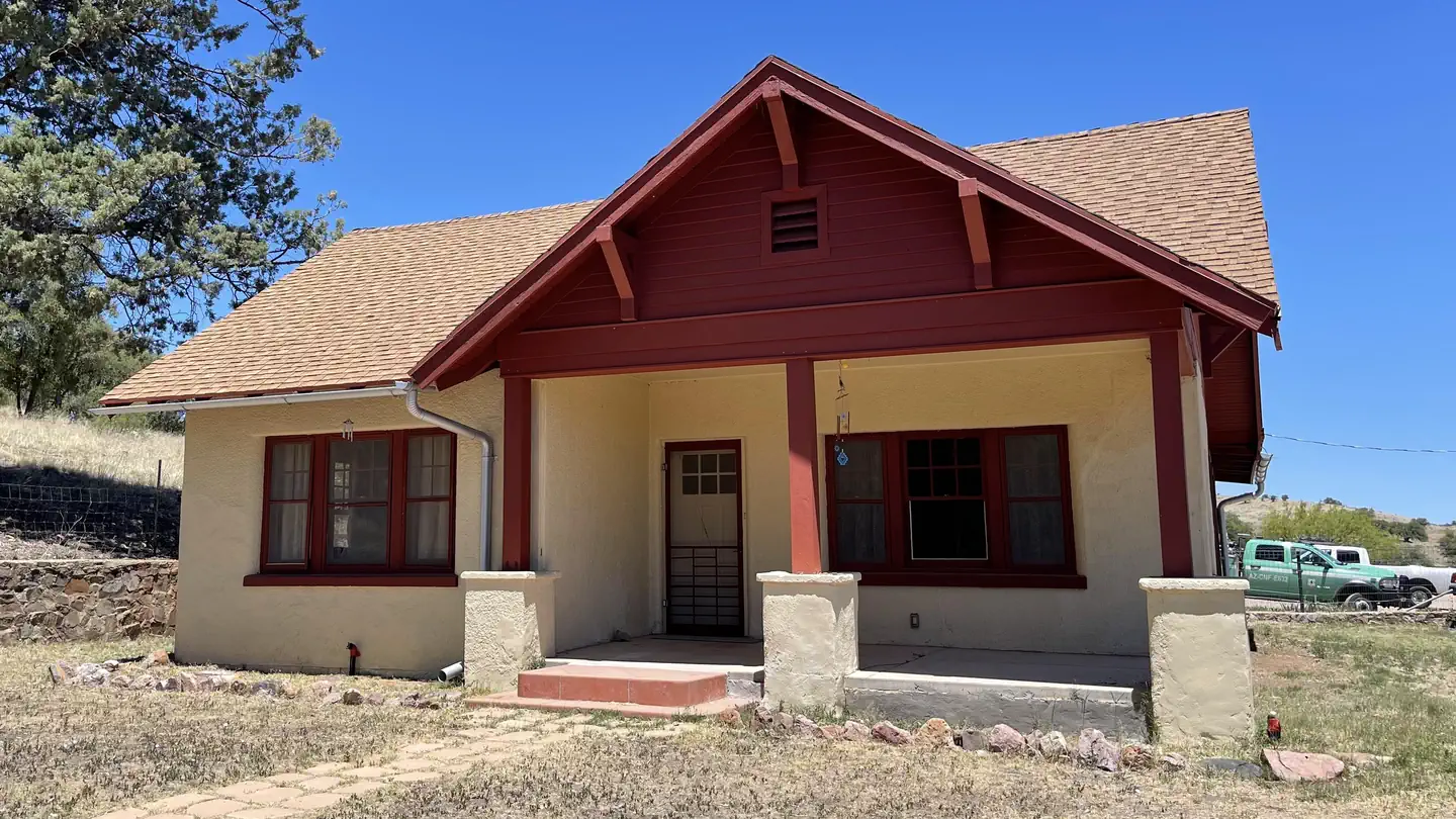
Kentucky Camp Cabin and Headquarters is located in the Santa Rita Mountains near Sonoita, Arizona in the Coronado National Forest. The five adobe buildings originally served as headquarters for the Santa Rita Water and Mining Company from 1902 to 1906. The facility also served as a cattle ranch from the 1920s through the 1960s. The Forest Service acquired the land in 1989 and it has since become an ideal location for guests seeking a unique lodging experience, rich in mining and ranching history.
Check availability on Recreation.gov ↗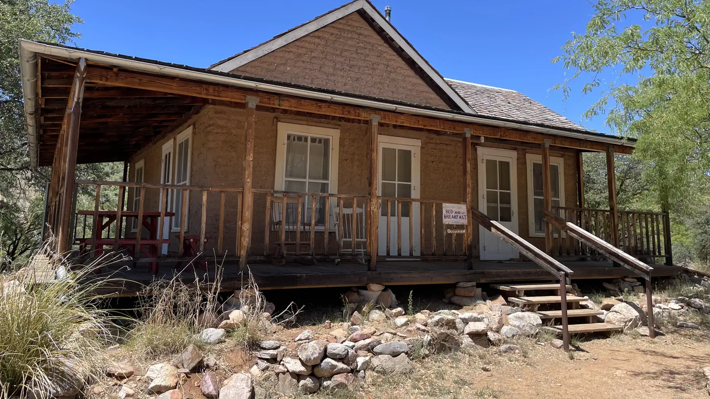

Site mix
| Cabins with electric | 1 |
Site guide
1 site. Tap a filter to narrow the list; the map follows.
| Site | Surface | Shade | People / vehicles | Fires |
|---|---|---|---|---|
| 001 | Gravel | Full | 5 / 5 | Yes |
Per-site records as published by the managing agency on Recreation.gov. Blank cells mean the agency listed nothing for that site. Check-in 2:00 PM, checkout 12:00 PM.
Amenities & rules
| Pets | Allowed |
| Campfires | Allowed, subject to restrictions |
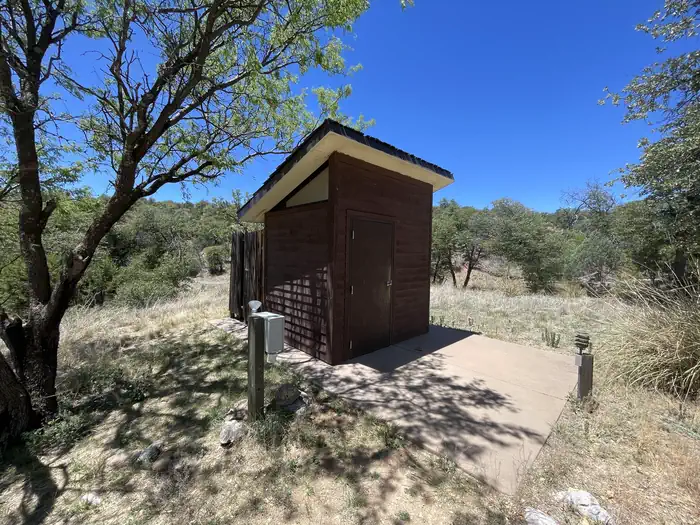
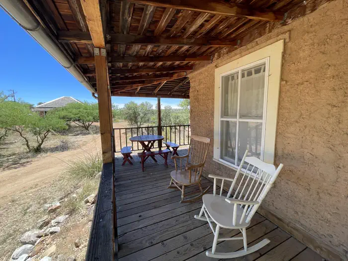
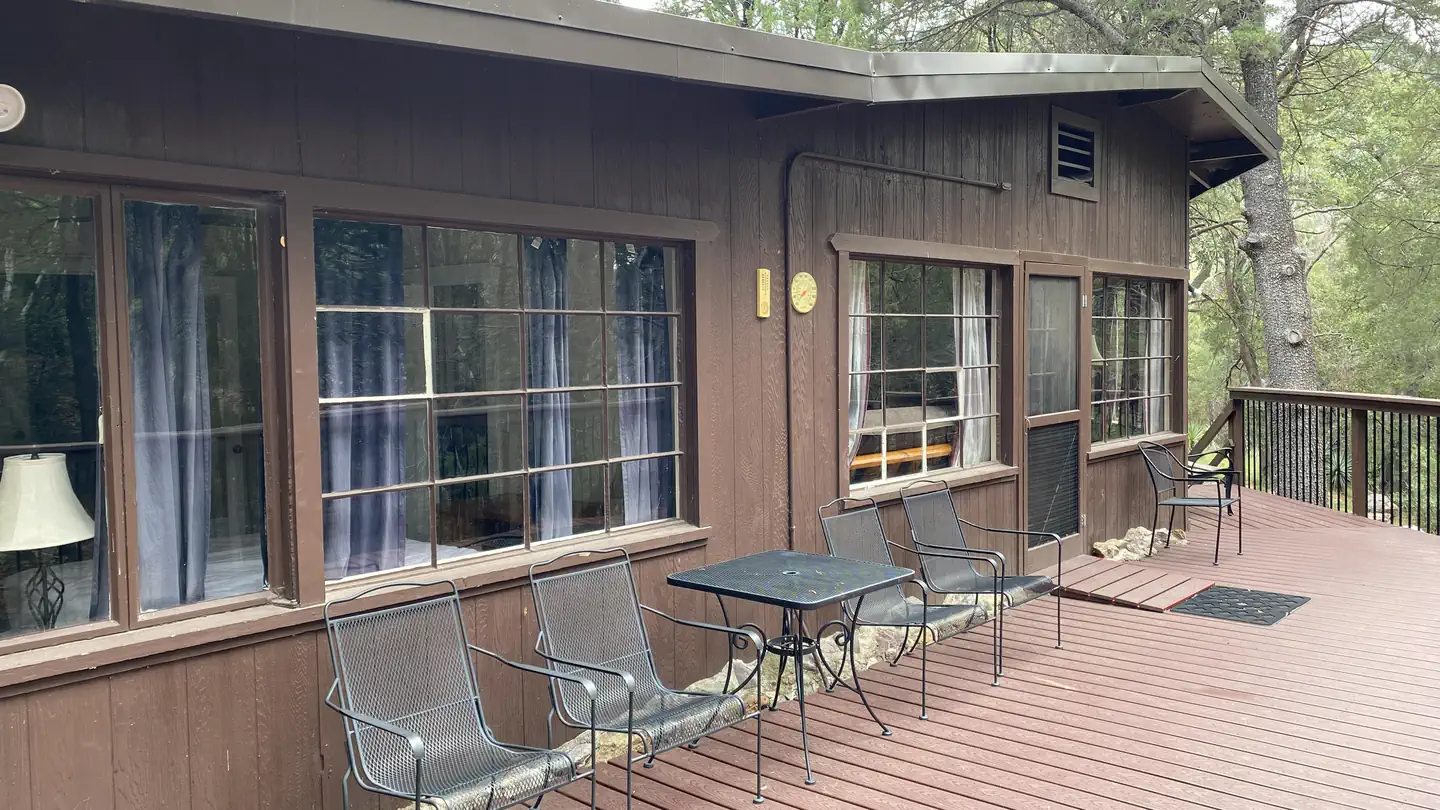
This facility consists of a cabin and headquarters building. The cabin can accommodate up to five people, and is equipped with two twin beds, a twin bunkbed and a full-sized futon. The kitchen has basic amenities including a small refrigerator, microwave, hot plate, coffee pot, dishes, utensils, cookware, and a table and chairs. Outside, there is a grill and picnic table for outdoor dining. A vault toilet, stall for solar showers, and an outdoor sink are located on site. The cabin has electricity and propane heat, but no indoor running water. Guests MUST bring their own food, sleeping bags, linens, towels, dish soap, matches, a first aid kit, toilet paper, solar shower, and garbage bags.
Individual sites vary. Confirm on Recreation.gov or with the managing office.
Weather by month
Getting there
From Tucson, take I-10 east to Exit #281 (Highway 83 - Sonoita/Patagonia). Travel south on Highway 83 for approximately 21 miles to the signed turnoff for Gardner Canyon Road. Turn right on Gardner Canyon Road and continue 0.9 mile to Forest Service Road 163.
| Nearest town | Nogales, Arizona |
| Coordinates | 31.7443° N, 110.7416° W · Directions ↗ |
Good to know
- Tent Camping is prohibited within the site boundary of Kentucky Camp.
Supplies & services
| Dump station | Dump station ↗ | 18.5 mi |
| RV sales & service | RV sales & service ↗ | 30.6 mi |
| Outdoor gear | Bass Pro Shops ↗ | 32.5 mi |
Locations © OpenStreetMap contributors. Call ahead; hours change seasonally.
Explore
Trails nearby
- 1.3 miFish Canyon OHV2 mi trail · hiking, horse, bike, motorcycle and 2 more
- 2 miCasa Blanca ↗19.3 mi trail · hiking, horse, bike · national_scenic_or_historic
- 2 miKentucky Camp ↗16.9 mi trail · hiking, horse, bike · national_scenic_or_historic
- 3.4 miEast Sawmill Canyon3.4 mi trail · hiking, horse
- 3.6 miGreaterville2.5 mi trail · hiking, horse, bike
- 4.1 miCave Canyon3.7 mi trail · hiking, horse, bike
Trail and trailhead records are the Forest Service's. Distances are straight-line to the nearer trail end. Trail conditions are not tracked here.
Public land it sits in
Mt. Wrightson Wilderness begins about 3.8 miles away, and it is the closest of these.
- 3.8 miMt. Wrightson Wilderness ↗Wilderness · Forest Service · 25,141 acres
- 4.1 miLas Cienegas ↗National Conservation Lands unit · Bureau of Land Management · 50,557 acres
- 5.6 miCoronado National Forest ↗National Forest · Forest Service · 1,785,091 acres
Each unit is published as a centre point and an acreage rather than a boundary, so this section stands it in for a circle of the same area. Whether a campground is inside, and how far it is from one it is outside, are both approximate.
Other campgrounds nearby


Cabin and lookout rentals nearby
Historic landmarks nearby
.jpg/960px-Titan_Missile_(41980404201).jpg)


Natural features
Spanning four life zones and several ecosystems between the Sonoran desert and the "Sky Island" mountain peaks, the area surrounding the camp and cabin supports abundant and biologically diverse plant and animal communities. Mountain peaks, high desert grasslands, and seasonal streams provide diverse habitat for the area's abundant wildlife. White-tailed and mule deer, rabbits, wild turkeys, and squirrels are commonly seen, along with numerous bird species. While black bear, Coati, foxes, ring-tailed cats, bobcats and mountain lions are more elusive.
Recreation
The area has popular hiking, mountain biking, and horseback riding trails which range from gentle walking paths, to steep, strenuous trails leading to the top of 9,453-foot Mt. Wrightson and other nearby peaks. The Arizona Trail runs through Kentucky Camp. Two-track and dirt roads are available for off-highway vehicle travel around Kentucky Camp; however, off-highway vehicles may not be ridden within the site's boundaries. Birders congregate in southeastern Arizona as it is touted as one of the country's most revered birding areas. With fifteen species of hummingbirds, 36 species of wood warblers, and over 256 documented bird species, the area is a birder's paradise.
Nearby
Numerous attractions are available nearby in Madera Canyon. Attractions within a one-hour drive include the Mining Museum, Titan Missile Museum, Whipple Observatory, Arizona-Sonora Desert Museum, San Xavier Mission, the Amerind Foundation, and Tumacacori National Historical Park.
Guidebooks for Arizona
We earn a small commission if you buy through these links. It does not change what we list.
- Best Backpacking Trips in Utah, Arizona, and New MexicoMike White and Douglas Lorain, 2016Find at Bookshop.org
Titles come from Open Library's catalog, matched by subject heading or by title.
Reference
Questions people ask
Do I need a reservation at Kentucky Camp Cabin And Headquarters Building?
Sites at Kentucky Camp Cabin And Headquarters Building are reservable on Recreation.gov. Any walk-up sites are listed on the booking page.
Source: Recreation.gov
What time is check-in at Kentucky Camp Cabin And Headquarters Building?
Check-in 2:00 PM, checkout 12:00 PM.
Source: Recreation.gov
How many sites does Kentucky Camp Cabin And Headquarters Building have?
1 site, including 1 cabin with power.
Source: Recreation.gov
Are there showers or a dump station at Kentucky Camp Cabin And Headquarters Building?
A vault toilet, stall for solar showers, and an outdoor sink are located on site.
Source: Recreation.gov
Are pets allowed at Kentucky Camp Cabin And Headquarters Building?
Yes, pets are allowed at Kentucky Camp Cabin And Headquarters Building. Leash rules apply.
Source: Recreation.gov
Can I have a campfire at Kentucky Camp Cabin And Headquarters Building?
Fires are allowed in the provided rings under normal conditions.
Source: Recreation.gov
Is there cell service at Kentucky Camp Cabin And Headquarters Building?
FCC coverage maps show AT&T 4G LTE at the campground point. Terrain changes that from one site to the next.
Source: FCC Broadband Map
What is there to do at Kentucky Camp Cabin And Headquarters Building?
The area has popular hiking, mountain biking, and horseback riding trails which range from gentle walking paths, to steep, strenuous trails leading to the top of 9,453-foot Mt. The Recreation section on this page has the rest.
Source: Recreation
What is the nearest town to Kentucky Camp Cabin And Headquarters Building?
Nogales, Arizona. Numerous attractions are available nearby in Madera Canyon.
Source: Getting there
What if Kentucky Camp Cabin And Headquarters Building is full?
The nearest public campgrounds are Bog Springs Campground (7.9 mi, first-come), Rock Bluff Group Site (27.4 mi), and Lakeview Campground (27.7 mi, first-come).
Source: Campgrounds nearby