Adams Ranger Station
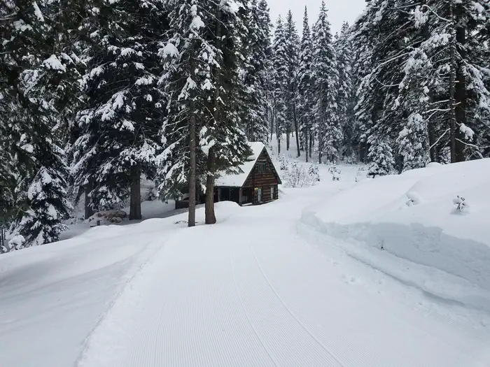
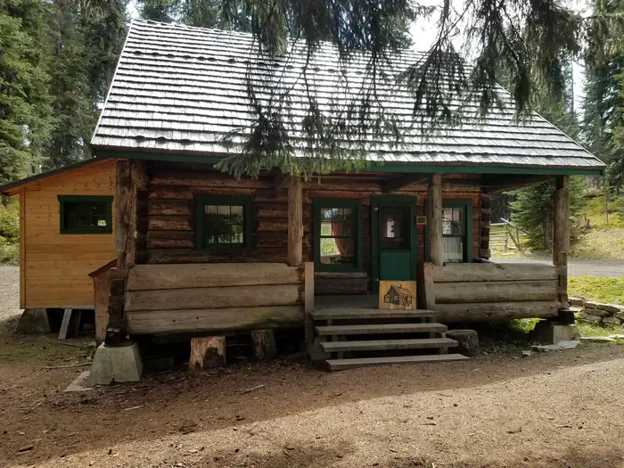
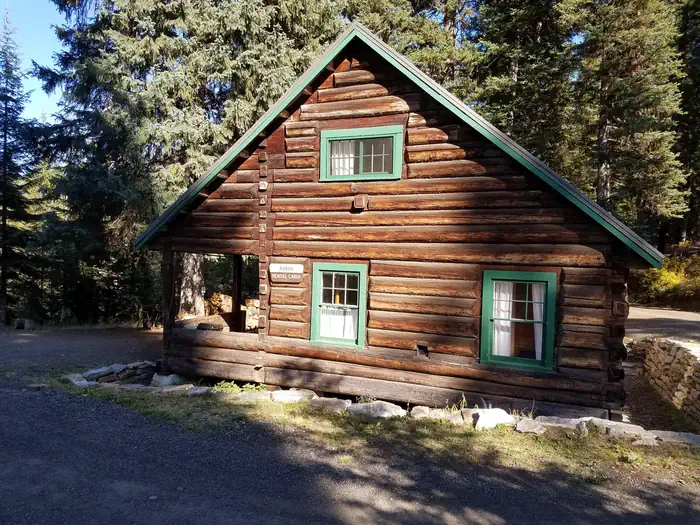
Adams Ranger Station Cabin is located in the heart of the Nez Perce National Forest at an elevation of 5,150 feet. Adams Camp served as a way station along the Milner Trail as early as 1862. The Forest Service established the area adjacent to Adams Camp as an administrative site in 1919. Adams Ranger Station was built in 1932 for the District Ranger and his family. It last served as District headquarters in 1958. Since then, it has served as a work center, hosting a variety of summer crews. The historic cabin is available for rent year-round, except during spring melt, which typically occurs from mid-March to late May.
Check availability on Recreation.gov ↗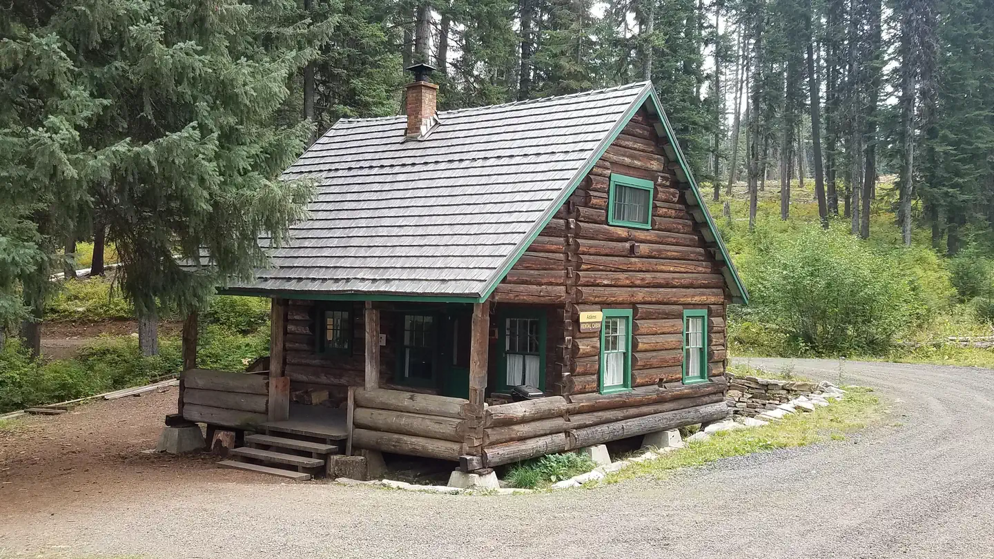
Site mix
| Cabins | 1 |
Site guide
1 site. Tap a filter to narrow the list; the map follows.
| Site | Entry | Surface | Shade | People / vehicles |
|---|---|---|---|---|
| 01 | Pull-through | Gravel | Full | 8 / 3 |
Per-site records as published by the managing agency on Recreation.gov. Blank cells mean the agency listed nothing for that site. Check-in 2:00 PM, checkout 12:00 PM.
Amenities & rules
| Max vehicle length | 20 ft |
The cabin can accommodate up to eight people and has one futon, one double bed, two single beds and two cots. Bedding and blankets are not provided. Other amenities include propane lanterns, a broom, bucket, mop, snow shovels, axes, mauls and firewood rounds. Firewood rounds provided are for heating the cabin, not for campfires in the fire ring outside. You must provide your own firewood for the outside fire ring. Guests must bring their own or melt snow in the winter. It is recommended that visitors bring flashlights, extra batteries, matches, lighters, garbage bags, candles, lantern mantles, newspapers for lighting fires, warm clothes, rain gear, boots, white gas and small propane canisters, first aid kit, cabin shoes or slippers, maps of Nez Perce National Forest and the Gospel Hump Wilderness and lock combinations. Sleeping bags (0 to 20 degrees) may also be needed.
Individual sites vary. Confirm on Recreation.gov or with the managing office.
Weather by month
Getting there
There are two ways to access this cabin in the summer: 1) From the town of Grangeville, turn south on the Grangeville-Salmon Road and follow the signs toward Gospel Hump and Salmon River. At mile marker 29, turn left (east) onto Hungry Ridge Road #309 and drive approximately 1 mile.
| Nearest town | Grangeville, Idaho |
| Coordinates | 45.6548° N, 116.0396° W · Directions ↗ |
Good to know
- There is a vault toilet, a propane cook stove (the oven part of the stove is not hooked up to the propane and does not work), dishes, silverware, cookware, bakeware, a table and chairs.
- Water is not available on-site.
Fire nearby
- PrescribedBrush Rx
39 mi from the campground · 150 acres
- PrescribedRx Stray Creek Lcrd
41 mi from the campground · 150 acres
- PrescribedGoose Rx
50 mi from the campground · 529 acres
- PrescribedMeadow Marsh Rx
50 mi from the campground · 70 acres
Distance is to the reported incident point, not the fire edge. Call the managing office before you drive.
Supplies & services
| Outdoor gear | Rae Bros. Sporting Goods ↗ | 19.1 mi |
Locations © OpenStreetMap contributors. Call ahead; hours change seasonally.
Explore
Worth a stop
Guests may wish to visit the historic gold-mining town of Florence. It is now a ghost town with a cemetery and a few long abandoned buildings.
- 13.8 miBlackerby Picnic Area ↗Day use
Trails nearby
- 0.1 miHump Trail ↗24.4 mi trail
- 0.5 miHungry Ridge ↗8.4 mi trail
- 1 miIdaho Centennial Trail ↗25.2 mi trail
- 1.7 miPeter Ready2.5 mi trail
- 1.9 miMill Creek Crossing3.6 mi trail
- 2 miDriveway ↗13.2 mi trail
Trail and trailhead records are the Forest Service's. Distances are straight-line to the nearer trail end. Trail conditions are not tracked here.
Public land it sits in
Gospel-Hump Wilderness begins about 4 miles away, and it is the closest of these.
- 4 miGospel-Hump Wilderness ↗Wilderness · Forest Service · 205,395 acres
- 4.6 miNez Perce-Clearwater National Forest ↗National Forest · Forest Service · 4,072,795 acres
- 6.6 miPayette National Forest ↗National Forest · Forest Service · 2,407,306 acres
Each unit is published as a centre point and an acreage rather than a boundary, so this section stands it in for a circle of the same area. Whether a campground is inside, and how far it is from one it is outside, are both approximate.
Other campgrounds nearby

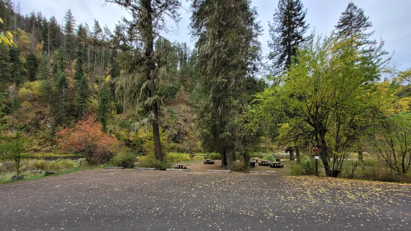
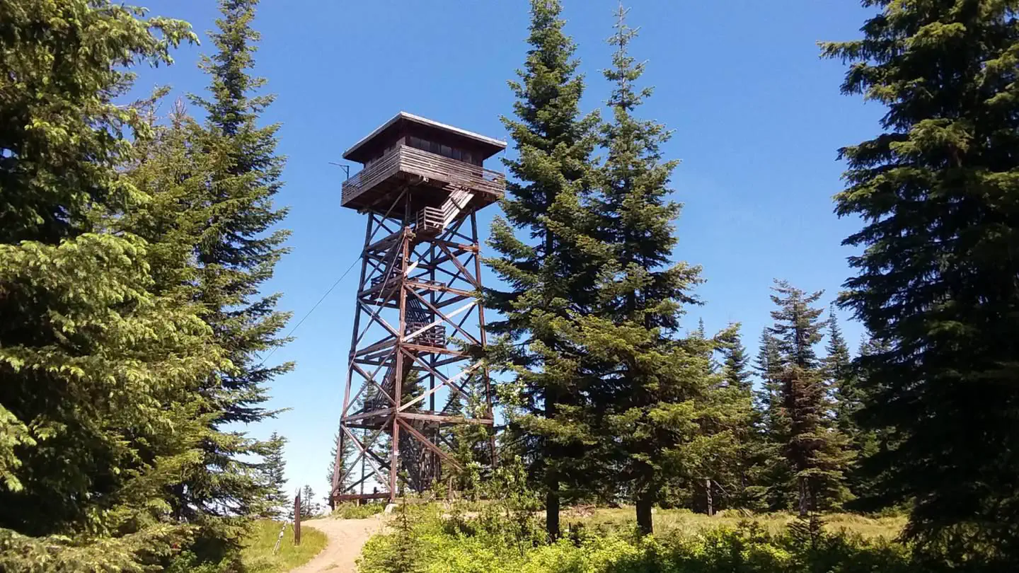
Cabin and lookout rentals nearby
On the National Register nearby
- Dr. Wilson Foskett Home and DrugstoreBuilding · White Bird · 14.6 mi
Natural features
Adams Ranger Station is near the Gospel-Hump Wilderness and part of the Salmon River/Highway 95 Corridor. The landscape in this corridor varies from the emerald Salmon River pouring through steep canyon walls to sapphire Moore's Lake in the remote Gospel-Hump Wilderness. The Gospel-Hump Wilderness has elevations ranging from 1,970 feet at the Wind River pack bridge on the Salmon River to 8,940 feet at the summit of Buffalo Hump. The northern part of the Wilderness is wetter and heavily forested; the southern part is dry and sparsely vegetated. The two parts are separated by a rugged, glaciated divide which contains the peaks for which the wilderness is named. Wildlife in the area includes mountain lions, moose, bighorn sheep, mountain goats and wolves.
Recreation
Many fun activities surround Adams Ranger Station, including numerous trails. Corral Creek, a nearby stock facility and trailhead, can accommodate horses and hikers. This trail system leads into the beautiful Gospel-Hump Wilderness. The Milner Trail, Road #641, is open to off-road vehicles in the summer and snowmobiles in the winter.
Guidebooks for Idaho
We earn a small commission if you buy through these links. It does not change what we list.

Titles come from Open Library's catalog, matched by subject heading or by title.
Reference
Questions people ask
Do I need a reservation at Adams Ranger Station?
Sites at Adams Ranger Station are reservable on Recreation.gov. Any walk-up sites are listed on the booking page.
Source: Recreation.gov
What time is check-in at Adams Ranger Station?
Check-in 2:00 PM, checkout 12:00 PM.
Source: Recreation.gov
How many sites does Adams Ranger Station have?
1 site, including 1 cabin.
Source: Recreation.gov
Will my RV fit at Adams Ranger Station?
The longest site here provides 20 feet of vehicle capacity. Most sites are shorter. The sidebar tool checks a trailer or motorhome length against every site.
Source: Will my RV fit
What is there to do at Adams Ranger Station?
Many fun activities surround Adams Ranger Station, including numerous trails. The Recreation section on this page has the rest.
Source: Recreation
What is the nearest town to Adams Ranger Station?
Grangeville, Idaho. Guests may wish to visit the historic gold-mining town of Florence.
Source: Getting there
What if Adams Ranger Station is full?
The nearest public campgrounds are Rocky Bluff Campground (1.9 mi, first-come), North Fork Slate Creek Campground (3.7 mi, first-come), and South Fork Group Site 5 (12.6 mi, partly first-come).
Source: Campgrounds nearby