Kingfisher
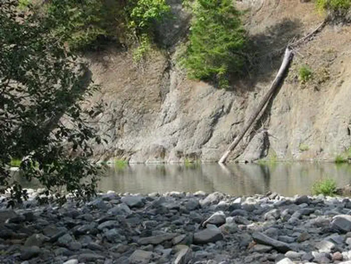
Kingfisher Campground is a diamond in the rough. Its unkempt appearance gives it a true nature feel, yet it offers numerous modern conveniences and is close to a variety of recreational opportunities. It lies next to the scenic Hot Springs Fork of Collawash River, a tributary to the Wild and Scenic Clackamas River nearby.
More like this: reservable in Oregon · pets allowed in Oregon
Check availability on Recreation.gov ↗

Site mix
| Standard, no hookups | 23 |
Site guide
Will my RV fit
The longest site here provides 35 feet of vehicle capacity. Most sites are shorter.
23 sites. Tap a filter to narrow the list; the map follows.
| Site | Entry | Fits, ft | Surface | Shade | Waterfront | People / vehicles | Fires |
|---|---|---|---|---|---|---|---|
| 001 | Back-in | 35 | Gravel | Full | 6 / 2 | ||
| 002 | Back-in | Gravel | Full | Riverfront | 6 / 1 | Yes | |
| 003 | Back-in | 20 | Partial | Riverfront | 6 / 2 | Yes | |
| 004 | Back-in | 20 | Partial | 6 / 2 | Yes | ||
| 005 | Back-in | 20 | Partial | Riverfront | 6 / 2 | Yes | |
| 006 | Back-in | Gravel | Partial | Riverfront | 6 / 2 | Yes | |
| 007 | Pull-through | 20 | Partial | 6 / 2 | Yes | ||
| 008 | Back-in | 20 | Partial | Riverfront | 6 / 2 | Yes | |
| 009 | Back-in | Gravel | Full | 6 / 2 | Yes | ||
| 010 | Back-in | Gravel | Partial | 6 / 1 | Yes |
Per-site records as published by the managing agency on Recreation.gov. Blank cells mean the agency listed nothing for that site. Check-in 2:00 PM, checkout 12:00 PM.
Amenities & rules
| Hookups | None |
| Max vehicle length | 35 ft |
| Equipment | RVs & trailers, Tents |
| Pets | Allowed |
| Tent pads | Yes |
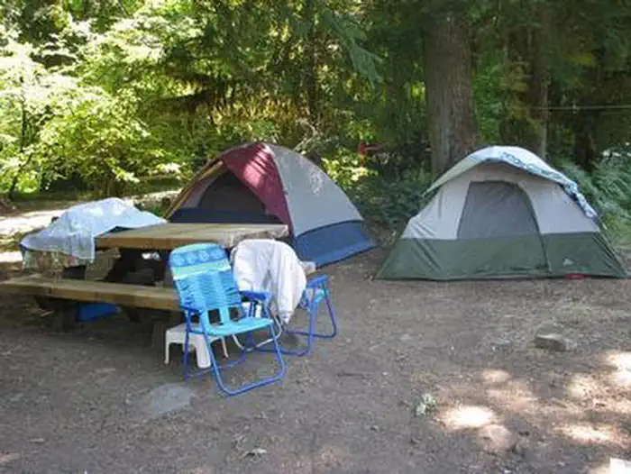
The campground offers nearly two dozen single-family sites for tent and RV camping. RVs larger than 19 feet, however, may have difficulty negotiating tight turns within the campground. No utility hookups are available. Parking surfaces are either paved or gravel. Each site is equipped with a table and campfire ring with grill. Accessible vault toilets and drinking water are provided. Firewood is available for purchase at the campground.
Individual sites vary. Confirm on Recreation.gov or with the managing office.
Season & status
| Status | Closed for the season. Forest Service sites close for the season; check the official page for the reopening date. |
| Forest | Mt. Hood National Forest |
| Rules | Vehicles 36 ft. maximum. |
Weather by month
Getting there
From Estacada, travel east on Highway 224 for 26 miles, then turn right on Road 46 and continue for 5 miles. Turn onto Road 63 and continue for 4 miles. Turn onto Road 70 and continue about 2 miles to the campground.
| Coordinates | 44.9773° N, 122.0925° W · Directions ↗ |
Good to know
- The Cascades Scenic Byway, which follows the Clackamas River, is not far from the campground.
Fire nearby
- PrescribedAustin Repair Pile Rx - West
7 mi from the campground
- WildfireAustin
8 mi from the campground · 12,888 acres · 98% contained
- PrescribedTimber Lake/Ripplebrook Admin Rx - West
8 mi from the campground
- PrescribedFawn Stew Piles Rx - West
8 mi from the campground
Distance is to the reported incident point, not the fire edge. Call the managing office before you drive.
Supplies & services
| Outdoor gear | Timber Town Resale ↗ | 22 mi |
| Dump station | Dump station ↗ | 25.3 mi |
| RV sales & service | Adventure Trading RV ↗ | 34 mi |
Locations © OpenStreetMap contributors. Call ahead; hours change seasonally.
Explore
Video
Kiwi Camping Kingfisher 6 Recreational Dome Tent - Key Features
Worth a stop
Kingfisher Campground is at the center of the Mt. Hood National Forest, where a variety of tourist attractions and historic sites draw thousands of visitors every year. A map of the area can be found at the Ripplebrook Camp Store about 9 miles north of the campground. Bagby Hot Springs is located about 5 miles southwest of the campground. A popular site for soaking and relaxing, the springs are in a heavily wooded area. The available bathhouses are fed by three major hot water springs and several minor outlets in the area. A historic guard station was built there in 1913. The city of Estacada is 35 miles northwest of the campground, with a variety of dining and shopping options, groceries and fuel.
- 10.6 miBattle Ax Creek Trailhead ↗Trailhead
- 11.7 miOpal Creek Trailhead (Gate) ↗Trailhead
- 14.4 miThree Pools Day Use Area ↗Day use
Trails nearby
- 3.1 miDickey Creek ↗5.9 mi trail
- 3.2 miThunder Mountain1.2 mi trail
- 3.7 miSkookum Lake1.2 mi trail
- 3.8 miBull of the Woods3.9 mi trail
- 4.8 miBagby ↗11.5 mi trail
- 4.9 miRiverside3.7 mi trail
Trail and trailhead records are the Forest Service's. Distances are straight-line to the nearer trail end. Trail conditions are not tracked here.
Public land it sits in
This campground sits inside Mt. Hood National Forest.
- inMt. Hood National Forest ↗National Forest · Forest Service · 1,060,160 acres
- 2.1 miBull of the Woods Wilderness ↗Wilderness · Forest Service · 36,879 acres
- 6.8 miOpal Creek Wilderness ↗Wilderness · Forest Service · 20,777 acres
Each unit is published as a centre point and an acreage rather than a boundary, so this section stands it in for a circle of the same area. Whether a campground is inside, and how far it is from one it is outside, are both approximate.
Other campgrounds nearby


Cabin and lookout rentals nearby
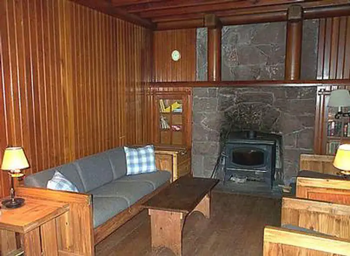
On the National Register nearby
- Bagby Guard StationBuilding · Estacada · 4.9 mi
Natural features
The campground is located in the Mt. Hood National Forest along the banks of the Hot Springs Fork of Collawash River, just north of the Bull of the Woods Wilderness. It is situated in a mixed evergreen forest at an elevation of about 1,250 feet. A variety of birds and wildlife make their homes in the area.
Recreation
Catch and release fishing for trout is allowed on the main fork of the Collawash, but the streams are closed to fishing. Whitewater rafting and kayaking are popular activities in the area. At least one 5-mile stretch of the more than 17-mile river boasts class III-IV whitewater. Visitors enjoy hiking in the Bull of the Woods Wilderness, which is south of the campground and offers numerous trailheads. Several primitive forest roads nearby are open to mountain biking.
Guidebooks for Oregon
We earn a small commission if you buy through these links. It does not change what we list.

Titles come from Open Library's catalog, matched by subject heading or by title.
Reference
Questions people ask
Do I need a reservation at Kingfisher?
Sites at Kingfisher are reservable on Recreation.gov. Any walk-up sites are listed on the booking page.
Source: Recreation.gov
What time is check-in at Kingfisher?
Check-in 2:00 PM, checkout 12:00 PM.
Source: Recreation.gov
Is Kingfisher open right now?
Closed for the season as of Oct 16, 2026.
Source: Forest Service status
How many sites does Kingfisher have?
23 sites, including 23 standard sites without power.
Source: Recreation.gov
Will my RV fit at Kingfisher?
The longest site here provides 35 feet of vehicle capacity. Most sites are shorter. The sidebar tool checks a trailer or motorhome length against every site.
Source: Will my RV fit
Are pets allowed at Kingfisher?
Yes, pets are allowed at Kingfisher. Leash rules apply.
Source: Recreation.gov
What is there to do at Kingfisher?
Catch and release fishing for trout is allowed on the main fork of the Collawash, but the streams are closed to fishing. The Recreation section on this page has the rest.
Source: Recreation
What if Kingfisher is full?
The nearest public campgrounds are Raab (3.5 mi), Bagby Campground (4.1 mi, first-come), and Riverford Campground (4.2 mi, first-come).
Source: Campgrounds nearby