Lane Spring Recreation Area
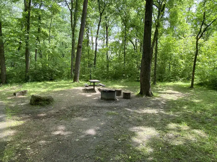
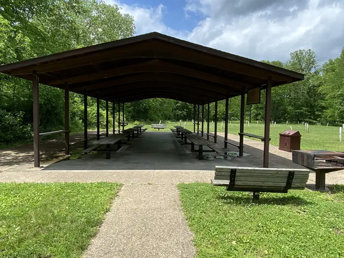
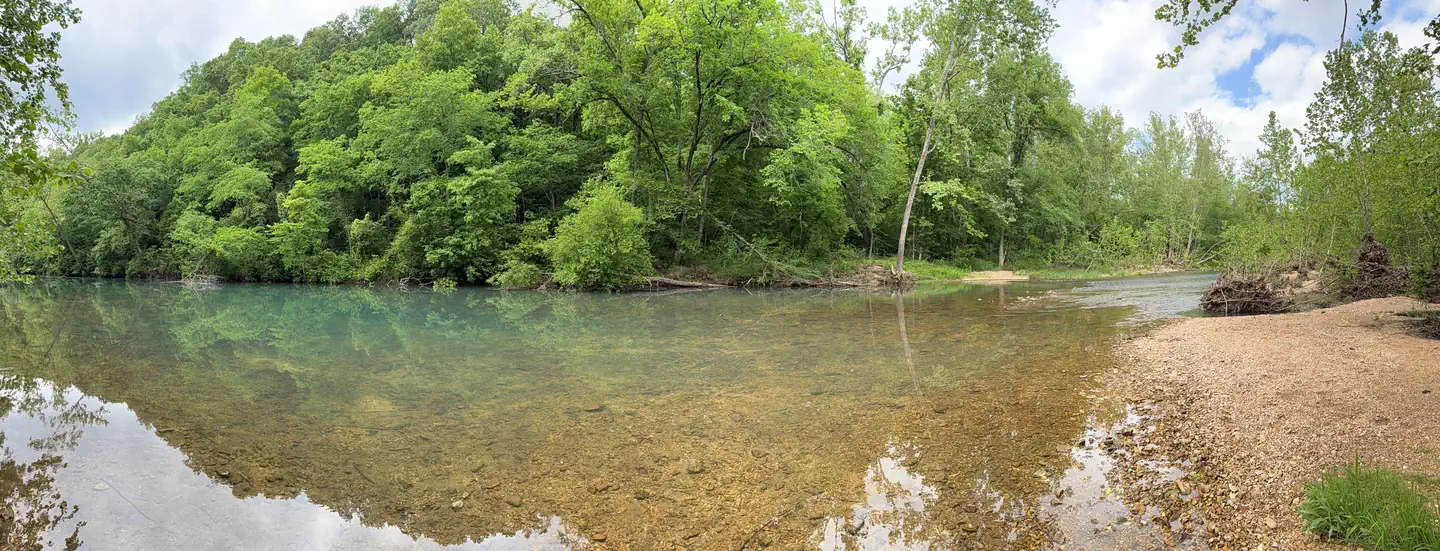
Lane Spring Recreation Area provides a peaceful setting along Little Piney Creek and a scenic patio overlooking beautiful Lane Spring. A large, accessible picnic area with two pavilions can be reserved. The site has multiple first come first serve campsites if an overnight stay is desired. A variety of outdoor recreation opportunities are in the area.
Some sites take reservations on Recreation.gov. Others are first-come, first-served.
More like this: electric hookups in Missouri · first-come in Missouri · reservable in Missouri · pets allowed in Missouri · group sites in Missouri
Check availability on Recreation.gov ↗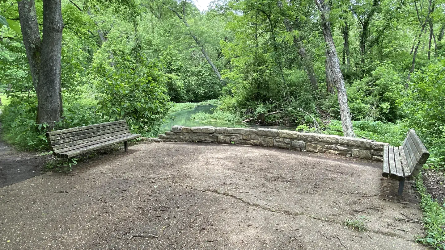
Site mix
| Standard with electric | 10 |
| Standard, no hookups | 8 |
| Group sites | 3 |
| group picnic area | 2 |
| Host/management | 2 |
Site guide
23 sites in 4 loops. Tap a filter to narrow the list; the map follows.
| Site | Loop | Type | Surface | Shade | Power | Waterfront | People / vehicles | Accessible |
|---|---|---|---|---|---|---|---|---|
| Dogwood Pavilion | DGWP | Group Picnic Area | Paved | Full | 15 amp | Riverfront | 100 / 38 | Yes |
| 01 | Loop A | Electric | Paved | Full | 15 amp | Riverfront | 8 / 2 | Yes |
| 02 | Loop A | Electric | Paved | Full | 15 amp | Riverfront | 8 / 2 | Yes |
| 03 | Loop A | Electric | Paved | Full | 15 amp | Riverfront | 8 / 2 | Yes |
| 04 | Loop A | Electric | Paved | Full | 15 amp | Riverfront | 8 / 2 | Yes |
| 05 | Loop A | Electric | Paved | Full | 15 amp | Riverfront | 8 / 2 | Yes |
| 06 | Loop A | Electric | Paved | Full | 15 amp | Riverfront | 8 / 2 | Yes |
| 07 | Loop A | Electric | Paved | Full | 15 amp | Riverfront | 8 / 2 | Yes |
| 08 | Loop A | Standard | Paved | Full | 15 amp | Riverfront | 8 / 2 | Yes |
| 09 | Loop A | Standard | Paved | Full | 15 amp | Riverfront | 8 / 2 | Yes |
Per-site records as published by the managing agency on Recreation.gov. Blank cells mean the agency listed nothing for that site. Check-in 7:00 AM, checkout 9:00 PM.
Amenities & rules
| Hookups | Electric |
| Pets | Allowed |
| Accessibility | Sites Dogwood Pavilion, 01, 02, 03 and 21 more are listed accessible |
The recreation area offers a picnic area with two group picnic pavilions, each equipped with tables, grills and electric outlets. Each can accommodate up to 100 people. If unreserved, the pavilions are available on a first-come, first-served basis. Each pavillion has 10-20 parking spots with handicap accessible paths to pavillions. These parking spots are not reservable, however there are additional parking spaces that have access to the spring. Additional individual picnic sites are available near the spring. Several family campsites are available as well. Each site is equipped with a table, lantern post and campfire ring with grill. Vault toilets and drinking water are provided.
Individual sites vary. Confirm on Recreation.gov or with the managing office.
Season & status
| Status | Open |
| Season | March 1 to October 31 |
| Forest | Mark Twain National Forest |
| Booking | Reservation needed for the group picnic pavilion - The pavilion is first come, first served if it's not already reserved. |
| Fees | Payment is by cash or check only, no credit cards are accepted at the recreation area. Camping $15 per single. $25 per single electric. $30 per double. Day Use Per car: $5/day. Per bus: $10/day. Group Picnic Pavilion:$50 per day (100 people max). |
| Rules | Campers required to check-in with on-site host upon arrival and to pick up fee envelope if the site was not reserved online. Campground: Fees will be paid at the fee tube provided. Fireworks are prohibited. Campsite parking allows for two vehicles per site. Park only in designated parking areas. No more than 8 people are permitted at single sites (16 for double sites). |
Weather by month
Getting there
From Rolla, Missouri, travel 12 miles south on U.S. Highway 63, then continue 1 mile west on Entrance Road.
| Nearest town | Rolla, Missouri |
| Coordinates | 37.7931° N, 91.8361° W · Directions ↗ |
Supplies & services
| Dump station | Dump station ↗ | 25 mi |
| Outdoor gear | Ozark Outdoors ↗ | 38.3 mi |
| RV sales & service | Bourbon RV ↗ | 40.4 mi |
Locations © OpenStreetMap contributors. Call ahead; hours change seasonally.
Explore
Video
video review Lane spring recreation area and campground outside of Rolla Missouri
Trails nearby
- 0.1 miBlossom Rock1.1 mi trail · hiking, bike
- 0.4 miCedar Bluff Trail1.3 mi trail · hiking, bike
- 4.2 miKaintuck Trail Yellow ↗5.4 mi trail · hiking, horse, bike
- 4.6 miSouth East Trailhead Spur0.05 mi trail · hiking, horse, bike
- 4.7 miKaintuck Trail Orange3.4 mi trail · hiking, horse, bike
- 4.7 miKaintuck Trail South Red1.6 mi trail · hiking, horse, bike
Trailheads within three miles
- 0.3 miBlossom Rock trailhead ↗Mark Twain National Forest · Season January to December
- 0.4 miCedar Bluff trailhead ↗Mark Twain National Forest · Season January to December
Trail and trailhead records are the Forest Service's. Distances are straight-line to the nearer trail end. Trail conditions are not tracked here.
Other campgrounds nearby


On the National Register nearby
- Community TheaterBuilding · Newburg · 9.1 mi
- Phelps County CourthouseBuilding · Rolla · 11.1 mi
- Phelps County JailBuilding · Rolla · 11.1 mi
Natural features
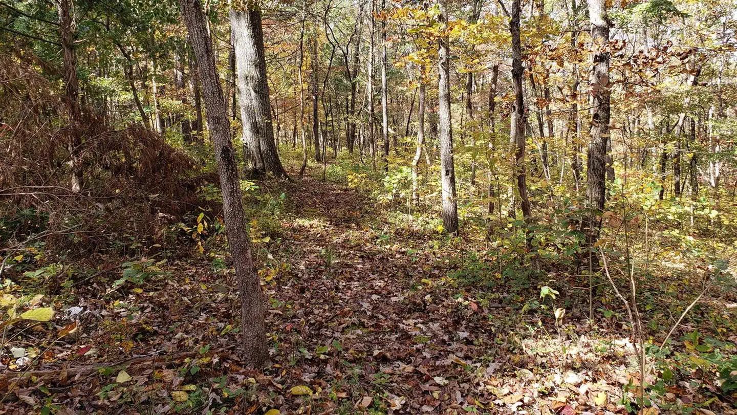
The recreation area is situated along Little Piney Creek, with some waterfront campsites available. A beautiful hardwood forest covers the area, which lies in the northwestern portion of the Mark Twain National Forest. An accessible shaded stone patio overlooks tranquil Lane Spring, a bubbling spring with watercress and native plant species. It is bordered by a variety of trees, including sycamore, cypress, oak and many others.
Recreation
Trout fishing is popular along the portion of the creek nearest Lane Spring, as it is managed by a wild trout fishery. The fish population is self-sustained instead of being stocked. Only artificial lures and flies may be used, and a daily limit is applied of one trout measuring 18 inches or longer. Bass and sunfish are also plentiful. The 1.25-mile Blossom Rock Trail and the 1.5-mile Cedar Bluff Trail traverse through lush bottomland vegetation with abundant wildflowers, before climbing to views of the river and rock outcroppings. Birding and wildlife viewing is popular along the trails.
Guidebooks for Missouri
We earn a small commission if you buy through these links. It does not change what we list.
Titles come from Open Library's catalog, matched by subject heading or by title.
Reference
Questions people ask
Do I need a reservation at Lane Spring Recreation Area?
For some sites. Some sites take reservations on Recreation.gov. Others are first-come, first-served.
Source: Recreation.gov
How much does it cost to camp at Lane Spring Recreation Area?
Payment is by cash or check only, no credit cards are accepted at the recreation area. Camping $15 per single. $25 per single electric.
Source: Recreation.gov
What time is check-in at Lane Spring Recreation Area?
Check-in 7:00 AM, checkout 9:00 PM.
Source: Recreation.gov
Is Lane Spring Recreation Area open right now?
Open as of Oct 16, 2026. Season March 1 to October 31.
Source: Forest Service status
How many sites does Lane Spring Recreation Area have?
25 sites, including 10 standard sites with power, 8 standard sites without power, 3 group sites, and 2 group picnic area.
Source: Recreation.gov
Does Lane Spring Recreation Area have hookups?
Yes, electric hookups at some sites.
Source: Recreation.gov
Are pets allowed at Lane Spring Recreation Area?
Yes, pets are allowed at Lane Spring Recreation Area. Leash rules apply.
Source: Recreation.gov
Are there accessible sites at Lane Spring Recreation Area?
Sites Dogwood Pavilion, 01, 02, and 03 are listed accessible on Recreation.gov, 25 sites in all. What that covers (a paved pad, an accessible table, a nearby accessible restroom) is on each site's booking page.
Source: Recreation.gov
Is there cell service at Lane Spring Recreation Area?
FCC coverage maps show Verizon 5G, AT&T 5G, and T-Mobile 5G at the campground point. Terrain changes that from one site to the next.
Source: FCC Broadband Map
What is there to do at Lane Spring Recreation Area?
Trout fishing is popular along the portion of the creek nearest Lane Spring, as it is managed by a wild trout fishery. The Recreation section on this page has the rest.
Source: Recreation
What is the nearest town to Lane Spring Recreation Area?
Rolla, Missouri.
Source: Getting there
What if Lane Spring Recreation Area is full?
The nearest public campgrounds are Paddy Creek Campground (20 mi, first-come), Akers (31.9 mi), and Red Bluff Campground (36.6 mi, partly first-come).
Source: Campgrounds nearby