Upper Narrows
Upper Narrows Campground is located southwest of Grantsville, Utah, in South Willow Canyon at an elevation of 6,400 feet. Visitors enjoy exploring local trails.
More like this: reservable in Utah · tent only in Utah · pets allowed in Utah · group sites in Utah
Check availability on Recreation.gov ↗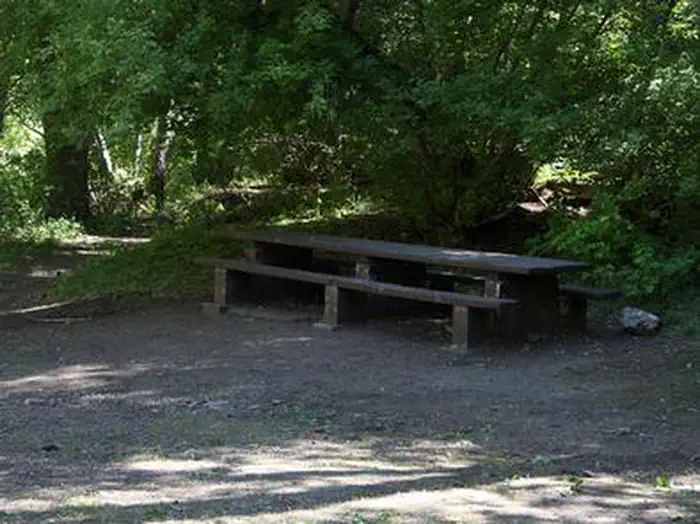
Site mix
| group walk to | 1 |
| Host/management | 7 |
Site guide
1 site. Tap a filter to narrow the list; the map follows.
| Site | Surface | Shade | Water / sewer | People / vehicles | Fires |
|---|---|---|---|---|---|
| 001 | Gravel | Full | No / – | 50 / 5 | Yes |
Per-site records as published by the managing agency on Recreation.gov. Blank cells mean the agency listed nothing for that site. Check-in 3:00 PM, checkout 12:00 PM.
Amenities & rules
| Equipment | Tents |
| Pets | Allowed |
| Campfires | Allowed, subject to restrictions |
| Fees | Cash, Check, or Scan & Pay (with recreation.gov app). 1 Group Site - $125.00, capacity - 50 people + 5 vehicles. 6 Single Sites (FCFS) - $22.00, capacity - 8 people + 1 vehicle. Extra Vehicle - $10.00 per vehicle (paid on-site cash/check). |
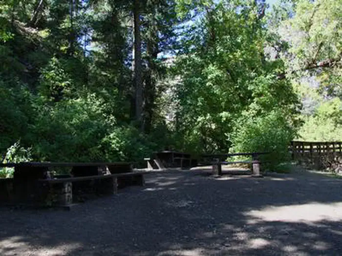
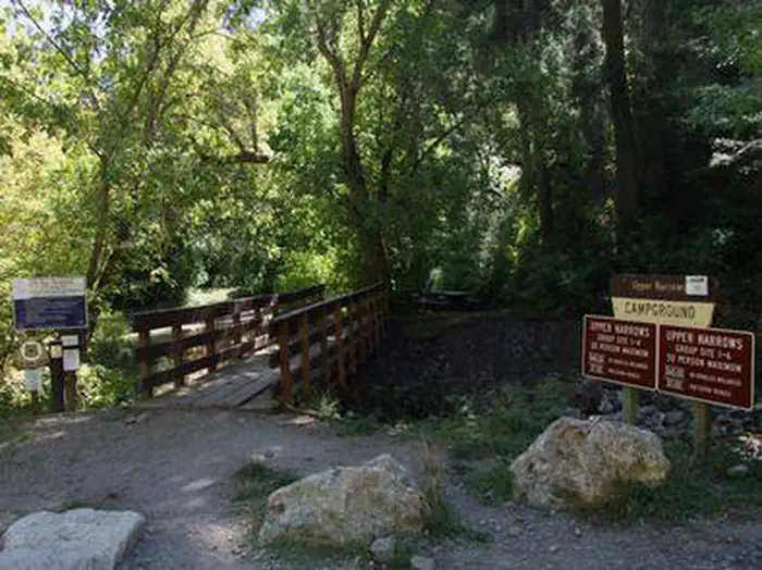
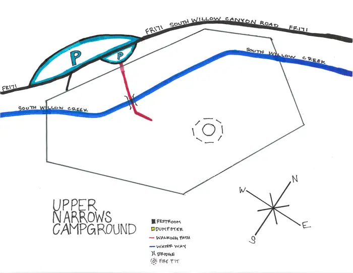
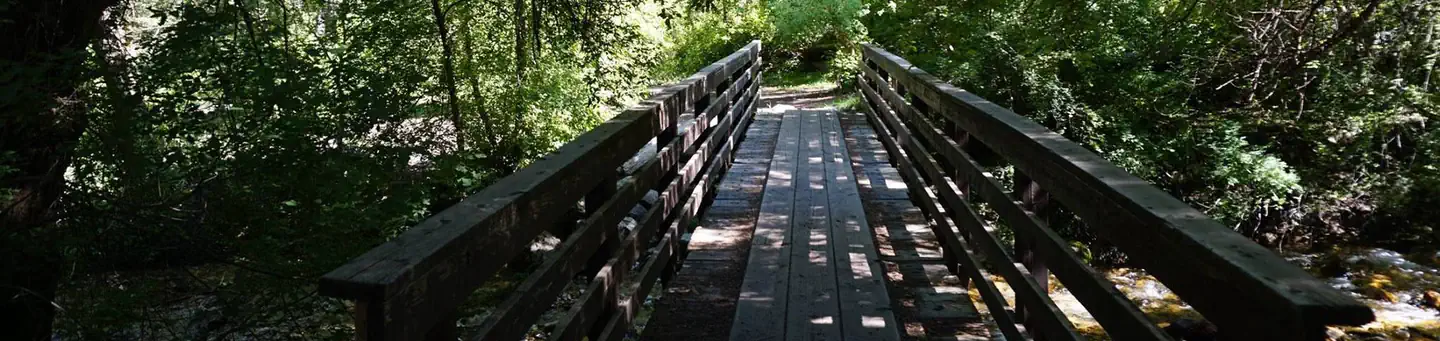
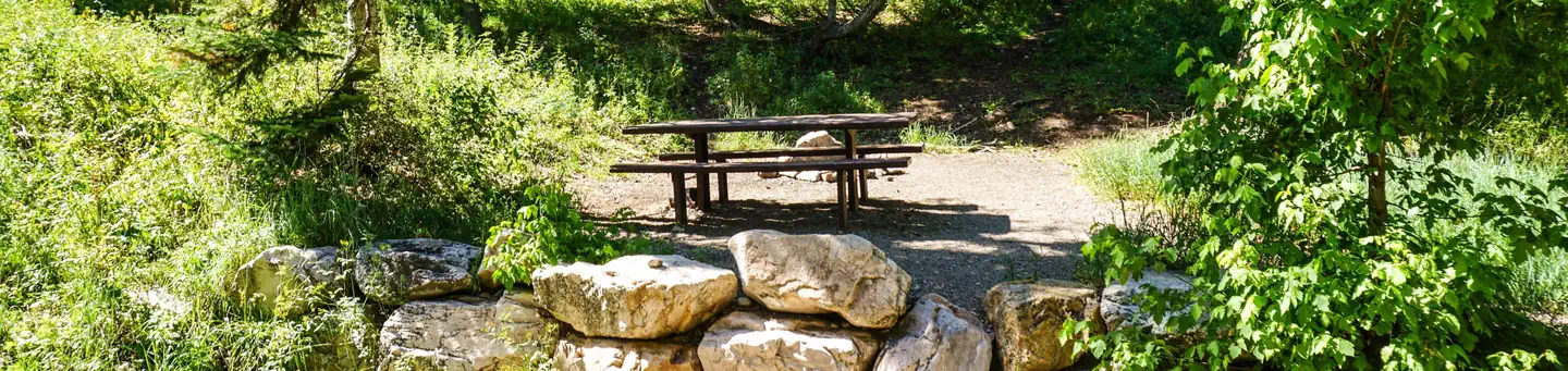
This primitive campground is dispersed over a mile-long stretch of road. One walk-to group site, ideal for family reunions or church groups, is available for up to 50 people. A footbridge must be crossed to access the site from the parking area. Picnic tables and campfire rings are provided, as are vault toilets. Roads and parking spurs are dirt.
Individual sites vary. Confirm on Recreation.gov or with the managing office.
Season & status
| Status | Closed for the season. Forest Service sites close for the season; check the official page for the reopening date. |
| Forest | Uinta-Wasatch-Cache National Forest |
Weather by month
Getting there
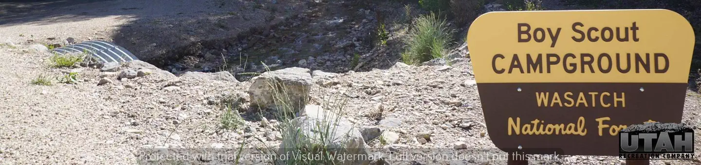
From Salt Lake City, head west on I-80 for 36 miles. Take the Stansbury-Tooele/Route 35 exit and travel south 3 miles to Route 138 West. Continue for 10 miles to Grantsville. Go through Grantsville to Cooley Street and turn south; go 5 miles to the South Willow Canyon turnoff. Boy Scout Campground is located 3 miles from the forest boundary.
| Nearest town | Dugway, Utah |
| Coordinates | 40.4917° N, 112.5908° W · Directions ↗ |
Charges and cancellations
- Change and Cancellation Policies and Fees
- Overnight and Day Use Facilities: To ensure fairness, reservation arrival or departure dates may not be changed beyond the booking window until 18 days after booking the reservation.
- Camping / Day Use: A $10.00 service fee will apply if you change or cancel your reservation (including campsites, cabins, lookouts, group facilities, etc.). The $10.00 service fee will be deducted from the refund amount.
- You can cancel or change reservations through Recreation.gov or by calling 1-877-444-6777.
- Late Cancellations
- Overnight and Day Use Facilities: Late cancellations are those cancelled between 12:01 a.m. (Eastern) on the day before arrival and check out time on the day after arrival.
- Individual Campsites: If a customer cancels a reservation the day before or on the day of arrival they will be charged a $10.00 service fee and will also forfeit the first night's use fee (not to exceed the total paid for the original reservation). Cancellations for a single night's reservation will forfeit the entire use fee but no cancellation fee will apply.
- Cabins / Lookouts: Customers will be charged a $10.00 cancellation fee and forfeit the first night's use fee if a cabin or lookout reservation is cancelled within 14 days of the scheduled arrival date. Cancellations for a single night's use will not be assessed a service fee.
- Group Facility: If a customer cancels a group overnight facility reservation within 14 days of the scheduled arrival date they will be charged the $10.00 service fee and forfeit the first night's use fee. Cancellations for a single night's use will not be assessed a service fee.
- Group Day Use Area: If a customer cancels a group day use facility reservation within 14 days of the scheduled arrival date, they will forfeit the total day use fee with no service fee charge.
- No-Shows
- Camping / Day Use: A camping no-show customer is one who does not arrive at a campground and does not cancel the reservation by check-out time on the day after the scheduled arrival date. Reserved campsites and group overnight facilities will be held until check-out time on the day following your scheduled arrival. Group day-use facilities will be held until check-in time on your scheduled arrival
- If a customer does not arrive at the campground or group facility by check-out time the day after arrival or does not cancel the reservation by the times listed under "Late Cancellations" above, the customer may be assessed a $20.00 service fee and forfeit use fees.
- Refunds
- Customers must request refunds no later than 14 days after the scheduled departure date. Recreation.gov will not grant refund requests after 14 days of departure.
- Reservation Fee: For some facilities, tours or permits an additional reservation fee is charged. For some overnight and day-use facilities, an additional non-refundable reservation fee may apply. The non-refundable reservation fee for tours and tickets is $1.00. The non-refundable reservation fee for permits varies by location.
- Refunds for Bankcard Purchases: Refunds for bank card payments will be issued as a credit to the original bank card.
- Refunds for Check or Cash Purchases: Refunds for Recreation.gov payments made by check or money order, and cash payments at selected campgrounds will be issued a check refund. A refund will be processed within 30 days of receipt and approval. Please Note: Refund requests made during or after departure can only be processed when approved by the facility management staff based upon local policy.
- Refunds for Emergency Closures: In the event of an emergency closure, the Recreation.gov team will attempt to notify users and offer alternate dates (as appropriate). If this is not possible, reservations will be cancelled and all fees paid will be refunded. Reservation fees for free tickets are non-refundable in the event of an emergency closure.
- Recreation.gov Billing Information
Fire nearby
- PrescribedJacob City Trailhead Rx
15 mi from the campground · 5 acres
- PrescribedCorner Canyon Rx
41 mi from the campground
- PrescribedPepperwood Rx
41 mi from the campground
Distance is to the reported incident point, not the fire edge. Call the managing office before you drive.
Supplies & services
| Outdoor gear | Sierra ↗ | 15.7 mi |
| Dump station | Dump station ↗ | 34.2 mi |
| RV sales & service | Camping World ↗ | 36.9 mi |
Locations © OpenStreetMap contributors. Call ahead; hours change seasonally.
Explore
Trails nearby
- 0.8 miMining Fork1.4 mi trail · hiking, horse
- 1 miMill Fork Canyon3.1 mi trail · hiking, horse
- 1.6 miDry Lake (pockets Fork)1.5 mi trail · hiking, horse
- 1.7 miStansbury Crest ↗10.4 mi trail · hiking, horse
- 2.4 miAbbots Fork ↗5.7 mi trail · hiking, horse, bike
- 2.5 miNorth Willow/Pass Canyon ↗5.1 mi trail · hiking, horse, bike
Trail and trailhead records are the Forest Service's. Distances are straight-line to the nearer trail end. Trail conditions are not tracked here.
Public land it sits in
This campground sits inside Deseret Peak Wilderness.
- inDeseret Peak Wilderness ↗Wilderness · Forest Service · 25,078 acres
- 12.6 miCedar Mountain Wilderness Area ↗Wilderness · Bureau of Land Management · 99,428 acres
Each unit is published as a centre point and an acreage rather than a boundary, so this section stands it in for a circle of the same area. Whether a campground is inside, and how far it is from one it is outside, are both approximate.
Other campgrounds nearby

On the National Register nearby
- Iosepa Settlement CemeterySite · Iosepa · 8.2 mi
- Anderson–Clark FarmsteadBuilding · Grantsville · 9.7 mi
- Hilda Erickson HouseBuilding · Grantsville · 9.7 mi
Natural features
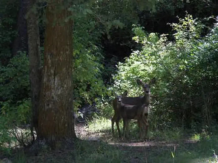
The remote desert canyon is forested with oak, maple, and juniper trees, which offer partial shade. Willow Creek runs alongside the site.
Recreation
The multi-use Stansbury Front and Medina Flat Trails begin nearby, offering access to the rugged Deseret Peak Wilderness. Willow Creek offers rainbow and brown trout fishing.
Guidebooks for Utah
We earn a small commission if you buy through these links. It does not change what we list.


Titles come from Open Library's catalog, matched by subject heading or by title.
Reference
Questions people ask
Do I need a reservation at Upper Narrows?
Sites at Upper Narrows are reservable on Recreation.gov. Any walk-up sites are listed on the booking page.
Source: Recreation.gov
How much does it cost to camp at Upper Narrows?
Cash, Check, or Scan & Pay (with recreation.gov app). 1 Group Site - $125.00, capacity - 50 people + 5 vehicles. 6 Single Sites (FCFS) - $22.00, capacity - 8 people + 1 vehicle.
Source: Recreation.gov
What time is check-in at Upper Narrows?
Check-in 3:00 PM, checkout 12:00 PM.
Source: Recreation.gov
What does it cost to cancel a reservation at Upper Narrows?
Camping / Day Use: A $10.00 service fee will apply if you change or cancel your reservation (including campsites, cabins, lookouts, group facilities, etc.). The $10.00 service fee will be deducted from the refund amount.
Source: Charges and cancellations
Is Upper Narrows open right now?
Closed for the season as of Oct 16, 2026.
Source: Forest Service status
How many sites does Upper Narrows have?
8 sites, including 1 group walk to.
Source: Recreation.gov
Can I bring an RV to Upper Narrows?
Upper Narrows is listed for tents only.
Source: Recreation.gov
Are pets allowed at Upper Narrows?
Yes, pets are allowed at Upper Narrows. Leash rules apply.
Source: Recreation.gov
Can I have a campfire at Upper Narrows?
Fires are allowed in the provided rings under normal conditions. As of 2026-10-16, there are 3 active fires within 50 miles, so check current restrictions before you light one.
Source: Fire nearby
Is there cell service at Upper Narrows?
FCC coverage maps show AT&T 4G LTE at the campground point. Terrain changes that from one site to the next.
Source: FCC Broadband Map
What is there to do at Upper Narrows?
The multi-use Stansbury Front and Medina Flat Trails begin nearby, offering access to the rugged Deseret Peak Wilderness. The Recreation section on this page has the rest.
Source: Recreation
What is the nearest town to Upper Narrows?
Dugway, Utah.
Source: Getting there