Intake Campground
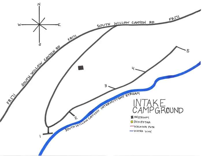
Intake Campground is located southwest of Grantsville, Utah, in South Willow Canyon at an elevation of 6,320 feet. It’s located in the Stansbury Range where visitors enjoy exploring local trails.
More like this: reservable in Utah · tent only in Utah · pets allowed in Utah
Check availability on Recreation.gov ↗
Site mix
| Standard, no hookups | 4 |
| Host/management | 2 |
Site guide
4 sites. Tap a filter to narrow the list; the map follows.
| Site | Water / sewer | People / vehicles | Fires |
|---|---|---|---|
| 1 | No / – | 8 / 1 | Yes |
| 2 | No / – | 8 / 1 | Yes |
| 3 | No / – | 8 / 1 | Yes |
| 4 | No / – | 8 / 1 | Yes |
Per-site records as published by the managing agency on Recreation.gov. Blank cells mean the agency listed nothing for that site. Check-in 03:00 PM, checkout 12:00 PM.
Amenities & rules
| Equipment | Tents |
| Pets | Allowed |
| Campfires | Allowed, subject to restrictions |
| Fees | Cash, Check, or Scan & Pay. 4 Single Sites - $22.00, capacity 8 people + 1 vehicle. Day Use - $15.00. Extra Vehicles - $10.00 per vehicle (paid on-site cash/check). Firewood - $9.00 (from camp host at Boy Scout Campground - paid on-site cash/check) |
This campground has 4 single sites. This campground has vault restroom facilities. There is no water system in this campground, you will need to bring your own water.
Individual sites vary. Confirm on Recreation.gov or with the managing office.
Season & status
| Status | Closed for the season. Forest Service sites close for the season; check the official page for the reopening date. |
| Forest | Uinta-Wasatch-Cache National Forest |
| Rules | 7 day stay limit. |
Weather by month
Getting there
| Nearest town | Dugway, Utah |
| Coordinates | 40.4980° N, 112.5711° W · Directions ↗ |
Good to know
- Although the South Willow Canyon road is paved, it is pitted with chuckholes and is not recommended for trailer use.
Charges and cancellations
A $10 service fee will be withheld from any refund for a cancellation. Depending on when you cancel in relation to your arrival day, it may be considered a late cancellation (see below). Changing an Existing Reservation: When changes are made prior to the cut-off window: If a customer wants to switch dates that are entirely outside of the original reservation dates, there is a $10 change fee. There is no change fee if a customer extends or shortens a reservation, as long as the change includes dates from the original reservation. If they choose to depart early, they may forfeit the recreation fee for the day of departure. There is no change fee if the customer wants to switch sites that are the same price with the same reservation dates in the same facility. If a reservation is made that includes dates beyond the maximum booking window, that reservation cannot be changed until 18 days have passed from the original booking date.
Fire nearby
- PrescribedJacob City Trailhead Rx
14 mi from the campground · 5 acres
- PrescribedCorner Canyon Rx
40 mi from the campground
- PrescribedPepperwood Rx
40 mi from the campground
- PrescribedParleys/Lambs Canyon Piles Rx
50 mi from the campground
Distance is to the reported incident point, not the fire edge. Call the managing office before you drive.
Supplies & services
| Outdoor gear | Sierra ↗ | 14.6 mi |
| Dump station | Dump station ↗ | 33.1 mi |
| RV sales & service | Camping World ↗ | 35.8 mi |
Locations © OpenStreetMap contributors. Call ahead; hours change seasonally.
Explore
Trails nearby
- 1.8 miMining Fork1.4 mi trail · hiking, horse
- 2.1 miMill Fork Canyon3.1 mi trail · hiking, horse
- 2.2 miAbbots Fork ↗5.7 mi trail · hiking, horse, bike
- 2.2 miStansbury Crest ↗10.4 mi trail · hiking, horse
- 2.3 miNorth Willow/Pass Canyon ↗5.1 mi trail · hiking, horse, bike
- 2.7 miDry Lake (pockets Fork)1.5 mi trail · hiking, horse
Trail and trailhead records are the Forest Service's. Distances are straight-line to the nearer trail end. Trail conditions are not tracked here.
Public land it sits in
Deseret Peak Wilderness begins about 0.6 miles away, and it is the closest of these.
- 0.6 miDeseret Peak Wilderness ↗Wilderness · Forest Service · 25,078 acres
- 13.4 miCedar Mountain Wilderness Area ↗Wilderness · Bureau of Land Management · 99,428 acres
Each unit is published as a centre point and an acreage rather than a boundary, so this section stands it in for a circle of the same area. Whether a campground is inside, and how far it is from one it is outside, are both approximate.
Other campgrounds nearby
On the National Register nearby
- Anderson–Clark FarmsteadBuilding · Grantsville · 8.7 mi
- Hilda Erickson HouseBuilding · Grantsville · 8.7 mi
- Grantsville First Ward MeetinghouseBuilding · Grantsville · 8.8 mi
Natural features
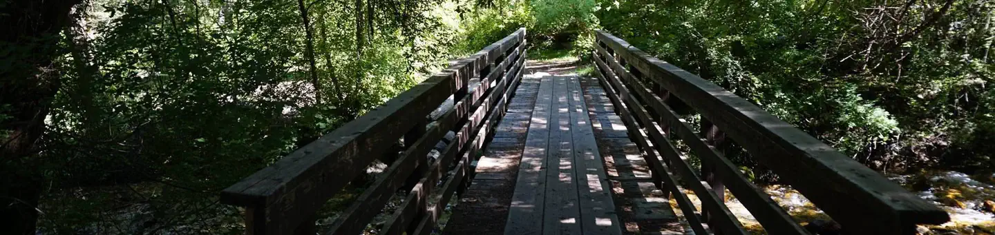
The remote desert canyon is forested with oak, maple and juniper trees, which offer partial shade. Willow Creek flows through the site.
Recreation
The multi-use Stansbury Front Trail and Medina Flat Trail begin across the road from the entrance, offering access to the rugged Deseret Peak Wilderness. Willow Creek offers rainbow and brown trout fishing.
Nearby
South Willow Canyon Road is a very scenic drive in the Tooele County, in western Utah, USA. The road is mostly paved but becomes gravel at the National Forest boundary and winds through some very interesting narrows, but any vehicle should be able to make it. The road is 7.1 miles long. The last 4 miles are unpaved. It’s noted for its fantastic wildlife. Along the road there are five forest service campgrounds. Snow can usually be found on the upper part of the trail from November to the middle of June. The road is pretty steep and narrow. The road ends at an elevation of 7,470ft (2.276m) above the sea level, at the beginning of the Deseret Peak Trail.
Guidebooks for Utah
We earn a small commission if you buy through these links. It does not change what we list.


Titles come from Open Library's catalog, matched by subject heading or by title.
Reference
Questions people ask
Do I need a reservation at Intake Campground?
Sites at Intake Campground are reservable on Recreation.gov. Any walk-up sites are listed on the booking page.
Source: Recreation.gov
How much does it cost to camp at Intake Campground?
Cash, Check, or Scan & Pay. 4 Single Sites - $22.00, capacity 8 people + 1 vehicle. Day Use - $15.00.
Source: Recreation.gov
What time is check-in at Intake Campground?
Check-in 03:00 PM, checkout 12:00 PM.
Source: Recreation.gov
What does it cost to cancel a reservation at Intake Campground?
A $10 service fee will be withheld from any refund for a cancellation.
Source: Charges and cancellations
Is Intake Campground open right now?
Closed for the season as of Oct 16, 2026.
Source: Forest Service status
How many sites does Intake Campground have?
6 sites, including 4 standard sites without power.
Source: Recreation.gov
Can I bring an RV to Intake Campground?
Intake Campground is listed for tents only.
Source: Recreation.gov
Are pets allowed at Intake Campground?
Yes, pets are allowed at Intake Campground. Leash rules apply.
Source: Recreation.gov
Can I have a campfire at Intake Campground?
Fires are allowed in the provided rings under normal conditions. As of 2026-10-16, there are 4 active fires within 50 miles, so check current restrictions before you light one. 7 day stay limit.
Source: Fire nearby
Is there cell service at Intake Campground?
FCC coverage maps show AT&T 5G at the campground point. Terrain changes that from one site to the next.
Source: FCC Broadband Map
What is there to do at Intake Campground?
The multi-use Stansbury Front Trail and Medina Flat Trail begin across the road from the entrance, offering access to the rugged Deseret Peak Wilderness. The Recreation section on this page has the rest.
Source: Recreation
What is the nearest town to Intake Campground?
Dugway, Utah. South Willow Canyon Road is a very scenic drive in the Tooele County, in western Utah, USA.
Source: Getting there