Silver Mines
Silver Mines Campground is located on the St. Francis River in the Mark Twain National Forest. It offers a variety of recreational opportunities and abundant historic and geological wonders.
Some sites take reservations on Recreation.gov. Others are first-come, first-served.
More like this: electric hookups in Missouri · first-come in Missouri · reservable in Missouri · big rigs in Missouri · pets allowed in Missouri · group sites in Missouri
Check availability on Recreation.gov ↗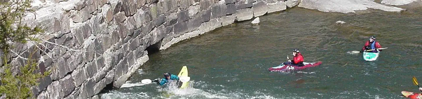


Site mix
| Standard, no hookups | 26 |
| Tent-only | 12 |
| Standard with electric | 9 |
| Group sites | 1 |
| group shelter nonelectric | 1 |
| Host/management | 27 |
Site guide
Will my RV fit
The longest site here provides 60 feet of vehicle capacity. Most sites are shorter.
49 sites in 7 loops. Tap a filter to narrow the list; the map follows.
| Site | Loop | Type | Entry | Fits, ft | Surface | Shade | Power | Waterfront | People / vehicles | Fires | Accessible |
|---|---|---|---|---|---|---|---|---|---|---|---|
| 022 | DBLS | Standard | Back-in | 30 | Paved | Partial | No | 16 / 4 | |||
| 034 | DBLS | Standard | Back-in | 60 | Paved | Partial | No | 16 / 4 | |||
| 001 | GRP | Group | 45 | Paved | Partial | No | 74 / 10 | Yes | |||
| Riverside Pavilion | GRP | Group Shelter Nonelectric | Gravel | Full | No | Riverfront | 75 / 20 | Yes | |||
| 039 | PSNG | Standard | Back-in | 35 | Paved | Partial | No | 8 / 2 | |||
| 041 | PSNG | Tent only | Back-in | Paved | Partial | No | 8 / 2 | ||||
| 042 | PSNG | Tent only | Back-in | Paved | Partial | No | 8 / 2 | ||||
| 045 | PSNG | Standard | Back-in | 30 | Paved | Partial | No | 8 / 2 | |||
| 046 | PSNG | Standard | Back-in | 35 | Paved | Partial | No | 8 / 2 | |||
| 048 | PSNG | Tent only | Back-in | Paved | Partial | No | 8 / 2 |
Per-site records as published by the managing agency on Recreation.gov. Blank cells mean the agency listed nothing for that site. Check-in 3:00 PM, checkout 2:00 PM.
Amenities & rules
| Hookups | Electric |
| Max vehicle length | 60 ft |
| Equipment | RVs & trailers, Tents |
| Pets | Allowed |
| Campfires | Allowed, subject to restrictions |
| Accessibility | Site Riverside Pavilion is listed accessible |
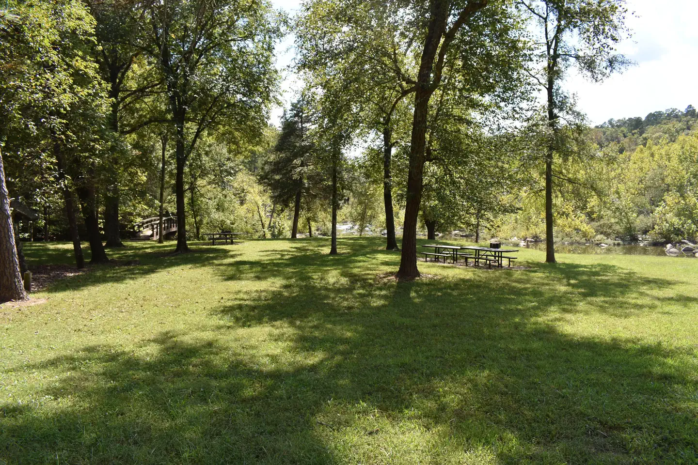
The campground offers dozens of single-family campsites, as well as large group sites, all available for tent and RV camping. Some sites have 30-amp electric hookups. The large group site can accommodate up to 74 people. Picnic tables and campfire rings with grills are provided, as are accessible vault toilets and drinking water. Parking spurs vary from asphalt, to grass, to gravel or dirt.
Individual sites vary. Confirm on Recreation.gov or with the managing office.
Season & status
| Status | Open |
| Forest | Mark Twain National Forest |
| Booking | Nonelectric Sites: No reservation Nonelectric sits are available first come, first served. Electric Campsites: Reservation needed - Reservations can be made up to 6 months in advance of visit for… |
| Fees | Day-Use Fee: $5 per vehicle. $10 per bus. $40 for season pass. Camping Fees: $15 for single non-electric. $25 for double non-electric. $20 for single electric. $35 for double electric. Group campsite $50 to $100 depending upon number of campers. |
| Rules | ATV's & UTV's may not be operated within this recreation area. Fireworks are prohibited. Campsite parking allows for two vehicles per site. Park only in designated parking areas. No more than 8 people are permitted at single sites (16 for double sites). Dogs must be on a 6 foot leash in the campground. Only collect dead and downed wood for campfires. |
Weather by month
Getting there
From St. Louis, Missouri, take I-55 south to Festus, then take Highway 67 south to Fredericktown, then take Highway 72 west for approximately 4 miles to Highway D. Turn left and travel approximately 2 miles on Highway D to the recreation area.
| Coordinates | 37.5528° N, 90.4372° W · Directions ↗ |
Supplies & services
| Dump station | Dump station ↗ | 18.2 mi |
| RV sales & service | WK Machine ↗ | 54.7 mi |
Locations © OpenStreetMap contributors. Call ahead; hours change seasonally.
Explore
Video
Silver Mines Recreation Area + Millstream Gardens
Trails nearby
- 0.1 miSilver Mines West Trail0.5 mi trail · hiking, horse, bike
- 0.2 miSilver Mines East Trail0.8 mi trail · hiking, horse, bike
- 0.3 miSilver Mines Spurunder 0.1 mi trail · hiking, horse, bike
- 0.5 miSummit Spur0.09 mi trail · hiking, horse, bike
- 0.5 miSilver Mine Dam Trail0.4 mi trail · hiking, horse, bike
- 0.6 miRehkop Trail0.2 mi trail · hiking, horse, bike
Trailheads within three miles
- 0.1 miRiverside (Einstein Mine) Trailhead ↗Mark Twain National Forest · Season February to November
- 0.6 miSummit Loop Trailhead (Silver Mine Rec Area) ↗Mark Twain National Forest
Trail and trailhead records are the Forest Service's. Distances are straight-line to the nearer trail end. Trail conditions are not tracked here.
Public land it sits in
Rockpile Mountain Wilderness begins about 7.3 miles away, and it is the closest of these.
- 7.3 miRockpile Mountain Wilderness ↗Wilderness · Forest Service · 4,236 acres
- 11 miPilot Knob National Wildlife Refuge ↗National Wildlife Refuge · Fish and Wildlife Service · 96 acres
Each unit is published as a centre point and an acreage rather than a boundary, so this section stands it in for a circle of the same area. Whether a campground is inside, and how far it is from one it is outside, are both approximate.
Other campgrounds nearby

On the National Register nearby
- Fredericktown United States Post OfficeBuilding · Fredericktown · 7.8 mi
- Madison County CourthouseBuilding · Fredericktown · 7.8 mi
- Fredericktown Missouri Pacific Railroad DepotBuilding · Fredericktown · 8 mi
Natural features
This beautiful area is located along the St. Francis River, the only river in Missouri classified as a whitewater river. It is widely used for kayaking during springtime. The campground is located at a historic mining operation and is known for its Precambrian granite and felsite rocks. A variety of wildlife makes its home in the area.
Recreation
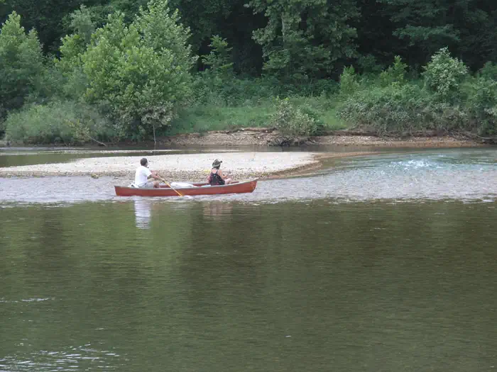
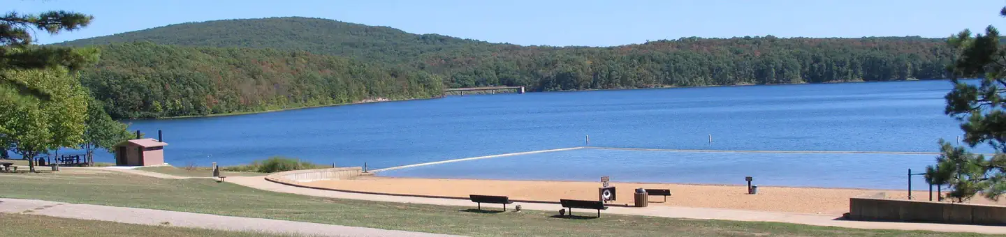
Parts of the river are available for swimming, while other portions provide good fishing. Whitewater kayaking is a popular activity during the springtime when water runs high. Depending on water levels, the state holds an annual kayaking competition the third weekend of March. The 2-mile Silver Mines Trail follows both sides of the river, leading to various picnic areas. A 1.2-mile trail spurs to a popular conservation area, where visitors can view spectacular rock formations along the river.
Nearby
The Millstream Gardens Conservation Area is located eight miles west of Fredericktown, or four miles west of the campground, on Highway 72. It is home to the scenic Tiemann Shut-ins and other spectacular sights along the riverbed.
Guidebooks for Missouri
We earn a small commission if you buy through these links. It does not change what we list.
Titles come from Open Library's catalog, matched by subject heading or by title.
Reference
Questions people ask
Do I need a reservation at Silver Mines?
For some sites. Some sites take reservations on Recreation.gov. Others are first-come, first-served.
Source: Recreation.gov
How much does it cost to camp at Silver Mines?
Day-Use Fee: $5 per vehicle. $10 per bus. $40 for season pass.
Source: Recreation.gov
What time is check-in at Silver Mines?
Check-in 3:00 PM, checkout 2:00 PM.
Source: Recreation.gov
Is Silver Mines open right now?
Open as of Oct 16, 2026.
Source: Forest Service status
How many sites does Silver Mines have?
76 sites, including 26 standard sites without power, 12 tent-only sites, 9 standard sites with power, and 1 group site.
Source: Recreation.gov
Will my RV fit at Silver Mines?
The longest site here provides 60 feet of vehicle capacity. Most sites are shorter. The sidebar tool checks a trailer or motorhome length against every site.
Source: Will my RV fit
Does Silver Mines have hookups?
Yes, electric hookups at some sites.
Source: Recreation.gov
Are pets allowed at Silver Mines?
Yes, pets are allowed at Silver Mines. Leash rules apply.
Source: Recreation.gov
Can I have a campfire at Silver Mines?
Fires are allowed in the provided rings under normal conditions. ATV's & UTV's may not be operated within this recreation area.
Source: Recreation.gov
Are there accessible sites at Silver Mines?
Site Riverside Pavilion is listed accessible on Recreation.gov. What that covers (a paved pad, an accessible table, a nearby accessible restroom) is on each site's booking page.
Source: Recreation.gov
What is there to do at Silver Mines?
Parts of the river are available for swimming, while other portions provide good fishing. The Recreation section on this page has the rest.
Source: Recreation
What if Silver Mines is full?
The nearest public campgrounds are Marble Creek Recreation Area (9 mi, first-come), Highway K (24 mi), and Council Bluff Recreation Area (29.6 mi, partly first-come).
Source: Campgrounds nearby