Te-Ah
Te-Ah Campground is located 28 miles east of Cedar City, Utah, in scenic Navajo Lake Basin. Touring bicycle groups commonly use Te-Ah as a stopover on their way through this beautiful corner of Utah. Fishing and canoeing on Navajo Lake are popular activities.
Some sites take reservations. Others are first-come, first-served.
More like this: first-come in Utah · reservable in Utah · big rigs in Utah · pets allowed in Utah · group sites in Utah · dark sky in Utah
Check availability on Recreation.gov ↗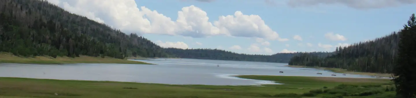
Site mix
| Standard, no hookups | 40 |
| Group sites | 1 |
| Host/management | 1 |
Site guide
Will my RV fit
The longest site here provides 116 feet of vehicle capacity. Most sites are shorter.
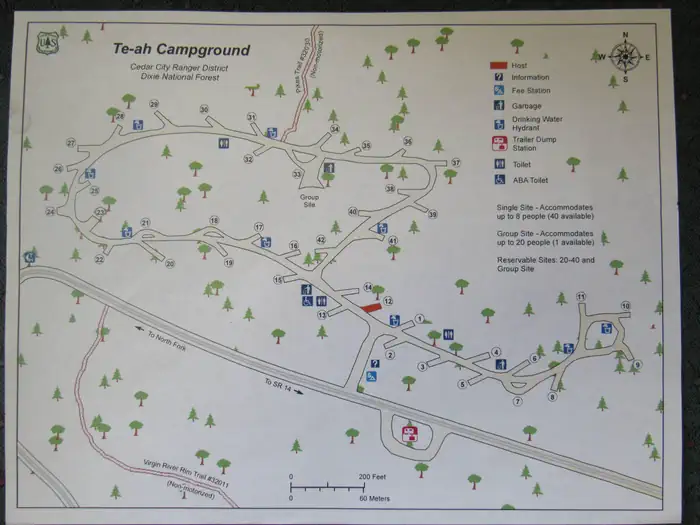
41 sites in 2 loops. Tap a filter to narrow the list; the map follows.
| Site | Loop | Type | Entry | Fits, ft | Surface | Shade | People / vehicles | Fires | Accessible |
|---|---|---|---|---|---|---|---|---|---|
| 001 | Lower | Standard | Back-in | 30 | Gravel | 8 / 1 | Yes | ||
| 002 | Lower | Standard | Back-in | 53 | Gravel | 8 / 1 | Yes | ||
| 003 | Lower | Standard | Back-in | 48 | Gravel | 8 / 1 | Yes | ||
| 004 | Lower | Standard | Back-in | 54 | Gravel | 8 / 1 | Yes | ||
| 005 | Lower | Standard | Back-in | 52 | Gravel | 8 / 1 | Yes | ||
| 006 | Lower | Standard | Back-in | 55 | Gravel | 8 / 1 | Yes | ||
| 007 | Lower | Standard | Pull-through | 116 | Gravel | 8 / 1 | Yes | ||
| 008 | Lower | Standard | Back-in | 48 | Gravel | 8 / 1 | Yes | ||
| 009 | Lower | Standard | Back-in | 48 | Gravel | 8 / 1 | Yes | ||
| 010 | Lower | Standard | Back-in | 45 | Gravel | 8 / 1 | Yes |
Per-site records as published by the managing agency on Recreation.gov. Blank cells mean the agency listed nothing for that site. Check-in 02:00 PM, checkout 11:00 AM.
Amenities & rules
| Hookups | None |
| Max vehicle length | 116 ft |
| Equipment | RVs & trailers, Tents |
| Pets | Allowed |
| Campfires | Allowed, subject to restrictions |
| Dark sky | 5.7 miles from Cedar Breaks National Monument, a certified International Dark Sky Park |
| Accessibility | Sites 017, 018, 023 are listed accessible |
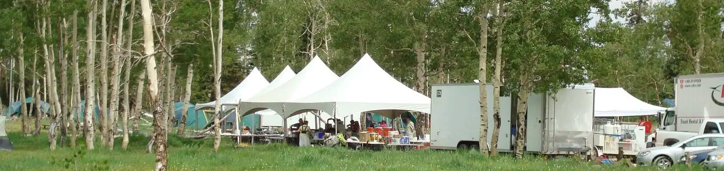
Te-Ah offers 41 single sites with picnic tables and campfire rings. One group site (#33) is available for up to a group size of 20 people. The site provides tables, bicycle wash and parking racks and a workspace for self-contained kitchens. Flush and vault toilets are provided and drinking water is piped from a spring. A newly paved road skirts the shoreline of Navajo Lake and leads to Te-ah on the lake's western edge, allowing good access for cars, trailers and bicycles. OHV/ATV's including street legal are not allowed in the campground. Please trailer them in and out of the campground.
Individual sites vary. Confirm on Recreation.gov or with the managing office.
Season & status
| Status | Closed for the season. Forest Service sites close for the season; check the official page for the reopening date. |
| Season | Late May to Early September |
| Forest | Dixie National Forest |
| Booking | or call 1-877-444-6777 Some single sites are available on a first come, first served basis |
| Fees | For current pricing and availability, visit www.recreation.gov |
| Rules | Quiet hours between 10 p.m. and 6 a.m. Campfires in approved campfire rings only. Fireworks are prohibited. Dogs must be on leash. OHV/ATV use prohibited in the campground. Maximum length of stay: 14 days |
Weather by month
Getting there
From Cedar City, Utah, take Highway 14 east for 25 miles. Turn south on Navajo Lake road and travel for 7 miles.
| Nearest town | Cedar City, Utah |
| Coordinates | 37.5328° N, 112.8125° W · Directions ↗ |
Fire nearby
- PrescribedLake Piles Rx
2 mi from the campground
Distance is to the reported incident point, not the fire edge. Call the managing office before you drive.
Supplies & services
| Dump station | Dump station ↗ | 0.3 mi |
| Outdoor gear | Sportsman's Warehouse ↗ | 16.6 mi |
| RV sales & service | Gander RV ↗ | 36.8 mi |
Locations © OpenStreetMap contributors. Call ahead; hours change seasonally.
Explore
Video
Te-Ah Campground - Dixie National Forest, UT
Worth a stop
Boat rentals, a boat ramp, lodging and supplies are available at nearby Navajo Lake Lodge. Also Duck Creek Pond is eight miles east great for fishing with the kids as well as the Duck Creek Visitor Center. Cascade Falls, Ice Cave and Mammoth Cave are also near-by favorites! Cedar Breaks National Monument is a short 20 minute drive, with hiking trails, guided tours and breathtaking scenery. Just outside Cedar Breaks is the Ashdown Gorge Wilderness Area, where hikers will find 10 miles of trails and the Twisted Forest, a stand of ancient bristlecone pine.
- 10.3 miChamberlain's Ranch Trailhead ↗Trailhead
- 13.7 miOrderville Gulch Trailhead ↗Trailhead
Trails nearby
- 0.3 miSouth Marathon Trail ↗6.2 mi trail · hiking, horse, bike
- 0.3 miNavajo Lake Loop Trail ↗8.5 mi trail · hiking, horse, bike
- 0.4 miPinks Trail0.5 mi trail · hiking, horse, bike
- 0.7 miLake View Ski0.8 mi trail · snowshoe, ski
- 1 miLodge Trail0.07 mi trail · hiking, horse, bike
- 1.1 miNavajo Lake Snowmobile Trail ↗10.9 mi trail · snowmobile, snowshoe, ski
Trail and trailhead records are the Forest Service's. Distances are straight-line to the nearer trail end. Trail conditions are not tracked here.
Public land it sits in
This campground sits inside Dixie National Forest.
- inDixie National Forest ↗National Forest · Forest Service · 1,711,285 acres
- 6.6 miAshdown Gorge Wilderness ↗Wilderness · Forest Service · 7,085 acres
- 7.1 miDeep Creek North Wilderness ↗Wilderness · Bureau of Land Management · 4,478 acres
Each unit is published as a centre point and an acreage rather than a boundary, so this section stands it in for a circle of the same area. Whether a campground is inside, and how far it is from one it is outside, are both approximate.
Other campgrounds nearby

On the National Register nearby
- Caretaker's CabinBuilding · Cedar City · 5.9 mi
- Visitor CenterBuilding · Cedar City · 6.1 mi
Natural features
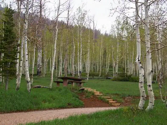
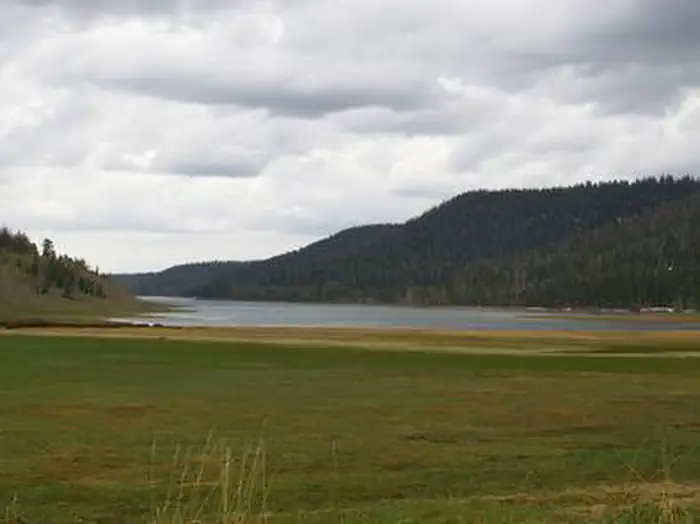
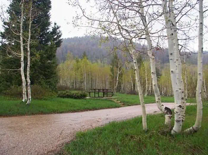
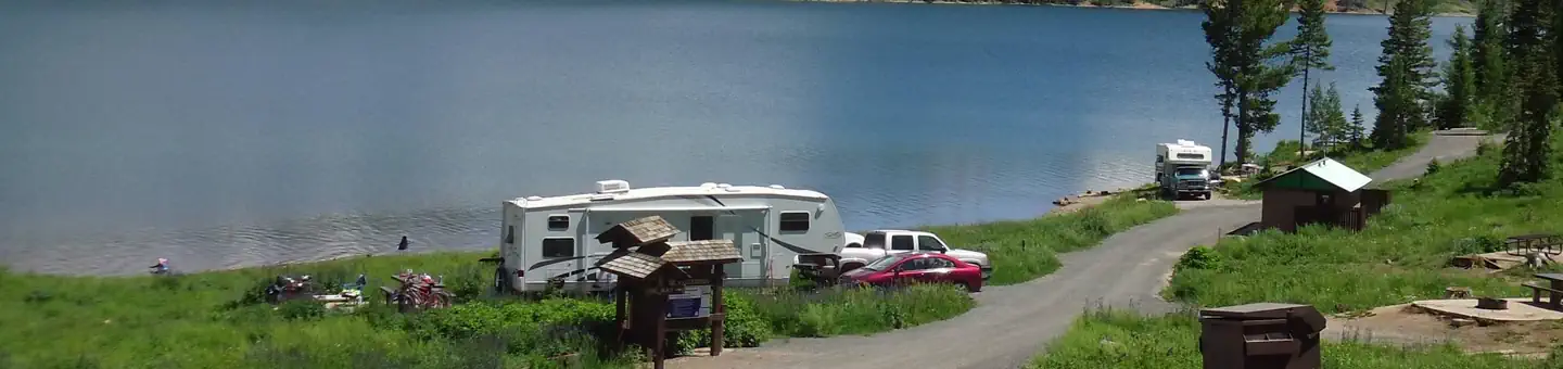
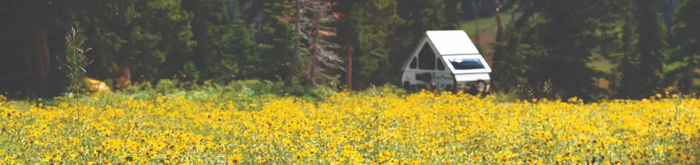
The campground is situated on the edge of a meadow high on the Colorado Plateau at an elevation of 9,200 feet. An aspen forest covers the campground. Navajo Lake can be viewed in the distance from several sites.
Recreation
Navajo Lake offers great canoeing, kayaking and fishing. Hiking and biking are popular activities as well. The Cascade Falls Trailhead is located in the campground. This beautiful trail has abundant wildlife and vegetation. The 34-mile Virgin River Rim Trail passes near the campground and is open to hiking, mountain biking and horseback riding.
Guidebooks for Utah
We earn a small commission if you buy through these links. It does not change what we list.


Titles come from Open Library's catalog, matched by subject heading or by title.
Reference
Questions people ask
Do I need a reservation at Te-Ah?
For some sites. Some sites take reservations. Others are first-come, first-served.
Source: Recreation.gov
How much does it cost to camp at Te-Ah?
For current pricing and availability, visit www.recreation.gov
Source: Recreation.gov
What time is check-in at Te-Ah?
Check-in 02:00 PM, checkout 11:00 AM.
Source: Recreation.gov
Is Te-Ah open right now?
Closed for the season as of Oct 16, 2026. Season Late May to Early September.
Source: Forest Service status
How many sites does Te-Ah have?
42 sites, including 40 standard sites without power and 1 group site.
Source: Recreation.gov
Will my RV fit at Te-Ah?
Recreation.gov lists no practical vehicle capacity limit for the largest site here, which usually means pull-through or open parking. The sidebar tool checks a trailer or motorhome length against every site.
Source: Will my RV fit
Are pets allowed at Te-Ah?
Yes, pets are allowed at Te-Ah. Leash rules apply.
Source: Recreation.gov
Can I have a campfire at Te-Ah?
Fires are allowed in the provided rings under normal conditions. As of 2026-10-16, there is 1 active fire within 50 miles, so check current restrictions before you light one. Quiet hours between 10 p.m.
Source: Fire nearby
Are there accessible sites at Te-Ah?
Sites 017, 018, and 023 are listed accessible on Recreation.gov. What that covers (a paved pad, an accessible table, a nearby accessible restroom) is on each site's booking page.
Source: Recreation.gov
Is Te-Ah good for stargazing?
Cedar Breaks National Monument, a certified International Dark Sky Park, is 5.7 miles away. Skies that dark carry for miles; a moonless night here should show the Milky Way.
Source: DarkSky International
What is there to do at Te-Ah?
Navajo Lake offers great canoeing, kayaking and fishing. The Recreation section on this page has the rest.
Source: Recreation
What is the nearest town to Te-Ah?
Cedar City, Utah. Boat rentals, a boat ramp, lodging and supplies are available at nearby Navajo Lake Lodge.
Source: Getting there