Lone Cone Cabin
The Lone Cone Cabin is a great destination for an overnight getaway or a week-long hunting trip. Located just 24 miles from Norwood, Colorado, the facility can be accessed in the summer and fall by passenger vehicle or 4WD, depending on conditions.
Check availability on Recreation.gov ↗

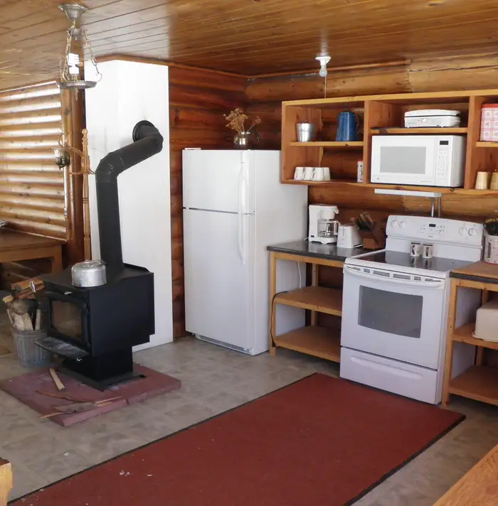
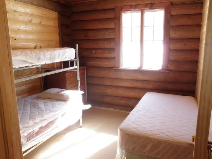
Site mix
| Cabins with electric | 1 |
Site guide
1 site. Tap a filter to narrow the list; the map follows.
| Site | Entry | Fits, ft | Surface | Waterfront | People / vehicles | Fires |
|---|---|---|---|---|---|---|
| 001 | Pull-through | 1000 | Gravel | Springs | 10 / 8 | Yes |
Per-site records as published by the managing agency on Recreation.gov. Blank cells mean the agency listed nothing for that site. Check-in 3:00 PM, checkout 12:00 PM.
Amenities & rules
| Campfires | Allowed, subject to restrictions |
There are two bedrooms; one with two bunkbeds, and the other room has a queen bed, and a queen-sized hide-a-bed couch in the living room (can sleep up to 8 full sized adults). The cabin has two woodstoves, one flush toilet, a shower, cleaning supplies, and a fully equipped kitchen (i.e. electric oven/range, microwave, refrigerator, plates, silverware, cookware, etc.). Keep in mind that if the power goes out to the cabin (happens regularly during windstorms), there is no water. Please come prepared for this possibility. Firewood is available in the woodshed next to the cabin. A horse corral with feed bunk and water trough is provided 150 yards south of the cabin. You must bring your own certified weed-free hay. In addition to bringing extra water; bring food, bedding (beds have mattress covers), warm clothing, flashlights, towels and toiletries. Please pack out your trash. Trash bags, toilet paper, and cleaning supplies are provided on site.
Individual sites vary. Confirm on Recreation.gov or with the managing office.
Weather by month
Getting there
Summer - Fall: From Norwood, drive 1.3 miles east on Highway 145, turn right onto County Road 44ZS (Lone Cone Road towards Miramonte Reservoir), and proceed 10.3 miles. Turn left/east onto 45M Rd/Beef Trail Rd, proceed 2.4 miles. Turn left onto Beef Trail Rd/M44 Rd, proceed 1 mile.
| Nearest town | Norwood, Colorado |
| Coordinates | 37.8931° N, 108.1586° W · Directions ↗ |
Good to know
- The water at this location is not potable but can be used for showers and washing dishes.
Fire nearby
- WildfireGold Mountain
28 mi from the campground · 39,747 acres · 92% contained
- PrescribedTransfer Rd Rx
40 mi from the campground · 139 acres
- PrescribedHigh Mesa Piles Rx
43 mi from the campground · 324 acres
Distance is to the reported incident point, not the fire edge. Call the managing office before you drive.
Supplies & services
| Outdoor gear | Telluride Angler ↗ | 19.1 mi |
| Dump station | Dump station ↗ | 27.8 mi |
Locations © OpenStreetMap contributors. Call ahead; hours change seasonally.
Explore
Worth a stop
- 9.8 miSpecie Creek Boat Launch ↗Boat launch
- 13.8 miCross Mountain Trailhead ↗Trailhead
Trails nearby
- 0.2 miLone Cone ↗9.9 mi trail · hiking, horse
- 0.6 miGurley Ditch ↗6.2 mi trail · hiking, horse, bike
- 3.6 miGoat Creek4.4 mi trail · hiking, horse, bike
- 4.5 miShoreline3.4 mi trail · hiking, horse
- 4.6 miLone Cone Peak1.2 mi trail · hiking, horse
- 4.7 miHughs Ditch Headgate0.2 mi trail · hiking, horse
Trail and trailhead records are the Forest Service's. Distances are straight-line to the nearer trail end. Trail conditions are not tracked here.
Public land it sits in
Lizard Head Wilderness begins about 4.1 miles away, and it is the closest of these.
- 4.1 miLizard Head Wilderness ↗Wilderness · Forest Service · 41,531 acres
- 6.9 miSan Juan National Forest ↗National Forest · Forest Service · 2,094,539 acres
- 14.7 miMount Sneffels Wilderness ↗Wilderness · Forest Service · 16,486 acres
Each unit is published as a centre point and an acreage rather than a boundary, so this section stands it in for a circle of the same area. Whether a campground is inside, and how far it is from one it is outside, are both approximate.
Other campgrounds nearby


Cabin and lookout rentals nearby
Historic landmarks nearby

Natural features
The cabin sits in a large secluded meadow at 9,200 feet elevation, surrounded by an aspen and spruce forest. Guests will have an excellent view of Colorado sunsets and the Lone Cone Peak from the front porch. The night sky is very dark here. You'll likely see the milky way on a clear night!
Recreation
It is just a short walk to the Lone Cone Trailhead where hikers and equestrians can gain access to the Lizard Head Wilderness. The cabin is within the heart of quality big game hunting terrain. Off-highway vehicle enthusiasts will find a large network of forest roads to ride. Summer: The large meadow surrounding the cabin is ideal for family gatherings and weddings. Additional mountain biking, motorcycling, hiking, equestrian and fishing opportunities can be found right out the door of the cabin or by driving just 15-20 miles to the Woods Lake Recreation Area or to Miramonte Reservoir State Wildlife Area. Opportunities abound for mushroom-picking and watching wildlife.
Guidebooks for Colorado
We earn a small commission if you buy through these links. It does not change what we list.



Titles come from Open Library's catalog, matched by subject heading or by title.
Reference
Questions people ask
Do I need a reservation at Lone Cone Cabin?
Sites at Lone Cone Cabin are reservable on Recreation.gov. Any walk-up sites are listed on the booking page.
Source: Recreation.gov
What time is check-in at Lone Cone Cabin?
Check-in 3:00 PM, checkout 12:00 PM.
Source: Recreation.gov
How many sites does Lone Cone Cabin have?
1 site, including 1 cabin with power.
Source: Recreation.gov
Are there showers or a dump station at Lone Cone Cabin?
The cabin has two woodstoves, one flush toilet, a shower, cleaning supplies, and a fully equipped kitchen (i.e.
Source: Recreation.gov
Can I have a campfire at Lone Cone Cabin?
Fires are allowed in the provided rings under normal conditions. As of 2026-10-16, there are 3 active fires within 50 miles, so check current restrictions before you light one.
Source: Fire nearby
What is there to do at Lone Cone Cabin?
It is just a short walk to the Lone Cone Trailhead where hikers and equestrians can gain access to the Lizard Head Wilderness. The Recreation section on this page has the rest.
Source: Recreation
What is the nearest town to Lone Cone Cabin?
Norwood, Colorado.
Source: Getting there
What if Lone Cone Cabin is full?
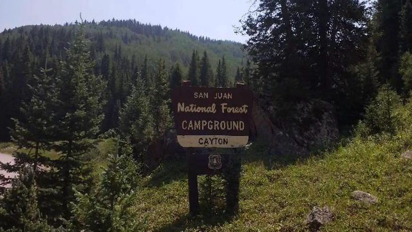
The nearest public campgrounds are Woods Lake (5.7 mi, first-come), Burro Bridge (8.9 mi, first-come), and Cayton Campground (13 mi).
Source: Campgrounds nearby