Cimarron Campground
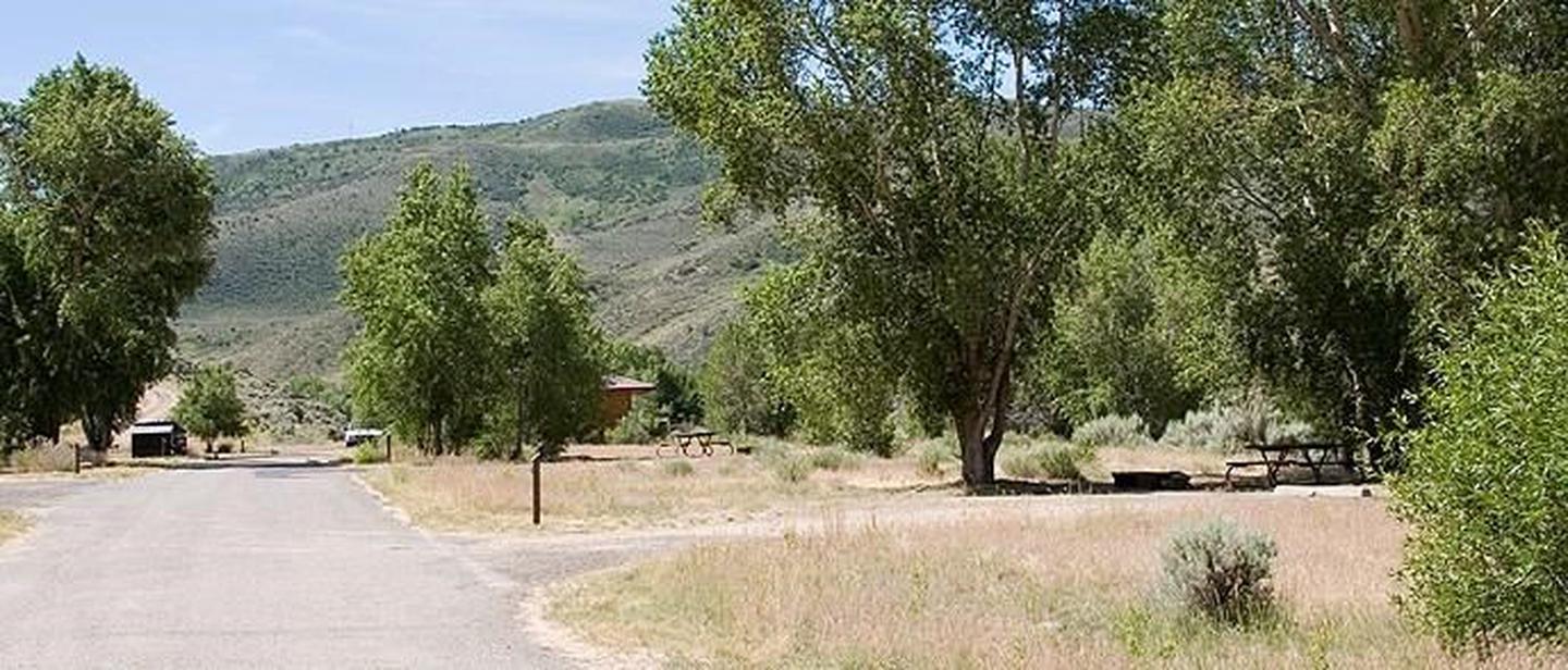
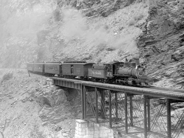
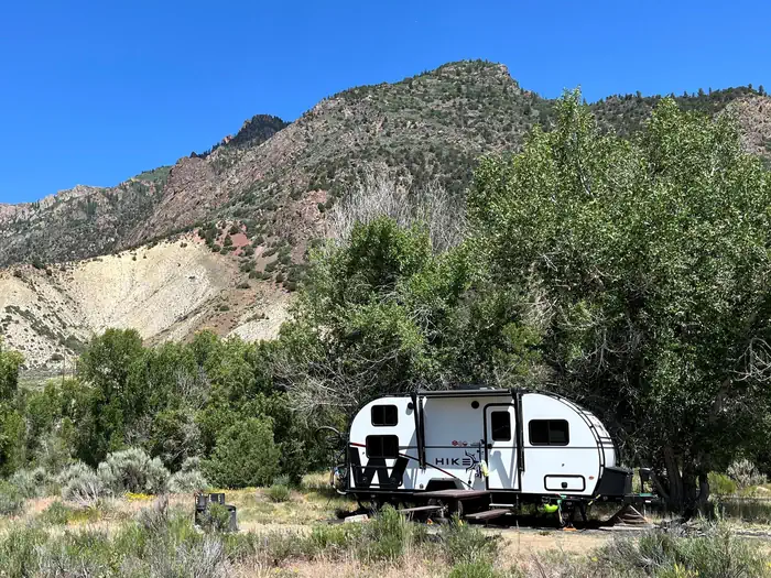
Cimarron Campground is located 20 miles (32 km) east of Montrose, CO on U.S. Highway 50 at the site of Cimarron, a historic narrow gauge railroad town. The campground accomodates all types of camping--from tents to medium sized RVs. All sites are first-come first-served, and the campground rarely fills. Railroad exhibits are adjacent to the campground, and Crystal Reservoir near Morrow Point Dam is approximately 1.5 miles away (2.4 km). Elevation: 6895 feet (2101 m)
Sites are first-come, first-served. Recreation.gov lists this campground for paying on site, and you may be able to pay with the Scan and Pay feature of its app.
More like this: first-come in Colorado · pets allowed in Colorado · dark sky in Colorado
Site mix
| Standard, no hookups | 22 |
| Host/management | 1 |
Site guide
17 sites. Tap a filter to narrow the list; the map follows.
| Site | Entry | Fires |
|---|---|---|
| 001 | Back-in | |
| 003 | Back-in | |
| 004 | Back-in | |
| 005 | Back-in | |
| 006 | Back-in | |
| 007 | Back-in | |
| 008 | Back-in | |
| 009 | Back-in | |
| 010 | Back-in | |
| 011 | Back-in |
Per-site records as published by the managing agency on Recreation.gov. Blank cells mean the agency listed nothing for that site.
Amenities & rules
| Pets | Allowed |
| Campfires | Allowed, subject to restrictions |
| Fees | All campsites at Cimarron Campground are first-come, first-served. This campground uses Scan & Pay to accept on-site payment through the Recreation.gov mobile app. |
| Dark sky | Inside Curecanti National Recreation Area, a certified International Dark Sky Park |
Seasonal potable water, flush toilets, dump station and trash/recycling collection provided. Picnic tables, fire grates and fire rings in every camp site.
Individual sites vary. Confirm on Recreation.gov or with the managing office.
Weather by month
Getting there
Cimarron Campground is located 20 miles (32 km) east of Montrose between mile markers 112 and 113 on U.S. Highway 50, at the site of a historic narrow gauge railroad town.
| Coordinates | 38.4433° N, 107.5553° W · Directions ↗ |
Fire nearby
- PrescribedHigh Mesa Piles Rx
15 mi from the campground · 324 acres
- WildfireGold Mountain
28 mi from the campground · 39,747 acres · 92% contained
- PrescribedTransfer Rd Rx
33 mi from the campground · 139 acres
Distance is to the reported incident point, not the fire edge. Call the managing office before you drive.
Supplies & services
| Outdoor gear | Sportsman's Warehouse ↗ | 16.9 mi |
| Dump station | Dump station ↗ | 20.9 mi |
Locations © OpenStreetMap contributors. Call ahead; hours change seasonally.
Explore
Video
Big Cimarron Campground - Camping by a River in Colorado
Worth a stop
The Cimarron Canyon Rail Exhibit is adjacent to the campground. Crystal Reservoir near Morrow Point Dam is approximately 1.5 miles (2.4 km) away.
- 10.5 miSouth Rim Visitor Center ↗Visitor center
- 12.8 miNorth Rim Ranger Station ↗Visitor center
- 14.9 miCommissary Trailhead ↗Trailhead
Trails nearby
- 2.7 miCorral Gulch Snowmobile/Ski4.3 mi trail · snowmobile, snowshoe, ski
- 4.2 miSuttons Corral Snowmobile/Ski ↗4.6 mi trail · snowmobile, snowshoe, ski
- 4.4 miOld Mesa Powerline Snowmo/Ski1.2 mi trail · snowmobile, snowshoe, ski
- 4.4 miSuttons Way1.2 mi trail · hiking, horse, bike, motorcycle and 2 more
Trail and trailhead records are the Forest Service's. Distances are straight-line to the nearer trail end. Trail conditions are not tracked here.
Public land it sits in
This campground sits inside Grand Mesa, Uncompahgre and Gunnison National Forests.
- inGrand Mesa, Uncompahgre and Gunnison National Forests ↗National Forest · Forest Service · 3,153,199 acres
- 11.8 miBlack Canyon of the Gunnison Wilderness ↗Wilderness · National Park Service · 15,599 acres
Each unit is published as a centre point and an acreage rather than a boundary, so this section stands it in for a circle of the same area. Whether a campground is inside, and how far it is from one it is outside, are both approximate.
Other campgrounds nearby

Cabin and lookout rentals nearby
On the National Register nearby
- Denver & Rio Grande Railroad Box Outfit Car No. 04414Structure · Cimarron · 0 mi
- Denver & Rio Grande Western Railroad Stock Car No. 5620Structure · Cimarron · 0 mi
- Denver & Rio Grande Western Railroad Stock Car No. 5679DStructure · Cimarron · 0 mi
Guidebooks for Colorado
We earn a small commission if you buy through these links. It does not change what we list.



Titles come from Open Library's catalog, matched by subject heading or by title.
Reference
Questions people ask
Do I need a reservation at Cimarron Campground?
No. Cimarron Campground is first-come, first-served. Sites are taken on arrival and paid at the fee station.
How much does it cost to camp at Cimarron Campground?
All campsites at Cimarron Campground are first-come, first-served. This campground uses Scan & Pay to accept on-site payment through the Recreation.gov mobile app.
What time is check-in at Cimarron Campground?
Check-in 1:00 PM, checkout 1:00 PM.
How many sites does Cimarron Campground have?
23 sites, including 22 standard sites without power.
Are there showers or a dump station at Cimarron Campground?
Seasonal potable water, flush toilets, dump station and trash/recycling collection provided.
Are pets allowed at Cimarron Campground?
Yes, pets are allowed at Cimarron Campground. Leash rules apply.
Can I have a campfire at Cimarron Campground?
Fires are allowed in the provided rings under normal conditions. As of 2026-10-16, there are 3 active fires within 50 miles, so check current restrictions before you light one.
Source: Fire nearby
Is Cimarron Campground good for stargazing?
Yes. Cimarron Campground sits inside Curecanti National Recreation Area, a certified International Dark Sky Park.
Source: DarkSky International
What if Cimarron Campground is full?
The nearest public campgrounds are East Portal Campground (7.7 mi), Black Canyon Of The Gunnison South Rim Campground (10.3 mi), and Lake Fork Campground (12.2 mi).
Source: Campgrounds nearby
Which national park is Cimarron Campground in?
Cimarron Campground is a Curecanti National Recreation Area campground. Entrance fees, alerts, and hours are on Park Atlas.