Shady Dell Campground
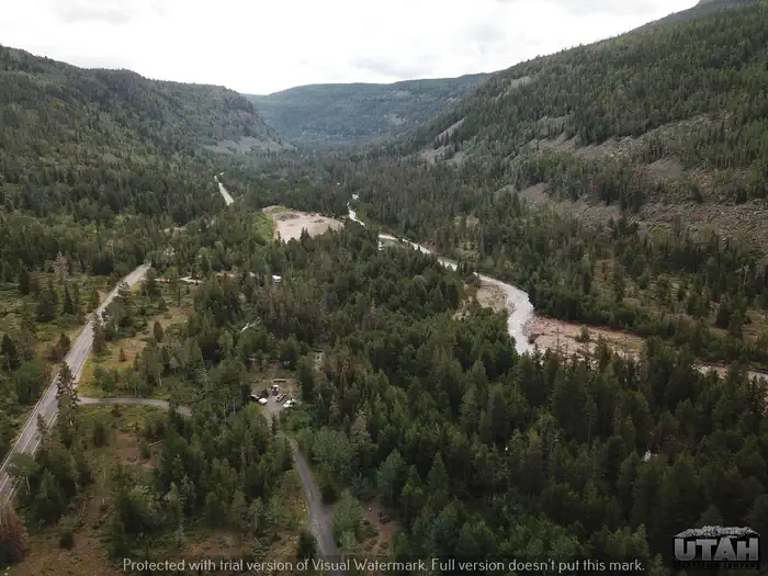
Shady Dell Campground is nestled in the curves of the Provo River. The campground is located on the beautiful Mirror Lake Scenic Byway in the Uinta Mountains of northeastern Utah at an elevation of 8,200 feet. The Uintas are known for their abundant recreational opportunities and scenic beauty.
More like this: reservable in Utah · big rigs in Utah · pets allowed in Utah
Check availability on Recreation.gov ↗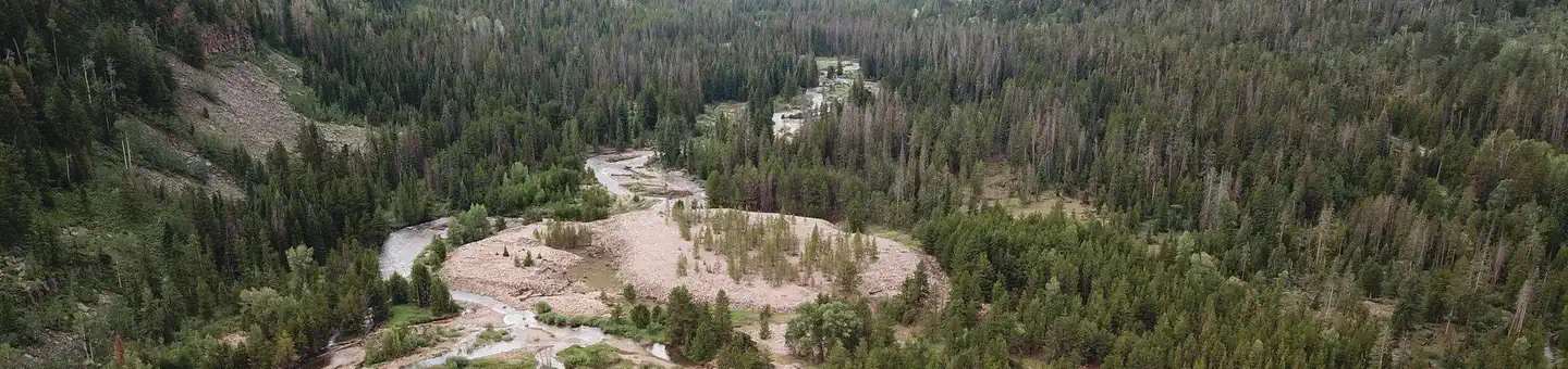

Site mix
| Standard, no hookups | 18 |
| Host/management | 4 |
Site guide
Will my RV fit
The longest site here provides 68 feet of vehicle capacity. Most sites are shorter.
18 sites. Tap a filter to narrow the list; the map follows.
| Site | Entry | Fits, ft | Surface | Shade | Water / sewer | People / vehicles | Fires | Accessible |
|---|---|---|---|---|---|---|---|---|
| 3 | Back-in | 28 | Paved | No / – | 8 / 1 | Yes | ||
| 4 | Back-in | 25 | Paved | Partial | No / – | 8 / 1 | Yes | |
| 5 | Back-in | 28 | No / – | 8 / 1 | Yes | |||
| 6 | Pull-through | 80 | Paved | Partial | No / – | 8 / 1 | Yes | |
| 7 | Back-in | 36 | Paved | Partial | No / – | 8 / 1 | Yes | |
| 8 | Pull-through | 55 | Paved | Partial | No / – | 8 / 1 | Yes | |
| 9 | Back-in | 50 | Paved | Partial | No / – | 8 / 1 | Yes | |
| 10 | Back-in | 22 | Paved | Partial | No / – | 8 / 1 | Yes | |
| 11 | Back-in | 41 | Paved | Partial | No / – | 8 / 1 | Yes | |
| 12 | Back-in | 26 | Gravel | Partial | No / – | 8 / 1 | Yes |
Per-site records as published by the managing agency on Recreation.gov. Blank cells mean the agency listed nothing for that site. Check-in 03:00 PM, checkout 12:00 PM.
16 campsite locations mapped by OpenStreetMap contributors. The site numbers are theirs and may not match the posts at the campground. Map data © OpenStreetMap contributors, ODbL.
Amenities & rules
| Hookups | None |
| Max vehicle length | 88 ft |
| Equipment | RVs & trailers, Tents |
| Pets | Allowed |
| Campfires | Allowed, subject to restrictions |
| Fees | Cash, Check, or Scan & Pay (with recreation.gov app). 17 single sites - $29.00, Capacity - 8 people + 1 vehicle. 1 double site - $57.00, Capacity 16 people + 2 vehciles. Day use - $15.00. Extra vehicle - $10.00 per vehicle (paid on-site cash/check). Firewood - $9.00 |
| Accessibility | Site 18 is listed accessible |
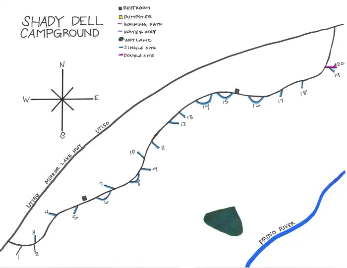
This campground has 19 single and 1 double campsites. Each site offers a picnic table and fire ring. Vault restroom facilities are available throughout the campground.
Individual sites vary. Confirm on Recreation.gov or with the managing office.
Season & status
| Forest | Uinta-Wasatch-Cache National Forest |
Weather by month
Getting there
In Kamas, UT, at the intersection of State Rt. 32 (Main St.) and State Rt. 150 (Center St.), take Rt. 150 (Mirror Lake Scenic Byway) east 17 miles to the campground sign. Turn right at the sign into the campground.
| Nearest town | Kamas, Utah |
| Coordinates | 40.5901° N, 111.0158° W · Directions ↗ |
Charges and cancellations
A $10 service fee will be withheld from any refund for a cancellation. Depending on when you cancel in relation to your arrival day, it may be considered a late cancellation (see below). Changing an Existing Reservation: When changes are made prior to the cut-off window: If a customer wants to switch dates that are entirely outside of the original reservation dates, there is a $10 change fee. There is no change fee if a customer extends or shortens a reservation, as long as the change includes dates from the original reservation. If they choose to depart early, they may forfeit the recreation fee for the day of departure. There is no change fee if the customer wants to switch sites that are the same price with the same reservation dates in the same facility. If a reservation is made that includes dates beyond the maximum booking window, that reservation cannot be changed until 18 days have passed from the original booking date.
Fire nearby
- PrescribedWest Fork Rx
9 mi from the campground · 730 acres
- PrescribedTaylors Fork Rx
11 mi from the campground · 300 acres
- PrescribedCarter Creek Rx
25 mi from the campground · 150 acres
- PrescribedNorth Fork Mill Rx
27 mi from the campground
Distance is to the reported incident point, not the fire edge. Call the managing office before you drive.
Supplies & services
| Dump station | Dump station ↗ | 1.8 mi |
| Outdoor gear | Fish Heads Fly Shop ↗ | 21.7 mi |
| RV sales & service | Parris RV ↗ | 45.9 mi |
Locations © OpenStreetMap contributors. Call ahead; hours change seasonally.
Explore
Video
Shady Dell Campground - Uinta National Forest, UT
Worth a stop
Mirror Lake Scenic Byway parallels the Lower Provo River as it snakes across a portion of the Uinta Mountains, leading to numerous high alpine lakes and streams, countless trails, breathtaking scenic viewpoints and various campgrounds. Fishing, canoeing, hiking, backpacking, horseback riding and biking are popular activities. The High Uintas Wilderness can be accessed from several trails along the byway.
- 5.3 miMurdock Basin Atv Trailhead ↗Trailhead
- 5.5 miUpper Falls Picnic Area ↗Day use
- 7.2 miBeaver Creek Picnic Area ↗Day use
- 10.1 miGrandview Trailhead ↗Trailhead
Trails nearby
- 1 miSpring Canyon Snomo Marked ↗9.3 mi trail · snowmobile, snowshoe, ski
- 1.8 miSoapstone Snomo Groomed ↗7.7 mi trail · snowmobile, snowshoe, ski · national_recreation_or_other
- 1.8 miScenic Byway ↗9.2 mi trail · hiking, horse, bike, motorcycle and 2 more
- 1.9 miSoapstone Ponds Snowshoe4.4 mi trail · snowshoe, ski
- 1.9 miSoapstone Ponds4.4 mi trail · hiking, horse, bike
- 2 miLambert Meadow Snomo Marked2.1 mi trail · snowmobile, snowshoe, ski
Trail and trailhead records are the Forest Service's. Distances are straight-line to the nearer trail end. Trail conditions are not tracked here.
Public land it sits in
This campground sits inside Uinta-Wasatch-Cache National Forest.
- inUinta-Wasatch-Cache National Forest ↗National Forest · Forest Service · 2,912,954 acres
Each unit is published as a centre point and an acreage rather than a boundary, so this section stands it in for a circle of the same area. Whether a campground is inside, and how far it is from one it is outside, are both approximate.
Other campgrounds nearby
Cabin and lookout rentals nearby
On the National Register nearby
- Charles B. Stewart Ranch HouseBuilding · Woodland · 5.8 mi
- Lester F. and Margaret Stewart Hewlett Ranch HouseBuilding · Woodland · 5.9 mi
- Barnard J. Stewart Ranch HouseBuilding · Woodland · 6.4 mi
Natural features
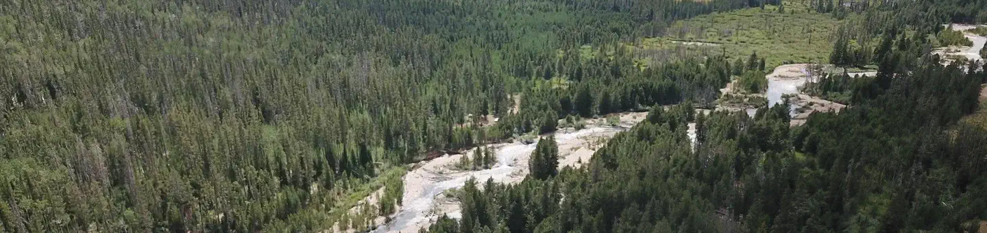
The campground is situated among a dense forest of pine, fir and aspen trees, which provide ample shade and beautiful fall color. Thickets of willow line the Lower Provo River, which flows alongside the campground.
Recreation
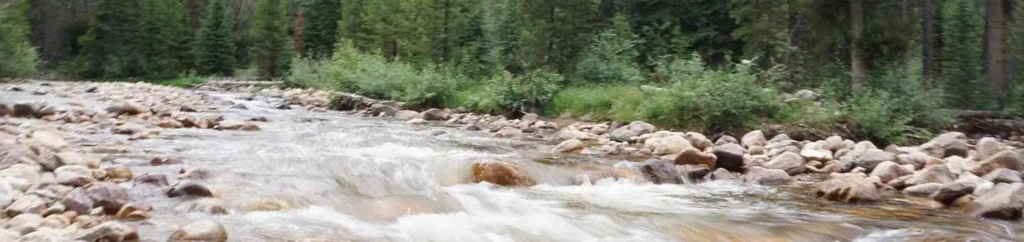
The Lower Provo River can easily be accessed from the campground and offers good trout fishing. Soapstone Basin is nearby, with miles of exciting off-road vehicle trails for riders of all skill levels. Numerous additional hiking, biking and horseback riding trails crisscross this beautiful region.
Guidebooks for Utah
We earn a small commission if you buy through these links. It does not change what we list.


Titles come from Open Library's catalog, matched by subject heading or by title.
Reference
Questions people ask
Do I need a reservation at Shady Dell Campground?
Sites at Shady Dell Campground are reservable on Recreation.gov. Any walk-up sites are listed on the booking page.
Source: Recreation.gov
How much does it cost to camp at Shady Dell Campground?
Cash, Check, or Scan & Pay (with recreation.gov app). 17 single sites - $29.00, Capacity - 8 people + 1 vehicle. 1 double site - $57.00, Capacity 16 people + 2 vehciles.
Source: Recreation.gov
What time is check-in at Shady Dell Campground?
Check-in 03:00 PM, checkout 12:00 PM.
Source: Recreation.gov
What does it cost to cancel a reservation at Shady Dell Campground?
A $10 service fee will be withheld from any refund for a cancellation.
Source: Charges and cancellations
How many sites does Shady Dell Campground have?
22 sites, including 18 standard sites without power.
Source: Recreation.gov
Will my RV fit at Shady Dell Campground?
Recreation.gov lists no practical vehicle capacity limit for the largest site here, which usually means pull-through or open parking. The sidebar tool checks a trailer or motorhome length against every site.
Source: Will my RV fit
Are pets allowed at Shady Dell Campground?
Yes, pets are allowed at Shady Dell Campground. Leash rules apply.
Source: Recreation.gov
Can I have a campfire at Shady Dell Campground?
Fires are allowed in the provided rings under normal conditions. As of 2026-10-16, there are 4 active fires within 50 miles, so check current restrictions before you light one.
Source: Fire nearby
Are there accessible sites at Shady Dell Campground?
Site 18 is listed accessible on Recreation.gov. What that covers (a paved pad, an accessible table, a nearby accessible restroom) is on each site's booking page.
Source: Recreation.gov
What is there to do at Shady Dell Campground?
The Lower Provo River can easily be accessed from the campground and offers good trout fishing. The Recreation section on this page has the rest.
Source: Recreation
What is the nearest town to Shady Dell Campground?
Kamas, Utah. Mirror Lake Scenic Byway parallels the Lower Provo River as it snakes across a portion of the Uinta Mountains, leading to numerous high alpine lakes and streams, countless trails, breathtaking scenic viewpoints and various campgrounds.
Source: Getting there
What if Shady Dell Campground is full?
The nearest public campgrounds are Soapstone (1 mi), Cobblerest Campground (2.1 mi), and Ponderosa Group Campground (4.5 mi).
Source: Campgrounds nearby