Paragon Dispersed Camping Area
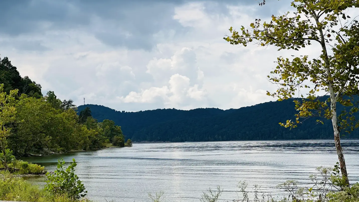
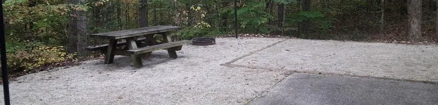
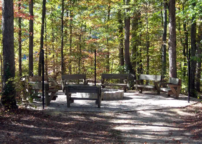
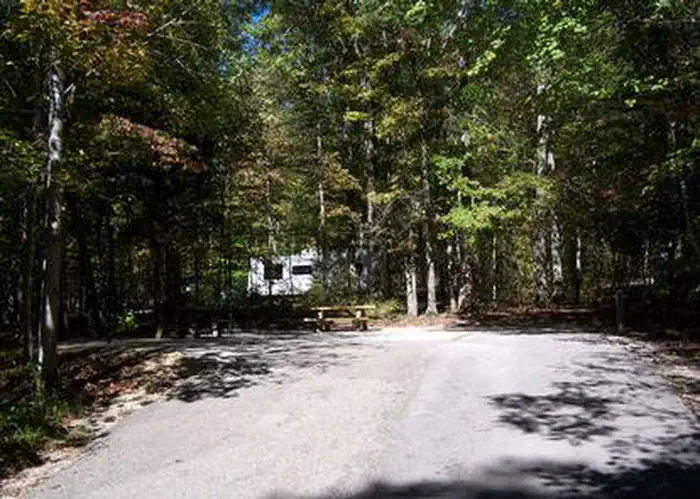
Paragon is a primitive camping area with 10 designated campsites, some with lantern posts and fire rings. Chemical toilets and trash pickup available mid-April through November. This dispersed camping area is located on the Cumberland District, Daniel Boone National Forest. It is near Cave Run Lake, widely known for its scenic beauty and varied outdoor recreation opportunities.This 8,270-acre lake is jointly operated and managed by the U.S. Army Corps of Engineers and the U.S. Forest Service. Nearby facilities: Poppin Rock Boat Ramp
More like this: first-come in Kentucky · tent only in Kentucky

Amenities & rules
| Equipment | Tents |
Individual sites vary. Confirm on Recreation.gov or with the managing office.
Season & status
| Status | Temporarily closed |
| Forest | Daniel Boone National Forest |
Weather by month
Getting there
| Coordinates | 38.0484° N, 83.3954° W · Directions ↗ |
Supplies & services
| Outdoor gear | Sky Bridge Station ↗ | 23 mi |
| Dump station | Dump station ↗ | 24 mi |
| RV sales & service | Bluegrass RV ↗ | 58.6 mi |
Locations © OpenStreetMap contributors. Call ahead; hours change seasonally.
No site-by-site records, no fee schedule, no directions or photos in the Recreation.gov record. What is here comes from the agency's own listing. The rest lives there.
Checked nightly. Modules appear as soon as the record fills in.
Explore
Worth a stop
- 3.9 miClaylick Boat Ramp ↗Boat launch
- 7.4 mi
- 10.3 mi
Trails nearby
- 4.2 miWindy Bay Shoreline Aunder 0.1 mi trail
- 4.2 miWindy Bay Shoreline B0.2 mi trail
- 4.2 miWindy Bay Shoreline0.2 mi trail
Trail and trailhead records are the Forest Service's. Distances are straight-line to the nearer trail end. Trail conditions are not tracked here.
Other campgrounds nearby
On the National Register nearby
- Morehead Voting House No. 7Building · Morehead · 8.8 mi
- Morehead Voting House No. 10Building · Morehead · 9.5 mi
- Rowan County CourthouseBuilding · Morehead · 9.6 mi
Guidebooks for Daniel Boone National Forest and Kentucky
We earn a small commission if you buy through these links. It does not change what we list.
Titles come from Open Library's catalog, matched by subject heading or by title.
Reference
Questions people ask
Is Paragon Dispersed Camping Area open right now?
Temporarily closed as of Oct 16, 2026.
Source: Forest Service status
Can I bring an RV to Paragon Dispersed Camping Area?
Paragon Dispersed Camping Area is listed for tents only.
Source: Forest Service
What if Paragon Dispersed Camping Area is full?
The nearest public campgrounds are Claylick Boat-In Campground (4.2 mi), Zilpo (6 mi), and Boat Gunnel Group Campground (6.8 mi).
Source: Campgrounds nearby