Juniper Campground Group Site
For groups visiting the North Unit of Theodore Roosevelt National Park, Juniper Campground Group Site is a great place to stay. Located four miles (6.4 km) from the entrance to the North Unit of the park, the Group Site is open from May through October.
More like this: reservable in North Dakota · pets allowed in North Dakota · group sites in North Dakota
Check availability on Recreation.gov ↗

Site mix
| group standard area nonelectric | 1 |
Site guide
1 site. Tap a filter to narrow the list; the map follows.
| Site | Entry | Surface | Shade | People / vehicles | Fires | Accessible | Rating |
|---|---|---|---|---|---|---|---|
| Juniper Group | Pull-through | Gravel | Partial | 60 / 20 | Yes | Yes | Standard |
Per-site records as published by the managing agency on Recreation.gov. Blank cells mean the agency listed nothing for that site. Check-in 12:00 PM, checkout 12:00 PM.
Amenities & rules
| Pets | Allowed |
| Campfires | Allowed, subject to restrictions |
| Accessibility | Site Juniper Group is listed accessible |
Toilets, drinking water and picnic tables are provided at this facility. The site can accommodate tents, trailers and RVs. The group site can accommodate between seven and 60 people with a maximum of 20 passenger vehicles. There are no hookups; a dump station is available for campers. All wheeled vehicles and trailers must remain on roadways or pads.
Individual sites vary. Confirm on Recreation.gov or with the managing office.
Weather by month
Getting there
The North Unit entrance is along U.S. Highway 85, approximately 14 miles (22.5 km) south of Watford City, ND and 50 miles (80 km) north of Belfield, ND. The distance by road from Medora to the North Unit is approximately 70 miles (113 km). Interstate 94 travelers can access U.S. Highway 85 at Exit 42 in Belfield, ND.
| Nearest town | Medora, North Dakota |
| Coordinates | 47.5942° N, 103.3339° W · Directions ↗ |
Fire nearby
- WildfireBear
18 mi from the campground · 10 acres
Distance is to the reported incident point, not the fire edge. Call the managing office before you drive.
Supplies & services
| Outdoor gear | Sportsman's Warehouse ↗ | 41.6 mi |
Locations © OpenStreetMap contributors. Call ahead; hours change seasonally.
Explore
Trails nearby
- 2.5 miHomers Camp0.07 mi trail · hiking, horse, bike
- 2.6 miLong X ↗5.8 mi trail · hiking, horse, bike
- 2.6 miMaah Daah Hey ↗144.3 mi trail · hiking, horse, bike · national_recreation_or_other
- 2.8 miCCC0.3 mi trail · hiking, horse, bike
Trail and trailhead records are the Forest Service's. Distances are straight-line to the nearer trail end. Trail conditions are not tracked here.
Public land it sits in
This campground sits inside Theodore Roosevelt Wilderness, which overlaps Dakota Prairie Grasslands.
- inTheodore Roosevelt Wilderness ↗Wilderness · National Park Service · 29,920 acres
- inDakota Prairie Grasslands ↗National Grassland · Forest Service · 1,384,927 acres
Each unit is published as a centre point and an acreage rather than a boundary, so this section stands it in for a circle of the same area. Whether a campground is inside, and how far it is from one it is outside, are both approximate.
Other campgrounds nearby

On the National Register nearby
- Grassy Butte Post OfficeBuilding · Grassy Butte · 14.4 mi
Natural features
The Little Missouri River is the central, unifying feature of this wild and broken land where, as a young man, Theodore Roosevelt ranched and hunted in the 1880s. The park is part of both the Northern Great Plains and the West, blending a rich natural beauty with diverse human history. The rugged topography, with its flora and fauna, also provides an opportunity to discover the badlands environment as Roosevelt once did. It is a place to experience a land and way of life that helped shape Theodore Roosevelt's attitudes and philosophy regarding conservation. Cottonwood trees surrounding the campsite turn golden in the fall. Although the campground is moderately forested, most of the campsites are in partial to full sun but visitors can cool off in the cold river when temperatures peak during summer.
Recreation
Hikers can access the Achenbach Trail and Little Mo Trail directly from the facility. The Achenbach Trail (17.7 miles/28.5 km), climbs from river bottomland up through the Achenbach Hills, drops to the river again, climbs to Oxbow Overlook along the way of a spur trail, and returns north of the river to the campground. Ask about the conditions of the river crossing before hiking. The Little Mo Trail (1.1 miles/1.8 km) is a self-guiding nature trail that begins at Juniper Campground and goes through river woodlands and badlands.
Nearby
The town of Watford City has shopping, restaurants, amenities and a theater is located approximately 15 miles (24 km) to the north. The Little Missouri National Grassland is the largest National Grassland in the nation at 1.03 million acres (416,826 ha). It is located in western North Dakota and is managed by the Medora Ranger District in Dickinson, ND and the McKenzie Ranger District in Watford City, ND. The National Grassland provides additional recreation opportunities in the area.
Guidebooks for Theodore Roosevelt National Park and camping across the country
We earn a small commission if you buy through these links. It does not change what we list.
- 2017 Guide to the Wild Horses of Theodore Roosevelt National ParkNorth Dakota Badlands, 2016Find at Bookshop.org
Titles come from Open Library's catalog, matched by subject heading or by title.
Reference
Questions people ask
Do I need a reservation at Juniper Campground Group Site?
Sites at Juniper Campground Group Site are reservable on Recreation.gov. Any walk-up sites are listed on the booking page.
Source: Recreation.gov
What time is check-in at Juniper Campground Group Site?
Check-in 12:00 PM, checkout 12:00 PM.
Source: Recreation.gov
How many sites does Juniper Campground Group Site have?
1 site, including 1 group standard area nonelectric.
Source: Recreation.gov
Are there showers or a dump station at Juniper Campground Group Site?
There are no hookups; a dump station is available for campers.
Source: Recreation.gov
Are pets allowed at Juniper Campground Group Site?
Yes, pets are allowed at Juniper Campground Group Site. Leash rules apply.
Source: Recreation.gov
Can I have a campfire at Juniper Campground Group Site?
Fires are allowed in the provided rings under normal conditions. As of 2026-10-16, there is 1 active fire within 50 miles, so check current restrictions before you light one.
Source: Fire nearby
Are there accessible sites at Juniper Campground Group Site?
Site Juniper Group is listed accessible on Recreation.gov. What that covers (a paved pad, an accessible table, a nearby accessible restroom) is on each site's booking page.
Source: Recreation.gov
What is there to do at Juniper Campground Group Site?
Hikers can access the Achenbach Trail and Little Mo Trail directly from the facility. The Recreation section on this page has the rest.
Source: Recreation
What is the nearest town to Juniper Campground Group Site?
Medora, North Dakota. The town of Watford City has shopping, restaurants, amenities and a theater is located approximately 15 miles (24 km) to the north.
Source: Getting there
What if Juniper Campground Group Site is full?
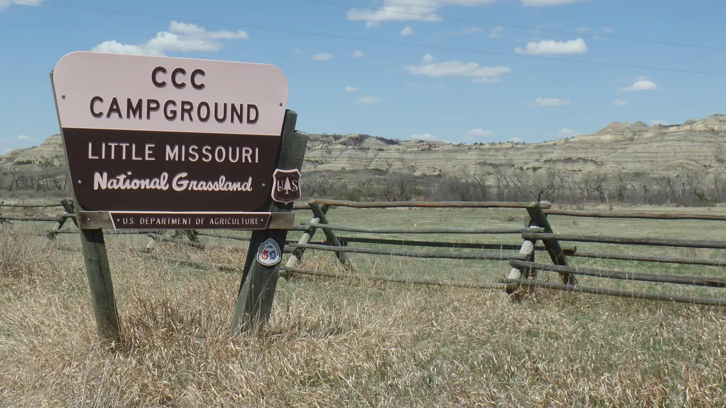
The nearest public campgrounds are CCC Campground (2.7 mi, partly first-come), Summit Campground (5.7 mi, first-come), and Magpie Campground (20.8 mi, first-come).
Source: Campgrounds nearby
Which national park is Juniper Campground Group Site in?
Juniper Campground Group Site is a Theodore Roosevelt National Park campground. Entrance fees, alerts, and hours are on Park Atlas.
Source: Theodore Roosevelt National Park