Art Lilley Campground
The off-highway vehicle (OHV) trail system in the Uwharrie offers a variety of topography and scenery. All trails are designated for all off-highway vehicles and marked with orange diamonds. Stay on the designated trail system to help prevent soil erosion and creek sedimentation, which occur as a result of illegal trail use. FS roads cannot be used as trail connectors, but all vehicles operating on the road system must be "street legal" meaning that the vehicles are fully licensed, inspected and registered. Persons violating these regulations will be fined according to the law. NCDOT approved helmets and eye protection are required.
More like this: first-come in North Carolina

Season & status
| Status | Open |
| Season | April 1 to December 15 |
| Forest | National Forests in North Carolina |
| Booking | No reservations are needed for this area. The campground is open from April 1 through December 15. |
| Fees | There is no fee to camp at Art Lilley Campground. You just need to make sure you have a vaild trail pass. |
Weather by month
Getting there
| Coordinates | 35.4081° N, 80.0737° W · Directions ↗ |
Supplies & services
| RV sales & service | West Trades Unlimited ↗ | 12.4 mi |
| Outdoor gear | Bass Pro Shops ↗ | 36.5 mi |
Locations © OpenStreetMap contributors. Call ahead; hours change seasonally.
No site-by-site records, no amenities, no fee schedule, no directions or photos in the Recreation.gov record. What is here comes from the agency's own listing. The rest lives there.
Checked nightly. Modules appear as soon as the record fills in.
Explore
Worth a stop
- 1.3 miFlintlock Valley Shooting Range ↗OHV / range
- 2 miCove Boat Ramp ↗Boat launch
Trails nearby
- 0.2 miFalls Dam OHV2 mi trail · hiking, horse, bike, motorcycle and 3 more
- 0.2 miLakeview OHV Challenge Cunder 0.1 mi trail · hiking, horse, bike, motorcycle and 3 more
- 0.2 miFalls Dam OHV Connector A0.05 mi trail · hiking, horse, bike, motorcycle and 3 more
- 0.2 miFalls Dam OHV Connector Bunder 0.1 mi trail · hiking, horse, bike, motorcycle and 3 more
- 0.3 miLakeview OHV1.7 mi trail · hiking, horse, bike, motorcycle and 3 more
- 0.3 miWolf Den OHV1 mi trail · hiking, horse, bike, motorcycle and 3 more
Trail and trailhead records are the Forest Service's. Distances are straight-line to the nearer trail end. Trail conditions are not tracked here.
Public land it sits in
Birkhead Mountains Wilderness begins about 14.5 miles away, and it is the closest of these.
- 14.5 miBirkhead Mountains Wilderness ↗Wilderness · Forest Service · 5,065 acres
Each unit is published as a centre point and an acreage rather than a boundary, so this section stands it in for a circle of the same area. Whether a campground is inside, and how far it is from one it is outside, are both approximate.
Other campgrounds nearby
On the National Register nearby
- Lane's Chapel Methodist Church and CemeteryBuilding · New London (Eldorado Township) · 5.3 mi
- Albemarle Graded School-Central Elementary SchoolBuilding · Albemarle · 7.9 mi
- Thomas Marcellus Denning HouseBuilding · Albermarle · 7.9 mi
Guidebooks for North Carolina
We earn a small commission if you buy through these links. It does not change what we list.
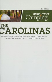
- Great Day Hikes on North Carolina's Mountains-To-Sea TrailFriends of the Mountains-to-Sea Trail and Jim Grode, 2020Find at Bookshop.org
Titles come from Open Library's catalog, matched by subject heading or by title.
Reference
Questions people ask
Do I need a reservation at Art Lilley Campground?
No. Art Lilley Campground is first-come, first-served. No reservations are needed for this area. Sites are taken on arrival and paid at the fee station.
Source: Forest Service
How much does it cost to camp at Art Lilley Campground?
There is no fee to camp at Art Lilley Campground. You just need to make sure you have a vaild trail pass.
Source: Forest Service
Is Art Lilley Campground open right now?
Open as of Oct 16, 2026. Season April 1 to December 15.
Source: Forest Service status
What if Art Lilley Campground is full?
The nearest public campgrounds are Arrowhead Campground (2.2 mi), Canebrake Horse Camp (2.6 mi), and Badin Lake Campground (2.8 mi).
Source: Campgrounds nearby