Mattole Campground
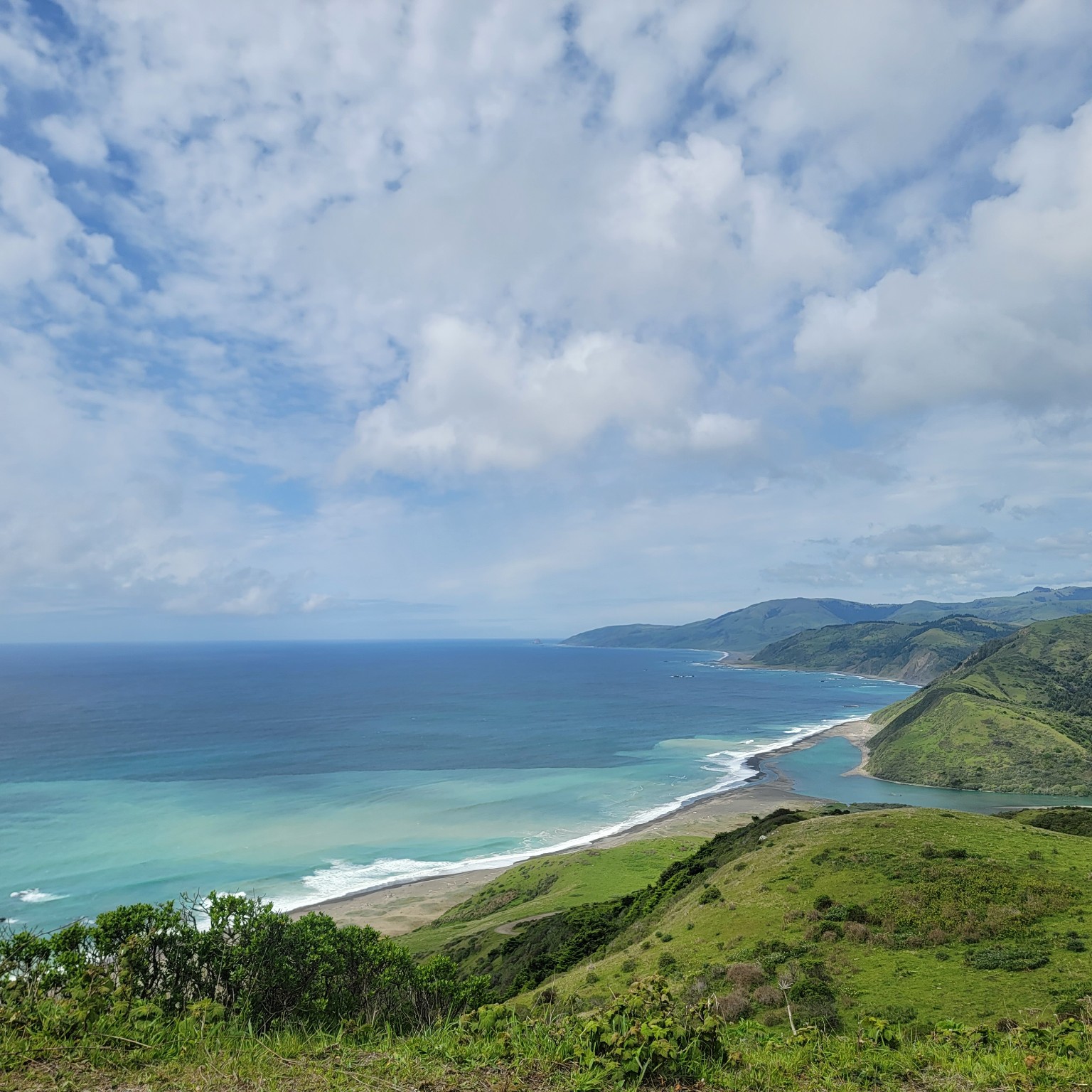
The Mattole Campground sits at the mouth of the Mattole River within the King Range National Conservation Area, offering one of the only low-cost coastal camping opportunities on California's north coast. The campground provides direct access to the Mattole River estuary and a short 600-foot trail through sand dunes leads to the beach. Wildlife viewing opportunities are excellent — elephant seals are commonly seen along the shore. The campground serves as the northern trailhead of the renowned Lost Coast Trail, one of California's most spectacular coastal hiking routes. A 3.2-mile one-way hike from the campground leads to the historic Punta Gorda Lighthouse.
More like this: first-come in California · accessible sites in California
Amenities & rules
| Fees | Use Fee: Camping - $15.00 |
| Stay limit | 14 days per calendar year within the King Range NCA |
| Accessibility | Wheelchair accessible campsites |
Individual sites vary. Confirm on Recreation.gov or with the managing office.
Weather by month
Getting there
Location: North end of King Range at the beach. U.S. 101 at Garberville, South Fork/Honeydew, or Ferndale exits. Follow signs toward Petrolia, turn on Lighthouse Road toward ocean.
| Nearest town | Arcata, California |
| Coordinates | 40.2892° N, 124.3559° W · Directions ↗ |
Supplies & services
| Outdoor gear | Sportsman Warehouse ↗ | 34.8 mi |
Locations © OpenStreetMap contributors. Call ahead; hours change seasonally.
Explore
Public land it sits in
King Range Wilderness begins about 8.7 miles away, and it is the closest of these.
- 8.7 miKing Range Wilderness ↗Wilderness · Bureau of Land Management · 42,695 acres
- 10.4 miKing Range National Conservation Area ↗National Conservation Area · Bureau of Land Management · 62,057 acres
Each unit is published as a centre point and an acreage rather than a boundary, so this section stands it in for a circle of the same area. Whether a campground is inside, and how far it is from one it is outside, are both approximate.
Other campgrounds nearby



Guidebooks for California
We earn a small commission if you buy through these links. It does not change what we list.

Titles come from Open Library's catalog, matched by subject heading or by title.
Reference
Questions people ask
Do I need a reservation at Mattole Campground?
No. Mattole Campground is first-come, first-served. Sites are taken on arrival and paid at the fee station.
Source: How first-come camping works
How much does it cost to camp at Mattole Campground?
Use Fee: Camping - $15.00
How many sites does Mattole Campground have?
23 sites.
Source: Site mix
How long can I stay at Mattole Campground?
14 days per calendar year within the King Range NCA
Are there accessible sites at Mattole Campground?
Wheelchair accessible campsites.
What is the nearest town to Mattole Campground?
Arcata, California.
Source: Getting there
What if Mattole Campground is full?
The nearest public campgrounds are Honeydew Creek (13.3 mi, first-come), Tolkan Campground (21.3 mi, first-come), and Nadelos Campground (26.1 mi, first-come).
Source: Campgrounds nearby